Welcome! Log In Create A New Profile Recent Posts
A Yosemite bear

The Moon is Waxing Gibbous (79% of Full)


Advanced

Re: North Peak and Excelsior Mountain Photos

All posts are those of the individual authors and the owner of this site does not endorse them. Content should be considered opinion and not fact until verified independently.

North Peak and Excelsior Mountain Photos
September 16, 2012 09:14PM
Got a chance to do two dayhikes this weekend. Here are some photos. Apologies for the poor quality; they were taken with a phone camera.

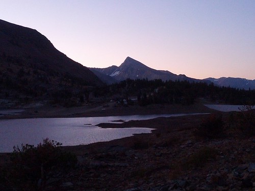
Mount Dana above Saddlebag Lake


Mount Conness North Ridge. Check out the distant (and blurry) Half Dome.


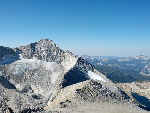
The route up North Peak. Saddlebag, Greenstone, and Conness Lakes


Lundy Canyon and Mono Lake from the summit of Excelsior


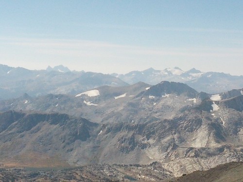
High Peaks from the summit of Excelsior (Banner, Ritter, Rodgers, Lyell, Maclure on the horizon)


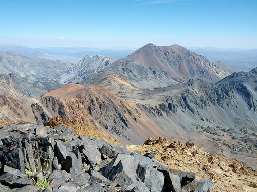
The route up Excelsior Mountain. Dunderberg Peak is prominent.
Re: North Peak and Excelsior Mountain Photos
September 17, 2012 06:00AM
You summited North Peak? Is that technical route?
Re: North Peak and Excelsior Mountain Photos
September 17, 2012 07:53AM
Quote
hotrod4x5
You summited North Peak? Is that technical route?

Not the route I took. From upper Conness Lake it's just a slog up a scree slope to gain the ridge. From the ridge it's a walk up.
Re: North Peak and Excelsior Mountain Photos
September 17, 2012 08:03AM
Ha...I looked back at my photos from a couple of months ago looking for the snow that is in your lakes photo. Not snow!!! Shiny sunlit lakes. tongue sticking out smiley
Re: North Peak and Excelsior Mountain Photos
September 17, 2012 05:07PM
Haha yep that's what happens with a bad camera and a very sunny day.
avatar Re: North Peak and Excelsior Mountain Photos
September 19, 2012 07:32AM
When you were doing Excelsior did you happen to see any boundary markers?
There was a large cairn on a saddle between there and Sky Pilot Col.
I got all excited but it was just a cairn. sad smiley
A really nice dayhike imo would be up North then down and thru Don't Be a Smart Pass to
Upper McCabe and then back up Secret Pass to Shepherd Crest (seems not many
go up there) and then back down and back to Saddlebag lake.
(it's < 10 miles... even less if you take the shuttle boat)


Chick-on is looking at you!


Edited 1 time(s). Last edit at 09/19/2012 07:32AM by chick-on.
Re: North Peak and Excelsior Mountain Photos
September 19, 2012 10:59PM
Nope, I didn't run across any boundary markers on Excelsior, but I didn't spend much time poking around up there.

The back side of North towards Upper McCabe looked nice. I'll have to find some time to go back and play in that area.
Sorry, only registered users may post in this forum.

Click here to login