Hi all, some of you have seen me poking around here and soaking up all the info, before and after my trip to Yosemite this past summer. Thanks again for all the help with that trip.
Well I've been bitten by the bug and want (need?) to get back Yosemite. This past summer with my daughter was day hikes and motel rooms, I'm currently sketching out a return for July 2013 solo backpacking. I would appreciate any thoughts/insights as I plan an itinerary.
Basically I am planning a loop around the Valley rim, plus CR and HD. FYI I've already done the Panorama, you'll see that's missing from my Valley rim "loop". Still loosey-goosey but here's where I am so far:
Day 1
fly in to SFO
Amtrak to Yosemite
get supplies, wilderness permit
camp in Valley
Day 2
hike up 4-Mile Trail to Glacier Point
hike Pohono Trail to Sentinel Dome and Taft Point
camp on trail - Bridalveil Creek?
Day 3
hike rest of Pohono Trail
get across Valley to Old Big Oak Flat Road Trail
camp on trail - near Cascade Creek??
Day 4
hike North Rim Trail
top of El Capitan
top of Yosemite Falls / Yosemite Point / Eagle Peak
camp on trail - Lehamite Creek??
Day 5
top of North Dome
detour to Indian Rock??
descend Snow Creek Trail
camp in Valley
Day 6
shuttle to TM
Not sure about this day. Possibilities:
some combo among Pothole, Lembert, May Lake, Tenaya Lake loop, etc.
Or...May Lake + Mt. Hoffmann?
Could spend all of this day around Tioga Rd and camp in TM, or could spend only part of this day around Tioga and start out Cathedral Lakes trail in afternoon for a "head start"
Day 7
Cathedral Lakes trail (I want the better views on this trail rather than from Tenaya Lake)
include some time to detour to the lakes
over to Sunrise Lakes (below I have a question about where to cross over)
camp on trail - Sunrise Lakes? Or, if I start CLT the previous day I could I get well past Sunrise Lakes this day?
Day 8
Forsyth/CR trails
Cloud's Rest
camp on trail - Sunrise Creek junction w/HD trail?
Day 9
JMT/Mist trails to Valley
camp in Valley...or if schedule allows take Amtrak out
Day 10
Amtrak to SFO
fly out
Ideally I would reverse this itinerary, start in the High country, come down from HD straight to the Panorama to Pohono, that would cut out one of the return trips through the Valley. However, I will be flying in from low elevation (Atlanta at 1k) and feel it better that I acclimate first with the 7-8k height of Pohono and North Rim before jumping to 9-10k of Cathedral Pass, CR, Hoffmann, etc.
My questions:
- Any overall thoughts appreciated.
- Am I realistic on daily distances and elevation changes? I hike/backpack around the Southeast and am in good shape, elevation diff probably will be my main variable. Based on how I felt on the Panorama I am targeting up to 12 mi/day on a use trail or otherwise relatively unimpeded, frankly probably on the portions below 8k. I figure I'll get up to 12 hrs/day on the move, but I want to stop and smell the roses, entertain side excursions, take lots of pics, relax a bit at lunch, etc.
- Which leads to: I don't believe any part of this involves any real bushwacking/scrambling, am I right?
- I've identified potential overnight spots, near water sources. That could be good and bad: good to be near water but everyone else will have the same idea so maybe not very secluded. Any alternate spots that don't make a day too short or too long?
- On day 3: how can I cross from the Pohono terminus at Tunnel View over to OBOFRT? Do I have to walk/hitch all the way back into the Valley, or is there a shorter way? I know that as the Valley ends on the west it becomes steep and the Merced needs to be crossed, so there may not be a shorter way.
- On day 7: cross-over JMT to Forsyth -- I see a connecting trail from JMT at Sunrise HSC, but that trail loops back to the north when I want to be heading south. From topos it looks like shortly after the JMT passes south of Tresidder Peak I could turn off to the right and go straight to the easternmost of the Sunrise Lakes and on across in more of a straight line -- is that doable? Haven't seen this marked as a trail anywhere. Elevations look not much different than if I went down to SHSC, but looks like I would cut possibly 2 miles by not coming too far south on JMT and then backtracking north to get to Forsyth. If where I'm talking about isn't clear, there's a saddle there between two peaks, I believe the southern of those peaks is Sunrise Mtn, the northern peak is just over 10k but I don't see it identified on any map (it's immediately east/south of Mildred Lake). So, I'm talking about crossing north of Sunrise Mtn rather than south of it. Just not sure if there is a use trail there, if not what conditions are, what kind of water crossing will be involved, etc. I'm fine for going off-trail, just would like to understand more about this.
I actually have more questions than this, but this is more than enough for now. Any input appreciated!
- Billy Joel

The Moon is Waxing Gibbous (61% of Full)
Re: input on itinerary idea: Valley Rim loop+CR+HD
All posts are those of the individual authors and the owner
of this site does not endorse them. Content should be considered opinion
and not fact until verified independently.
October 16, 2012 10:01AM | Registered: 11 years ago Posts: 269 |
|
Re: input on itinerary idea: Valley Rim loop+CR+HD October 16, 2012 02:32PM | Registered: 13 years ago Posts: 864 |
Quick thoughts:
Day two might be a bit ambitious. You might be able to shash some food in a bear box in the valley for a resupply on day 3 to lighten your load.
On day 3, you'll have to hike the road from Tunnel View to the valley and cross the Merced either via the Pohono or El Cap bridge. Once on the valley floor you can follow trails to the OBOFR. (Another option would be to follow the old Wawona Road down to the valley...) The start of the OBOFR isn't signed, so be sure to review the various threads on this forum on how to find it.
The OBOFR contains a few segments that some would consider bushwhacking/scrambling--mostly in the rockslides areas below Rainbow View. There are plenty of TRs and pictures here.
Between Day 5 and 6, why not just hike up to the Tioga Road and take the shuttle to Tuolumne Meadows, instead of hiking back to the Valley? The free shuttle runs at least to Olmstead Pt.
For your Day 7 question, yes, you could head cross-country from upper Long Meadow to the highest Sunrise Lake, but there are some nice views from Sunrise HSC area itself, including lower Long Meadow. Generally cross-country travel in unknown terrain is half as fast as on-trail travel, so you might not save much time compared to the trail. That said, cross-country travel in this area is generally easy--gentle terrain and mostly open forest.
Starting in TM instead of the Valley may make some sense--although the starting elevation is higher, the net elevation gain your first day will be less--certainly less than the 4,000'+ you'll climb from the valley to Sentinel Dome.
One thing to keep in mind is that the regulations for wilderness permits and exiting/re-entering the backcountry are subject to some interpretation--you may need a second wilderness permit if you spend more than a night in Tuolumne Meadows. The best bet is to try to get your entire trip spelled out on your original permit so you don't have to stand in line in TM again.
|
Re: input on itinerary idea: Valley Rim loop+CR+HD October 16, 2012 06:07PM | Registered: 13 years ago Posts: 931 |
For the OBOFR leg: the typical entrance for those heading up is from that V-9 sign just past El Capitan on Northside Drive. One thing a person can do instead is to take a narrow road (usually gated/locked to prevent cars, similar to the one up to Crane Flat Lookout), hike into the boulder area that's almost directly below the Rainbow View railing. Go directly up those boulders to save some mileage. I believe this entrance is located at a point along the road where there's 2-way traffic.
This is also one exit strategy for those coming down from the North Rim/Tamarack that can't find the old road or just want to avoid all of those Rockslide washouts: just scramble directly down to the valley.
This is also one exit strategy for those coming down from the North Rim/Tamarack that can't find the old road or just want to avoid all of those Rockslide washouts: just scramble directly down to the valley.
|
Re: input on itinerary idea: Valley Rim loop+CR+HD October 16, 2012 08:05PM | Registered: 14 years ago Posts: 755 |
Quote
Ohnivy-Drak
For the OBOFR leg: the typical entrance for those heading up is from that V-9 sign just past El Capitan on Northside Drive. One thing a person can do instead is to take a narrow road (usually gated/locked to prevent cars, similar to the one up to Crane Flat Lookout), hike into the boulder area that's almost directly below the Rainbow View railing. Go directly up those boulders to save some mileage. I believe this entrance is located at a point along the road where there's 2-way traffic.
This is also one exit strategy for those coming down from the North Rim/Tamarack that can't find the old road or just want to avoid all of those Rockslide washouts: just scramble directly down to the valley.
That might be an option for an agile day hiker, but I can't imagine going up it with a full backpack on the same day that I came down from Bridalveil Creek. Maybe Chick-on could comment, since he has probably hiked on that rock pile. Don't forget that this is on the sunny side, and much of the shade in that area is full of poison oak....
October 16, 2012 09:43PM | Moderator Registered: 14 years ago Posts: 7,421 |
I wouldn't send anyone into that rock pile below Rainbow View as a route up to
Rainbow View or the old road. I'd only send them there if they wanted to climb
the walls or check out what an incredible rock fall looks like.
(the satellite views on Google Earth are not recent enough to show the recent rockfall)
If someone really wanted to climb up or down and shortcut the old road
then they are probably best served by heading up by Black Spring.
The service yard area will involve a good deal more thrashing thru the oaks and
poison oak (when I went thru this area heading up the old horse trail... I was
constantly dodging the PO).
Anyway, unless you park right near Black Spring you're really not saving much.
JR would be best served to simply stay on the trails imho.
|
Re: input on itinerary idea: Valley Rim loop+CR+HD October 17, 2012 08:12PM | Registered: 13 years ago Posts: 864 |
I'm with those experts of not-really-trails--chick-on and wherever--here... take the OBOFR instead of the direct scramble. The amount of scrambling needed to follow the old road from the valley to Rainbow View isn't that much. Most of the road is still quite open, with a gentle grade and an occasional obstruction:
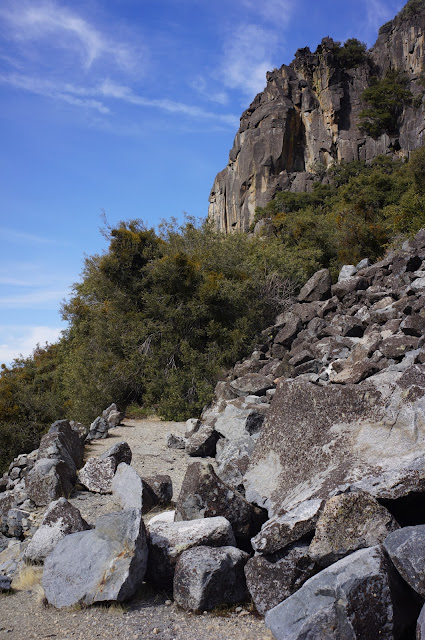
It's overall less steep than the trail will be at the El Capitan junction that's before the Cascade Creek Bridge.
Speaking of which, if you do camp near Cascade Creek (where there are a few nice campsites, albeit of questionable distance-from-trail-and-water legality), on the way to El Cap look for the "shortcut" (actually an old road, probably part of the Gentry's development or sawmill...) that's mentioned in the Schaffer book to avoid a needless elevation drop.
The shortcut climbs to the left in this picture, maybe 100-200 yards south of the bridge (what you see here is probably the worst part):

(That said, I would load up on water at Cascade Creek, maybe even have dinner, then haul up to the nice open granite around 7,000' on the way to El Cap and camp there... Cascade Creek is somewhat "busy" since it's fairly close to Tamarack Flat and sees a fair amount of day use, and while there is some nice granite in the creek, there are no views...)
It's overall less steep than the trail will be at the El Capitan junction that's before the Cascade Creek Bridge.
Speaking of which, if you do camp near Cascade Creek (where there are a few nice campsites, albeit of questionable distance-from-trail-and-water legality), on the way to El Cap look for the "shortcut" (actually an old road, probably part of the Gentry's development or sawmill...) that's mentioned in the Schaffer book to avoid a needless elevation drop.
The shortcut climbs to the left in this picture, maybe 100-200 yards south of the bridge (what you see here is probably the worst part):
(That said, I would load up on water at Cascade Creek, maybe even have dinner, then haul up to the nice open granite around 7,000' on the way to El Cap and camp there... Cascade Creek is somewhat "busy" since it's fairly close to Tamarack Flat and sees a fair amount of day use, and while there is some nice granite in the creek, there are no views...)
October 18, 2012 08:18AM | Registered: 11 years ago Posts: 269 |
|
Seasons October 16, 2012 05:38PM | Registered: 12 years ago Posts: 201 |
This would be a good route for the month of April or May when the road Tioga road is still closed for winter. In July you have the vast high country available and a million possible routes. To limit yourself to a trip that focuses on Yosemite Valley seems like an opportunity lost. Ask here instead what people recommend for ten days of July Yosemite backpacking, I'll bet you'll get some fantastic suggestions.
October 16, 2012 09:05PM | Registered: 11 years ago Posts: 269 |
Wow, lots of great feedback everyone, thanks!
@Basilpop:
4 Mile up to SD might be ambitious. It's hard for me to gauge -- I've seen people report that just the 4 Mile killed them, and others who say they breezed through. There was one guy, on here or TripAdvisor don't remember which, who if I recall correctly claimed to go up 4 Mile to top of SD, then all the way down Panorama+Mist to Happy Isles -- in 6 hours. I do know that day I've sketched out is a whole lot of up (yep 4100' or so).
You even touched on 2 of the questions I didn't ask yet, if I can use only one wilderness permit and if I can cache in the Valley. I'll follow up directly with Yosemite NPS on those details. Without a vehicle don't know if caching is really an option anyway, that could take up a good bit of time using the shuttle.
I have read that OBOFR could involve some bushwhacking/scrambling, thanks for reminding me. I should be able to handle that and will review the TRs as well to confirm, and I'll have GPS on the trail. Also FYI, Backpacker magazine did a destination report on a route up this trail, but you guys probably knew that.
North Dome to Tioga Rd? How do you spell "duh"? Thanks for pointing out the obvious to me, I clearly needed it! Looking back now, I can't figure out why I was thinking to loop back to the Valley at all, makes no sense. All I can figure is I was so set on thinking of it as two pieces that I didn't see this. I would derive no special pleasure from banging my knees down Snow Creek and putting in several miles in the wrong direction.
Did not consider the scenery factor in looking at that possible "shortcut" off Long Meadow, thanks for pointing that out. I want to do Cathedral Lakes Trail specifically because it is more scenic, even if longer, I think you're right in pointing out how that same principle maybe should be applied to this segment as well. That potential shortcut did look like mostly open forest and rock, but even if it is quicker I like that you point out other things to appreciate.
As for starting in TM, I just don't have enough higher-altitude experience to plan on having no problems, so I still think better for me to do the 7k-8k for a few days first. I'll see how I do and then I'll know better for next time.
@Ohnivy-Drak and Wherever:
Appreciate the input on OBOFR. I don't mind a little scrambling, but yes will have a full pack and full sun exposure so may look to the more established route, even if longer. Will watch for poison oak, and maybe if I dangle a Twinkie I can get Chick-on's input as well...
@Katy:
While I don't disagree with what you say, I see it more as making a selection from among many good choices. I am the Yosemite newbie here I know, but from all I've gathered I think the Valley rim is considered something different than "The Valley." And even the rim is probably old hat to most of you, but it's all new to me. But beyond that and really more importantly, I just think it's prudent to give altitude respect until I know more how I do with it. Until I know I can handle it, I don't want my plan too dependent on jumping to 9k+. I would love to do more in the true high country, that's what future trips are for! You might notice I have a day in the high country that I don't have clear ideas on, I'd love your input on that.
Thanks all!
October 16, 2012 09:26PM | Registered: 13 years ago Posts: 1,351 |
This past trip you were prepared to spend your first night at Cathedral Lakes (9300'), instead spent it at Tuolumne Meadows Backpackers Camp (8600'), hardly any difference as far as altitude is concerned. Were you generally OK w/ the altitude there (its been a long time since I've had even a headache from altitude, but a headache is OK if it goes away with normal amounts of aspirin, watch for any of the symptoms mbear and curry-pizza-dude have posted about)? Vogelsang High Sierra Camp is above 10K.
Since you're willing to travel along a road circumnavigating the Valley, you could choose to hike one of the valley rims followed by more time in the high country. Not sure when exactly you plan in July, if its a normal snow year the high country will be open by then anyway, if its a weak snow year you may want more time in the high country, if its like 2010-2011 then things were challenging early on but by mid-month the high country was opening up quite nicely. Treat 2010-2011 as an extreme wet year, and 2011-2012 as an extreme dry year.
Along the south rim watch the no camping zones, your day two suggestion of Bridalveil looks like the first legal camping area.
Edit: On the poison oak...western poison oak is a different species than the poison oak in the east, same oil, but it can grow in incredibly dense clumps below, I'd say about 5,000' in the central Sierra (4,000' in the central CA coastal ranges). Make sure you know what the plant looks like if you're proposing lower altitude scrambling, it can grow as a bush, a small shrub, and as a vine (the latter not as common in the Sierra compared to north state redwood groves or some canyons in Ventana Wilderness).
Edited 2 time(s). Last edit at 10/16/2012 09:38PM by ttilley.
October 17, 2012 06:34AM | Admin Registered: 15 years ago Posts: 17,050 |
Quote
ttilley
Edit: On the poison oak...western poison oak is a different species than the poison oak in the east, same oil, but it can grow in incredibly dense clumps below, I'd say about 5,000' in the central Sierra (4,000' in the central CA coastal ranges). Make sure you know what the plant looks like if you're proposing lower altitude scrambling, it can grow as a bush, a small shrub, and as a vine (the latter not as common in the Sierra compared to north state redwood groves or some canyons in Ventana Wilderness).
October 17, 2012 09:55AM | Registered: 11 years ago Posts: 269 |
October 17, 2012 04:47PM | Registered: 12 years ago Posts: 578 |
October 18, 2012 08:20AM | Registered: 11 years ago Posts: 269 |
October 17, 2012 10:01AM | Registered: 11 years ago Posts: 269 |
thanks ttilley. Not sure what you're referencing about staying Cathedral Lakes, not part of my itinerary, and I haven't BP'd in YNP before so no past experience with the altitude. I did drive Tioga Rd this past summer, no problems, but that's not the same thing as huffing with a full pack and miles to civilization so I still want to start this trip on the cautious side.
My timing in July is open at this point, I know to avoid weekends if possible and certainly July 4th, otherwise open.
Bridalveil Creek - legal camping - yep, why I'm eyeballing it.
And will keep an eagle eye out for the poison oak. Thanks!
My timing in July is open at this point, I know to avoid weekends if possible and certainly July 4th, otherwise open.
Bridalveil Creek - legal camping - yep, why I'm eyeballing it.
And will keep an eagle eye out for the poison oak. Thanks!
October 16, 2012 09:54PM | Moderator Registered: 14 years ago Posts: 7,421 |
Listen to basilbop. He's a smart bird.
Have you done the Amtrak thing before? Seems like a pain in the booty.
If not strapped for cash... I'd consider renting a car and then doing something like:
Glacier Pt. to Crocker Pt. and back.
North Dome to Yosemite Pt. and back.
Cathedral Lakes/Echo Creek/Merced Lake/Vogelsang Loop
May Lake w/ Mt. Hoffmann
etc.
If hung up on Amtrak then maybe you can do
- south rim loop in one trip. ("easy" in 3 days)
- north rim loop in one trip (come down Yose Falls) ("easy" in 3 days)
- TM hiking back down to valley in rest o days via whatever route you decide
Half Dome fun planning
|
Re: input on itinerary idea: Valley Rim loop+CR+HD October 17, 2012 06:55AM | Registered: 15 years ago Posts: 165 |
Did you getting a talking to by a ranger about going to Half Dome early in the morning?
The reason that I ask is that we were in the Valley in late July, my niece talked to a girl from Georgia on a Yosemite shuttle. She said that her dad started his hike to Half Dome at 3 AM because he didn't have a HD reservation. Then when we went up the next day, we were talking to a ranger about a guy from Georgia that didn't have a HD reservation....
Just wondering if you were the same gent from Georgia.
October 17, 2012 07:54AM | Registered: 11 years ago Posts: 269 |
October 17, 2012 07:59AM | Registered: 11 years ago Posts: 269 |
@Chick-on,
No never done Amtrak to/from YNP, it definitely does look like a pain. I'm hoping to avoid car rental costs for a vehicle that will be used for about 2 days and parked for 8, though I agree if I did have a car that widens my options and I could/would use it more. If the rates are good I'll do the car.
Tanks for the suggestions, I a-peach-iate it.
Edited 1 time(s). Last edit at 10/17/2012 08:00AM by JRinGeorgia.
|
Re: input on itinerary idea: Valley Rim loop+CR+HD October 17, 2012 09:27AM | Registered: 15 years ago Posts: 619 |
October 17, 2012 09:52AM | Registered: 11 years ago Posts: 269 |
|
Re: input on itinerary idea: Valley Rim loop+CR+HD October 22, 2012 07:12AM | Registered: 14 years ago Posts: 923 |
October 22, 2012 01:50PM | Registered: 15 years ago Posts: 4,173 |
Quote
AlmostThere
There's no public transportation from Fresno. Probably should be, but there isn't.
It's indeed surprising.
I'm surprised that the Chukchansi Gold Indian casino doesn't offer bus service from Yosemite Valley to their casino off of Hwy 41. They do offer three daily round trips from Fresno to their casino.
.
|
Re: input on itinerary idea: Valley Rim loop+CR+HD October 17, 2012 10:15PM | Registered: 13 years ago Posts: 103 |
I have used amtrak / YARTS twice to get into and out of Yosemite Valley. I think it is an awesome way to get to the park. I fly into Sacramento, stay in a motel that is a block from the amtrak station, walk theire the next morning and typically board a bus to Stockton followed by a train to Merced. There the Yarts bus will pick you up and carry you straight into Yosemite Valley. If you wish you can stop on the way (Mariposa, El Portal, etc) and reboard. Amtrak will sell you a ticket that includes the Yarts fee. The last time we left at around 7 or 8 in the morning and we were in the valley just after noon. It's easy, you don't have to drive, and you don't have to pay for a rental that is sitting somewhere not being used. Leaving is exactly the reverse. If leaving from TM, one can take an early Yarts to the Valley and then a later bus out and after switching to a train in merced, be back in Sacramento that evening.
So, unless you are addicted to the freedom of movement at any time of your choice that a rental car would afford, I'd recommend the Amtrak approach. Plus it's kinda fun to be "deposited" in the Valley and know you have no ready mechanism of leaving.
So, unless you are addicted to the freedom of movement at any time of your choice that a rental car would afford, I'd recommend the Amtrak approach. Plus it's kinda fun to be "deposited" in the Valley and know you have no ready mechanism of leaving.
|
Re: input on itinerary idea: Valley Rim loop+CR+HD October 17, 2012 10:21PM | Registered: 13 years ago Posts: 103 |
Someone has mentioned in this thread the possibility of hiking north to Tioga road instead of descending the Snow Creek Trail back into the Valley. I did just that this summer. After leaving NOrth dome, and taking the side trip to Indian Rock, we followed the trail to the footbridge across Snow Creek, but instead of crossing it at that point continued on and camped at an awesome site directly across from half dome. This is a great place to view the color show of the setting sun on the face of the dome. The next morning we backtracked, crossed the bridge and continued up the eastern most trail that swings by the edge of Tenaya Canyon (affording great views of face of Clouds Rest). Ultimately we exited at Olmsted Point, caught the shuttle into TM and spent the night in the backpackers campground.
October 18, 2012 08:40AM | Registered: 11 years ago Posts: 269 |
Thanks for that input Frank. One of my shortsights so far is that I'm "planning" to fly in to wherever and jump on Amtrak but haven't checked actual schedules yet, from SAC looks like I would need an extra day, or at least an exta half-day, on the front end. Not sure about timing on the back end, but need to take the actual bus/train schedule into account.
Besides not paying for a car, another benefit to bus/train is I can snooze, read, relax and not have to actually drive. But, it will come down to schedule feasibility and cost as I explore the details.
And thanks for that tip about camping top of Snow Creek. I've seen pics and videos from the rim east of ND with incredible HD views. I might have to re-arrange my itinerary a bit in order to be able to camp there, I'll noodle with that. At least look into detouring a bit down that way.
Cheers all.
October 20, 2012 11:00PM | Registered: 12 years ago Posts: 343 |
October 21, 2012 05:49AM | Registered: 11 years ago Posts: 269 |
Sorry, only registered users may post in this forum.

