I have a family member who is doing some finishing touches on a booklet that she is putting together of our relatives going to the Valley in 1916. I was stumped on these locations and I was hoping you could help me out a little.
http://imgur.com/a/mHITs
I am really curious about 3 and 6

The Moon is Waxing Gibbous (58% of Full)

Re: Help Identifying Locations from Yosemite 1916
All posts are those of the individual authors and the owner
of this site does not endorse them. Content should be considered opinion
and not fact until verified independently.
|
Help Identifying Locations from Yosemite 1916 April 17, 2013 04:55PM | Registered: 12 years ago Posts: 51 |
|
Re: Help Identifying Locations from Yosemite 1916 April 17, 2013 05:49PM | Registered: 12 years ago Posts: 1,976 |
I looked through three books that have old pictures, one by Peter T. Hoss (Born in Yosemite) and two by Leroy Radanovich ( Images of America - Yosemite Valley and Images of America - Yosemite National Park and Vicinity) and didn't see any that would match up with yours.
You could try contacting Peter T Hoss at http://www.creativeoffsprings.com and/or Leroy Radanovich at radanov@sti.net and they might know
Let us know if you find out the locations. Great pictures!!
Edited 1 time(s). Last edit at 04/17/2013 07:27PM by parklover.
You could try contacting Peter T Hoss at http://www.creativeoffsprings.com and/or Leroy Radanovich at radanov@sti.net and they might know
Let us know if you find out the locations. Great pictures!!
Edited 1 time(s). Last edit at 04/17/2013 07:27PM by parklover.
April 17, 2013 07:19PM | Registered: 13 years ago Posts: 1,351 |
|
Re: Help Identifying Locations from Yosemite 1916 April 17, 2013 08:04PM | Registered: 12 years ago Posts: 1,976 |
If you go to the thread: http://yosemitenews.info/forum/read.php?3,64758 there is a old map of Curry and you can see where the pool in picture 2 was located. It was called the Swimming Plunge or the Swimming tank. Plawrence also posted a link to the site http://www.nps.gov/history/history/online_books/yose/camp_curry_clr.pdf were you can see a picture of the pool from a different angle.
Edited 1 time(s). Last edit at 04/17/2013 08:05PM by parklover.
Edited 1 time(s). Last edit at 04/17/2013 08:05PM by parklover.
April 17, 2013 09:01PM | Registered: 15 years ago Posts: 670 |
Quote
parklover
If you go to the thread: http://yosemitenews.info/forum/read.php?3,64758 there is a old map of Curry and you can see where the pool in picture 2 was located. It was called the Swimming Plunge or the Swimming tank. Plawrence also posted a link to the site http://www.nps.gov/history/history/online_books/yose/camp_curry_clr.pdf were you can see a picture of the pool from a different angle.
The photo in the second link makes it pretty clear that the pool is at Curry. It's on page 49.
April 17, 2013 08:54PM | Registered: 15 years ago Posts: 670 |
These are just wild guesses, no guarantee to accuracy.
1) On one of the roads into the valley. Might that be a sign of some kind on the tree on the left? Cars and Trucks parked behind the tree on the left. Stables/Barn/Corral in the background. Not in the valley?
2) Swimming Pool? The Lodge, Curry? What cliff might be in the background? Does that look like the cliffs NW of the Lodge, i.e. the pool is at the Lodge?
3) This HAS to be somewhere at Happy Isles.
4) Ranger Station? At one of the entrance gates? Is that a message board behind the two guys? Are they talking to someone inside the door, or are they around something beside the door?
5) Nice! I'd guess Mirror Lake, although it might be somewhere along the river in the valley. I wonder if that rock is still there or if one of the floods since has moved it. Try flipping and mirroring the photo to see what the cliffs reflected in the water look like. MIght that be Indian Canyon reflected? If so then this isn't Mirror Lake. If that's Indian Canyon then this is late summer when the river flow is next to nothing.
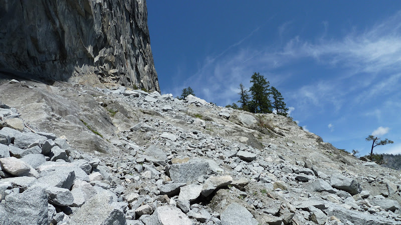
6) My first impression is Glacier Point with the Geology hut in the background, but the hut is of rock and that building is wooden. Where might there be a structure on top of a dome? Or is it not a dome but just slabs going down from somewhere. Are there any other photos you can associate with this one that might give you some context? Why is there snow in just this photo? Different trip, or just a higher elevation?
7) no idea, not enough to ID, I want to say some around Liberty Cap or Mt Broadrick
8) Illilouette Fall taken from quite a ways up the canyon, someone did some real scrambling!
These are just a few of what you have? Was there more one trip? Are you sure they're all Yosemite related? It might be interesting to take your collection as a whole and try to match photos together by trip, roll of film, location, etc. You might be able to decern some interesting information that way.
1) On one of the roads into the valley. Might that be a sign of some kind on the tree on the left? Cars and Trucks parked behind the tree on the left. Stables/Barn/Corral in the background. Not in the valley?
2) Swimming Pool? The Lodge, Curry? What cliff might be in the background? Does that look like the cliffs NW of the Lodge, i.e. the pool is at the Lodge?
3) This HAS to be somewhere at Happy Isles.
4) Ranger Station? At one of the entrance gates? Is that a message board behind the two guys? Are they talking to someone inside the door, or are they around something beside the door?
5) Nice! I'd guess Mirror Lake, although it might be somewhere along the river in the valley. I wonder if that rock is still there or if one of the floods since has moved it. Try flipping and mirroring the photo to see what the cliffs reflected in the water look like. MIght that be Indian Canyon reflected? If so then this isn't Mirror Lake. If that's Indian Canyon then this is late summer when the river flow is next to nothing.
6) My first impression is Glacier Point with the Geology hut in the background, but the hut is of rock and that building is wooden. Where might there be a structure on top of a dome? Or is it not a dome but just slabs going down from somewhere. Are there any other photos you can associate with this one that might give you some context? Why is there snow in just this photo? Different trip, or just a higher elevation?
7) no idea, not enough to ID, I want to say some around Liberty Cap or Mt Broadrick
8) Illilouette Fall taken from quite a ways up the canyon, someone did some real scrambling!
These are just a few of what you have? Was there more one trip? Are you sure they're all Yosemite related? It might be interesting to take your collection as a whole and try to match photos together by trip, roll of film, location, etc. You might be able to decern some interesting information that way.
|
Re: Help Identifying Locations from Yosemite 1916 April 17, 2013 09:27PM | Registered: 11 years ago Posts: 24 |
# 2 looks like the old “swimming tank” at Camp Curry
#3 might be at Happy Isles. Just a note, the old crossing of the Dana Fork behind the Tuolumne Meadows High Sierra Camp was exactly like that, no bridge.
#5 Mirror Lake?
#7 wild guess…..base of Liberty Cap just up from the La Casa Nevada site?
#8 Illilouette Falls
#3 might be at Happy Isles. Just a note, the old crossing of the Dana Fork behind the Tuolumne Meadows High Sierra Camp was exactly like that, no bridge.
#5 Mirror Lake?
#7 wild guess…..base of Liberty Cap just up from the La Casa Nevada site?
#8 Illilouette Falls
|
Re: Help Identifying Locations from Yosemite 1916 April 17, 2013 09:42PM | Registered: 12 years ago Posts: 1,976 |
The beauty of a laptop is that you can flip it upside down. If you do so, the cliff's reflection in the water in picture 5 doesn't look like it is at Mirror Lake. Plus it looks like there is a large meadow in the background which leads me to believe that it might be along the river in the valley.
|
Re: Help Identifying Locations from Yosemite 1916 April 18, 2013 09:03AM | Registered: 13 years ago Posts: 617 |
Quote
qumqats
1) On one of the roads into the valley. Might that be a sign of some kind on the tree on the left? Cars and Trucks parked behind the tree on the left. Stables/Barn/Corral in the background. Not in the valley?
I'm pretty sure I've seen a picture of these buildings before but will have to browse through a bunch of my old-photos books to see if I can find out. I'd say that the sign on the tree (which is on the left of the tree but the right of the photo
 ) looks VERY much like a National Park sign so I'd guess that this is one of the entrance stations. It looks like it might be the OBOFR in the Carlon area but I'm guessing (I've not hiked the Old Coulterville Road near Hazel Green but based on areas nearby, I wouldn't be surprised to find out it was around there.
If I can find anything in my library that looks like a match, I'll let you know.
If you DO get ID's from a different source, please share them here (as well as any more of these old photos you can find...there's a bunch of us here that love the trip report photos but really go to town on these historic shots!)
April 17, 2013 09:52PM | Moderator Registered: 14 years ago Posts: 7,421 |
April 17, 2013 10:16PM | Moderator Registered: 14 years ago Posts: 7,421 |
Here's Lower Cascade Falls today (ok, earlier this year) ... your #8:

def... not this:
http://yosemitenews.info/forum/read.php?3,64047,64047#msg-64047
The others will take a bit of time...
I think that is mirror lake though... just not looking in the "normal" direction...

def... not this:
http://yosemitenews.info/forum/read.php?3,64047,64047#msg-64047
The others will take a bit of time...
I think that is mirror lake though... just not looking in the "normal" direction...
April 18, 2013 07:46AM | Moderator Registered: 14 years ago Posts: 7,421 |
Do not completely discount that #7 is actually that really big rock.
(I don't see it as Liberty or Broderick) (those are too smooth and don't have the ramp like the picture)
(Moraine Dome and Helmet have that type of feature... but I highly doubt it's one of them)
Biggest hesitation is that the feature doesn't seem smooth enough to be that rock.
Great photos. Got any more?
April 18, 2013 03:36PM | Admin Registered: 15 years ago Posts: 17,050 |
April 18, 2013 05:02PM | Registered: 12 years ago Posts: 80 |
April 18, 2013 05:14PM | Moderator Registered: 14 years ago Posts: 7,421 |
|
Re: Help Identifying Locations from Yosemite 1916 April 22, 2013 05:43PM | Registered: 12 years ago Posts: 285 |
April 20, 2013 05:49PM | Registered: 12 years ago Posts: 80 |

April 22, 2013 04:33PM | Moderator Registered: 14 years ago Posts: 7,421 |
Sorry, only registered users may post in this forum.

