
http://yosemitenews.info/forum/read.php?3,57245,57272#msg-57272
http://yosemitenews.info/forum/read.php?3,65293
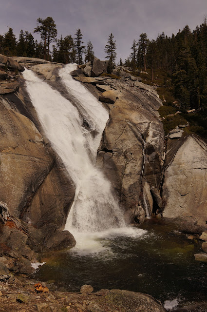
Here is a photo from Chick-on's report:
We had snagged someone's cancellation at the lodge for three nights starting on Wednesday. This was a family room with an extra bed, so we could enlarge our usual hiking team. Ha! A few weeks ago I did a Grand Canyon hike with a lady friend. She is so enamored of her "Rim-to-Rim-in-Day" T shirt that we figured she needed a "I got to the top of Half Dome" T shirt, too. The plan was to successively enter the daily Half Dome lottery for Thursday, Friday, or Saturday (You know the results of one before you have to enter the next). We would do the Diving Board if all of those failed.
As it turned out, we won the lottery for Friday. That left Wednesday afternoon and Thursday to get warmed up. We sent our lady friend up the Four Mile Trail on Wednesday (she hadn't hiked in the Valley before) while we bushwhacked up the old Mariposa Trail to Moonlight Rock. But we now had the perfect opportunity to go to the twin falls, which we had been itching to do since passing it by while hiking the old Mono Trail nearby.
http://yosemitenews.info/forum/read.php?3,58253,58275#msg-58275
The timing was good, because on the following day they were going to close the trail head for 12 days, in order to give Tamarack Flat over to a private Indian pow-wow. Not that you could find this out from the park's trails status report. You had to guess it from a comment under "campgrounds". They were going to close the automobile entry all the way up at Tioga Road....
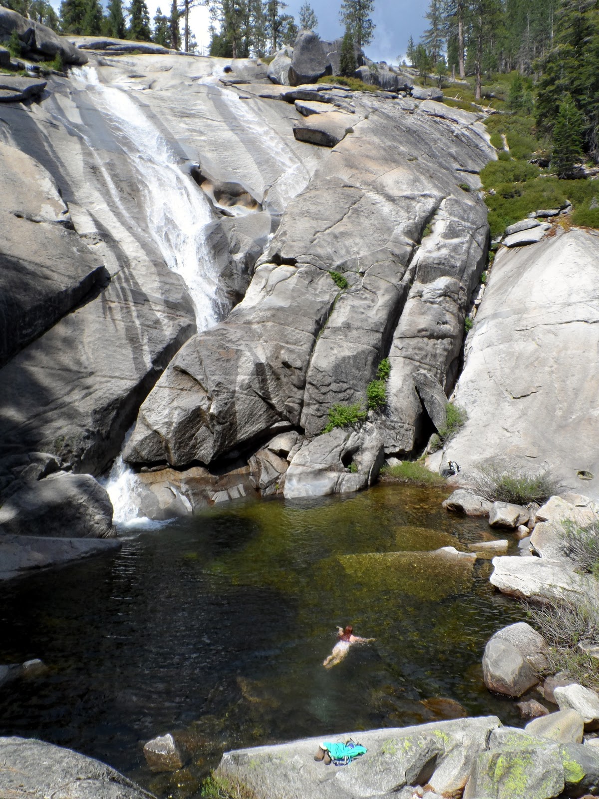
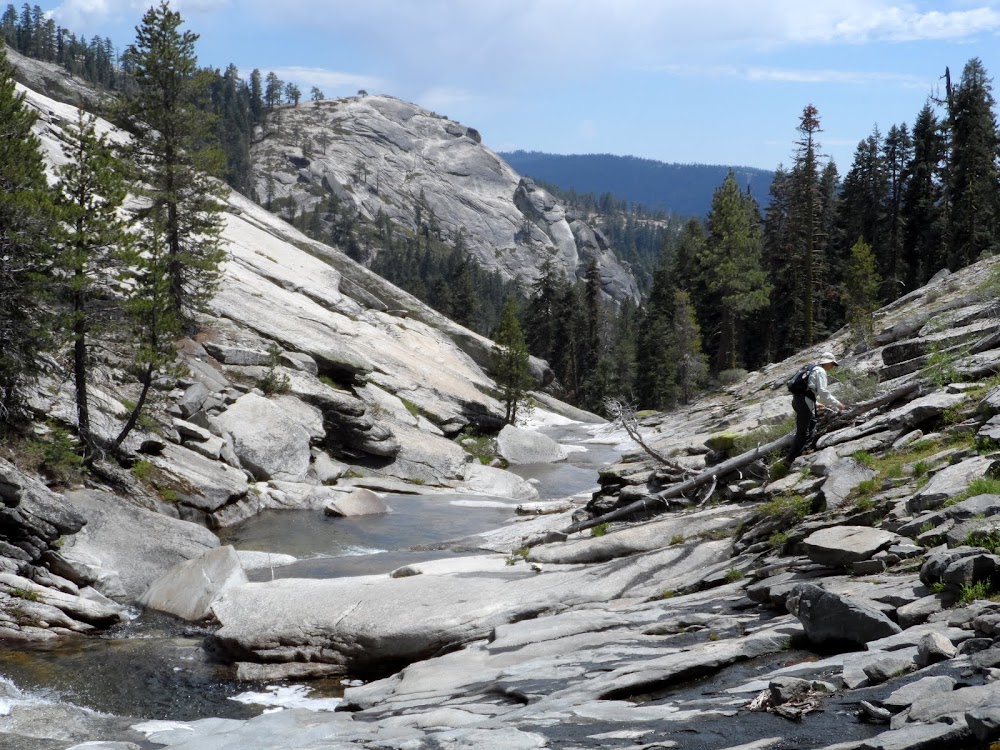
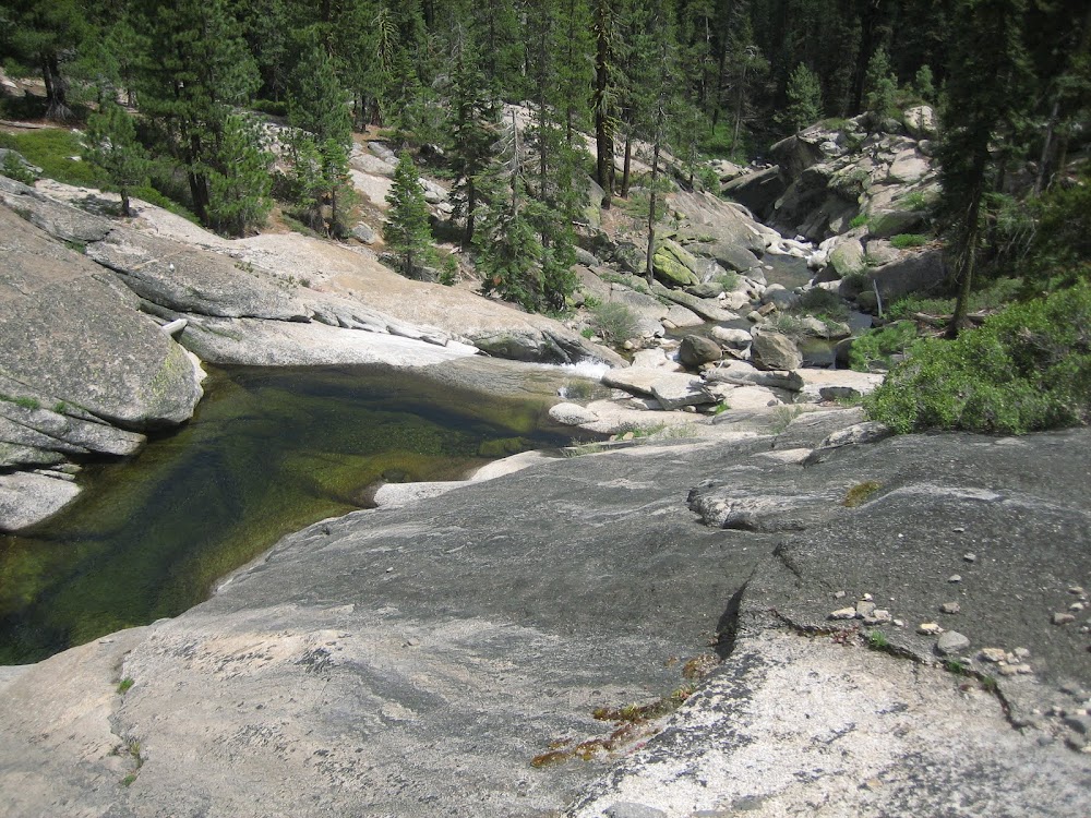
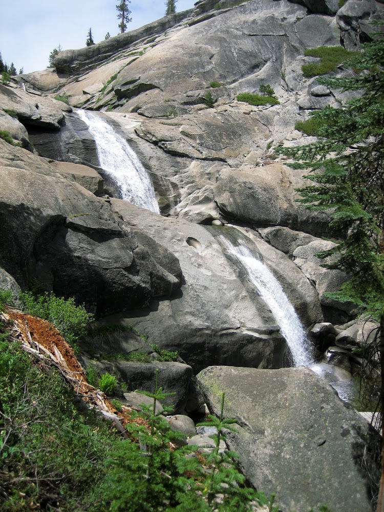
In order to make an all day trip of it (11 miles, 2500 vertical), we elected to start up the west side of Coyote Creek, looking for the elusive Split Rock, then around the top of that drainage and come down Cascade Creek to the falls. Below the falls, the creek is a rocky cascade all the way down to the new highway. But above the falls is a quarter mile of open granite pools and smaller falls:
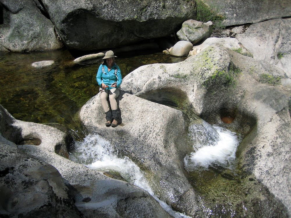
This was the high point of the hike. We were only two miles as the crow flies from a busy campground, and yet we could see no evidence that anyone ever comes here. Even though there is a prime flat spot at the top of the falls, there is no use trail, no litter, no tent footprint, no fire ring (Let's keep it that way), not even any chicken tracks. Perfect.
Of course, you do have to pay your dues to get there. Here is our track:
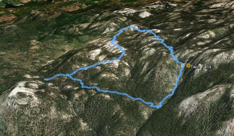
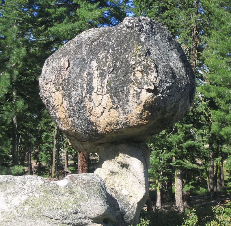
The track starts at Tamarack Flat trail head, next to the Devils Dance Floor. We went up the old Mono Trail to the ridge west of Coyote Creek, then along the slick rock of that ridge, looking at the many weird rocks. There were numerous toadstool rocks:
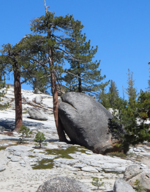
Amorous rocks:
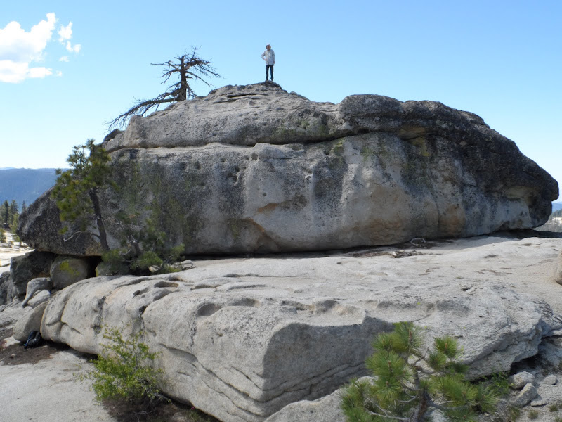
Rocks to climb, with tough initial moves:
And, of course, we saw not a single soul all day. In June. Quite a contrast to Half Dome the next day....


