http://www.cosmos-monitor.com/ca/map1936/e-sierra.html

The Moon is Waxing Gibbous (57% of Full)
July 29, 2013 12:22AM | Admin Registered: 15 years ago Posts: 17,050 |
July 29, 2013 12:43AM | Registered: 15 years ago Posts: 4,173 |
|
Re: Another old map July 29, 2013 09:06AM | Registered: 10 years ago Posts: 115 |
August 02, 2013 06:04PM | Registered: 13 years ago Posts: 424 |
August 02, 2013 07:04PM | Registered: 15 years ago Posts: 4,173 |
August 02, 2013 07:17PM | Registered: 13 years ago Posts: 424 |
|
Re: Another old map July 29, 2013 10:45PM | Registered: 15 years ago Posts: 141 |
Quote
plawrence
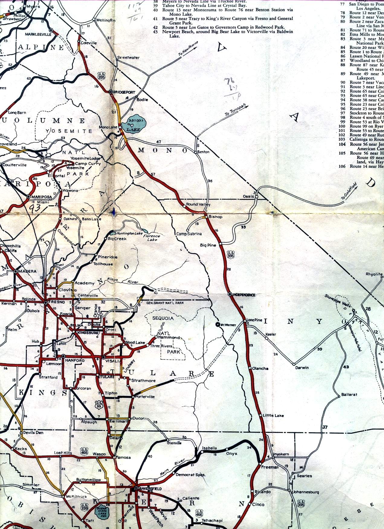
Looks like Hwy 49 wasn't yet built between Mariposa and Oakhurst, and that Chowchilla Mountain Road was still a major route between Mariposa and Wawona as the result.
.
|
Re: Another old map August 02, 2013 02:18PM | Registered: 12 years ago Posts: 45 |
August 02, 2013 02:39PM | Admin Registered: 15 years ago Posts: 17,050 |
Quote
Rob65
The map shows the planned route of State Route 190 across the Sierra south of Sequoia National Park as well.
August 02, 2013 04:07PM | Registered: 15 years ago Posts: 4,173 |

|
Re: Another old map August 02, 2013 05:56PM | Registered: 12 years ago Posts: 45 |
|
Re: Another old map August 02, 2013 09:05PM | Registered: 12 years ago Posts: 953 |
|
Re: Another old map August 02, 2013 10:20PM | Registered: 12 years ago Posts: 45 |
|
Re: Another old map August 02, 2013 09:42PM | Registered: 12 years ago Posts: 140 |
August 02, 2013 10:09PM | Registered: 15 years ago Posts: 4,173 |
Quote
KC
Oh yeah, add the proposal to blast a huge tunnel through Sonora Pass in the 1940s as one we can all be happy did not happen.
|
Re: Another old map August 02, 2013 10:24PM | Registered: 12 years ago Posts: 45 |
|
Re: Another old map August 03, 2013 07:51AM | Registered: 12 years ago Posts: 140 |


