All posts are those of the individual authors and the owner of this site does not endorse them. Content should be considered opinion and not fact until verified independently.

The Sierra High Route: The Good, The Great, and The Ugly
September 07, 2013 04:00PM
Over the past several years my wife and I have been completing sections of Roper's Sierra High Route. Our first segment--recently repeated--was the descent down Horse Creek Canyon. Next came a wonderful trip from Thousand Island Lake to Tuolumne Meadows via Lake Catherine, Twin Island Lakes, Bench Canyon, and Blue Lake Pass. A bit after that, we did the segment from Lake Italy to Mono Creek out of Pine Creek. A few years later we completed the short segment between Whitebark Pass and Minaret Lake. Unfortunately, last year she couldn't accompany chick-on and me on our week-long adventure from Roads End to Palisade Basin and back.

Last week, after escaping the Rim Fire smoke, we headed south with chick-on to complete another segment, starting from North Lake/Piute Pass and exiting at Pine Creek via Lake Italy/Italy Pass. After saying our good-byes to tomdisco and burro dude, we headed towards Mammoth to grab a room--and shower--for the night. After a bit of a hectic evening re-stocking our food for the next five days, we went to sleep.


Day 1: North Lake to Humphreys Basin

We didn't have any permits reserved for the second trip (all reservations had been sold out), but despite a bit of a late start due to some last-minute technology snags copying TV shows between OS X and Android devices at the local McDonalds, we were able to secure our North Lake/Piute Pass permits at the Mammoth ranger station. After leaving the chick-on-mobile at the Pine Creek trailhead, we continued down to North Lake, where only a few parking spots remained. After a bit of a road walk through the campground and nearing mid-day, we finally hit the trail.

The Piute Pass trail is generally well-graded, with ample evidence of heavy backpacker--and especially stock--use. Early on, we were treated to views of the colorful Piute Crags.


Eventually we reached the chain of lakes east of the pass, where the gradient of the trail eased a bit.


A cool breeze had been with us since the start, but the clouds forming didn't appear too threatening. Also, there was no hint of smoke in the air.


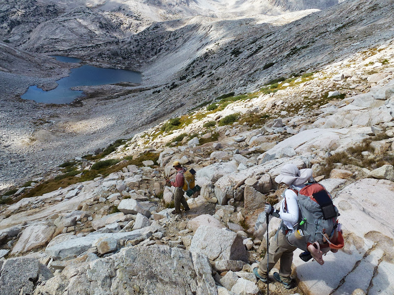
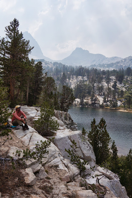
Eventually we reached the pass, with its views to the east...


...and west.


We stopped for the obligatory "summit" pictures, but the wind was not inviting.


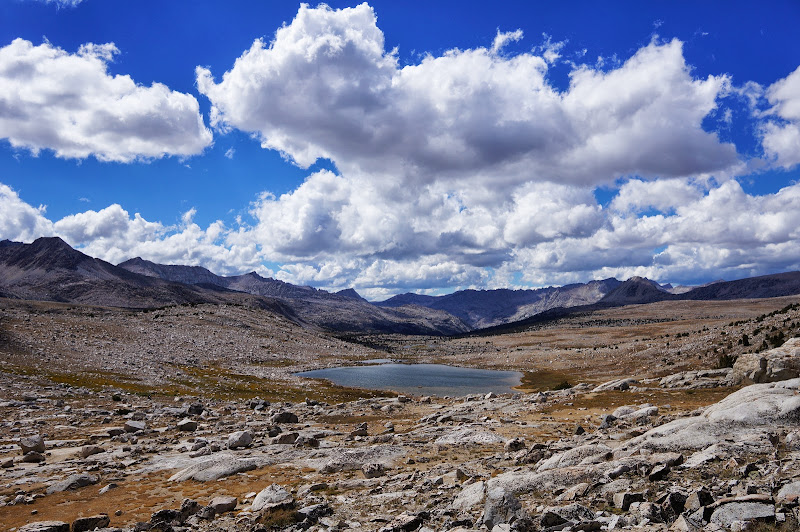
Compared to the east side, the Piute Creek headwaters and Humphreys Basin were broad, flat, and desolate.


To the south, the steep cliffs of the Glacier Divide loomed high over us.


Mt. Humphreys itself stood tall and solitary to our south.


We had met a few other hikers near the pass, but they were headed down Piute Creek; once we left on the unsigned Desolation Lake spur trail, we were on our own. After awhile we passed north of Lower Desolation Lake, one of the first landmarks on the High Route north of Piute Creek.


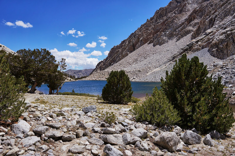
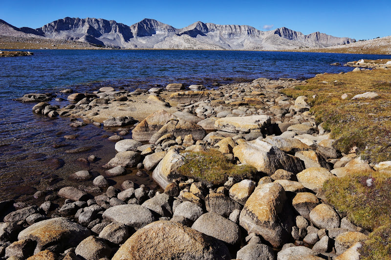
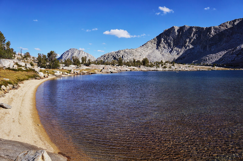
Not long thereafter we reached large--and desolate--Desolation Lake, where we fumbled for a bit trying to find a flat, wind protected campsite.


Unfortunately, all the good smooth granite had been installed at an incline, but we eventually found a spot where we could pitch our shelters against the wind.


The wind mostly died down and the skies cleared at night, and the nighttime temperatures were actually warmer than what we'd experienced in Yosemite.


Nighttime visibility was excellent: 2.5 million light years.


Day 2: Humphreys Basin to Merriam Lake via Puppet Pass and French Canyon

The next morning, we packed and headed towards the "crux" of the second day: Puppet Pass. Along the way we passed Mesa Lake, at which point we were "officially" on the High Route.


Unfortunately, the High Route has become popular, and a use trail has developed up the inlet valley that the route recommends on the way to Puppet Pass. This is perhaps one of the few cases where Roper is overly-specific; the granite ridge to the west of Mesa Lake provided both a more durable surface and superior views. After a momentary brain fade as to which low "pass" was Puppet Pass, we turned to the subtle, low gap to the west.


It ends up that Puppet Pass has an alternate name, which the Secor book prefers.


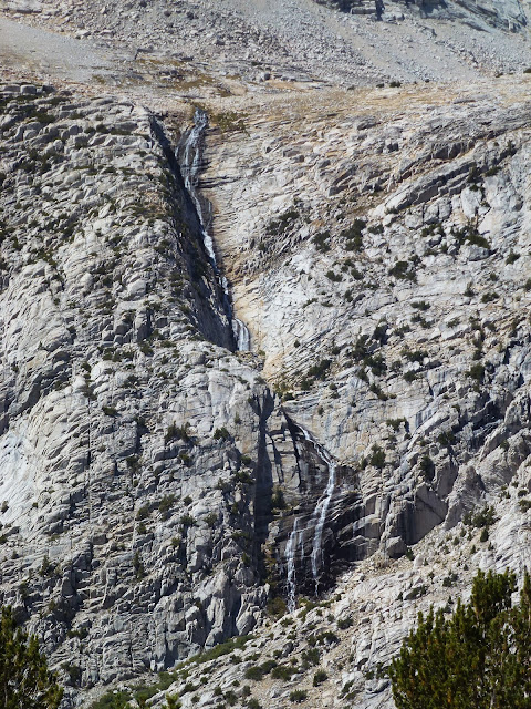
The west side of the pass, unlike the east, was quite steep, but offered great views of several French-themed lakes, the impressive Royce Creek cascade and, in the distance, our destination: Merriam Lake.


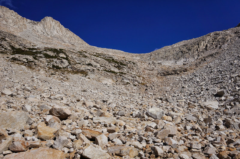
The first few hundred feet descending off Puppet Pass was typical Sierra blocky talus; fortunately, the talus soon ended as we approached the bench with Puppet, Roget, Alsace, and other lakes.


We chose to drop to the next level of lakes--L, Moon, and Elba--closer to Moon than Elba, both to see more lakes and to avoid some steep cliffs near Elba, so we traversed high around the east end of Puppet. (Another alternative--ascended a few years ago--would have been to use a nice gully that descends north from Alsace Lake...)


Moon Lake was nice...


but we continued towards Elba for our lunch break and mid-afternoon nap.


After resting a bit, we resumed the high route, heading in the general direction of the large Royce Creek cascade, one of the more impressive cascades in the High Sierra.


The descent was gentle and mostly through open forest, and soon we were on the Pine Creek trail.


We followed this trail for about a mile until we found--barely--the unsigned, faint spur trail to Merriam Lake.


This "trail" was more of a game path that people occasionally use than a real trail, and it didn't waste any distance on switchbacks as it climbed several hundred feet to the meadows below Merriam Lake.


After our slow, steep ascent, we reached these broad, flat meadows, which had excellent views of Pilot Knob and the Glacier Divide in the distance. Some stashed gear near a campsite indicated that others had been here and would return.


We had considered camping in this meadow, but instead decided to push on towards the lake. Another party was already camped at the lake, but we found a decent campsite a respectful distance from them.


The fabled Swedish Bikini Team was sunning on the beach of Merriam Lake:


Unfortunately, they had left for their remote camp before we could get the pink bird's attention.

After a quick bath and dinner, we retied to our beds, either to sleep or play Candy Crush.


Day 3: Merriam Lake to Bear Country and Beyond

The previous night had been warm, and our sleeping bags were free of ice and dew in the morning. The pink one was already up (still searching for the elusive Swedish Bikini Team?) when we started breakfast and packing away our gear.


The High Route follows the inlet creek above Merriam, and the advance party radioed to us that there was a use trail up it. Again, Roper appears to have over-specified the route, as there were many easy and durable ways to ascend to the valley above Merriam, which provided a bit of relief--and lots of nice easy strolling over open granite--towards LaSalle Lake .


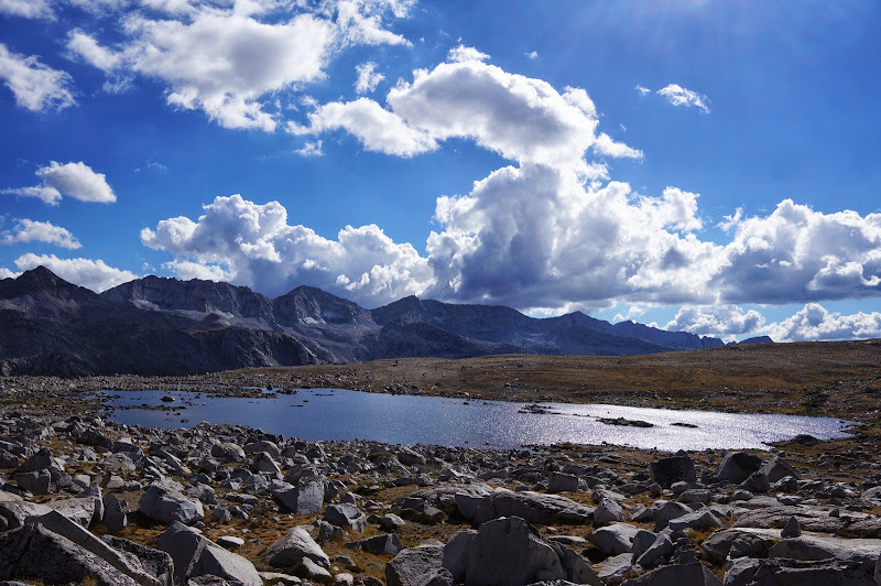
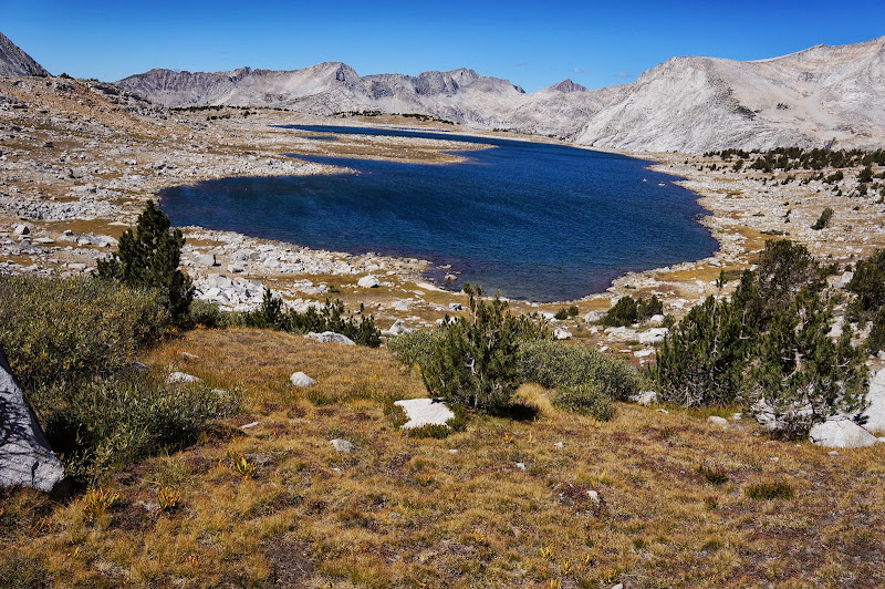
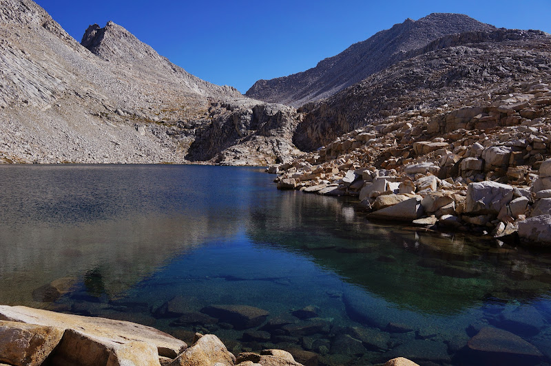
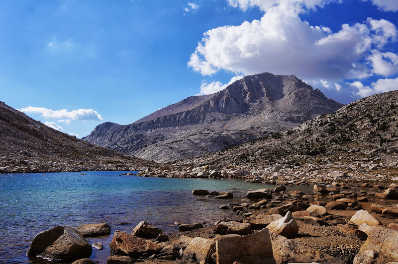
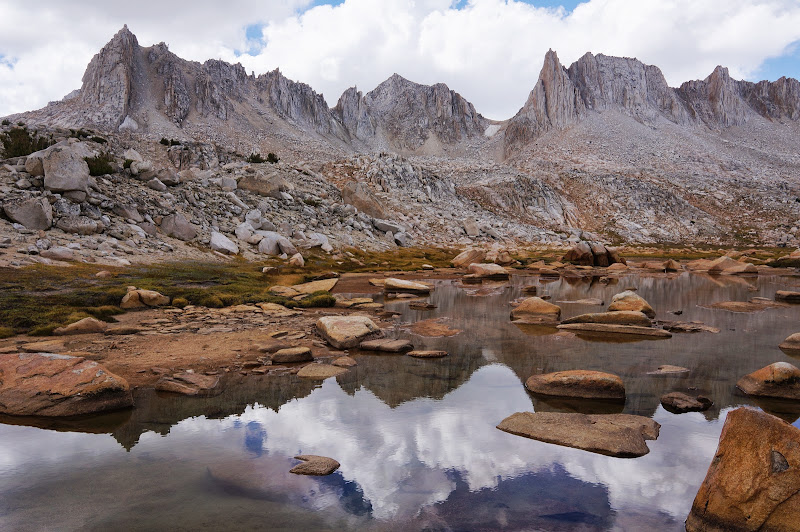
LaSalle was an exemplar High Sierra Lake with clear, deep blue waters.


Its headwall provided the final minor obstacle towards Feather Pass, a rocky gully up its headwall.


As is often the case, it looked worse than it ended up being, and soon we were walking up the final slabs towards Feather Pass.


From Feather Pass we could see Merriam Lake behind us, and the Bear Lakes basin (specifically Bearpaw and Usra) below us. The west-side drop did not appear as rough as Puppet Pass had been.


In fact, the talus had a healthy amount of sand--something that reminded me of the "miracle" trail above Jumble Lake we had followed years ago, and that we'd be following again soon.


The edge-on exfoliating slabs of granite on Feather Peak and the peak to its northwest had an interesting "feathered" look, like pages from some thick book that were both disintegrating and timeless.


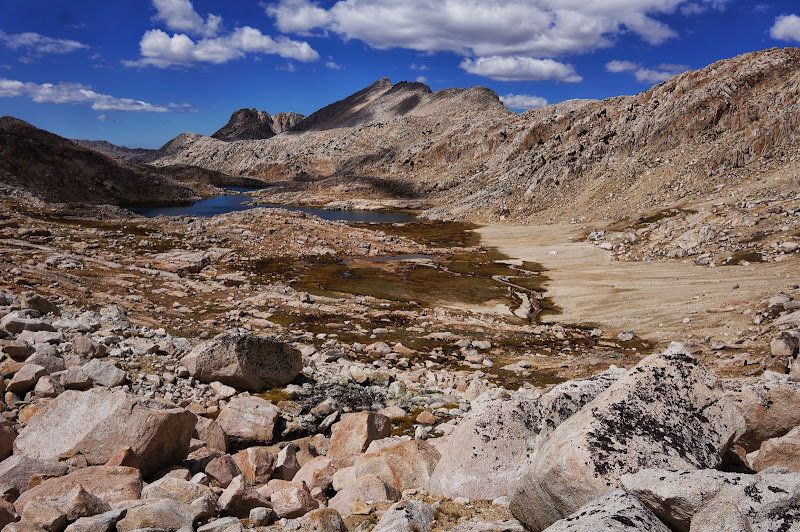
We soon reached the level valley containing the various ursine lakes, where a use trail led along the northeast side through open meadow and sand towards our next High Route obstacle: the climb to White Bear Pass.


At Ursa Lake, we saw the grass "ramp" that would lead us to the Black and White bears; a rocky arrow left by a previous party (seriously? did they not read the "leave no trace" request in the book?) pointed the way for "M".


From Black Bear Lake and its nearby tarns we had excellent views of Seven Gables, although in our counting we always came up a few gables short.


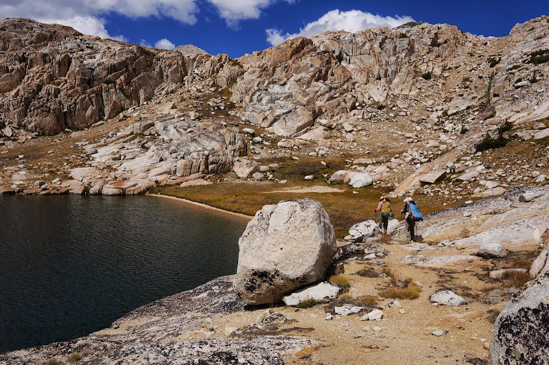
After navigating a bit of convoluted country, we reached White Bear Lake, perched almost at the saddle of its namesake pass. The granite surrounding this lake, with its rounded corners and steep cliffs, would not be out of place surrounding a lake in the Emigrant Wilderness at half the elevation, but seemed to me to be a bit alien in the more rugged (or "angry" as OD might say) High Sierra, near almost 12,000'.


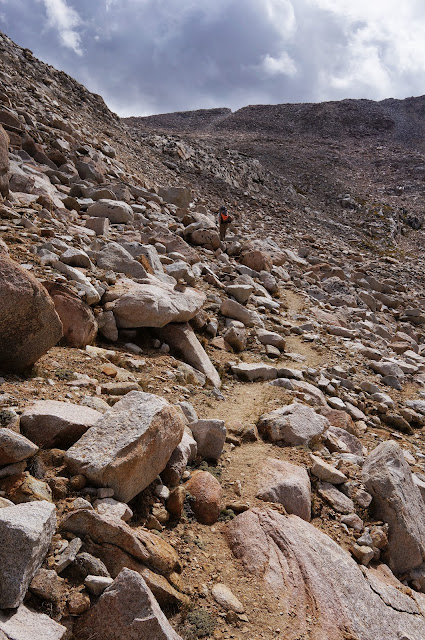
Unlike its east side, a miniscule climb from the lake, the west side of the pass was a massive drop and talus slog.


The guidebook informed that we should head to our right, northwest, and avoid heading left; the willow-covered ledges and obvious signs of other travelers made it obvious which way to head down.


The going was slow and tedious--the granite was sandy, the willows concealed rocks beneath, and the large talus near the bottom offered no easy passage. It was the hardest pass of the trip, but we took our time and dropped to lake level safely. Looking back, the pass was a vertical wall, one we would not have believed was climbable without prior knowledge.


The book had suggested we ponder why Brown and Teddy Bear lakes have ursine names yet are in a different drainage... until we realized that all these lakes fed into Bear Creek. Misnamed or not, being close to their clear, blue waters, and Mt. Hilgard behind them, indicated that we were almost at our destination. (Now, as for Bear Creek Spire...)


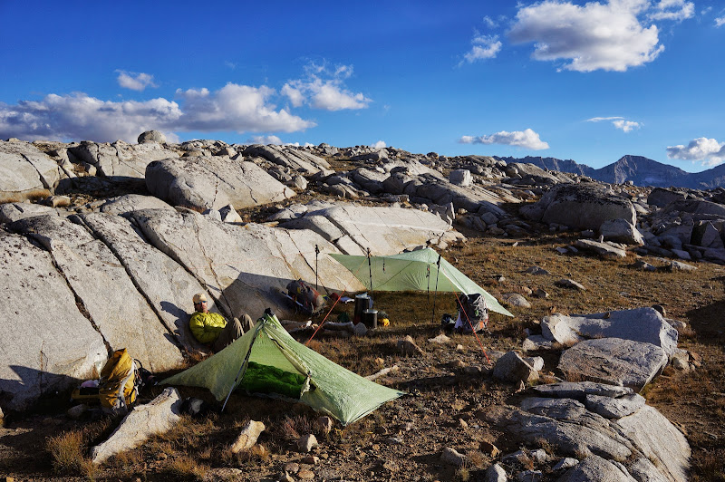
We considered stopping near one of the lakes, but the promises of smooth granite and protective trees coaxed us to push a bit further, and near Hilgard Branch, we found the promised accommodations.


We soaked, bathed, and fill up our water containers at Hilgard Branch, then returned to the granite slabs to set up camp and prepare dinner.


The weather forecast for the past few days had been hinting at thunderstorms and showers, yet despite some clouds, we had remained dry. The final clouds settled as the sun sat. We were treated to flashes in the sky in the early part of the night, lighting up the eastern horizon. With no sounds, and no real clouds in our area, we realized there was some heavy activity thankfully far away.


The nighttime, as previously, was warm and dry, although some light clouds rolled in during the night...

Day 4: Lake Ugly to the Tungsten Mine

Quote
shr_sandbagger_sroper12
[Lake Italy] is not a particularly interesting lake; indeed, it can be argued that it is fundamentally ugly.

Ugly or not, Lake Italy is a large lake, and we spent a good part of the next day walking to and around it, shielding our eyes from its ugliness. We had camped near the obvious but unmaintained Italy Pass trail, which we followed to and around the lake. On rumors that the SBT was testing out a new beach, the pink one had headed off before us to check out the north shore of Lake Italy, something my wife and I had done years ago en route to Gabbot Pass and Second Recess. Our progress along the south shore was slowed due to chatting with a few couples camped near the outlet.


The building clouds did Lake Ugly no favors, and soon enough we were near its heel, where we started the climb to the "miracle" trail above Jumble Lake.


The route between Jumble and Italy is quite faint compared to most other parts of the trail, although we did get a few helpful pointers from the locals.


Soon we were saying our last good-byes to the lake and the "uninteresting peaks" surrounding it.


From a distance it appears as if the route around Jumble Lake would be a talus slog, but in fact there is a nice, sandy path that cuts through the boulderfield.


Above Jumble Lake, we climbed through alpine (sierran?) meadows and over flat granite slabs towards Italy Pass.


The pink one had gone ahead and had picked up a weather forecast that called for rain and flash flooding, so we decided that we'd hike all the way out that day.


In the distance, we saw Mt. Humphreys surrounded by heavy clouds.


The route down to and through Granite Park was mostly straightforward, progress being slowed mainly due to photo breaks.


We descended by numerous small tarns and through several hanging meadows and valleys as we dropped towards Honeymoon Lake.


Along with the clouds, we noticed--for the first time since leaving Yosemite--the smell of smoke in the air.


We stopped for a snack at Honeymoon Lake, its numerous campsites the upper limit of most Pine Creek hikers.


Past Honeymoon, we passed a few dozen hikers in different groups climbing the trail. It was, after all, the Saturday of a three day weekend. We reached Pine Lake in short order, but decided to press on instead of stopping for a final dip in the water.


We did stop for a snack and rest below the lake, then started the long, but well-graded, descent to the trailhead.


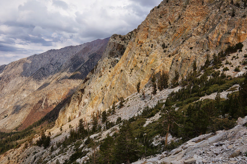
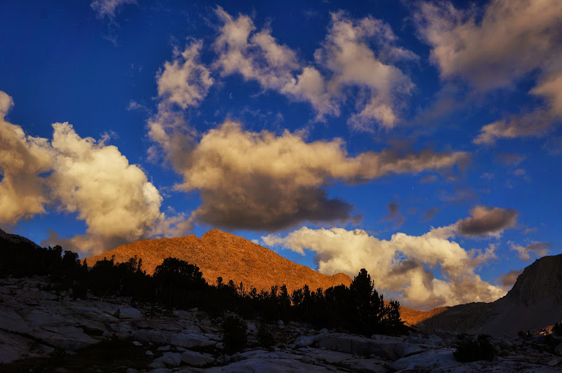
The evening sun, clouds, and smoke cast a warm glow on the rocks--a bit like we'd experienced in Horse Creek Canyon, but with a lot less smoke obscuring the views.


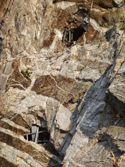
Near the Brownstone Mine we saw a few climbers working a route, and we continued to pass occasional hikers as we followed the trail, then road, then trail again, back towards the car.

We got to the car as the sun sat, packed, and drove back to North Lake to pick up the other car.


We stopped in smoky Mammoth for a, well, mammoth pizza, then drove to also-smoky Lee Vining for a motel room for the night. On the drive to Mammoth, we drove through a short but heavy downpour.

In Yosemite, we had been fortunate to avoid a lot of smoke; along this Sierra High Route segment, we completely avoided getting wet in the backcountry. Beautiful country, excellent company, cooperative weather, and no serious (re)injuries: a completely successful trip! The sad part: we're running out of High Route segments to hike... but I do owe someone a "make good" return to the southern segment...


More Pictures
Re: The Sierra High Route: The Good, The Great, and The Ugly
September 07, 2013 04:37PM
Re: The Sierra High Route: The Good, The Great, and The Ugly
September 07, 2013 04:55PM
My two cents...

On resupply/layovers and re-entry... I recall having a hard time in the time-warp zone known as Muir Trail ranch when I re-supplied for the final time for my third and final leg to Whitney & the Portal during my two-week JMT hike in 2010. 3 hours just went poof.. and I felt a bit weird being that close to all those people, and the hustle and bustle, and computer time... and whatnot.. So I guess I should have been a bit more prepared for the tweakiness that was the first day hiking back up and into the high country on this second trip, the day after hiking out from our Slide-Spiller trip. The pack felt heavier again, the altitude was overall higher and we were going longer. And though the day was clear enough, the weather forecast was reminiscent of two weeks' prior when monsoonal storms hit the Sierras hard. And our usual two hiking buddies were caught in storms which they said were as bad as they've ever encountered. I was leery of walking into a stormy mess. But I really wanted to do this hike... And though the beginning of the day was truly glorious, the wind was strong and bitter at Piute Pass and I was concerned as we worked our way to Desolation Lake. All day, I'd felt slow and stupid. And the west side of the pass was very austere, which I like very much, but I was overly concerned that the pink one wouldn't be happy. And all that put me in a truly sad mood. Thankfully the two birds took my moodiness in stride, and after settling in at Desolation Lake and cooling my sore feet and eating some food, I felt much better. That was easily the lowest point for me in the whole 10 consecutive days of hiking during the two trips.

On talus... The two meaty days included one to two off-trail passes a day... and given the remote environment, I was definitely very cautious with my footing. It took a lot of mental focus and physical energy to carefully place my foot and then transition weight onto it. Over and over again. Thankfully, my shoes gripped well, and the weather ended up smiling on us during the trip and the trickiest passes were done with the best of weather. I know all too well that a short fall, say even 10 feet, can cause a major injury that would cause a lot of trouble. I never got scared, but I had a healthy respect for the terrain and my condition, and was very happy whenever we got down to the flat ground past a talus field! Thankfully, knock on wood, I've not fallen any distance on trail yet. I've tripped and keeled over once and another time slid on wet granite and fell on my leg, cracking my radio screen, but that's all... no real injuries suffered while on trail. Trying to keep it that way...

On skipping cooling my foot... After the first day going to Desolation Lake, I realized again what a stupid idea it had been not to stop and take the time to cool my foot... but we'd gotten a fairly late start and I was worried about my speed going uphill and making it to camp. Overall, bad idea. Cooling every 5 miles, a much better idea. And even at 11k', I was wishing for cooler water!

On little froggies.... Forgot to mention chick-on had been trying to help a little froggie at Miller Lake during the first trip... on this trip, on the day we hiked down from Italy Pass towards Honeymoon Lake, we walked a couple of miles in Granite Park where we each saw several little froggies stuck in the trail! chick-on kept trying to help them out. I became worried about stepping on them, or skewering them with my sticks. Kinda nerve-wracking! They were so cute. I planned on looking them up, but didn't/haven't.

On LNT... What part of "Leave No Trace" is ambiguous? I was a bit disheartened to see the number of ducks and artificial markers on the "off-trail" sections as we did. Roper's pleas to those following his route to leave things as pristine as possible for the next Sierra traveler to enjoy obviously went unheard or deliberately ignored. I wonder how he feels going through some of these areas now... And folks, pack out your trash. We did as much garbage duty as we could...

On the glories of the Sierra... Yosemite has and always will hold the most special spot in my heart for many, many reasons, but the Sierra from there to Whitney is a veritable playground, with numerous gorgeous places to visit. Here's hoping we continue to preserve and protect it for future generations!

On Radios (again)... Each of us had a radio, and that turned out to be oh, so, fabulous! We could spread out, send info back and forth during route-finding, and just plain have fun with each other even though we were hiking at our own preferred speeds. It allowed chick-on to explore away, while Basilbop kindly stayed with me when I was slower. We wasted no time wondering where another party was, what we should or should not do.. we could maximize our time having fun! Yay!

On Good Company... I was very very lucky that I had two of the best companions one could ever hope to have on the trail with me! They were both patient, encouraging, funny and kind. And very, very talented!


Edited 1 time(s). Last edit at 09/07/2013 04:59PM by JustKeepWalking.
Re: The Sierra High Route: The Good, The Great, and The Ugly
September 07, 2013 11:06PM
The picture of White bear Lake is great. I would love to be there right now! What makes Lake Italy ugly? Am I missing something? Great TR, thanks!!
avatar Re: The Sierra High Route: The Good, The Great, and The Ugly
September 08, 2013 07:58AM
Note basilbop's quotation...they're snarking on Roper, who called it ugly.

I've seen it twice, once coming south from Gabbott and the other time north from Dancing Bear (and posted a morning picture of it on Chick-on's thread). I like it. I don't like the descent from Dancing Bear...(the descent from Gabbott is a x-country stroll).


Edited 1 time(s). Last edit at 09/08/2013 08:02AM by ttilley.
Re: The Sierra High Route: The Good, The Great, and The Ugly
September 08, 2013 04:39PM
Gotcha! I think I was in severe dreamland trying to figure out when I can get the family to do this amazing route. I think I just bumped this one to the top of the list over a trip up Cherry Creek... maybe if all goes good, I can do both!
avatar Re: The Sierra High Route: The Good, The Great, and The Ugly
September 09, 2013 07:21AM
Tanks for everything. You have no idea how much I appreciate the company and the
utter appreciation, respect, and awe for The Sierra that you two have.
Just an absolute joy to hike with. Personally I'm so addicted on days I'm not out there
I'm constantly thinking about places to explore and scheming how to get more days in.
Def. will get to over 100 this year again... and it's just never seems to be enough.
Respects
Chick-on is looking at you!

And thanks for the TRs. My wife loves them. (she has no patience with me showing her my 500 faux toes)


Chick-on is looking at you!
Re: The Sierra High Route: The Good, The Great, and The Ugly
September 09, 2013 05:09PM
Quote
chick-on
You have no idea how much I appreciate the company and the
utter appreciation, respect, and awe for The Sierra that you two have.

I am so humbled to read this as I feel the same about you! Sharing the trips with you this year has been an utter joy. In short, sentiments reciprocated! And I hear you about scheming about how to get back.. If we didn't have the upcoming trip... we would be back there this coming weekend, and the next, and the next.. and so on! Looking forward to getting back in October...

100 days? Oh golly, I hope I'll be able to hit that someday...work, other life.. but my heart is always yearning for the mountains. I'd have to count our car-camping days and Thanksgiving days to even come close... sigh...

Glad your wife enjoys the TRs! And 500 faux toes? That must be the very-pared-down set! smiling smiley

After your SHR segment with Basilbop last year, I had him talk me through all the photos and we spent a few nights re-living your trip. Not as good as being there, but hey... smiling smiley
Re: The Sierra High Route: The Good, The Great, and The Ugly
September 09, 2013 09:00AM
Wow. I really enjoyed the photos, particularly the star shots. Roper's opinion of the Lake Italy region reveals how arbitrary most opinions about high country aesthetics are... I gave up trying to pick my "favorite" place a long time ago. It's all good.

It's interesting that you guys felt there were lots of ducks and use trails in that area. I remember thinking there wasn't much impact at all, except for an obvious trail through the sand on the north side of Feather Pass. Overall I thought the High Route was still mostly untouched by humans (though the number of use trails increased as you head further north.) I wonder how much of that stuff fluctuates from season to season and depending on the last few travelers through the area. We knocked over any cairns we saw and picked up any trash we saw (though that was only a few energy bar wrappers on the whole hike.)

On talus... my two worst talus bloopers so far have been (1) rolling a microwave sized block onto my foot, and (2) taking a step back without looking where I thought a rock was, but there was actually just a hole. Fortunately I got away from both of those unscathed. Sticky rubber on your shoes and a willingness to use your hands just as much as your feet makes talus much less nerve-wracking and improves your chances if a block does roll.


How do you like the cuben Trailstar? I have a silnylon one and I'm tempted to swap it out for the cuben version to save some weight. But most of the reviews say it's hard to get a taut pitch.


And here's a photo since you endured all my yakking...

Re: The Sierra High Route: The Good, The Great, and The Ugly
September 10, 2013 04:01PM
Quote
AndrewF
It's all good.

That's the exact phrase chick-on uses! I say it differently and with many many more words! smiling smiley

Quote
AndrewF
I remember thinking there wasn't much impact at all, except for an obvious trail through the sand on the north side of Feather Pass.

Years ago, our first section of the SHR was from Thousand Island past Catherine, through Bench Canyon, past Blue Lake and into Yosemite... I thought from Catherine to Blue was really pristine, except for some yahoo's trash bag and random kit scattered to and fro on the ramp up to Blue Lake Pass. We packed out what we could. Looks like he got caught in a storm or a bear ripped through the stuff and scattered it. Why it wasn't collected by the party in question? No idea. Didn't find a body, so figured someboy was in a hurry. Sigh. But no ducks or paths worn into the ground there. But that was a number of years ago... Kinda worried about going back now to see how it has fared.

On this trip, we saw paths in any soft ground, it seemed, and in rugged country where there are obvious constriction points, this will happen. Just try to minimize the damage, I say. But ducks were not hard to find... and that egregious rock-arrow? Sigh. Really? If I think about it too much I get incensed that someone would read Roper's book, decide to do the route for whatever reason, but ignore his pleas to keep the area pristine. WHY are people backpacking? It's not a paid sport, there are no trophies, no prizes. I naively keep thinking people backpack because they love nature and want to be out in it and experience it - and here is where I seem to go wrong - want to share that experience either directly with others (hiking buddies) or indirectly by leaving the area as pristine as they found it for the next party. I don't know if things are getting worse...(I don't even know if I even want to mention the abomination that's going on nowadays)... or if it's cyclical, or if things will get better again...

Quote
AndrewF
On talus... my two worst talus bloopers so far have been (1) rolling a microwave sized block onto my foot, and (2) taking a step back without looking where I thought a rock was, but there was actually just a hole. Fortunately I got away from both of those unscathed. Sticky rubber on your shoes and a willingness to use your hands just as much as your feet makes talus much less nerve-wracking and improves your chances if a block does roll.

Heck, hands? I'll use my whole body and will butt-scootch off a high rock, etc. I'll use every mechanical advantage I can with my body since I'm not that strong, the pack is a good percentage of my body weight, and I'm already down one knee ligament, and have the various joint issues. I need to move carefully and thoughtfully. The only times I've come close to boo-boos is when my mind wanders - that's how all my injuries (all in the front-country) have happened! And that's the most tiring bit, the constant focus. I love it! smiling smiley

And speaking of butt-scootch. Chick-on was leading down some bit, and he sat, hung his leg over and planted his foot on a rock and lowered himself down. Told me it was easy. I was looking at the drop and was skeptical.. But I sat and hung my leg down, and whiffed the rock by many inches. I had to really scootch and stretch and then could get my toe on the rock and then I had to really use good old calf muscles to lower myself down... And then the most insightful comment from chick-on: "You're short!" Might have been "You have short legs!"winking smiley I hear this a lot from my hubbie, who is 6' tall. I'm 5'5" and that still seems to be solidly in the "average" height for a woman in the US! But I make do the best I can...

And have I mentioned how much I LOVE LOVE LOVE the rubber on my La Sportiva Ultra Raptors? Made a HUGE difference. Slipping really wasn't an issue.... except on those bloody willow (or whatever they were) branches coming down from White Bear Pass. Hard to see the footing and I was getting worried about my ankle.

Okay, I want to be dealing with all that again, RIGHT NOW*... It was fabulous!

*Another chick-on phrase when referring to his desire to be back in the mountains.
Re: The Sierra High Route: The Good, The Great, and The Ugly
September 10, 2013 04:18PM
I think what you describe isn't really limited to the SHR. Just about everywhere I've been has use trails of one kind or another. They are a lot more prominent when the terrain naturally funnels people into one path. Use trails don't bother me nearly as much as trash. I was way out in the middle of nowhere near Balloon Dome last weekend and stumbled across a campsite with a decaying sleeping bag, rusted out pot, two collapsed lawn chairs, and a 6' long, 3' diameter log that had been sawed into a bench.

I remember those willows on White Bear Pass. I had to hand-over-hand my way down a few willow branches to get down a few steep bits. Fun stuff.
Re: The Sierra High Route: The Good, The Great, and The Ugly
September 10, 2013 04:25PM
And no, I see the use trails and ducks all over the backcountry.. it's just that somehow the SHR bits... I just expect more (more = no ducks, no trash), you know? Unrealistic? Probably. I realize people have been all over in the backcountry. I just wish they would be half as courteous as you - and clean up after themselves. Thanks to you and everyone else who takes the time and energy to pack out others' trash!

And yeah, I recall one section where I had to find a good branch I could tug on to work my way across to a better section... I'd prefer not having to do it, but if not doing it meant not going back... I'd do it again in a heartbeat! smiling smiley


Edited 1 time(s). Last edit at 09/10/2013 04:31PM by JustKeepWalking.
Re: The Sierra High Route: The Good, The Great, and The Ugly
September 09, 2013 10:20AM
Thank you so much for this superb TR, what a lovely time you folks had! I plan to do the SHR one year, and I hope to see it in pristine condition when I do. Your pictures are sooo good, and the accompanying write up is engaging and enjoyable as well. Many thanks to you and JKW for sharing this with us.

Ditto on AndrewF's question about the cuben Trailstar. Been thinking about picking up a silnylon one as well, because it seems it's more forgiving in getting a taut pitch on less than ideal terrain. Were you folks able to find stakeable ground most of the time, or did you often have to employ rock anchors?
Re: The Sierra High Route: The Good, The Great, and The Ugly
September 09, 2013 01:34PM
My wife and I both read the reviews comparing the Cuben and silnylon TrailStars, but in the end decided to try the Cuben version. I didn't find the Cuben TrailStar significantly more difficult to pitch than, say, the Cuben DuoMid, and overall it was easier than getting a taut pitch with the silnylon BD Mega Light, which really needs flat ground. It also held its pitch all night, unlike silnylon which stretches and requires constant re-tensioning, especially if wet. There were some teething pains, mostly around untangling the guylines and LiteLine extensions. The pitches we generally used had three corners on the ground, so the corners that were off the ground could compensate for uneven terrain. The "ideal" center pole height for a nice wind-blocking setup (rear close to ground) seems to be about 110cm.

We used Kelty TripTease (with pre-tied loops for staking out) on all ten LineLoc's--3' on the corners and 4' on the edges, and we had no problems with the TripTease sliding through the LineLocs (TarpTent uses the same line and locs...). For the "high" corners/edges, we used MLD's LiteLine and Mini LineLoc's, cut to 10' lengths with pre-tied loops opposite the lineloc ends, with small Nite-Eyez plastic S-biners to connect these longer lines to the TripTease loops. (The LiteLine is too thin to work with the LineLocs.) We brought 5 LiteLine/LineLoc/S-biner lines, but never used more than three. One change I made post-trip was to replace the TripTease line on the corner opposite the MLD logo edge (which is traditionally the "door" for the TrailStar...) with a different-color cord for easy identification, since this is the first corner I stake out.

My pitching sequence:
1) Set trekking pole to ~110-120cm. Ask someone to hold it, or jam into ground.
2) Stake "back" corner (opposite logo'd edge) close to ground, with ridge taut to top of tent/pole
3) State two corners on either side of the "back" corner, also close to ground. At this point, both back panels should be taut.
4) Connect long LiteLine/S-biner to edge with MLD logo, clove hitch to pole, stake out so ridge from pole to logo is taut. The clove hitch should be close to the tent to keep the pole from swaying
5) The remaining two corners can be pitched high for more of a lean-to (use longer lines with clove hitches around poles) or low for a more enclosed shelter (bring close to ground)
6) Stake out all remaining edges. I've found that these stakes need to be further out than the corners to add tension to the panels and edges.
Re: The Sierra High Route: The Good, The Great, and The Ugly
September 09, 2013 02:28PM
Thanks for the detailed response. I'm using a Cuben Duomid now, so good to know pitching is not much more difficult. I LOVE that cuben doesn't stretch when wet, unlike silnylon. Had a little tape failure on my last trip that allowed some leaking during the thunderstorms, but Ron sent me some cuben and seamgrip to patch it up. Haven't gotten around to doing it yet though.

I like your guyline system may consider doing something similar. I've just been taking along some extra triptease and using hitches when I need more length.


Edited 1 time(s). Last edit at 09/09/2013 02:28PM by HikingMano.
Re: The Sierra High Route: The Good, The Great, and The Ugly
September 09, 2013 04:27PM
Staying taut helps it stay quiet in windy conditions. I am a huge fan of the cuben! The light sage green color isn't bad, though I'd prefer yellow! smiling smiley I also liked how we figured out how to relatively easily convert from big wind shelter for 3 for dinner, to a tighter pitch for 2 for night with strong winds. I love our big mid for space, but I must say I did fine with the TrailStar and am a huge fan now. Totally spoiled with the space under it.

On the guylines and extensions, just take the extra few seconds to bundle each cord securely, so it's easy to pitch the next time...
Re: The Sierra High Route: The Good, The Great, and The Ugly
September 09, 2013 06:08PM
Yeah, that flexibility is a nice plus for the Trailstar! I hear/read the common complaints with the trailstar is that you lose headspace pretty quickly from apex to edges (in storm mode), I gather it hasn't bothered you two yet? I just want one for trips where I'm really expecting windy conditions.
Re: The Sierra High Route: The Good, The Great, and The Ugly
September 10, 2013 03:28PM
Basilbop and I cranked down tight on all but one peak, which allowed me to crawl in/out without the difficulty I'd feared. We've read the same issues, but it was worth it to find out if the trade-off between the headroom of our Mid would be made up for with the wind/storm-worthiness... and so far, I'd have to say YES - for me. I don't much like crawling in and out of shelters, but I think I can manage with this one. We'll have to see about downpours... we haven't been rained on yet... but there is a lot of room under there. We put our bags close to each other in the middle and our packs/shoes and other bits on the outside with the lower vertical clearances. I'm hopeful. I LOVE the mid, but in big windy storms, it catches a lot of wind. Has never failed on us, but has needed monitoring and re-staking/tightening. Silnylon has a lot to do with that, but a big Cuben mid is too outrageously expensive - I asked Ron for a quote a few years ago.. Yeeeowp. So, really hoping the TrailStar works. As we move with it into the shoulder and rainy season, we'll find out! smiling smiley
Re: The Sierra High Route: The Good, The Great, and The Ugly
September 09, 2013 11:04AM
Great photos and trip report. I'm particularly intrigued by photo 23 in your album (Mt. Humphries https://picasaweb.google.com/106845571956435018334/SHR13HumphreysBasinToLakeItaly?authuser=0&feat=directlink&noredirect=1#5919165062938758402) showing two different rock forms in the mountain. My daughter teaches 8th grade science and would love to have a full res copy of that for her class. Would you be so kind to email me a copy ? I'll send my email address via PM.
Re: The Sierra High Route: The Good, The Great, and The Ugly
September 10, 2013 01:37PM
Beautiful pictures, inspiring trip report.

Would this be the "Chick-on Mobile" mentioned at the start of the report?
Re: The Sierra High Route: The Good, The Great, and The Ugly
September 10, 2013 03:23PM
IF ONLY!!!! LOVE THE YELLOW!!!
avatar Re: The Sierra High Route: The Good, The Great, and The Ugly
September 10, 2013 07:42PM
That chicken is way too regal.


Old Dude
avatar Re: The Sierra High Route: The Good, The Great, and The Ugly
September 11, 2013 12:37PM
Love it! Bear Lakes basin is probably my favorite region of the sierra.
Re: The Sierra High Route: The Good, The Great, and The Ugly
September 11, 2013 01:28PM
Next August, I am planning for 5 or 6 days either doing this route or more likely coming in at the Pine Creek TH and heading to the Bear Lakes area. I am thinking of setting up a small base camp and doing day hikes around the area. I am in love with the pictures of the area and the great trail reports. I just bought and read Steve Roper's book this week and I think I will probably be single minded until I get to go. It will just be my wife and 11 year old son. Does anyone have any opinions or ideas of going this way? Thanks!!
Sorry, only registered users may post in this forum.

Click here to login