
The Moon is Waxing Gibbous (60% of Full)
Re: Why California’s Trails Are Disappearing From Our Maps
All posts are those of the individual authors and the owner
of this site does not endorse them. Content should be considered opinion
and not fact until verified independently.
|
Why California’s Trails Are Disappearing From Our Maps January 24, 2014 10:33AM | Registered: 11 years ago Posts: 133 |
|
Re: Why California’s Trails Are Disappearing From Our Maps January 26, 2014 05:36PM | Registered: 12 years ago Posts: 140 |
January 27, 2014 08:03AM | Moderator Registered: 14 years ago Posts: 7,421 |
Ken also put it here:
http://yosemitenews.info/forum/read.php?1,71766
Fresno Bee correctly put it in the Opinion section.
This is my limited dealings with trails and whatnot. I'm definitely not familiar at all with the Sequoia NF...
Without question the "cannot use chainsaws" just isn't true anymore. I'm not sure when the change
occurred but I would almost say that nearly all tree cuts now are done with chainsaw.
Without question in Yosemite that is true. Z Old dood and I even saw wheelbarrels in the b/c.
Seen chainsaws frequently.
Seems to me that trails "disappear" due to a) lack of use, b) a different route is used/abuse c) the
orginal trail was obscure at best to begin with and d) the powers that be have decreed it so
I have seen all of thse first-hand.
Not so sure about more graffitti and more fires. Personally I just don't buy that one. Peeps are gonna
do what they want to do it seems. The amount of "education" when you pick a NF permit is zip.
"Sign here, there you go" or not even that.
Anywho. There is a just a ridonkulous number of trails out there. You really don't have to go far.
Not sure it's even possible to hike them all in your lifetime to be honest. Couple that with that is
just The Sierra... and the possibilities are mind boggling (I get a headache looking at maps ... going dang...
I haven't seen anything yet!)
What am I saying? We got it damn good here in California... even if the rest of the country and
world think we are all immigrants and hopped up on weed or getting plastic surgery.

One other note... When the wife and I were hiking up Snow Creek one winter we ran into a b/c ranger
and during the conversation we got to talking about trails... he said that trails need to be
entirely rebuilt every 10 years. I thought that statement was just not true. Especially on the trail we
were on.
Anywho. Thats my 5 percent worth.

http://yosemitenews.info/forum/read.php?1,71766
Fresno Bee correctly put it in the Opinion section.
This is my limited dealings with trails and whatnot. I'm definitely not familiar at all with the Sequoia NF...
Without question the "cannot use chainsaws" just isn't true anymore. I'm not sure when the change
occurred but I would almost say that nearly all tree cuts now are done with chainsaw.
Without question in Yosemite that is true. Z Old dood and I even saw wheelbarrels in the b/c.
Seen chainsaws frequently.
Seems to me that trails "disappear" due to a) lack of use, b) a different route is used/abuse c) the
orginal trail was obscure at best to begin with and d) the powers that be have decreed it so
I have seen all of thse first-hand.
Not so sure about more graffitti and more fires. Personally I just don't buy that one. Peeps are gonna
do what they want to do it seems. The amount of "education" when you pick a NF permit is zip.
"Sign here, there you go" or not even that.
Anywho. There is a just a ridonkulous number of trails out there. You really don't have to go far.
Not sure it's even possible to hike them all in your lifetime to be honest. Couple that with that is
just The Sierra... and the possibilities are mind boggling (I get a headache looking at maps ... going dang...
I haven't seen anything yet!)
What am I saying? We got it damn good here in California... even if the rest of the country and
world think we are all immigrants and hopped up on weed or getting plastic surgery.
One other note... When the wife and I were hiking up Snow Creek one winter we ran into a b/c ranger
and during the conversation we got to talking about trails... he said that trails need to be
entirely rebuilt every 10 years. I thought that statement was just not true. Especially on the trail we
were on.
Anywho. Thats my 5 percent worth.
January 27, 2014 11:59AM | Admin Registered: 15 years ago Posts: 17,050 |
January 27, 2014 01:16PM | Moderator Registered: 14 years ago Posts: 7,421 |
Quote
eeek
Quote
chick-on
Without question the "cannot use chainsaws" just isn't true anymore.
I talked to a trail crew leader in Kings Canyon a while back. He said they were allowed to use chainsaws in the National Park but were not allowed to use them on National Forest land. <shrug>
Interesting. The parks definitely did not used to be allowed to use them in the past.
All the mess around Reds is not in any NP... they had to have used chainsaws there. I guess they got some exemption?
January 27, 2014 02:58PM | Admin Registered: 15 years ago Posts: 17,050 |
January 27, 2014 04:31PM | Moderator Registered: 14 years ago Posts: 7,421 |
I remember a video a while back that went over the pains they had to go thru to cut a really big log
that was blocking a trail. This video was "advertising" Sequoia-Kings Canyon.
They took great pride in cutting the logs by hand. This is mainly what I am basing my comment about "used to" on.
that was blocking a trail. This video was "advertising" Sequoia-Kings Canyon.
They took great pride in cutting the logs by hand. This is mainly what I am basing my comment about "used to" on.
|
Re: Why California’s Trails Are Disappearing From Our Maps January 27, 2014 04:47PM | Registered: 11 years ago Posts: 194 |
Quote
chick-on
Interesting. The parks definitely did not used to be allowed to use [chainsaws] in the past.
I have seen them dangling off mules in Yosemite on several occasions (most recently 2012 around Seavey Pass).
Addendum: Oops - I was reading the thread backwards iand didn't see that Chick-on said exactly the same thing.
Edited 1 time(s). Last edit at 01/27/2014 04:49PM by Royalist.
January 27, 2014 10:07PM | Moderator Registered: 15 years ago Posts: 1,347 |
I think that Chick-y and I have talked about this before: The American National Forest has always been (in my lifetime...better ask Old Dude for more significant historical perspective) a pilage-free-for-all on both the resources and the environment, itself. Think: chainsaws, maruading super trucks, bullets flying, timber 'managmement', squatting, graffitti -- did I leave out anything?
I believe that trail upkeep is the least of the long list of problems, and it has been going in this direction for a long time.
The body betrays and the weather conspires, hopefully, not on the same day.
I believe that trail upkeep is the least of the long list of problems, and it has been going in this direction for a long time.
The body betrays and the weather conspires, hopefully, not on the same day.
|
Re: Why California’s Trails Are Disappearing From Our Maps January 29, 2014 05:02PM | Registered: 11 years ago Posts: 194 |
January 29, 2014 10:47PM | Moderator Registered: 15 years ago Posts: 1,347 |
Quote
Royalist
Quote
Bee
chainsaws, maruading super trucks, bullets flying, timber 'managmement', squatting, graffitti -- did I leave out anything?
Yes - pot farms.
How could I forget?? (I need to remember to add this one to my "everyday" rant about forest abuse)
There is a HUGE problem with erosion caused by the wholesale clearing/excessive watering of illegal pot farms in the Forest Hill Auburn area.
The body betrays and the weather conspires, hopefully, not on the same day.
|
Re: Why California’s Trails Are Disappearing From Our Maps January 27, 2014 12:34PM | Registered: 12 years ago Posts: 140 |
January 27, 2014 01:19PM | Moderator Registered: 14 years ago Posts: 7,421 |
January 28, 2014 10:02AM | Moderator Registered: 15 years ago Posts: 1,876 |
I guess I'll be the skunk at the lawn party for this conversation. Other than very short term noise pollution, what exactly is the objection to using chain saws to clear deadfall from existing trails? It's far quicker than hand sawing and the quicker deadfalls are cleared---the quicker trail users get back onto the trail instead of trampling multiple paths around obstructions. I'm a back country purist in many respects but not on this subject. Let the trail maintenance folks get in, do their thing, and get out as soon as possible. The greater Yosemite and High Sierra area has experienced some widespread tree fall devastation in recent years that have closed trails for extended periods of time. Do folks have any real appreciation for how much longer it would take to clear such damage if only hand saws were used? Where would you even find sufficient labor who would wish to work that dumb? Where would you get the financing to pay for labor that takes several times longer than doing the same job with chain saws? I'll admit I'm no fan of being around chain saw activity but the job to be done requires a little common sense.
O.K., I'm ready for the flamers. (we need an icon of a skunk)
O.K., I'm ready for the flamers. (we need an icon of a skunk)
January 28, 2014 10:24AM | Moderator Registered: 14 years ago Posts: 7,421 |
Hang on there. You are reading into this. I never said that chainsaws shouldn't be allowed.
My original point was simply a reply to the article in that it took so much effort to clear a trail
b/c chainsaws were NOT allowed... to which I said that I didn't think that to be true.
Anytime you are on a trail and the log is cut 20 times... then I can say that they did that with
a chainsaw... and seen that all over (why the heck this is done is.. beyond me)
Anywho. Get in der and chainsaw away.
One other comment w/r to the original article... one issue I sort of have is that the peeps
working the office... I'm pretty sure a large number never even have been on the trails
they are giving permits out for. I've given up asking anything of them other than stuff like
"now dogs are NOT allowed into Lord Meadow, correct?" (I'm right on this) ..
Anywho. We have always thanked the trail crews we see.
Oh, one other thing I've seen that seems "government" is the over-maintenance.
They must have money and just have to spend it or it goes away. I have examples...
I'll just give one.. and I haven't seen what they have or have not done yet on it..
but I have no idea how you spend 600K on the trail to Beehive... or why you would
even want to do that.
|
Re: Why California’s Trails Are Disappearing From Our Maps January 30, 2014 10:35AM | Registered: 11 years ago Posts: 133 |
Wow, some great discussion!
The issue of chainsaws always generates discussion. The law that governs this is the Wilderness Act, which contains language that requires the "minimal tool" required for doing a job safely:
"PROHIBITION OF CERTAIN USES
(c) Except as specifically provided for in this Act, and subject to existing private rights, there shall be no commercial enterprise and no permanent road within any wilderness area designated by this Act and, except as necessary to meet minimum requirements for the administration of the area for the purpose of this Act (including measures required in emergencies involving the health and safety of persons within the area), there shall be no temporary road, no use of motor vehicles, motorized equipment or motorboats, no landing of aircraft, no other form of mechanical transport, and no structure or installation within any such area."
This "minimum tool" provision is decided by the Cabinet head of the department involved. For National Parks, headed by the Dept of the Interior, the Secretary of the Interior decided that the minimal tool for cutting trees was a chainsaw. For National Forests, headed by the Dept of Agriculture, the Secretary decided that the minimal tools for cutting trees were hand saws.
It is possible to gain exemptions. The Blowdown last year in Red's Meadows is a good example. 10,000 trees were blown down, and to cut them by hand would have taken many many years, and would have created many safety issues for hikers. An exemption was granted by the Regional Forester for the Ansel Adams and John Muir Wildernesses, in the area affected only. However, exemptions are rare.
There are many workers on the National Forests that consider the rules to be absurd. Most hikers don't care, they want the trails open. Without chainsaws, many (but not all) jobs take longer, some FAR longer. Often, there is a window on specific trails where there is access, but not hikers yet. The prohibition in that setting is apparently to spare the trees from hearing the sound of chainsaws and scaring them? Seriously, some have proposed allowing the use for, say, 2 weeks each year, to allow the really gnarly jobs to get done. Far too logical, it'll never happen.
the cost of trail maint is quite high. Commercial work costs about $15-20k PER MILE. That assumes no special problems, like having to build structures like walls or drains, or having to build around archeological sites. You have to come out and actually see what is done, to understand. It is far more complex than one might assume.
One great comment: "Where would you even find sufficient labor who would wish to work that dumb?"
If you have never run a crosscut saw, you would not know that users really enjoy using them. It is almost Zen-like in practice. Crosscut Sawyers LIKE to do this work. The conflict comes from the competing concept of work production. But to put the comment in context, it would be like asking, with the advent of photography, why would anyone be dumb enough to do a painting?
It's great to see so many people contributing!
January 30, 2014 08:34PM | Moderator Registered: 14 years ago Posts: 7,421 |


January 31, 2014 12:48AM | Admin Registered: 15 years ago Posts: 17,050 |
January 31, 2014 07:16AM | Moderator Registered: 14 years ago Posts: 7,421 |

January 31, 2014 09:12AM | Moderator Registered: 15 years ago Posts: 1,347 |
January 31, 2014 07:27AM | Moderator Registered: 14 years ago Posts: 7,421 |
To further comment just a little bit... what my opinion is in Yosemite is that they
just put a spike camp at a place that one hasn't been for awhile... and they
go and find stuff to do... which includes paving the trail. Personally I'm really
curious what was done in Jack Main last year. One place I can see some work
being done was east of the Isthmus. Other than that I dunno. As much as
I appreciate all the work they do I really think they just go overboard sometimes.
Sometimes it detracts from the experience. The example I can give is the
traverse on the south side of the Merced between Bunnell and Echo Valley.
They lined up about 20 huge boulders to mark the trail. Not a fan.
Here's an example of paving the trail for why?

Lower Ottoway is below for your convenience...
This made no sense to me other than whomever was making the decisions
decided that a couple of steps would be nice here.
Anyway... I've prob. said more than what people want to hear.
I'll finish by saying that I've said it before... we've run into these people many
times and they just love the work and we say thank you thank you...
and many of them are young kids from the CCC and it's just a great
experience for them. I'm sure it is live changing.
Yosemite sure has change my life.
Have a nice day
just put a spike camp at a place that one hasn't been for awhile... and they
go and find stuff to do... which includes paving the trail. Personally I'm really
curious what was done in Jack Main last year. One place I can see some work
being done was east of the Isthmus. Other than that I dunno. As much as
I appreciate all the work they do I really think they just go overboard sometimes.
Sometimes it detracts from the experience. The example I can give is the
traverse on the south side of the Merced between Bunnell and Echo Valley.
They lined up about 20 huge boulders to mark the trail. Not a fan.
Here's an example of paving the trail for why?
Lower Ottoway is below for your convenience...
This made no sense to me other than whomever was making the decisions
decided that a couple of steps would be nice here.
Anyway... I've prob. said more than what people want to hear.
I'll finish by saying that I've said it before... we've run into these people many
times and they just love the work and we say thank you thank you...
and many of them are young kids from the CCC and it's just a great
experience for them. I'm sure it is live changing.
Yosemite sure has change my life.
Have a nice day
|
Re: Why California’s Trails Are Disappearing From Our Maps February 01, 2014 06:44PM | Registered: 15 years ago Posts: 84 |
Last year, I had a fairly long conversation with one of the trail crew supervisors as they were working above Hetch Hetchy, an area he said they were working on for the 2nd time that year. He said he had been working trail crew in Yosemite for over 15 years. A few of the questions I asked were why some trails are routinely (or even over) maintained while others appear almost neglected; and, on average, how frequently is any given trail worked on. I assumed the answer would have something to do with the popularity of the trail and condition based need. It didn't. He indicated that the Park Service budget was woefully inadequate in terms of funding for trail maintenance and that the bulk of the money came from private donations or through the Yosemite Conservancy. Further, much of that money comes from a few very large donors, several of whom have specified where the money will be spent (i.e., on which specific trails). He gave an example of one couple that recently donated over 10 million, but specified it was to be used in the Red Peak Pass area only.
Quote
chick-on
To further comment just a little bit...
February 05, 2014 08:26AM | Moderator Registered: 14 years ago Posts: 7,421 |
LV. Thanks for posting that. Now it makes more sense of why we've seen work
being done on a seemingly trail that really didn't need any work in 06, 09, and 12...
I was told by a ranger that the park gets a large sum of money from DNC specifically
for trail maintenance which is part of the contract with them. I was given a number
but I'll just say it was a rather large number rather than saying a number which
I may have altered, etc. etc.
|
Re: Why California’s Trails Are Disappearing From Our Maps January 28, 2014 09:59PM | Registered: 12 years ago Posts: 140 |
Combo of all the things you've listed, deadfall, whatnot, are the culprits. PCT is in great condition as are trails around popular places like Lake Alpine and Sword Lakes.
As for trip reports, I don't post them because I don't post a lot of photos. For a tiny flavor here's a few though.
As for trip reports, I don't post them because I don't post a lot of photos. For a tiny flavor here's a few though.
|
Re: Why California’s Trails Are Disappearing From Our Maps February 05, 2014 11:29AM | Registered: 11 years ago Posts: 133 |
Great discussion. Chick, it is difficult to evalauate a trail job from a photo, perhaps from the wrong angle. Rockwork is very difficult and time consuming.
Why a crew would put in steps is sometimes difficult to fathom. You really have to understand the dynamics of what is going on, particularly with water, at that point. Also something that hikers frequently miss, is that many trails are supposed to be for stock, too. What might be trivial for a hiker, may be exceedingly dangerous for stock....slick rock at an angle is among the worst. When I ride, that scares the heck out of me. The mitigation is often to build a step, burying the offending slick rock. Not saying that was the situation in your photo, but that is common. I'm definitely not a fan of lining a trail with boulders. when I find that, I often remove them.
But there are situations where it is the best solution to a problem. Trailwork is often a problem-solving exercise, and is a thinking person's game.
We also may go a little overboard in clearing (particularly brush), when we think we won't be back for 5 years.
February 05, 2014 02:00PM | Moderator Registered: 14 years ago Posts: 7,421 |
It is (well I find) very interesting to go on a trail in early spring when there is loads of water flowing
everywhere. You will find rock work frequently where washes cut across a trail.
If you take that same trail in fall it may look like some rock work was done for no reason.
It appears to me that many of the trail work done has evolved over many decades.
Trail washes out here... ok, we need to put in some rockwork to mitigate the erosion.
As for slick rock.. wow.. they really went to town on the trail up from Merced Lake up Lewis Creek.
Can you say cobblestones? Now there is trail that could use a bit of rework with some steps.
We have found the cobbles in that area to be pretty tretcherous.
The recent Yosemite Railroad book that thecheif posted is v. interesting.
A great picture of the very top of the Mist Trail right before the comfort station atop
Nevada Falls.
http://yosemitenews.info/forum/read.php?3,71844,71844#msg-71844
That section of trail is in spectacular shape now. Has really stood the test of time..
February 05, 2014 09:47PM | Registered: 15 years ago Posts: 670 |
Quote
chick-on
. . . snip . . .
The recent Yosemite Railroad book that thecheif posted is v. interesting.
A great picture of the very top of the Mist Trail right before the comfort station atop
Nevada Falls.
http://yosemitenews.info/forum/read.php?3,71844,71844#msg-71844
That section of trail is in spectacular shape now. Has really stood the test of time..
"test of time"?
A lot of that section of trail is newly rebuilt since the flood in . . . ah . . .(googling) 1997!
That gully is a flood overflow channel for the Merced River during high water. There's actually a dam just off trail between the "Comfort Station" and Nevada Fall that you can easily see if you know where to look. That keeps water from running down the gully during a normal winter melt, but didn't do much good during the 1997 flood. Most of the trail down the gully had to be rebuilt after the flood.
I'm sure there are other sections of trail with stone work that have REALLY stood the test of time and have survived for 50-100 years I'd think. I've seen walls where the rocks are all covered in really thick moss and lichen. OLD!
|
Re: Why California’s Trails Are Disappearing From Our Maps February 05, 2014 11:28PM | Registered: 11 years ago Posts: 133 |
Just to give people an idea of what can, and is done by experts, here is a project done by a couple of my mentors:
https://www.wilderness.net/toolboxes/documents/tools/trail_work_H-T_dolly.pdf
https://www.wilderness.net/toolboxes/documents/tools/trail_work_H-T_dolly.pdf
February 06, 2014 01:09AM | Moderator Registered: 15 years ago Posts: 1,347 |
Very informative document; it reminds me of something from The Woodwright's Shop: no power tools allowed, and the participants are guaranteed to lose weight!
The body betrays and the weather conspires, hopefully, not on the same day.
The body betrays and the weather conspires, hopefully, not on the same day.
February 06, 2014 06:38AM | Moderator Registered: 14 years ago Posts: 7,421 |
Ok. Maybe I need to look closer. You are right. Part of the wall was rebuilt.
I guess it only lasted 87-ish years... ... and a good portion is still intact.
Took me awhile to find my faux toe of it. I was stumped by the old photo for
quite some time of where exactly it was. Saw it in old archives and couldn't
even convince myself it was Yosemite.
You can compare my faux toe to the one in the brochure...
or simply look at z colour of the rocks.
Map of Z area in question:

2 of the Zags partially rebuilt:

Edited 1 time(s). Last edit at 02/06/2014 06:40AM by chick-on.
I guess it only lasted 87-ish years...
... and a good portion is still intact.Took me awhile to find my faux toe of it. I was stumped by the old photo for
quite some time of where exactly it was. Saw it in old archives and couldn't
even convince myself it was Yosemite.
You can compare my faux toe to the one in the brochure...
or simply look at z colour of the rocks.
Map of Z area in question:
2 of the Zags partially rebuilt:
Edited 1 time(s). Last edit at 02/06/2014 06:40AM by chick-on.
February 19, 2014 06:42AM | Moderator Registered: 14 years ago Posts: 7,421 |
Impossible to get the same photo of the zig zags now... trees block the view almost entirely:
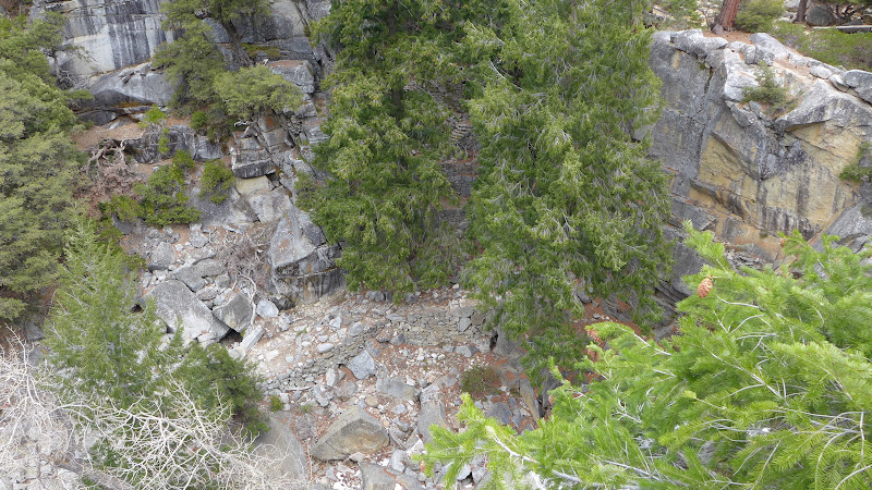
Water is common in the zig zags ... from above. dunno how much water from the flood from the merced itself would have
come down the zigs. I don't think any... but I don't contend the flood did a lot of damage to trails.
Water is common in the zig zags ... from above. dunno how much water from the flood from the merced itself would have
come down the zigs. I don't think any... but I don't contend the flood did a lot of damage to trails.
February 19, 2014 06:43AM | Moderator Registered: 14 years ago Posts: 7,421 |

February 06, 2014 07:17AM | Moderator Registered: 14 years ago Posts: 7,421 |
One comment / complaint I have in this realm is that the trail workers are being instructedQuote
Ken M
something that hikers frequently miss, is that many trails are supposed to be for stock, too.
to take big rock.. smash big rock.. make small rock... put into trail. Dang. What a pain in the rump
this is to walk in. When Z Perret and I did Murro Blanco we went over Mather Pass twice...
Personally I could not get my bootie off the darn JMT in that section quick enough. Gravelled
trail... I was just asking "do the people that are doing this actually hike? cause this really sucks" .
In comparison the trek thru Murro Blanco was a complete and utter joy.
Maybe eventually it settles out... but I dunno about that since stock comes thru and roto tills it
back up.
|
Re: Why California’s Trails Are Disappearing From Our Maps February 06, 2014 08:59PM | Registered: 11 years ago Posts: 133 |
Good observation.
The "preferred" final top surface of a trail is dirt, even when we've put in a deep layer of broken rock to provide excellent drainage so that the trail won't wash out, and that is generally what's done.
However, there are a few exceptions, and you probably hit on one of them: we are supposed to be "naturalizing" the trail setting. If the setting is an alpine one where there is no dirt around, then it would be creating an artificial situation, if one brought dirt in to create a final top surface of dirt.
Another is in the slide presentation that I'd posted a few posts up, in slide 44, it shows the repaired trail in broken rock, but the trail beyond with the usual dirt covering over fill. Why did they not put in dirt? It is because the log up against the trail, and eventually other wood, would be kept wet by the dirt, and would rot out much sooner, perhaps a decade. So they left this short section in rock.
Breaking up rock to create a trail surface is very hard work, and no sane person does any more of it than they have to!
But you have to put it in for drainage, or the trail ends up as a mudbath. For example, a project that I was involved in, seen in the following photograph. This section was impassible to horses due to slanting rock faces, and they went around it, causing enormous erosion and damage. We created these steps, and the rocks that you see across the trail are only about 1/3 of the actual rock--the rest is buried. We had to dig large pits for them to rest within, placed them, then filled with rock so they wouldn't move when a horse stepped on them. We then backfilled with crushed rock for drainage, then put on 4 in or so of dirt. It took a crew of 7 five days to do less than 100 feet, with a dozen steps.
February 07, 2014 07:22AM | Moderator Registered: 14 years ago Posts: 7,421 |
Mr. Ken, thanks for the discussion and the insights and docs about trail building.
The work above begs the question(s) (well... from me) ... why are we building trails
for stock? Why do we spend so much time and energy making a trail suitable
for stock? Why do we need to have stock in the backcountry? Are pack outfitters
doing way too much damage?
I think without question stock do an incredible amount of damage and wear and tear
on the trails. Why are pack outfitters needed? Are they? Why? Really why?
|
Re: Why California’s Trails Are Disappearing From Our Maps February 07, 2014 05:14PM | Registered: 12 years ago Posts: 140 |
February 07, 2014 05:28PM | Moderator Registered: 14 years ago Posts: 7,421 |
|
Re: Why California’s Trails Are Disappearing From Our Maps February 07, 2014 05:49PM | Registered: 12 years ago Posts: 140 |
February 08, 2014 01:17AM | Registered: 15 years ago Posts: 4,173 |

|
Re: Why California’s Trails Are Disappearing From Our Maps February 10, 2014 08:42PM | Registered: 11 years ago Posts: 133 |
Quote
chick-on
Mr. Ken, thanks for the discussion and the insights and docs about trail building.
The work above begs the question(s) (well... from me) ... why are we building trails
for stock? Why do we spend so much time and energy making a trail suitable
for stock? Why do we need to have stock in the backcountry? Are pack outfitters
doing way too much damage?
I think without question stock do an incredible amount of damage and wear and tear
on the trails. Why are pack outfitters needed? Are they? Why? Really why?
I've never been a lover of stock, as a backpacker, and asked myself those questions many times.
As near as I can see, it comes down to tradition and custom. And I understand that.
What seems unreasonable to me is the huge fleet of stock that can go out....25 at a time.
The few that support a trail crew or other administrative work is not likely to cause significant
damage. But a huge herd, that covers the same ground over and over,
seems to be a horse of a different color.....
|
Re: Why California’s Trails Are Disappearing From Our Maps February 10, 2014 10:45PM | Registered: 12 years ago Posts: 140 |
February 11, 2014 07:07AM | Moderator Registered: 14 years ago Posts: 7,421 |
|
Re: Why California’s Trails Are Disappearing From Our Maps February 12, 2014 06:22PM | Registered: 12 years ago Posts: 140 |
It's a legacy thing from when Congress signed the wilderness act. Had to make some deals to get it passed, which I'm glad it did, moos and all.
I remember coming down from the pass between Bull Run and Henry Peaks in Carson-Iceberg, stopping to get a drink out of a "pristine" stream, and looking up to see a bunch of cows. Had a filter and glad I used it.
I remember coming down from the pass between Bull Run and Henry Peaks in Carson-Iceberg, stopping to get a drink out of a "pristine" stream, and looking up to see a bunch of cows. Had a filter and glad I used it.
February 19, 2014 06:46AM | Moderator Registered: 14 years ago Posts: 7,421 |
|
Re: Why California’s Trails Are Disappearing From Our Maps February 19, 2014 06:13PM | Registered: 12 years ago Posts: 140 |
Sorry, only registered users may post in this forum.

