Welcome! Log In Create A New Profile Recent Posts
A Yosemite bear

The Moon is Waxing Gibbous (61% of Full)


Advanced

Re: Wires and pipes near the Four Mile Trail

All posts are those of the individual authors and the owner of this site does not endorse them. Content should be considered opinion and not fact until verified independently.

avatar Wires and pipes near the Four Mile Trail
May 26, 2014 03:14PM
At a couple of switchbacks on the Four Mile Trail I've noticed what looks like thin steel wire, coathanger gauge or so, running above the trail. For instance, the wire runs above the switchback I call "L20" and is visible on the rocks next to "L28". Last year I followed it (without going offtrail) to this odd-looking attachment point:


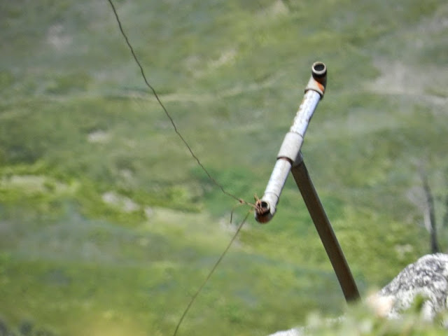
Both the wire and the pipe fittings look old and rusty. There's no sign of insulators so I wouldn't think this setup would've been designed for any electrical or communications use -- not directly, anyway. Someone obviously went to a certain amount of trouble to put it there, so what could it be for? One possibility that occurs to me, is that it might have been the "messenger wire" mechanically supporting something like a telephone cable that's no longer there.

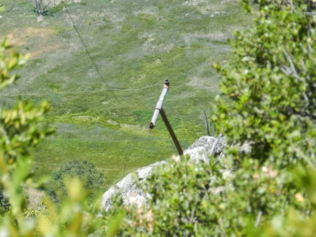
Here's a pic from Columbia Rock showing the location of the pipe-supporting rock. It was cropped from a much wider view so it's not very sharp, unfortunately:


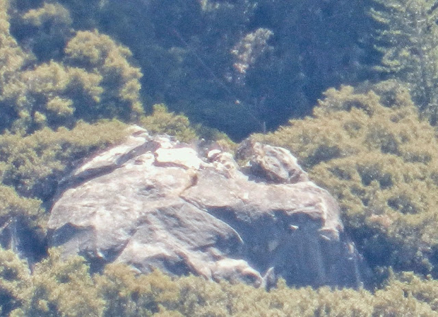
Last September I was up at Columbia Rock again and happened to catch the light just right. Here's the same rock and the wire shining in the sun:


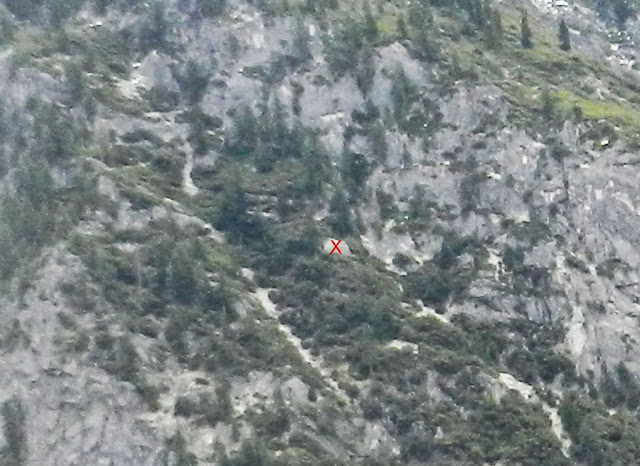
This xRez view from Eagle Point (with my labels added) shows the rock and both of the switchbacks in question:


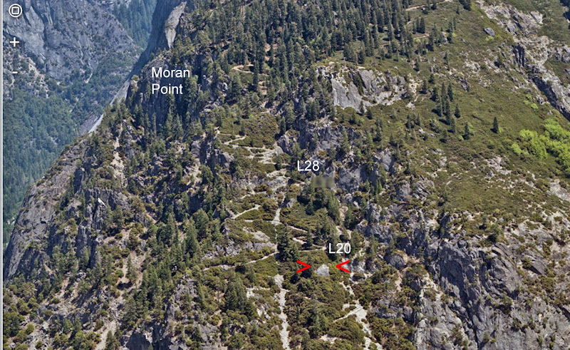
[Picture corrected 5/28/14. The previous version had the "L28" switchback label a little too low, at L26.]

In case anyone's not familiar with xRez, here's where that pic came from... http://www.xrez.com/yose_proj/yose_deepzoom/index.html ... and here's some more about it: http://www.xrez.com/case-studies/national-parks/yosemite-extreme-panoramic-imaging-project/


Edited 1 time(s). Last edit at 05/28/2014 10:47AM by gophersnake.
avatar Re: Wires and pipes near the Four Mile Trail
June 16, 2014 11:44PM
Here is a link to an old map: http://gisserver.princeton.edu:81/navigatorMapViewer.htm?map=923

It was in another post by gophersnake from earlier today. The map shows all the telephone and telegraph lines installed and proposed. The T bar in your photos are from the tele lines from the valley floor to GP.


Old Dude


Edited 2 time(s). Last edit at 06/16/2014 11:47PM by mrcondron.
avatar Re: Wires and pipes near the Four Mile Trail
June 17, 2014 12:26AM
I've noticed those T-bars too (and a wire laid on the ground), but I've seen them east of the current (and even old) FMT above Union Point (not west as shown on the old map).

.
avatar Re: Wires and pipes near the Four Mile Trail
June 17, 2014 10:02AM
Quote
mrcondron
The map shows all the telephone and telegraph lines installed and proposed. The T bar in your photos are from the tele lines from the valley floor to GP.

Hey, thanks! It never occurred to me that anyone would bother to put telephone lines on a map, nor that that line could have been there as early as 1910 -- so of course I only looked at the Old Village stuff.
Re: Wires and pipes near the Four Mile Trail
June 17, 2014 01:38PM
Quote
gophersnake
Quote
mrcondron
The map shows all the telephone and telegraph lines installed and proposed. The T bar in your photos are from the tele lines from the valley floor to GP.

Hey, thanks! It never occurred to me that anyone would bother to put telephone lines on a map, nor that that line could have been there as early as 1910 -- so of course I only looked at the Old Village stuff.

Those lines were probably in service at least until the hotel at Glacier Point burned down. There would have been a phone at Union Point during the period when the comfort station, fountain, and horse trough were operational.

Those pipes don't have to be the original poles. Telegraph and telephone poles get replaced all the time.
avatar Re: Wires and pipes near the Four Mile Trail
June 17, 2014 09:30PM
Embaressed I'm embarrassed to note that wherever had posted a piece of that map (or a very similar one) here a year and a half ago.

On the other hand, seeing that thread again reminded me that in the meantime, I've gone ahead and answered some of my own questions. I'll be posting about it shortly.
Sorry, only registered users may post in this forum.

Click here to login