
They weren't in a mood for long, tough hikes before or after their climb. Liberty Cap on Monday afternoon was fine. On Wednesday we did a bunch of easy stuff from Olmstead Point to the Mt. Watkins summits, and on Friday we did Sierra Point before driving home. The El Cap Ridge hike was too long to do on a laid-back Thursday, so we did the Inspiration Ridge hike instead. I've mentioned this before. Except for Chick-on, I've never heard of anyone else going there.
I call it Inspiration Ridge, because it runs down from the Badger Pass area to the Inspiration Point / Tunnel View area. It starts on the Glacier Point Road at the saddle just east of the Badger Pass ski area. There is a cross country ski run that heads north from there, along the ridge, and which then heads north east to Dewey Point when the ridge splits. There is no summer trail along that route, though the yellow markers are visible up in the trees. I have hiked it, and there are a lot of fallen trees and bushy places to deal with near the Dewey Point end of things. But the Inspiration Ridge variation has almost no bushwhacking problems. Basically, you follow the ridge down to where you can pick up the Old Wawona Road. You follow that to the real Inspiration Point (where the Pohono Trail touches the abandoned parking lot). This is somewhat overgrown now, and all the modern Inspiration Point photos are taken from farther down the Pohono Trail. From the old parking lot you have your choice of routes down to the modern parking areas. We chose to follow the old road to where it hits the Pohono Trail the second time, then down the trail to Tunnel View.
We have done this before. You can also do it as an out-and-back from the Glacier Point Road. A favorite option is shown in this link to a trip where we went up the ridge to the boulders, then along Meadow Brook to the top of Silver Strand Falls, and back down via the Pohono Trail:
http://yosemitenews.info/forum/read.php?3,39035
We elected to leave a car at the Tunnel View parking lot, although following the Old Wawona Road all the way to the base of Bridalveil Falls is equally good. That way, even with a leisurely pace, numerous bouldering problems, and lunch, the whole trip lasted from 9 am to 2 pm.
Here is the Google Earth version of things.


On the map, "1" is Badger Pass. That loop is their parking lot. "2" is the start of the hike, at the saddle that cross country skiers hate climbing up to on the snow-covered road. You can see Dewey Point straight north of there.
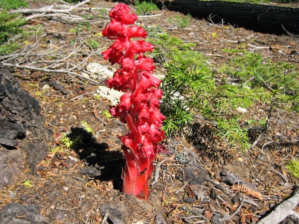
Along the ridge, the flowers were subdued by the drought. But not so the fungi. There were some really big ones:
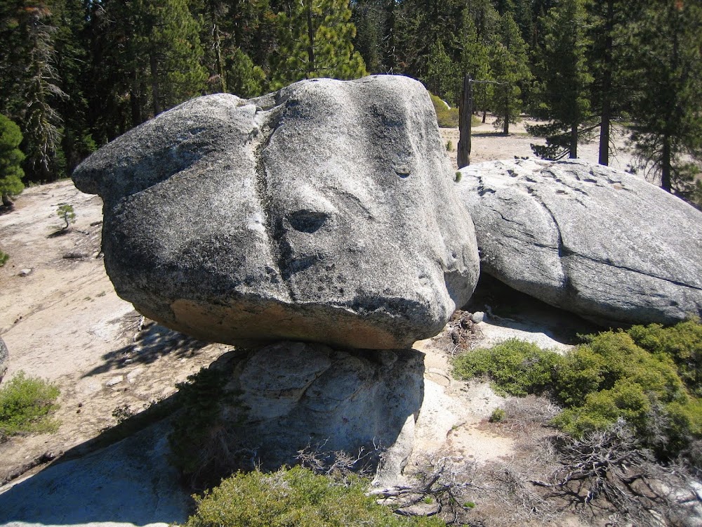
Soon after turning northwest, the landscape opens up. And there are scenic boulders everywhere.

In the distance, you can see the ski area and lifts:

A fairy garden of boulders. This one is much harder to get onto than you might think.

The not-yet-famous kissing boulders:

Some of the larger ones have the most amazing crenelated tops, with bowls and cups and battlements.
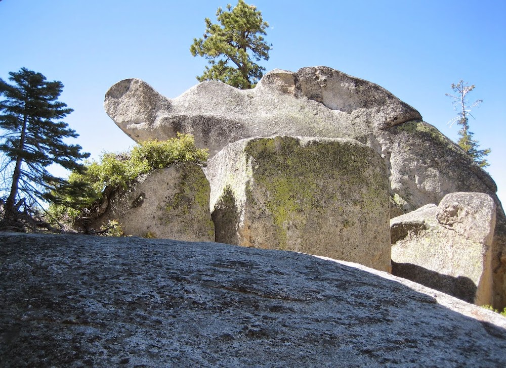
That one could be climbed for a view of the gawkers down below.

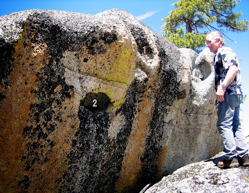
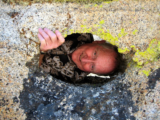
Another boulder has several interesting features. 1) It has a mini-bridge the size of a towel rack. 2) It has a window into a large bathtub-sized opening.


OK. Enough foolishness. I highly recommend this hike as an introductory off-trail day hike. One suggestion: If you have a gps, and if you are at all unsure about recognizing the old road when you hit it, put in waypoints beforehand for the road and for Turtleback Dome (which is where you would end up if you crossed the road without recognizing it). The only other place where you might go wrong is early on, where the upper ridge forks, and where you need to turn left. A waypoint there could be helpful.
None of the photos were taken by me. All the credit goes to my good hiking buddy.
Edited 3 time(s). Last edit at 06/10/2014 06:00PM by wherever.


