A number of recent (past year or 2) posts in the trip report section have referenced success (or lack thereof in certain cases) in finding one or more of the hundred plus boundary markers that were placed during the survey of 1905-1906. This survey was likely done as a companion to the legislation that was in process. Chick-on in particular has been visiting likely boundary marker sites over the years, having, I believe, first simply stumbling upon them in his journeys, taking mental notes about where he tends to find them, and generally using his gained knowledge, wits and experience to find others.
One of the easiest Boundary Markers to find is at the Crane Flat Gas Station. Taking the loop driveway into the gas station from the Highway 120 side, and you will see a pipe sticking up about 18” above the ground, likely marked with some surveyor flagging, on your left hand side about 20 or 30 yards before you reach the buildings and pumps. There is a disc on top of the pipe that indicates the marker # etc. This was the boundary of the park in 1905, before later 20th century additions extended the park further west.
Several of us have joined Chick-on on some of his boundary marker journeys, and it can be quite fun when you find a marker, like an Easter egg hunt, and frustrating when you can’t find one where you think that there ought to be one. The frustration is heightened when you happen to be in a far corner of the park, maybe 2 or 3 days hike in, and you know that it might be a long time, if ever, before you might be back to that area again.
Having experienced that frustration more than once, I endeavored to find additional information that could help in the search. My search took me through, variously, the visitor’s center, the valley research library above the museum, and the park archives in El Portal, with more than a few Park Service employees being very helpful in the search. In the end, a realty specialist in the Superintendent’s Office made a call and discovered the records at, I believe, the BLM offices in Sacramento, and he graciously provided me with an electric copy of the survey notes as well as the map. It was quite a find, and Chick-on’s enthusiasm when I shared it with him was, well, overwhelming.
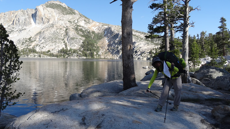
It has been about 6 months or so since Chick-on, Basilbop, JustKeepWalking, AndrewF, and, I am sure, others, have used the notes and map to help find some of these historical relics in their travels around the park. And so when I was up in the northern reaches of the park last weekend (TR here ) with Chick-on, JustKeepWalking (and by the way she does just that), and AndrewF. On Sunday, AndrewF and I took a “short cut” back to the car at Twin Lakes, leaving the upper reaches of Matterhorn Canyon, crossing over Matterhorn Pass into the upper reaches of Spiller Canyon, then traversing quickly over to Horse Creek Pass and down the Horse Creek “trail”.
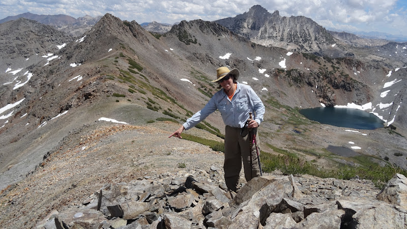
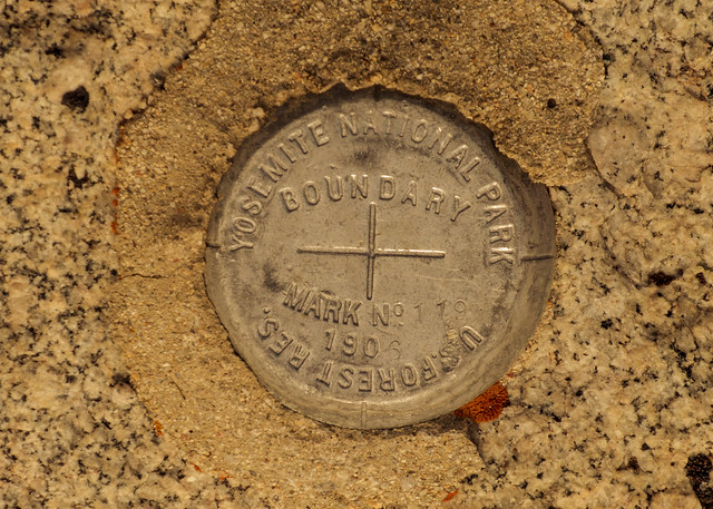
As we reached the top of Matterhorn Pass, we stopped to rest and AndrewF scouted for the best route down the east side into Spiller. As he passed the low point, he shouted up to me…”hey, here’s the boundary marker, #119!”. And sure enough, there it was, an aluminum disc glued to the rock near the low point of the saddle, #119, placed in 1906.
And I was confused, as I was pretty certain that this part of the Park’s boundaries were defined by the drainage boundaries that define the Great Basin and the Pacific Ocean limits…and this marker was about a half a mile away from that. It seemed to me that the boundary marker should have been placed at Horse Creek Pass, between the Horse Creek and Spiller Canyon drainages. So perhaps, I thought, there was some mining or other interest that had chewed a small corner of the park out at this location way back when. Certainly it couldn’t simply be a surveyor’s mistake, could it?
Research was called for, and I have had just a small bit of time to check the survey notes and maps. And it appears to me that this Boundary Marker is, in fact, off by more than half a mile…the surveyor glued it down in the wrong saddle, putting it at Matterhorn Pass rather than Horse Creek Pass. So if I am correct, how could this have happened?
One clue comes from the survey notes themselves, particularly the following passage:
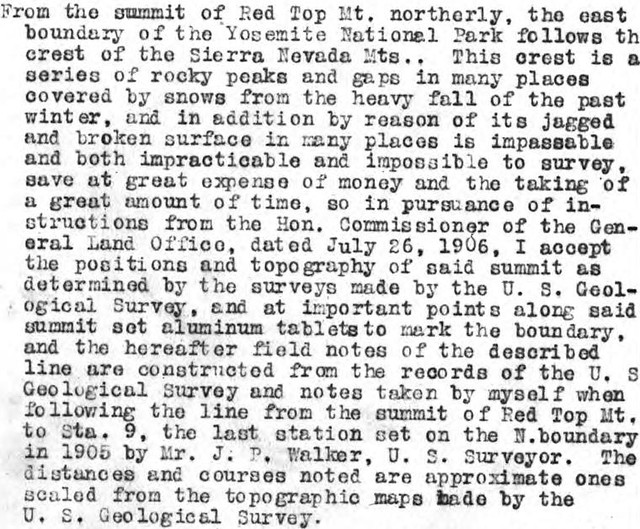
So while the rest of the boundary had been done by a true field survey by a large party of men, supported by mules, hauling their equipment over mountains and through forests, and reconciling their locations with astronomical observations, the east side of the park was, apparently, too difficult given the terrain, the snow and other considerations. What other considerations? I have to think that the San Francisco earthquake of April 18, 1906 must have played a part of the decision.
The terrain at the location is slightly tricky, and perhaps it was a cloudy, rainy day when the surveyor laid down the aluminum tablet. Maybe some other human issue came into play. Or maybe he just screwed up, who knows? Whatever the case, this spot is remote enough that I am sure that few people have noticed the error in the last hundred plus years.
 He was probably tired and hungry and thinking about Jolly Cone burgers in Bridgeport.