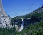
For the first time since at least as far back as 1983, Saddlebag Lake Reservoir on Lee Vining Creek is spilling. This is a rare event—and possibly a first—for the highest lake you can drive to in California.
http://www.monolake.org/today/2017/08/08/saddlebag-lake-reservoir-spills/
Saddlebag Lake Reservoir spills
All posts are those of the individual authors and the owner
of this site does not endorse them. Content should be considered opinion
and not fact until verified independently.
August 24, 2017 10:33AM | Admin Registered: 15 years ago Posts: 17,050 |
|
Re: Saddlebag Lake Reservoir spills August 24, 2017 04:29PM | Registered: 13 years ago Posts: 693 |
|
Re: Saddlebag Lake Reservoir spills August 24, 2017 07:24PM | Registered: 9 years ago Posts: 391 |
August 25, 2017 10:34AM | Admin Registered: 15 years ago Posts: 17,050 |
September 07, 2017 08:32AM | Registered: 12 years ago Posts: 229 |
I'm thinking about going up there in the next couple weeks for a hike to Green Treble Lake and maybe up to Finger Lake. Anyone been up to Saddlebag Lake recently? Water still going over the dam?
The picture taken from the dam shows a lot of snow in the Green Treble Lake area and above. Has it melted? I'm not interested in snow hiking.
Another question.... We'd take the trail from Sawmill Campground. It crosses Lee Vining Creek. Is there a bridge there? Log crossing? I've read many trip reports starting at Sawmill Campground but no one has ever mentioned how the creek is crossed. It's not obvious on Google Earth images.
Thanks!
|
Re: Saddlebag Lake Reservoir spills September 09, 2017 02:33PM | Registered: 15 years ago Posts: 384 |
Was in 20 Lakes Basin on Thursday September 7. Hiked in early along west reservoir trail a bit after sunrise to my favorite area at the Wasco Tarns that has wonderful areas of colorful metasedimentary geology. Reservoir is no longer spilling on the overflow but very full. There are still snow banks nearly into the reservoir and the rusty metamorphic scree and talus has nice Coville's columbine. Had just come out of a 9-day backpack into Humphreys Basin the afternoon before so had been in all the recent t-storm weather for days. The areas I visited were much more green than usual for early September with wildflowers in wetter areas near what is usually a peak in early August.
Wasco Tarns are all very full with very green lawns unlike the usual late summer dried brown. Dwarf bilberry and arctic willow that usually have turned red and yellow by that date are still very green except in the most dry sunny exposures that had melted out first. Conness Creek still with a lot of water over the big cascade. South side of Greenstone Lake below peak 11239 is still draining considerable water and has impressive dense expanses of red hued Pierson's paintbrush, castilleja peirsonii, more than I've ever seen in the past with a list of other familiar species mixed in. Big snowfield in the southwest corner of that ridge was fun walking up some then boot skiing down. Numbers of hikers are of course down since the ferry is no longer running thus visitors must hike an extra 1.4 miles to reach the back side of the reservoir.
Would only recommend a near term visit when winds are NOT blowing smoke from the Yosemite lightning fires in from the southwest or west.
David
http://www.davidsenesac.com
Edited 3 time(s). Last edit at 09/09/2017 02:36PM by DavidSenesac.
Sorry, only registered users may post in this forum.


