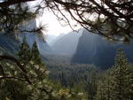
There are multiple fires burning in Yosemite National Park's wilderness. Wildfires when caused by lightning are a natural phenomenon on the landscape. Fire managers work to restore healthy forests and reduce the threat of extensive, severe fire by allowing some lightning-ignited wildfires to burn. While hiking trails and sitting at vistas you may see smoke in some of these areas.
Stage 2 Fire Restrictions are currently in place inside Yosemite National Park. Please review the details for Stage 2 Fire Restrictions, which will remain in place until further notice. https://www.nps.gov/yose/planyourvisit/firerestrictions.htm
Fire Name: Indian Date: 9/27/18
Discovery Date: 9/4/18 Location: Near Porcupine Camp Ground, in Yosemite's Wilderness
Size: 102 acres Status: Active
Strategy: Monitor Cause: Lightning
Predominate growth is on the north and west flanks of the fire, fire behavior is creeping and smoldering with pockets of condensed heat in heavy dead and down fuels. This fire is surrounded by many natural barriers and rock bands. Fire crews are monitoring daily with easy access off the Tioga road.
Fire crews will be working along Tioga road as the fire backs down towards the road. There may be smoke impacts to Porcupine Campground and Yosemite Valley at night and in the morning when smoke settles in low areas. There will also be smoke impacts to Tioga road, we urge motorists to follow all posted signs and use caution when driving in the area.
Fire Name: Rancheria Date: 9/27/18
Discovery Date: 9/8/18 Location: North end of Rancheria Mountain, in Yosemite's Wilderness
Size: 41 acres Status: Active
Strategy: Monitor. Cause: Lightning
The fire is creeping though dead and down ground fuels in red fir. The spread is mostly north and southwest following vegetation pockets. There are some natural barriers including very green vegetation, rock out cropping's, and changes in vegetation. Smoke production has been very light with some overnight accumulation in the Tuolumne river canyon. Fire crews will continue to assess impacts to trails.
Fire Name: Unicorn Date: 9/27/18
Discovery Date: 7/28/18 Location: Unicorn Peak Area, in Yosemite's Wilderness
Size: 2.6 acres Status: Active
Strategy: Occasional patrol with very low spread. Cause: Lightning
The Fire is at 9500 feet in elevation. Smoke may be visible from Tuolumne meadows.
Fire Name: Pinnacles Date: 9/27/18
Discovery Date: 9/8/18 Location: Near Clouds Rest, Yosemite's Wilderness
Size: 1/10th acre Status: Active
Strategy: Monitor Cause: Lightning
This is a high elevation fire with low spread potential, burning near areas of granite and rock outcroppings.
Fire Name: Rafferty Date: 9/27/18
Discovery Date: 9/21/18 Location: Near Ireland Lake, in Yosemite's Wilderness
Size: 1/10th acre Status: Active
Strategy: Monitor Cause: Lightning
This is a high elevation fire with low spread potential, burning near areas of granite and rock outcroppings
For more information:
Yosemite National Park Fire Updates Page: https://www.nps.gov/yose/blogs/fireinfo.htm
Yosemite Fire and Aviation Twitter:@YosemiteFire
Fire Informaiton: yose_fire_info@nps.gov
Fire Update September 27th, 2018
All posts are those of the individual authors and the owner
of this site does not endorse them. Content should be considered opinion
and not fact until verified independently.
Sorry, only registered users may post in this forum.


