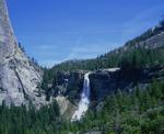
I did the Clouds Rest hike last week and was, as usual, quite impressed with the scenery. What a tough hike though...don't recall who it was that told me it was an easy hike that was mostly level after the beginning, but I had a very different experience...gotta find out what their training regemin is and see what kinds of walls they climb that make the Clouds Rest hike seem level.
Anyway, I've got a bunch of great photos, and I'd like to be able to identify some of the subjects. So here are some questions...
In the beginning, there is a 2-mile climb up a steep mountain, ending up at the first trail junction. Does anyone know what that mountain is called?
Then, after the trail junction, when the trail goes downhill and loses much of the altitude gained on the 2 mile climb, there is a big dome (or something like a dome) on the left-hand side as one is hiking toward Clouds Rest. Does that dome have a name?
After the massive altitude loss, there is a small lake in an area that is indeed flat. The lake is right on the trail and seems big enough to be named. Does it have a name?
Let me know if I'm not being specific enough. I think these landmarks are prominant enough that they are obvious, but I can provide more detail or photos if necessary.
Re: Clouds Rest Landmarks
All posts are those of the individual authors and the owner
of this site does not endorse them. Content should be considered opinion
and not fact until verified independently.
Sorry, only registered users may post in this forum.


