 That's probably due in part to the difficulty of getting good GPS readings around cliff walls and tree cover, but I also get the feeling that Google is sometimes pretty sloppy with their mapping. Overextended with new projects, maybe. They've been showing the Four Mile trail on their maps as a wiggly line with fewer than 20 switchbacks.
  The real thing has 59.
If Google has added street views of trails to Google Maps as well as Google Earth, the same data are probably being used for both. Someone asked in another thread:
Quote
buster
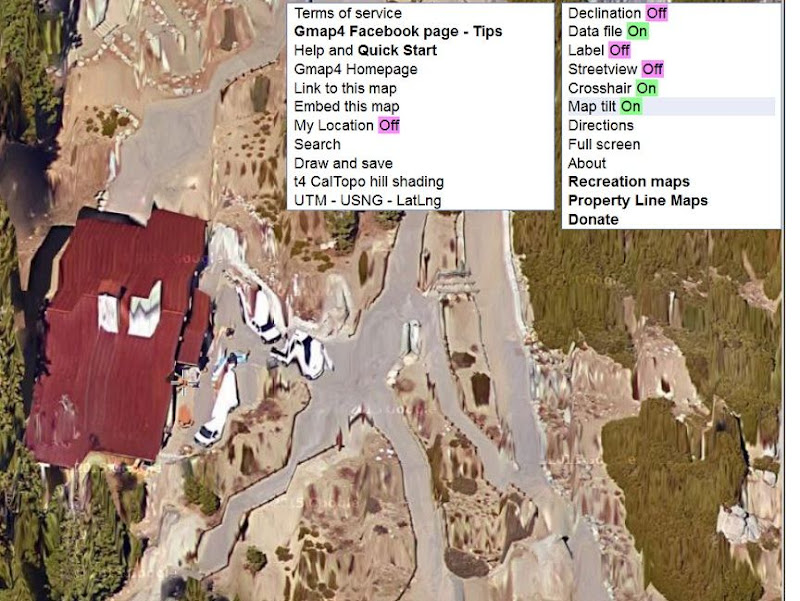
Google Streetview (First time I've used the trail street view option of google maps. Kind of odd but useful in this case. Also, anyone else notice and get annoyed with how google maps is now try to display trees in 3d formats on it's satellite imagery? It looks really weird, is distracting, not helpful at all and makes it harder to look at the imagines)
I use Gmap4 to access Google Maps. Years ago someone posted a link to a "Howson Creek Trail" map that I recentered on Yosemite Valley (or maybe they did). I've been using it ever since:
http://www.mappingsupport.com/p/gmap4.php?q=http://www.mappingsupport.com/p/gmap4/helpfile/Howson_Creek_trail.kml&ll=37.7462,-119.5922&t=t4&z=14&hillshade=18&coord=latlng&directions=off&mylocation=off&label=off&layers=off&screen=auto&streetview=off
That opens as a topo map but you get to switch among satellite views, street maps, and topo maps and zoom in and out, while staying centered on the same spot. A few months ago I noticed that Google had messed up their closest-zoom satellite views horribly by attempting to model buildings and trees three-dimensionally. At first I was outraged but I discovered that Gmap4 gives you a control for switching between the new scrambled-eggs view and a normal satellite view. It's called "Map tilt" and is found on the Menu pulldown at the top right.


Edited 1 time(s). Last edit at 01/11/2016 04:27PM by gophersnake.

 I've been making lots of use of those maps for my Four Mile Trail project.

