Welcome! Log In Create A New Profile Recent Posts
Half Dome, Yosemite National Park

The Moon is Waxing Gibbous (79% of Full)


Advanced

Olympic Peninsula Pics

All posts are those of the individual authors and the owner of this site does not endorse them. Content should be considered opinion and not fact until verified independently.

avatar Olympic Peninsula Pics
August 06, 2014 07:17PM
Last week (and earlier...) I backpacked in Washington's Olympic Peninsula, a coastal hike from Ozette to Yellow Banks, and a hike from the East Fork Quinault over Anderson and La Crosse Passes. It had been raining as I drove into Washington, but the rains stopped and I had dry weather the entire time.

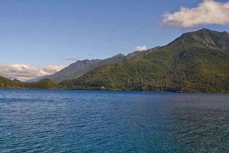
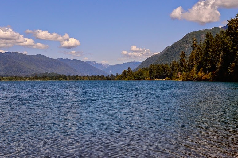
Before hiking along the coast I stayed on Lake Crescent. Daytime picture:
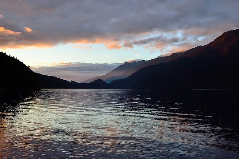


And at sunrise:


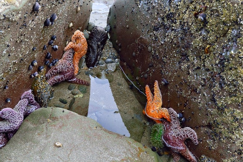
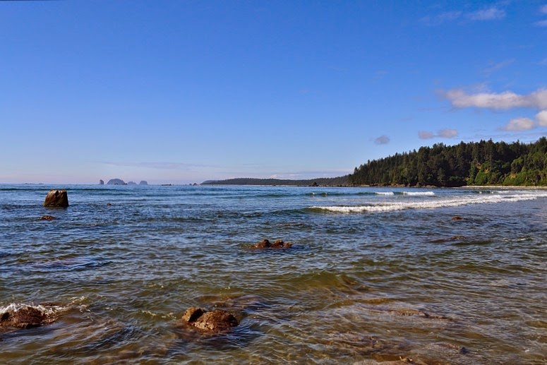
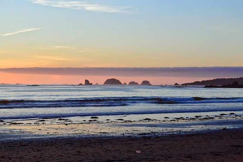
Coastal hike pictures...

Tidepool:


View towards Cape Alava, the western-most point in the 48 coterminous states:


...and at sunset...


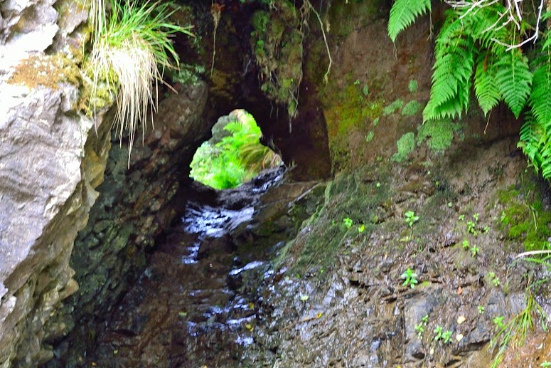
There is a headland just before (north of) Yellow Banks which can be rounded, under what "Custom Correct Maps" considers normal conditions, with tides below 5 feet. Otherwise there's a tunnel which I didn't want to bother with for reasons this picture makes clear:


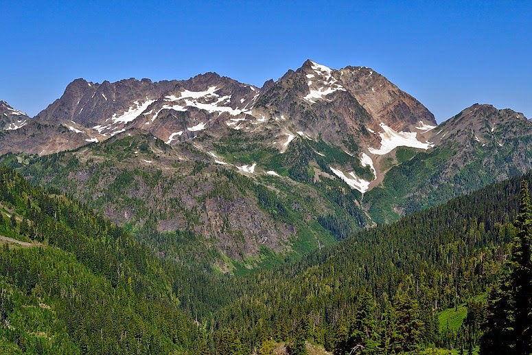
In between backpacking trips...Lake Quinault:


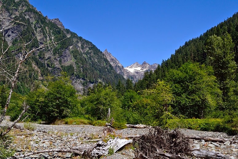
And pics from the Quinault Valley, Anderson Pass/Peak, La Crosse Pass, etc.
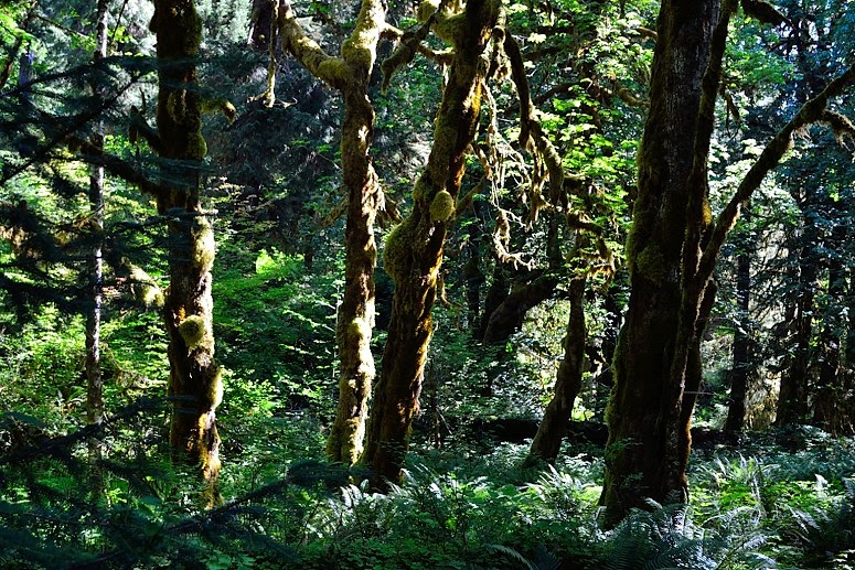
Rain forest:


Enchanted Valley:


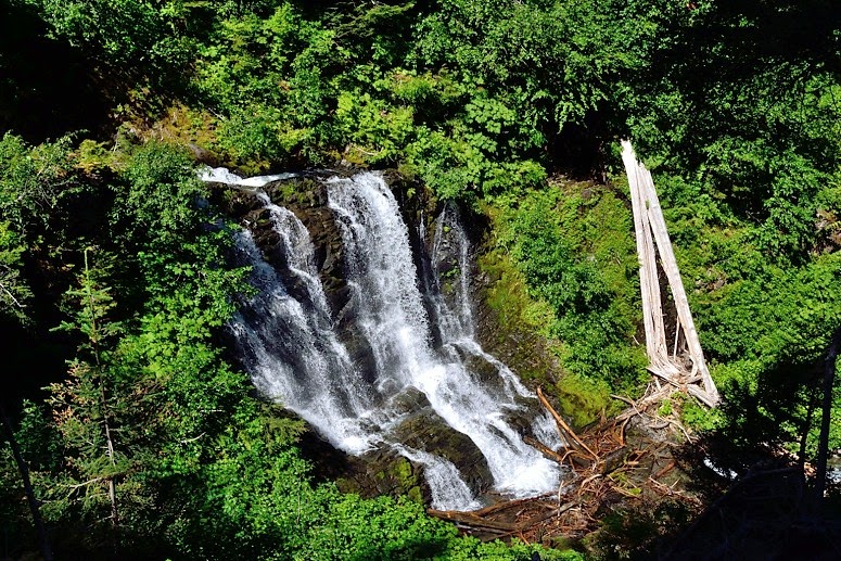
Unnamed waterfall, on unnamed stream, heading towards Anderson Pass:


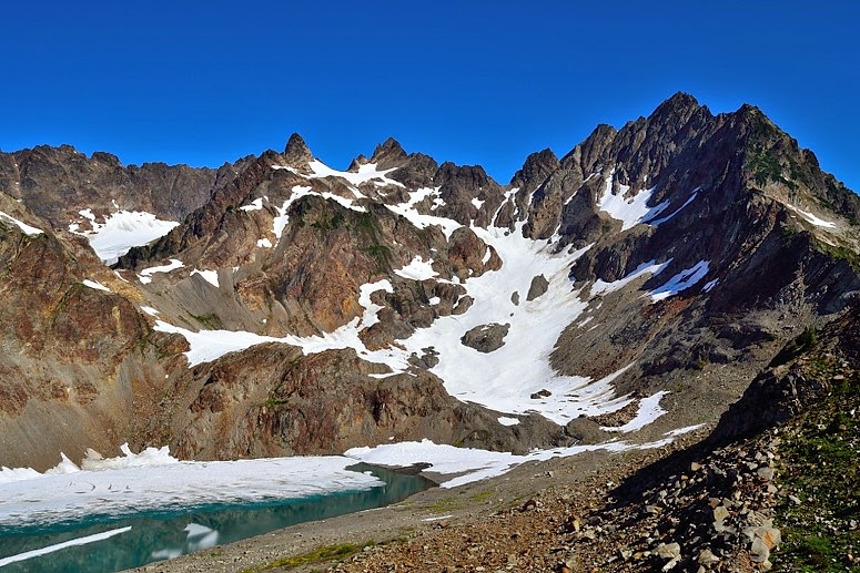
Mt. Anderson and Anderson Glacier:
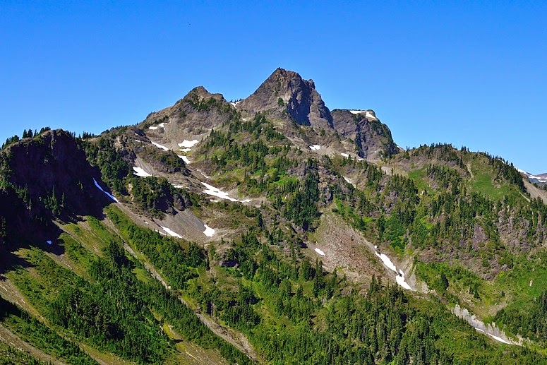


Mt. La Crosse:


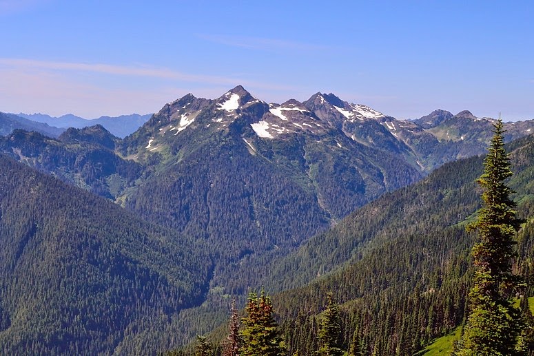
From some rocks above La Crosse Pass, Mts Steel and Duckabush, and the Duckabush Valley:


Mt.. Anderson, from La Crosse Pass:

Re: Olympic Peninsula Pics
August 07, 2014 09:44AM
Love the mountains rising from sea level... And people wondered why I had a hard time acclimating for Mt. Whitney a couple years ago. "Why not use the high elevation mountains in Alaska?" Well because I regularly climb 4-5,000 foot elevation gain mountains but rarely, if ever, go over 6,000 feet. Anything over that and it is no longer "hiking" but instead real "mountaineering".
avatar Re: Olympic Peninsula Pics
August 07, 2014 08:09PM
I've wilderness-camped three times in Alaska - Glacier Bay (sea level), Prince William Sound (sea level), and Katmai's Valley of 10,000 Smokes (about 1,500-2,000 ft.).

The Olympics top out less than 8,000', and have glaciers because their winters are so wet.
avatar Re: Olympic Peninsula Pics
August 12, 2014 12:29PM
I have got to get up there sometime. It's always sunny like that...yes?
avatar Re: Olympic Peninsula Pics
August 12, 2014 01:07PM
I may be lucking out this summer. My Nelson Lake weekend backpack in July came during a two-day break in monsoon thunderstorms. Then this trip...

Quinault Ranger District Climate Normals
avatar Re: Olympic Peninsula Pics
August 12, 2014 06:15PM
Nice...bought any lottery tickets recently?
Sorry, only registered users may post in this forum.

Click here to login