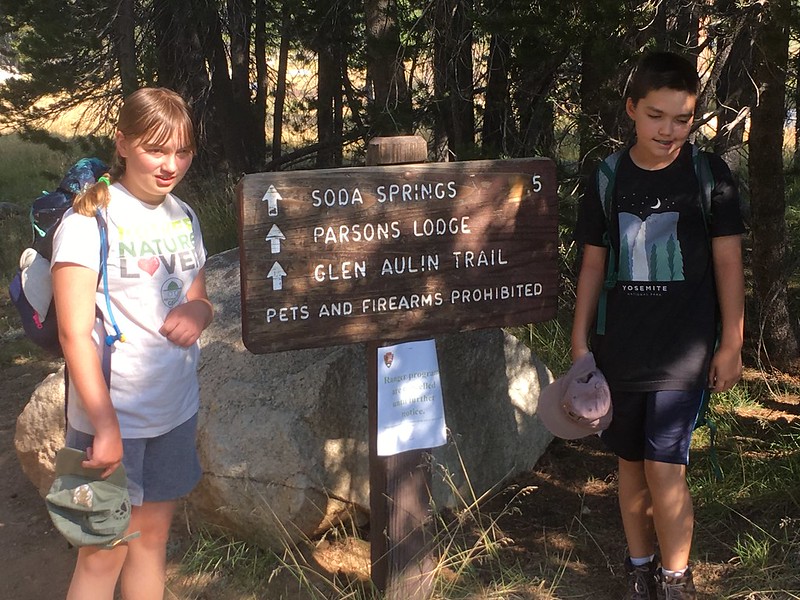
Background: We visited our first High Sierra Camp (May Lake) three years ago. We chose May Lake because it would be a short (if a little steep) hike in for our kids, who were 7 and 9 at the time. We stayed only one night, but had a wonderful time and decided to try to get reservations at Glen Aulin the next summer. We lost out in the HSC lottery, but tried again the following year and got in. Unfortunately, that was summer of 2017 and the HSCs did not open due to all the snowfall during the previous winter. Luckily we didn't have to compete in the lottery again as they just bumped our reservations forward to 2018. We were scheduled to go in early July, but we got an email from the concessionaire in spring saying that Glen Aulin HSC would open late due to reconstruction of the bridge over Conness Creek. I called to reschedule, and the earliest slot they had available for two nights for four people was Aug 9 & 10. As our kids started school on Aug 13, we didn't have much choice. Those delays were the origins for our fears that our attempts to get to Glen Aulin must be cursed.
Anyway, we finally had some solid dates, so I scheduled a few days at Reds Meadow Resort in Devils Postpile the weekend before, and reserved a couple nights at White Wolf before we hiked in to Glen Aulin. (Yeah, yeah, we could have camped at Devils Postpile and up in Tuolumne Meadows... but there are no reservations at the campgrounds around DP, and I wasn't comfortable driving the family in there on a weekend in August without some confirmed place to stay the night). The trip was set, and nothing was left to do but look forward to it with great anticipation.
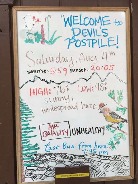
But the Curse of Glen Aulin reared its head once again as forest fires erupted in the Sierra. The Ferguson Fire was burning west of Yosemite, and the Lions Fire was burning southwest of Devils Postpile. Neither of them posed a direct threat to the areas we were visiting, but reading the daily air quality reports as we got closer to our trip was pretty depressing. By the time we left both TM and DP were forecast to have hazardous air quality, and the National Weather Service was recommending either limited or no outdoor activity in these areas, especially for kids. Sigh. Not wanting to cancel the trip, I headed out to the local hardware store and bought some N95 respirators per the NWS recommendation. We would go and see and do what (if anything) we could.
Day One: Through Fire and Brimstone Enroute the Devil's Lair
Okay, so maybe it wasn't quite that dramatic but, wow, did we drive through a lot of smoke. Our departure from the Bay Area was under a light haze of smoke from local wildfires. The Central Valley was likewise overcast with smoke. Hwy 120 through Yosemite and Tioga Pass was closed (the curse again!), so we had to take Hwy 108. It was smoky much of the way, but eventually the blue skies emerged as we climbed higher toward Sonora Pass. We saw some relatively thick smoke in a valley below and to the north of us as we drove, and I remember thinking that seemed pretty distant from the Ferguson Fire. What we didn't know at the time was that the Donnell Fire was raging nearby, and a portion of Hwy 108 and Sonora Pass would be shut down a few hours after we passed through. We made it over Sonora Pass and drove down the eastern side of the Sierras past Bridgeport, Lee Vining, and Mammoth Lakes to Minaret Vista, where we were greeted with this stunning view of the Minarets and Mt. Ritter:
Okay, so there's not a picture there... but that is essentially what we saw. Nothing. It was like looking out over San Francisco Bay on a foggy day. We were halfway down the road into Reds Meadow Valley before the ridge on the other side of the San Joaquin River even came into view. We stopped at Starkweather Lake for a very late lunch, then drove on to the Devils Postpile NM visitor center. The ranger on duty was busy between apologizing to visitors that he couldn't sell any of the merchandise other than water and snacks (because the volunteer staffer from the Eastern Sierra Interpretive Association had been sent home due to poor air quality) and trying to explain to someone on the phone (who sounded like they had planned a trip similar to ours, encompassing Devils Postpile and Yosemite) some of the options they had and restrictions they would face if they went through with their trip. We headed out to do the short loop trail around Devils Postpile.
The wife and kids were initially reluctant to wear the respirators because, let's face it, they make you look silly (I had no problem since looking silly is my normal state). You could definitely tell the difference, though. Respirator off: Standing directly downwind from the campfire. Respirator on: Clean air. Once we started up the grade to the top of the Postpile and our breathing got a little heavier, you could feel the smoke getting in your lungs. This was enough to convince my wife (who has some allergy issues) that wearing the respirator and looking silly was a better option than having a splitting headache later that night. The kids even bought in, if somewhat more reluctantly:
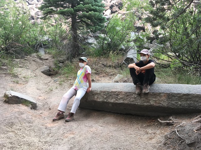
The kids sitting on a post-Postpile pile of columnar basalt. Don't they look happy? I figure the respirators are good training, because with the way we are treating this planet they will probably be required wear outside the air locks by the time they have kids. (Who here is old enough to remember the movie Logan's Run?)
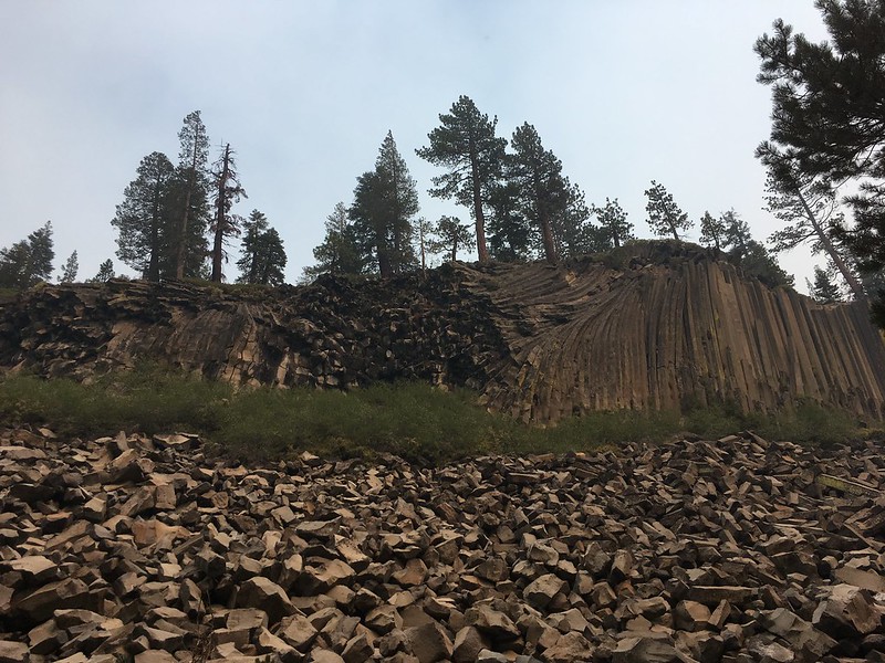
Devils Postpile
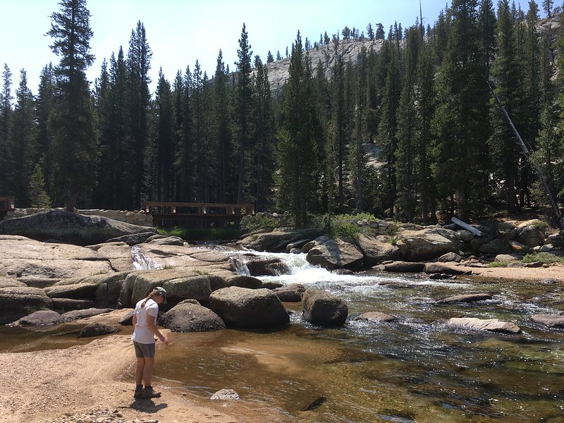
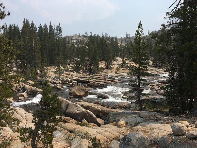
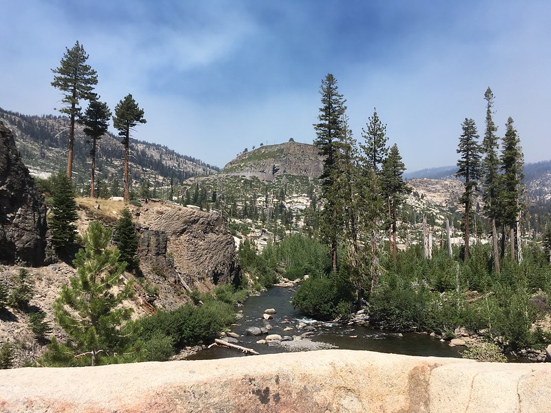
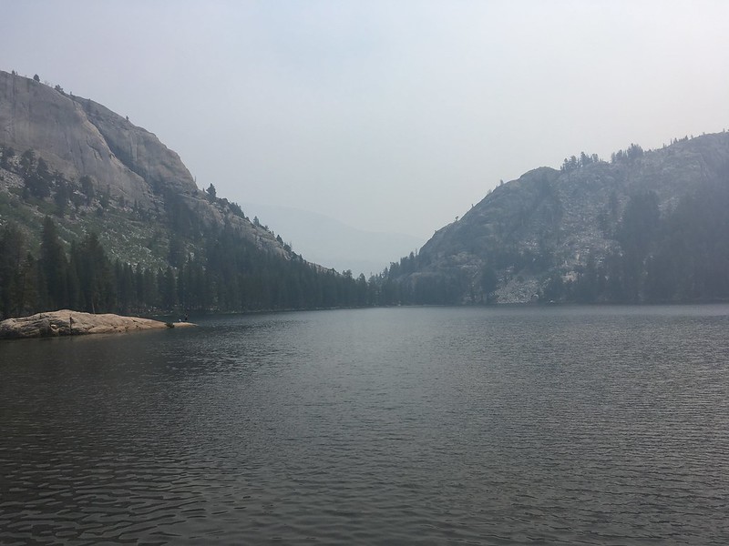
On the way back we took a quick side trip across the bridge over the river to stop at Soda Springs.
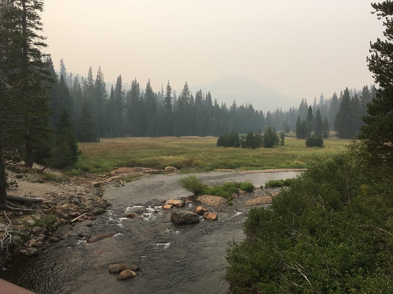
Looking north up the Middle Fork San Joaquin River.
After that we headed on to Reds Meadow Resort and settled into our cabin to cook dinner, work on Junior Ranger booklets, and fret over the smoky conditions.
Day 2: Rainbow Falls
The next day brought some relief in that the smoke was not nearly as bad. We went to the visitor center again to hear a ranger talk, but found out that all interpretive programs had been cancelled due to the air quality. The kids finished up their Junior Ranger books and got their badges (Side note - If anyone else has kids or is interested in Junior Ranger programs, the Devils Postpile JR patch is pretty cool... it is hexagonal like the columnar basalt in the Postpile). The kids wanted to visit Soda Springs again, so we took a quick walk down there to let them play a bit.
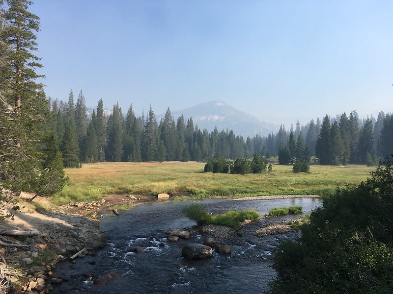
Middle Fork San Joaquin River again. Significantly less smoke!
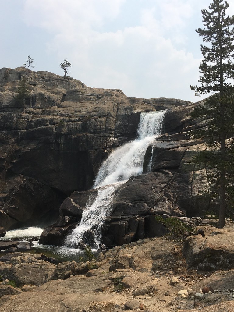
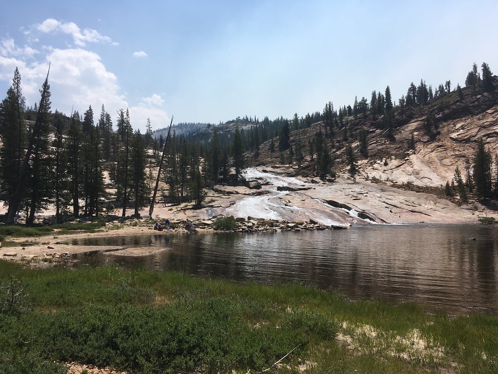
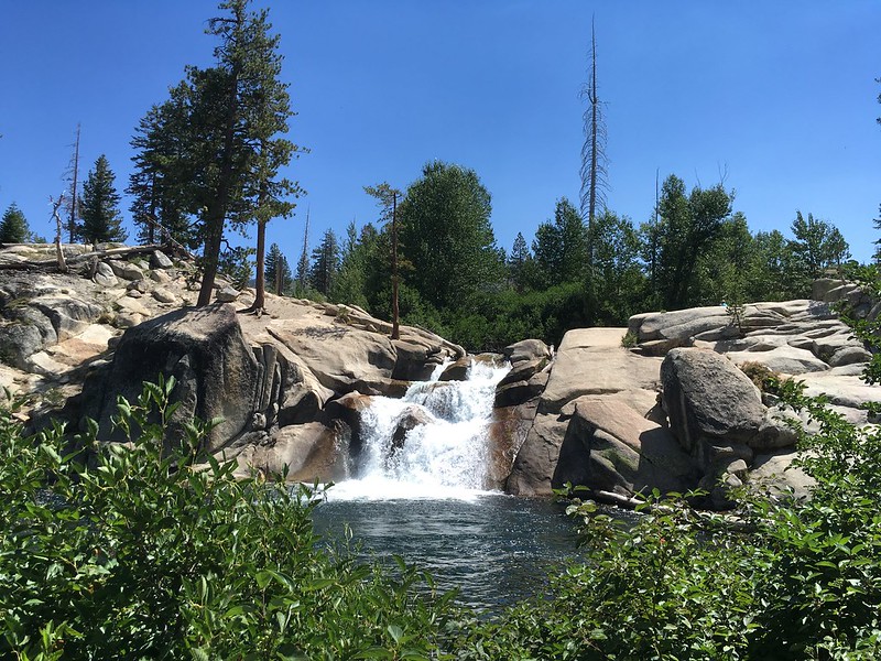
We drove back to the cabin, loaded up the day packs, and headed out on the hike to Rainbow Falls. We brought the respirators but didn't wear them much because the air, while still having a faint tinge of smoke, was not nearly as bad as on the previous day. The air quality seemed to get even better as we got closer to the falls, which was a little puzzling since we were walking toward the area affected by the Lions Fire. We stopped to look at Rainbow Falls, which was flowing better than I had expected, and then continued on the trail to Lower Rainbow Falls.
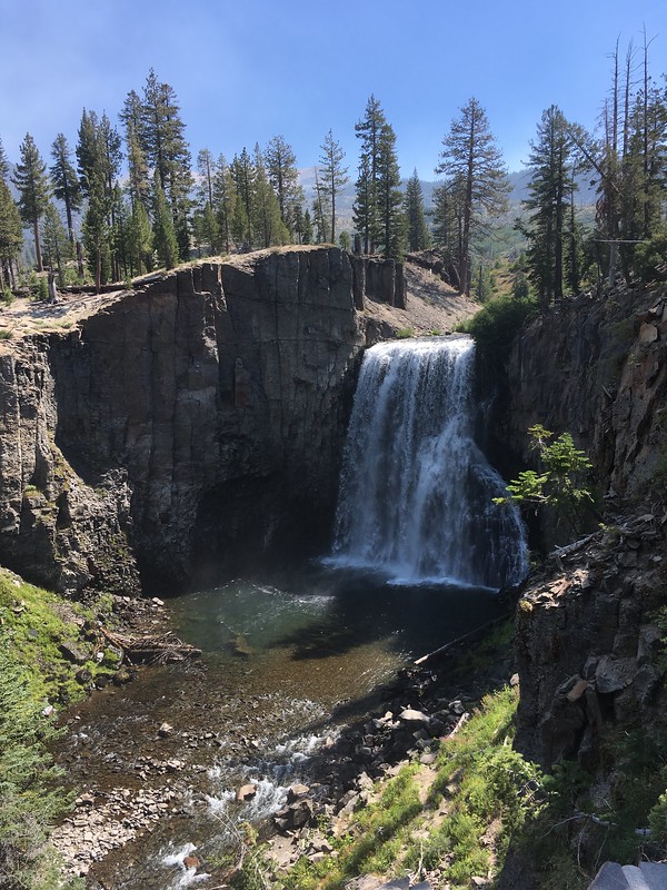
Rainbow Falls
There were some people down at the base of Lower Rainbow Falls, so we had lunch on the rocks at the top of the falls. Looking to the east/southeast, you could see smoke rising from the Lions Fire, and we saw and heard several helicopters going back and forth between Mammoth and the fire. After lunch my daughter and I scrambled down to get a view from below the falls before we headed back to the cabin with a quick stop at Rainbow Falls to take advantage of the better sun angle.
View downriver from above Lower Rainbow Falls. Smoke from Lions Fire visible in the distance.
Lower Rainbow Falls
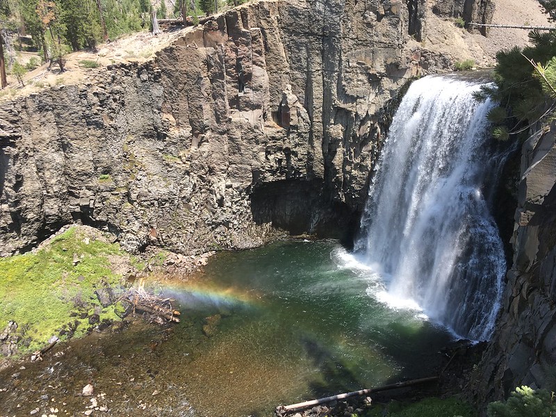
Rainbow Falls... with rainbow!
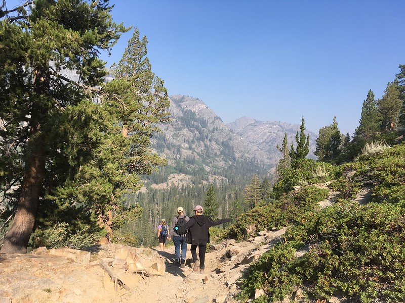
Day 3: Shadow Lake
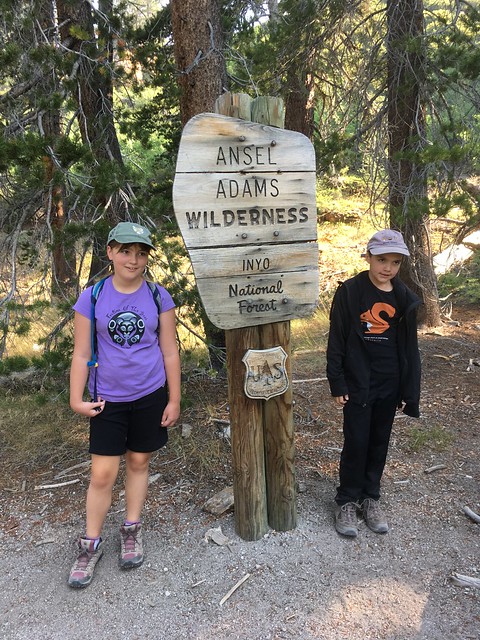
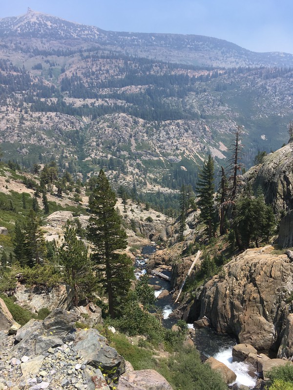
In planning this trip, I had targeted Shadow Lake in the Ansel Adams wilderness for one of our hikes while staying at Reds Meadow. While I would have loved to hike to Garnet or Thousand Island Lakes, they were a little out of dayhike range for the kids. Shadow Lake, at around 8.5 miles round trip from Agnew Meadows, seemed just about their limit. The smoky conditions had me worried that even this distance might be too much, but fortunately the morning of Day 3 brought continued (if only slight) improvement in air quality. We loaded up the packs after breakfast, piled into the car and drove up to the trailhead at Agnew Meadows. The hike took us north and down to the Middle Fork San Joaquin, which we eventually crossed as the trail turned east and started climbing up several switchbacks and then alongside Shadow Creek. Even with the light haze, the views around Shadow Lake were pretty incredible. We found a suitable spot on a rocky outcropping along the north shore and stopped for a lunch break and some play time for the kids.
The kids: "Wait, HOW long is this hike, Dad?"
Hiking down toward the Middle Fork San Joaquin River.
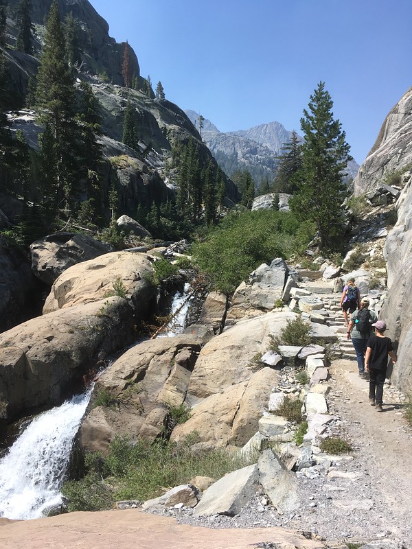
Hiking up to Shadow Lake with Shadow Creek cascading alongside
View to the west over Shadow Lake. The Minarets visible at last!
View east toward the outlet of Shadow Lake.
About an hour after we arrived, the wind picked up and blew a slug of smoke in up from the San Joaquin River canyon.
View east after the smoke blew in.
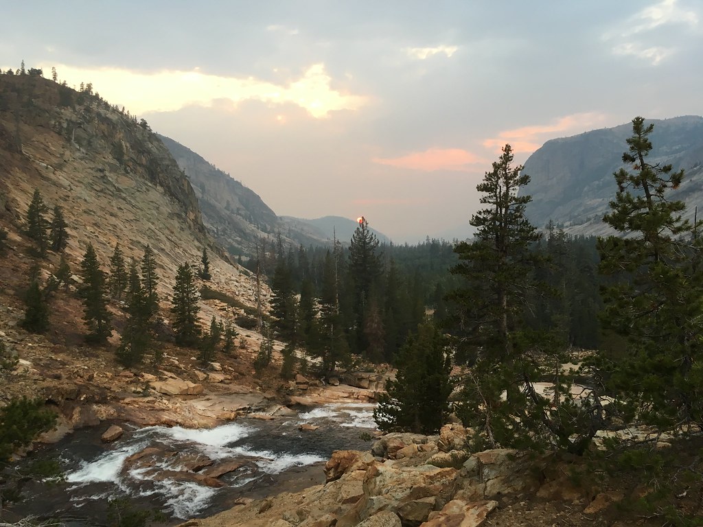
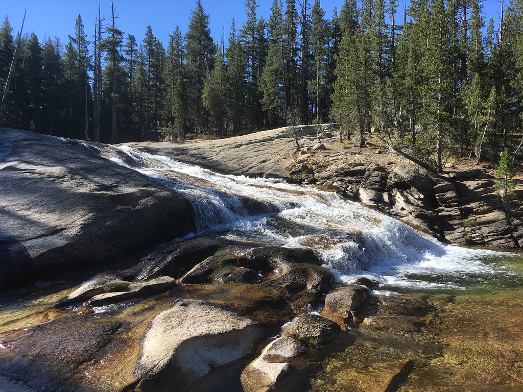
Not knowing how smoky it would be on the hike out, we decided to pack up and start heading back. We took a quick side trip up to the junction with the JMT and the bridge over a waterfall on Shadow Creek before turning around. By the time we got back to the Shadow Lake outlet the smoke had pretty much cleared out, but with momentum established we retraced our route to Agnew Meadows and drove back for our final night at Reds Meadow Resort.
Looking down Shadow Creek toward the Middle Fork San Joaquin River.
Day 4: To Tuolumne
We departed Reds Meadow on Tuesday, managing to dodge the rampaging shuttle buses as we drove back up to Minaret Vista. The views today, while still hazy, were a thousand times better than when we arrived.
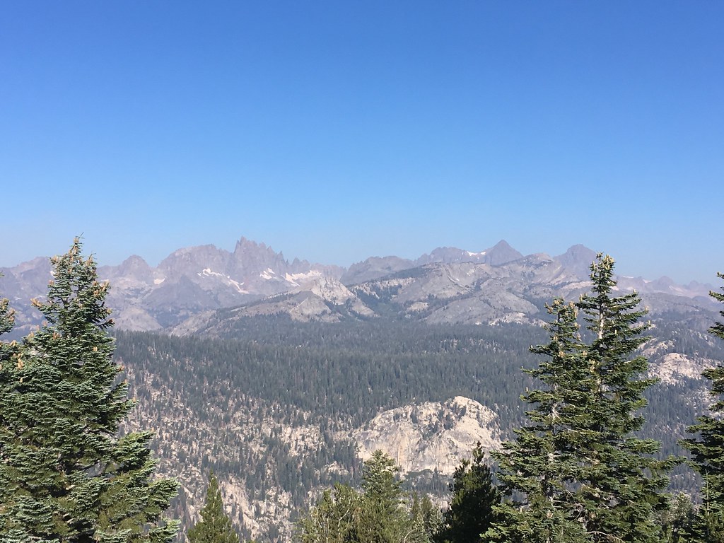
View from Minaret Vista
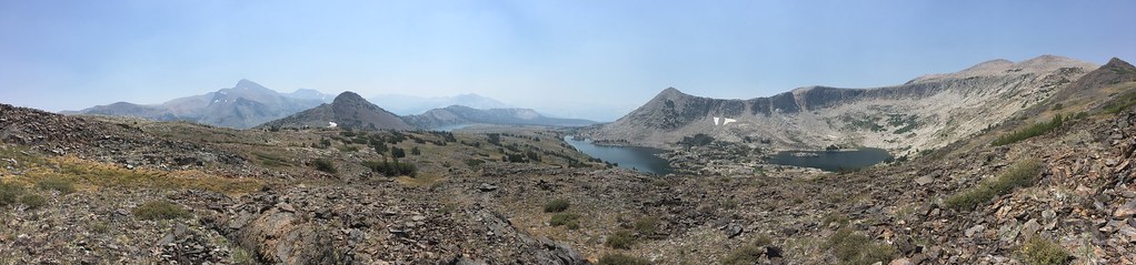
From there we went headed to Tioga Pass. Our target today was the Gaylor Lakes and the Great Sierra Mine.
Looking down into Gaylor Lakes Basin from the ridge above Tioga Pass.
After travelling in the car for an hour, hopping out at 10.000 feet and then immediately climbing another 500 feet in the first half mile, let's just say I was not too popular with the wife and kids. Fortunately the easier trail and amazing scenery ahead bailed me out.
Looking back down at Middle Gaylor Lake from the trail to Upper, with the Cathedral Range off in the distant haze.
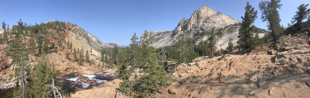
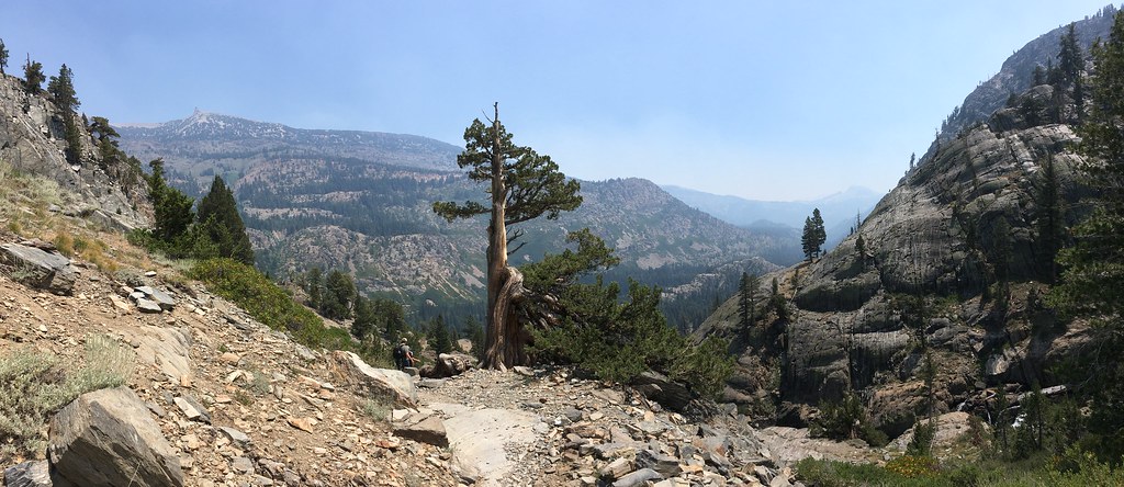
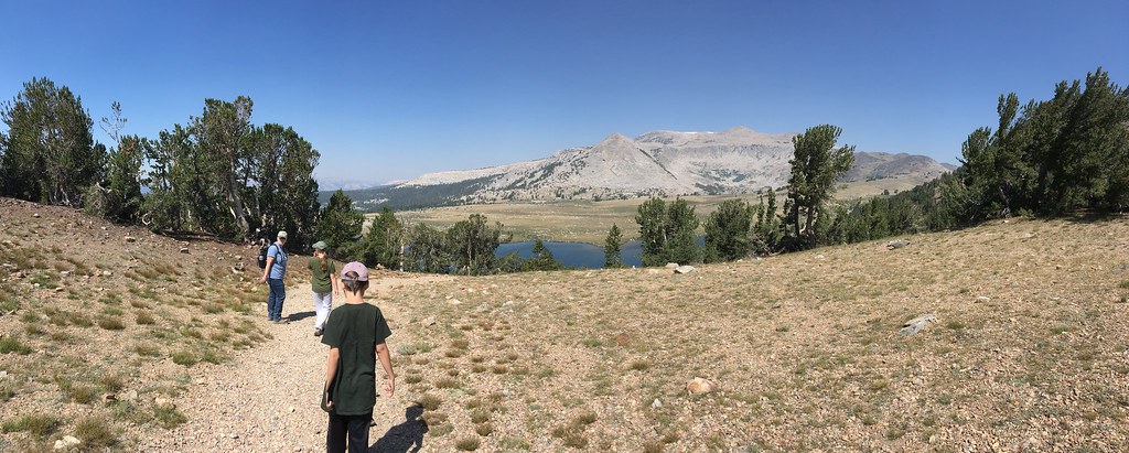
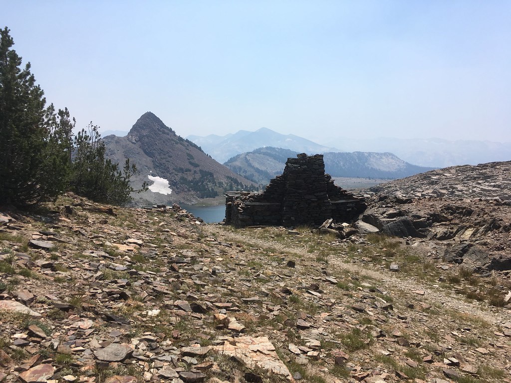
We hiked to Upper Gaylor Lake and on up to the Great Sierra Mine site.
We crossed over to get a look down into the Granite Lakes Basin before returning.
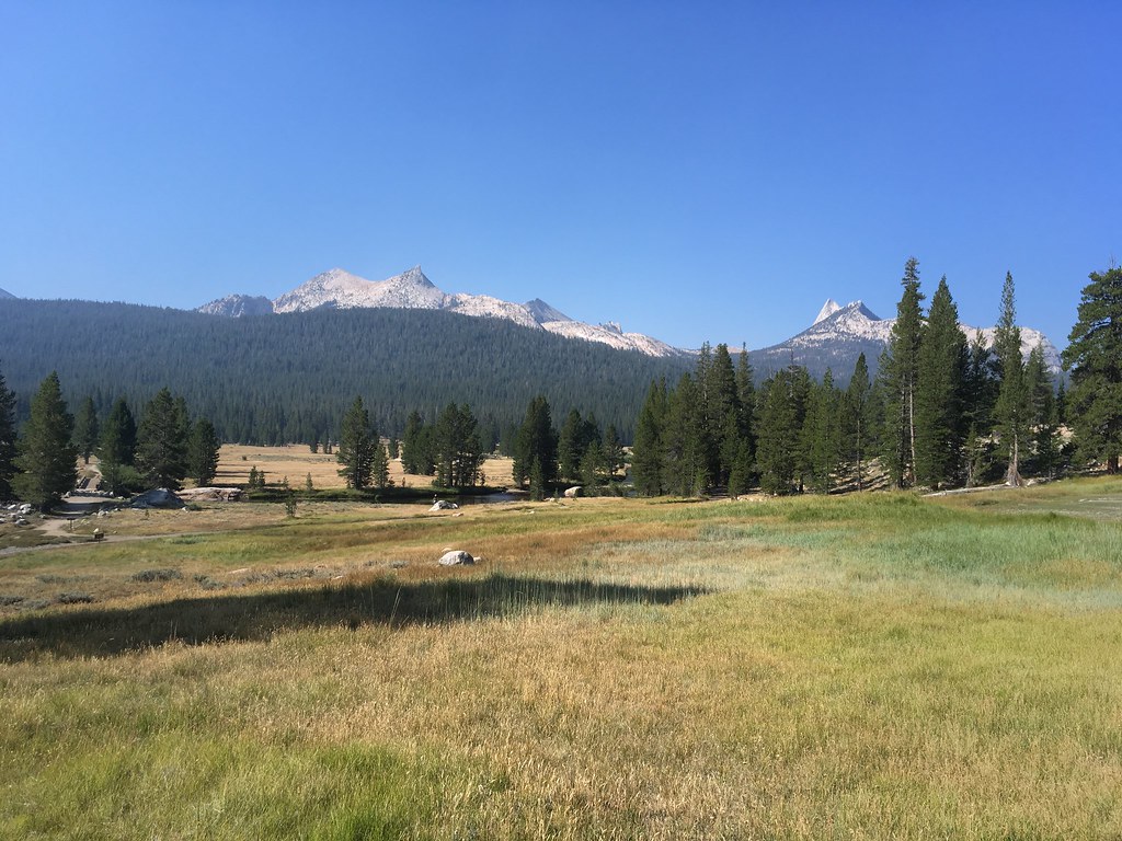
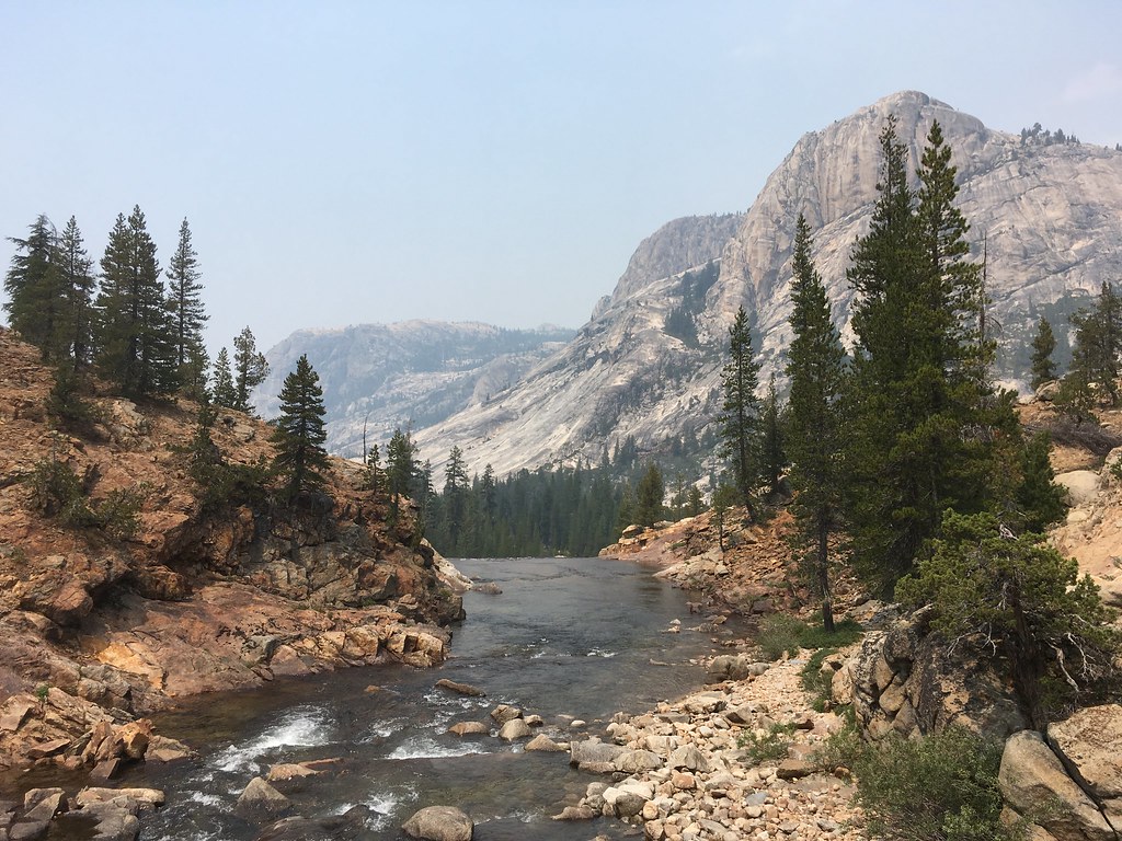
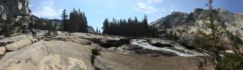
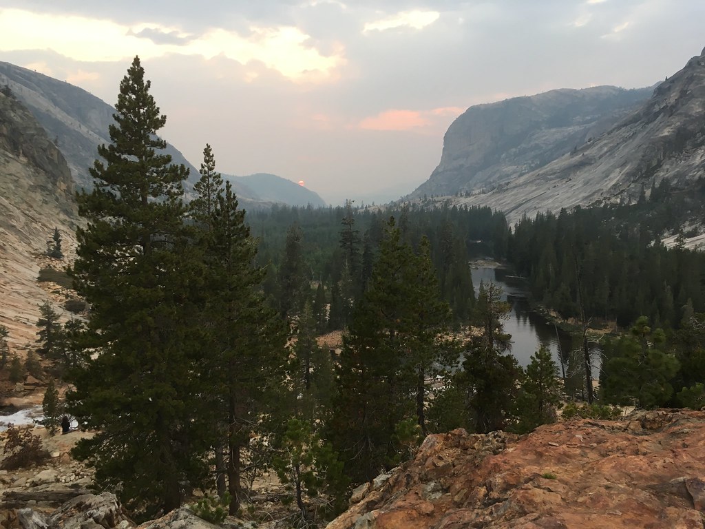
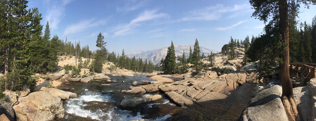
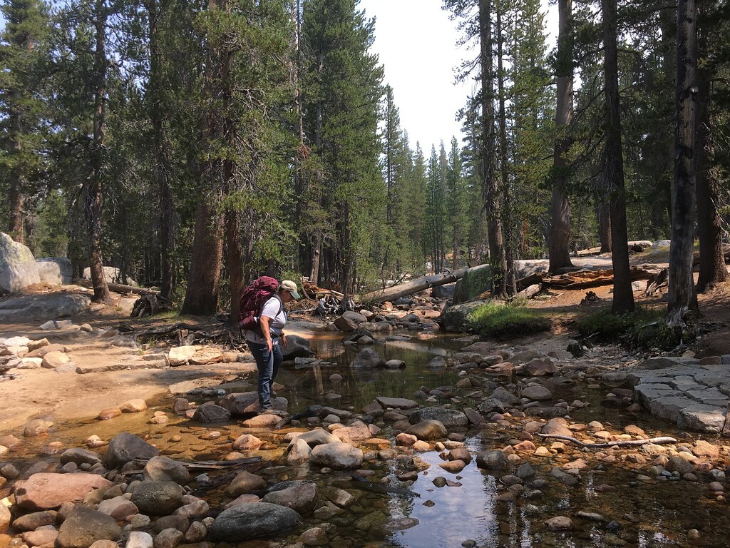
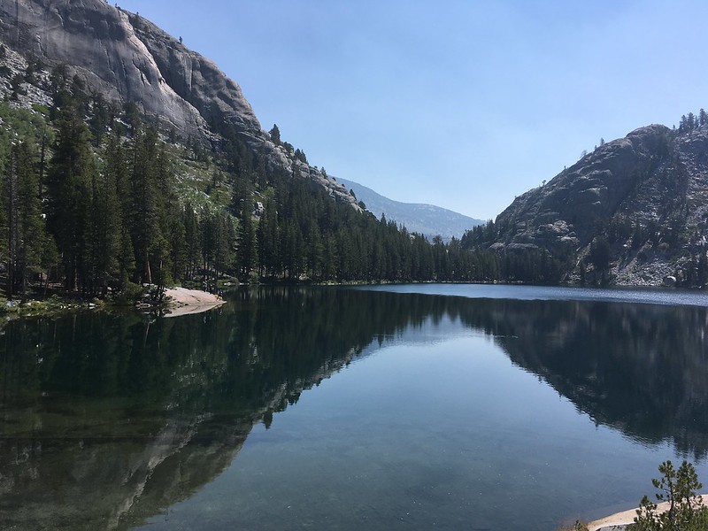
After this hike, we headed on to White Wolf Lodge, where we were staying for the next two nights. While the air in the Tuolumne River basin was pretty clear thanks to an east wind that day, as soon as we crossed over into the Merced River watershed the smoke got thick quickly. We couldn't see across Tenaya Lake. Olmstead Point was like looking into a fog bank. When we arrived at White Wolf, it seemed almost deserted. A quick inquiry at the Lodge told us why... they were shutting down the next day. Since we had a two night stay planned, they offered to shift our stay to the Tuolumne Meadows Lodge for both nights. We eagerly accepted since that was where we were planning to do most of our hiking. Our luck continued after we drove back to Tuolumne Meadows, as they essentially let us pick which tent cabin we wanted since they had so many cancellations due to the fire and smoke. We chose a cabin near the Dana Fork and enjoyed listening to the water tumble over Miller Cascade during our stay.
Lembert Dome over the Dana Fork of the Tuolumne River
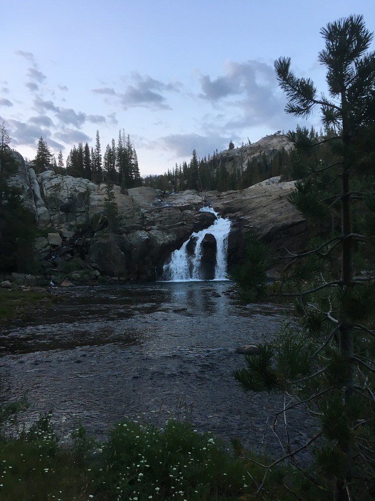
Miller Cascade on the Dana Fork
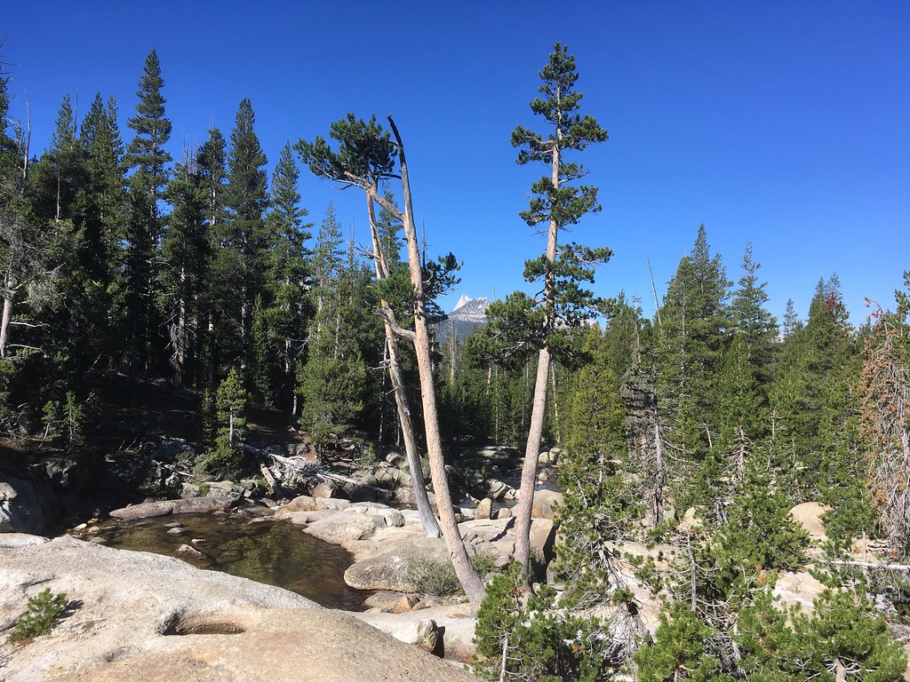
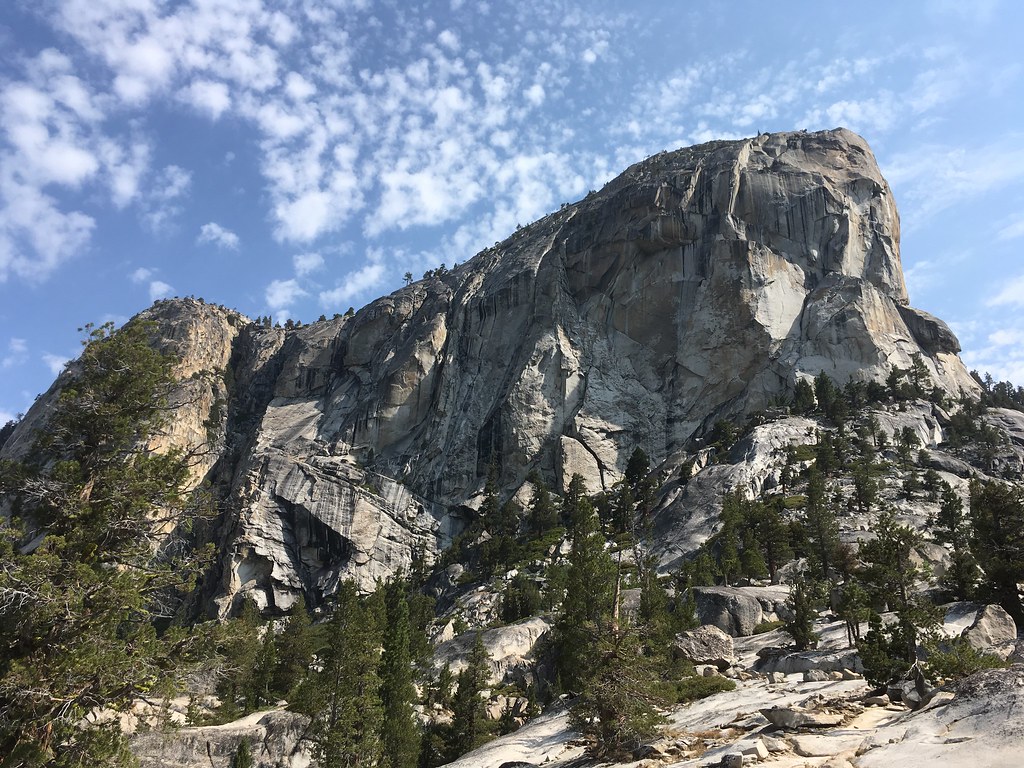
Cathedral Peak peeks between two lodgepole pines.
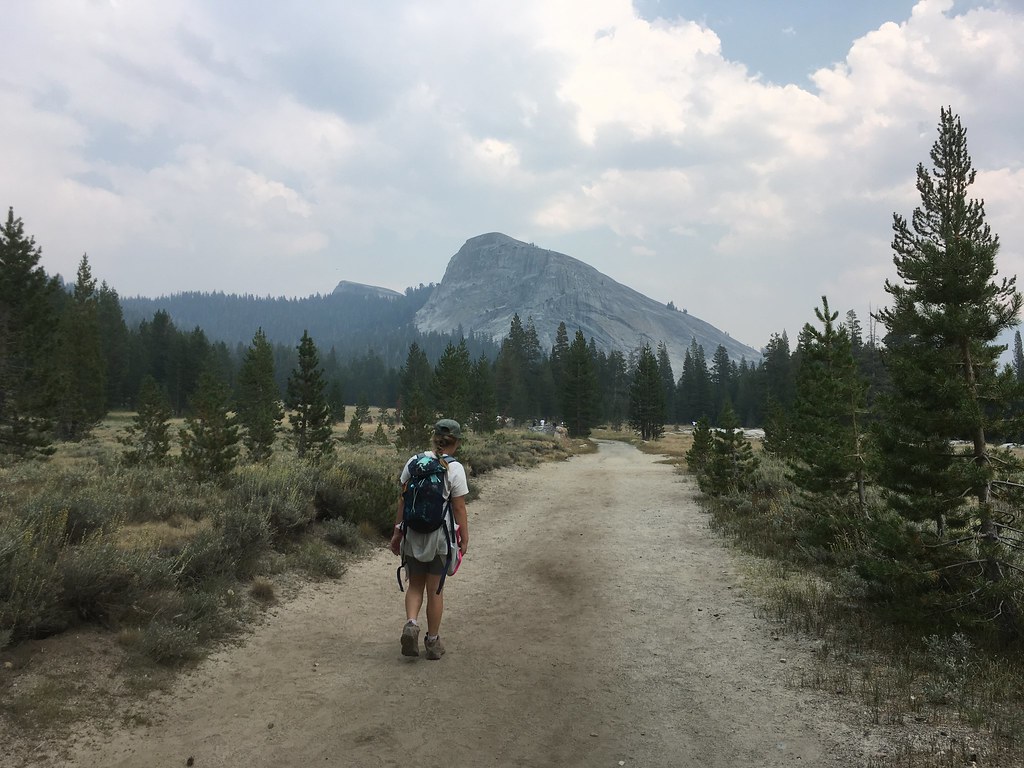
Day 5: Saddlebag Lake
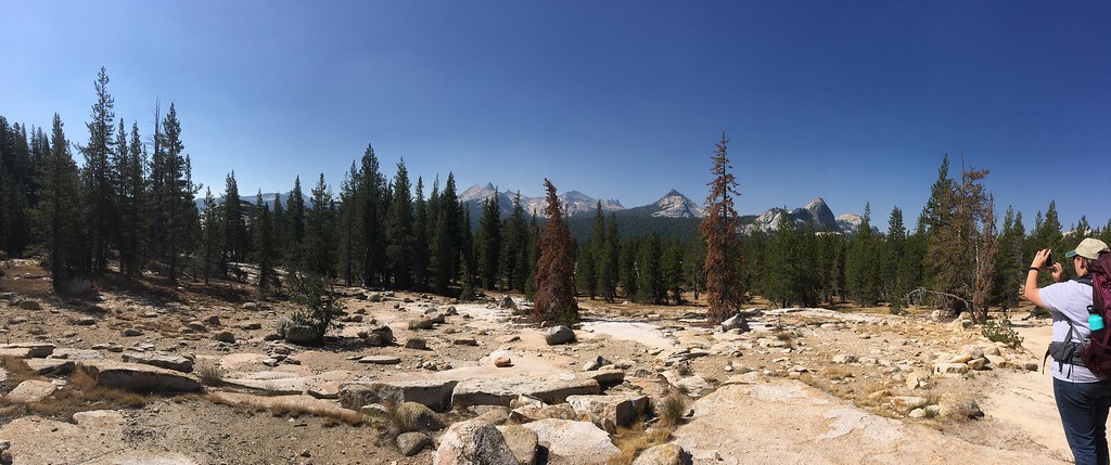
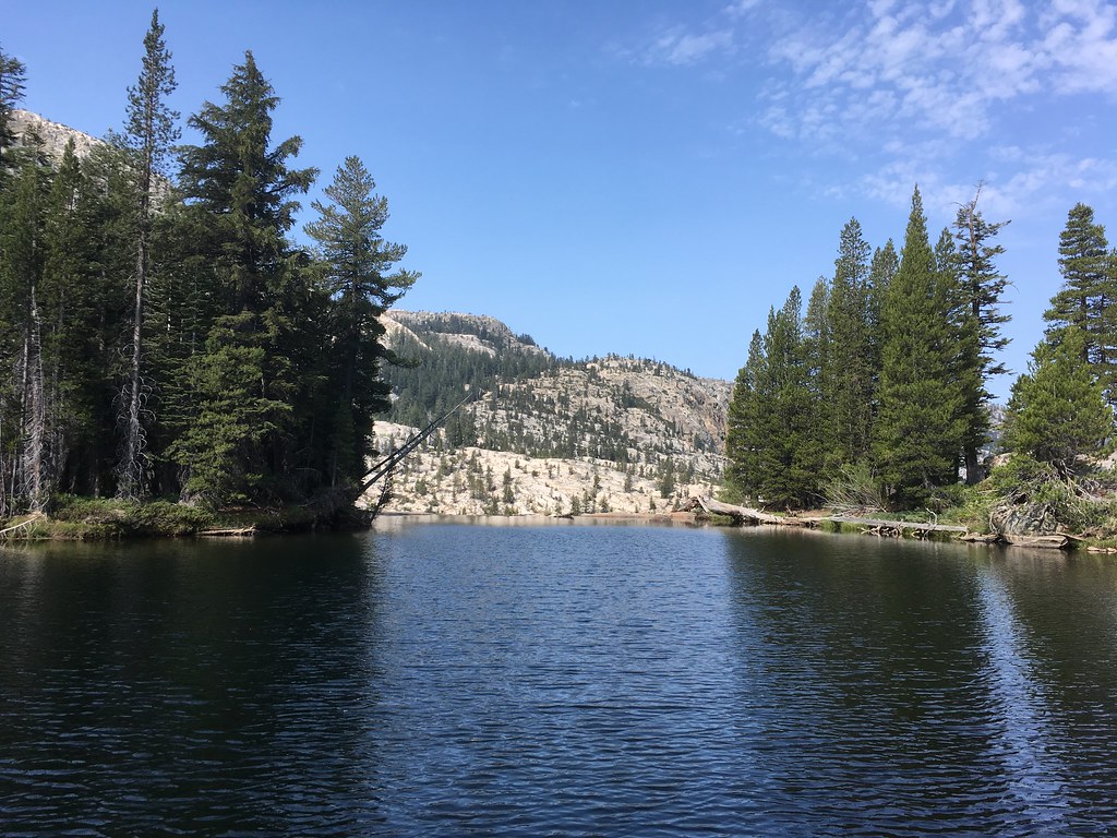
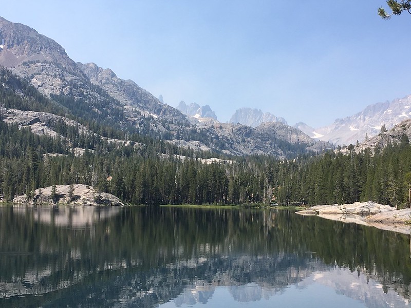
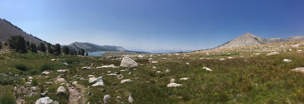
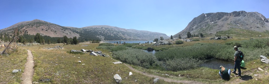
We got a late start the next day because the kids were having too much fun exploring the Dana Fork. The better half had also twisted her knee a bit on yesterday's hike, so we decided to take it easy today. Since we had already done many of the easier hikes in the TM area, we decided to head over Tioga Pass and hit the Saddlebag Lake/Twenty Lakes Basin area. This is the last place I went backpacking... roughly a quarter century ago! (We as a family are working on a return to it... which I hope will be reflected in future TRs). I'd forgotten how much loose talus there is on the trail around the west side of Saddlebag (sorry, honey!). With the late start we just kept the hiking to a circuit of Saddlebag Lake, with a short foray to Greenstone Lake for lunch.
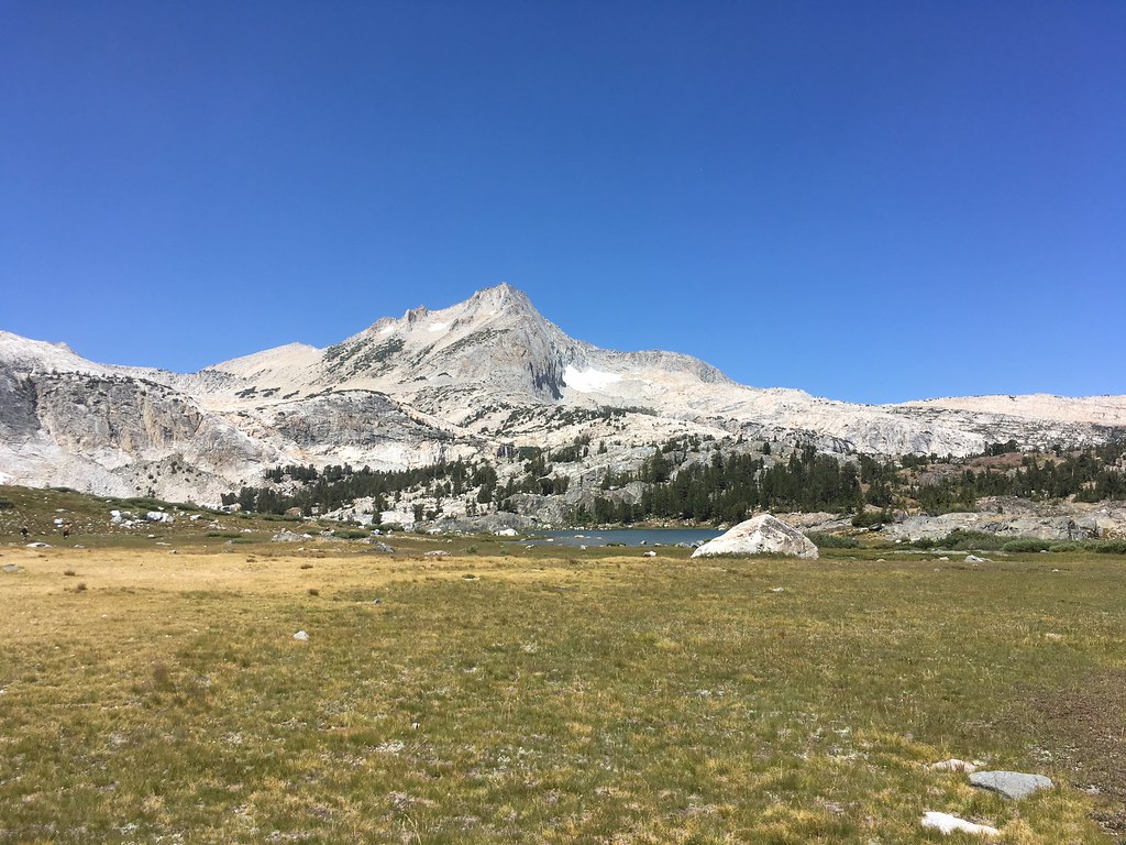
Mt. Conness (or maybe North Peak?) and Greenstone Lake in the Twenty Lakes Basin
Looking back at the north end of Saddlebag Lake
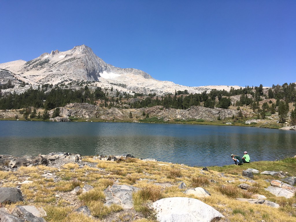
Lunch at Greenstone Lake
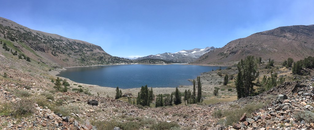
South saddlebag.
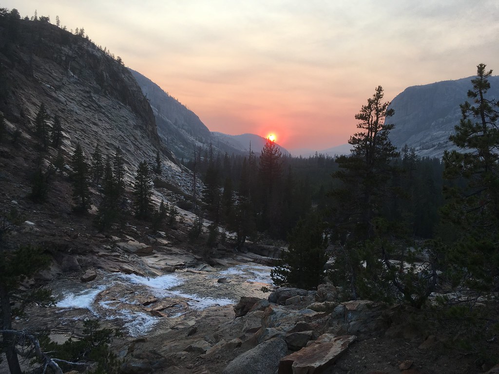
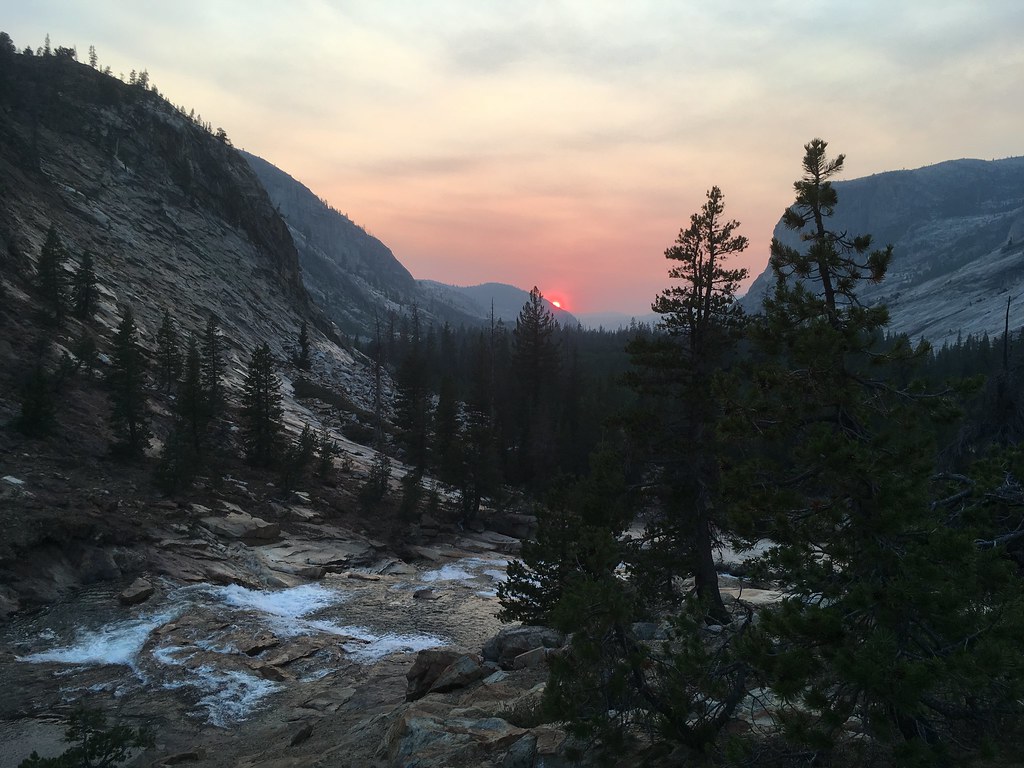
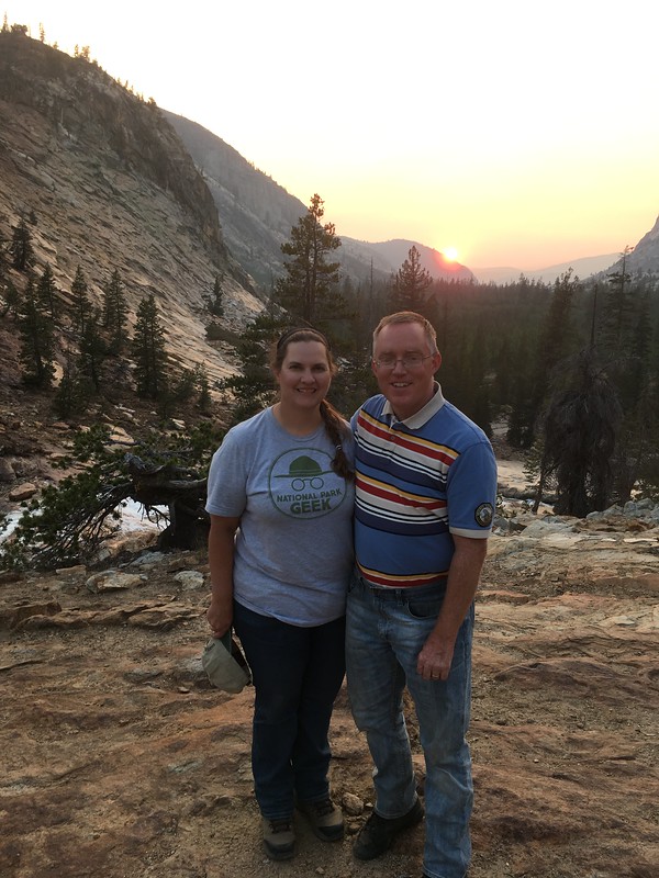
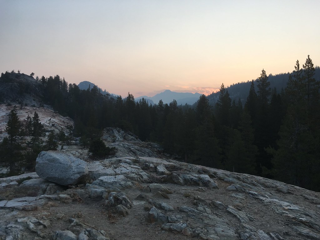
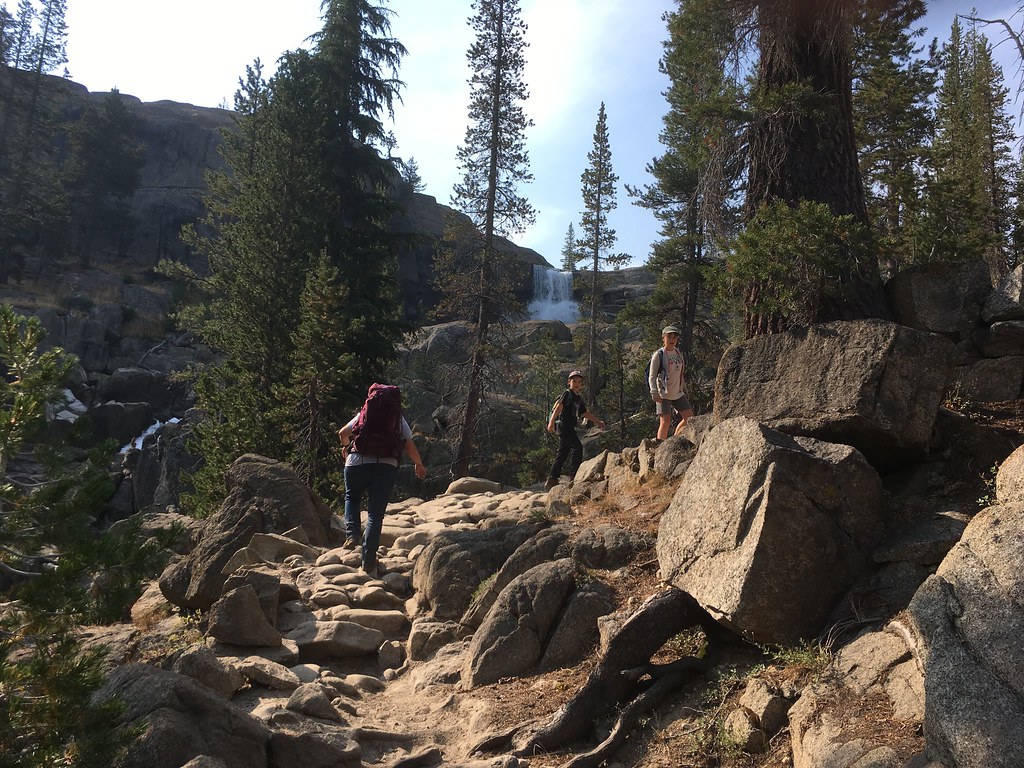
We headed back to TM Lodge to enjoy the sunset and prepare for our hike in to Glen Aulin the next day.

Sunset over the Dana Fork of the Tuolumne
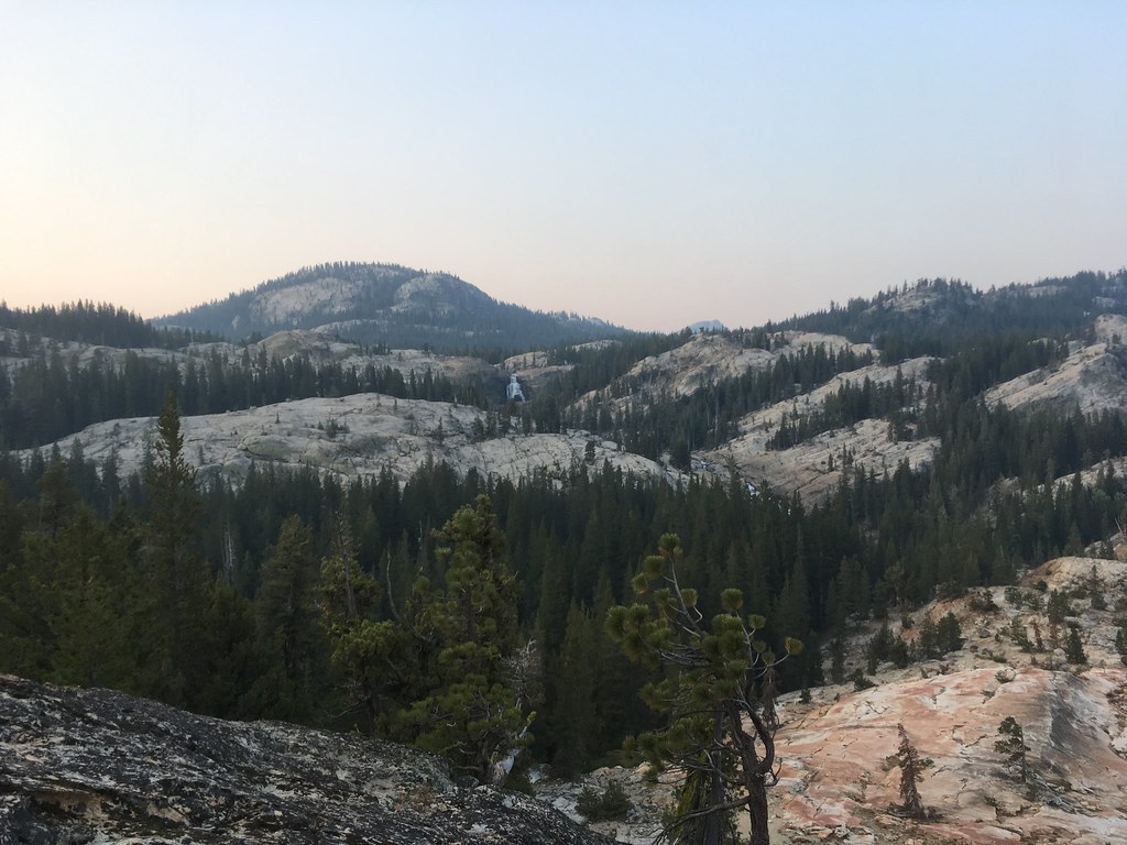
(My apologies for all the delays in posting this Trip Report! Life intervened. I'll use another post to cover the Glen Aulin section of the trip.)
Edited 4 time(s). Last edit at 09/08/2018 02:47PM by FatFlatlander.