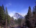
Anderson Spur. Have you ever wondered why the trail out of Happy Isles crosses the river to go up the north bank, even though that side is rockier than the other side, and then climbs too high before it goes back down again to the Vernal Falls Bridge? Well, the John Muir Trail didn't go that way originally. (It was Mr. Snow's Trail then.) That original trail is now the horse trail, which so many hikers have stumbled down after taking a wrong turn at dusk. But there is nothing wrong with the route of the horse trail, especially now that horses are much less common on the trail than they used to be. Certainly not wrong enough to warrant building a new trail and a much bigger bridge than would have been needed at Illiouette Creek to improve the old trail. The answer goes back to the Mist Trail and the Anderson Trail, and a race to get an easy and safe trail both to the top of Vernal Falls and to Snows Hotel which was built on a large flat spot on the north bank, just above the Silver Apron and below Nevada Falls.
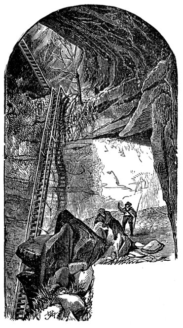
Remember, in those days most of the trails were built as toll trails, to generate profits. The Mist Trail was built about the time of Snow's Trail, which circles far above Vernal Falls before coming back down to it. But to get up Vernal Falls, the Mist Trail had a long, damp and mossy wooden ladder. At least one person fell off it and died. The attachment bolts for this ladder are still accessible on top of the outcrop. Much later, someone blasted rock so as to turn a small crack into the current ledge with railing that climbs next to the falls.
But at the time Anderson set out to build a competing trail, the Mist Trail was bad. He built a trail with much better construction technique and views than the Mist Trail, and his route would avoid the shower bath that you receive on the Mist Trail. His plan was to end his trail by blasting a ledge to the top of Vernal Falls on the north river bank, with convenient access to the falls, Emerald Pool, and the hotel. He did fantastically good work, but it took too long and the money ran out in 1882. His trail sat abandoned for a while, then in 1885 the park service took it over, and ran an extension down to the new Vernal Falls Bridge near the start of the Mist Trail. This allowed them to send horse traffic down via the old trail, much to the relief of all.
But there is still a bit of Anderson's trail above the current route. As you climb up, just before you cross a boulder field and start down to the new bridge, you will see some stonework on your left. This is the next Anderson switchback going up. You can follow it for a while, until it just ends where his dream collapsed.
Union Point. What would Yosemite Falls Trail be without the lookout at Columbia Rock? Union Point on the Four Mile Trail was an even better lookout. It is on all the maps, but in recent years you passed by it without seeing a thing. This prominent flat area and lookout had been decommissioned: covered with live brush, and the sign torn down. You could work your way in there, if you knew where to go, but the brush completely spoiled the view. It was even worse than the brush on Old Inspiration Point.
Now, it is true that the Four Mile Trail doesn't really need a lookout. You can see it almost everything just by stopping in the middle of the trail in places. But a large flat resting area with a pipe rail lookout would still be welcome on almost any trail. I've grumbled about the loss of this historic place for years, as have others, and the park service has relented. I was up there last week, and Union Point has been restored. Or, at least, the brush has been cut. The old iron sign with its cutout letters has been rescued. The views are back, except right at the pipe rail. A couple of trees have grown up to block the view there, and need to be pruned....
So, why was it destroyed in the first place? Embarrassment, probably. The lookout spot was there from the very beginning, but in 1932 it got a major upgrade: a drinking fountain at the turnoff from the main trail, a horse trough and another drinking fountain on the flat area of the point, and a comfort station. Today there is no place to pee from Glacier Point to the Valley, and not even a portable potty at the bottom. This facility must have been a big deal at the time. Of course, a comfort station in those days probably had a pit toilet or a primitive septic field. You've seen the new fancy toilet at the top of Nevada Falls, and what a big deal it is to service it today. Involves a helicopter, I believe. In 1932 there wasn't much of a way to keep the place sanitary as it aged. It also required a lot of maintenance and almost daily trash hauling. In 1969, rather than shutter the comfort station, they leveled it and destroyed all traces of it. In the process, Union Point disappeared. Maybe it's been long enough that they can bring back the view without complaints about the missing toilet....
But what about the water source? This is mostly a dry trail, and that was a bigger problem when there was a lot of horse traffic. This is where the Glacier Point water works comes in. As you come down from Glacier Point, look out at the first switchback that has a view of Sentinal Rock. You will see a water tank and pump house below.But I don't think system was originally built just to service Glacier Point and the hotel that burned down there in the 50s. I think it was also built to send water down to Union Point, a job which required no pump and no water tank. It was gravity feed from the spring to the Point. The last short run had to have been iron pipe to allow some gravity pressure to build up to operate the fountains. A bit of iron pipe still lay along the trail last year; it's gone now as part of the cleanup.
Away from the trail, though the water could just flow downhill with no pressure, and in places they could use leftover wooden water pipes from the cavalry days in Yosemite. Some of them are still there:


You see, in 1907 the cavalry bought a bunch of these wrought-iron-wrapped redwood pipes for various projects in the Valley. Some may have been quite large. I know that they tore up some of it when they repiped the valley water system in 1985. How the wooden pipe in the photos got up to Union Point is a bit of a mystery, but no doubt it was on hand at a time when some pipe was needed in 1932....
It's an interesting curiosity. When was the last time you saw any wooden pipes?


 I wished I'd filtered the faucet water too.


