Welcome! Log In Create A New Profile Recent Posts
Deer in Yosemite

The Moon is Waxing Gibbous (55% of Full)


Advanced

Re: Easy hikes around Yosemite Valley

All posts are those of the individual authors and the owner of this site does not endorse them. Content should be considered opinion and not fact until verified independently.

Easy hikes around Yosemite Valley
April 24, 2011 05:21PM
To build on a couple previous threads: I was up there last Monday and Tuesday. The trails in the Valley are clear of snow, though there is some snow under the trees, and you can expect some muddy puddles. Many of the trails out of the Valley will lead you to snow rather quickly. Less so on the sunny side of the Valley, of course, but you will get soaked if you go anywhere near the base of Upper Yosemite Falls on the Upper Falls Trail. The Snow Creek Trail is your best bet for getting up to the snow line on the sunny side.

Going up out of Happy Isles, the only trail presently open starts up the John Muir Trail, then crosses over to the Mist Trail above Vernal Falls and ascends from there. I don't know where the snow line currently is on that route.

On the south side of things, the snow level is much lower, as explained below. The Four Mile Trail is closed for the indefinite future. There is a chute near the top, which the trail crosses, that is normally full of icy snow until well after they can plow the road to Glacier Point. Which won't be any time soon. They won't open the Four Mile Trail until after that chute melts out.

So, what to do when you are tired of the rather limited trails around the valley? Well, first make sure that you have found them all. The Park Service is always trying to minimize the number of trails. Their phase one is to take down the trail entrance signs. After the traffic dies down in a few years, phase two is to stop cutting the dead trees that fall across the road and to stop maintaining the culverts and bridges. Eventually, phase three is to deny that there ever was a trail there, as they do for the Sierra Point Trail, the Ledges Trail, and the Indian Canyon Trail.

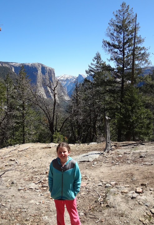
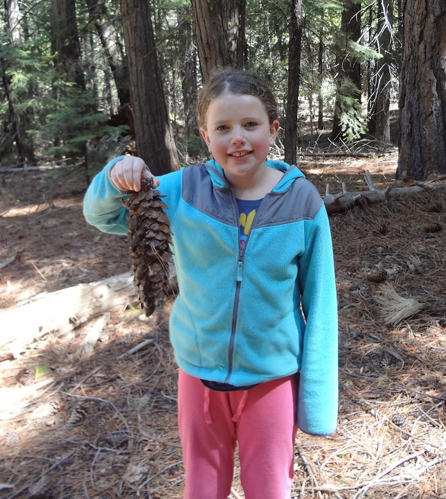
Here are two very easy trails that we did last week with my five-year-old granddaughter. The first is the trail along the river from Happy Isles to the entrance of Lower Pines Campground, then on to the Awhanee. Start by crossing the bridge at Happy Isles to get to the north side of the creek, and start walking downstream along the bank. Almost immediately you will find the old pavement, which extends the rest of the way, though in some places it is beneath some sand and pine needles. This trail is at phase one, mentioned above, and is in excellent shape. I think that they took down the signs because when the river is at maximum flood it can go under water. The creeks and waterfalls are in full Spring runoff, but they are not at flood right now. If the trail is dry, it's OK. If it's under water, please have enough sense to stay out of the river...


When you get to Lower Pines Campground, go in the entrance, and follow along the right hand road until you see a "fifteen minute parking" sign near the bank of the creek, which comes out of Tenaya Canyon. Walk along the bank for a short distance until you see a foot bridge over the creek, which puts you on the north bank of the combined creeks. From there, cross the (currently closed) backpackers campground toward the Royal Arches cliff, and you will immediately see the paved bike trail to the Awhanee, where you can pick up the shuttle bus. The Awhanee itself is worth a look around inside.

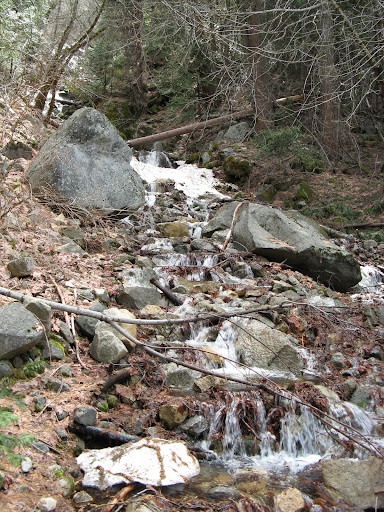
On Tuesday afternoon, we did a nice easy hike that starts at the "Discovery View" parking lot at the east entrance to the Wawona tunnel on route 41. This is the trailhead for the Pohono Trail, which runs along the valley rim all the way to Glacier Point. But you aren't going there, just 0.6 miles to where it crosses the old Wawona road. This was a main entrance to the valley before the tunnel was built. Since then, it has been a trail with great views, that goes to the base of Bridalveil Falls. However, it it now in phase two of abandonment: The culverts are gone and there are numerous fallen trees across the trail. None of the trees present any real obstacle, however, since you can just walk under or around them. The two stream crossing, however, could be a problem in very high water. Fortunately, even in Spring runoff these creeks aren't very big. In fact, the road never had any bridges in this section, just a couple of culverts that are now gone.


Old Wawona Road and Silver Strand Falls (on Meadow Brook) as seen from the hike

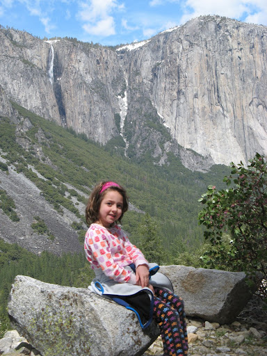
View from Artist Point

Artist Point is not a real point, but just a place on the road with great views, just before it crosses Artist Creek. This had a couple of logs across it, where the five-year-old needed a steadying hand to avoid stepping in the creek. Which was about four inches deep in most places.

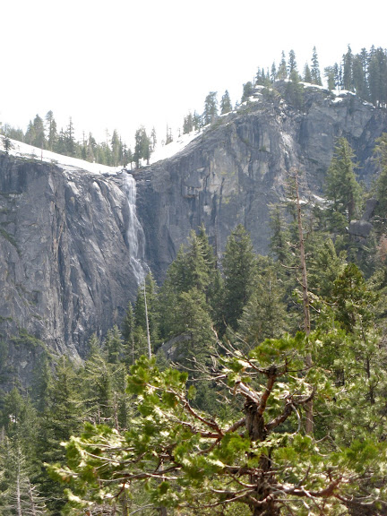
Further on, you cross Meadow Brook, which has a lot more water, but is wide and not very deep. The easier crossings are up the hill a hundred feet or so, but we just walked across on a snow bridge:


Meadow Brook crossing, looking back

Snow bridge across meadow brook; Ribbon Falls and El Cap Gully from that point.

Here are the details: From the tunnel parking lot, it's 0.6 miles and 500 vertical feet to the junction with the old road. It's 2 miles along the old road to Bridalveil Falls, of which the last quarter mile is on the shoulder of the new road. We also hiked up from the junction about 0.25 miles to get the view from Inspiration Point. It may not be the official viewpoint, but the view is pretty good, and above there the trail runs into the woods and was covered with snow. The snow is not very deep, but in the morning you can't dent it all all without spikes on your shoes. In the afternoon the surface could be marked by an adult, and steps kicked to a depth of an inch or so, but it was still slippery and the kid left no imprint at all. You had to hold her hand, or she'd be over the side in a moment.

So, the snow level on the shady side of the valley was at about 5200 feet last week, or roughly a thousand feet above the valley floor. Looking over at the sunny side, the snow level was up at the valley rim.

Another easy and seldom done hike is on the sunny side of the valley: the Old Big Oak Flat road, which is well described in this posting: Old Big Oak Flat Road hike
It is in much poorer shape that the one we did last week.
Re: Easy hikes around Yosemite Valley
April 30, 2011 09:28AM
Thanks for the hike suggestions and lovely photos. Greatly appreciated.
Re: Easy hikes around Yosemite Valley
April 30, 2011 12:35PM
Thank-you for sharing your experience :-).
Re: Easy hikes around Yosemite Valley
April 30, 2011 05:27PM
How did your daughter like Yosemite? I am planning on take my little nieces soon and will probably plan similar easy hikes.
Re: Easy hikes around Yosemite Valley
April 30, 2011 09:45PM
Quote
missjw
How did your daughter like Yosemite? I am planning on take my little nieces soon and will probably plan similar easy hikes.

She loved it, but we there only there for two nights. Hiking is fine, as long as you realize that there will be frequent stops and distractions. She liked the hands-on Indian demo inside the museum as much as anything. She learned how to make a whistle from an acorn cap, and that sort of thing.

Trying to read the writing on the stones in the old cemetery, across the street from the museum was also fun. The mist and air blast near the base of Yosemite Falls was good.

Her big thrill is that she can now hike uphill faster than her grandmother. When she wants to, that is. But it's a big boost for her to not be the slowest one in the group.

Don't dwell too much on the big sights that adults love. A nearby frog is more interesting than a distant waterfall.
Re: Easy hikes around Yosemite Valley
May 01, 2011 07:05AM
Quote
wherever
Don't dwell too much on the big sights that adults love. A nearby frog is more interesting than a distant waterfall.

This is actually a good tip for adults in general! The big sights are indeed spectacular and I do love them but learning that a frog, or a butterfly or a gentle trickle down a moss-covered rock-face can be every bit as beautiful and enchanting as staring over the ledge of Nevada Fall (which happens to be one of my single favorite views in the Park) can enhance one's love not just of the Park but of anyplace you happen to be (even if it's something as apparently "unnatural" as midtown Manhattan).

--David
avatar Re: Easy hikes around Yosemite Valley
May 01, 2011 05:33PM
Amen. I'd hike with you anytime.

I have a very dear friend who loves to go hiking, but I cannot stand hiking with him. He is a true destination hiker, and he bolts off toward the top, while I'm still taking in the sights. I imagine he would say he doesn't like hiking with me because I need to take a picture of every rock and flower. smiling smiley

wherever, thanks for for the trail info for the valley. When we were there two Februarys ago, I had a great time just walking/hiking around the valley, and seeing all the sights from different angles.
Re: Easy hikes around Yosemite Valley
May 08, 2011 11:56PM
I am with you. Total agree it is not a task or checklist type of past time. Just take your time and enjoy.
Re: Easy hikes around Yosemite Valley
May 09, 2011 09:05AM
Glad she had a great time. The frog story was cute. We never know what they are thinking, finding beauty and awe in aspects we adults would sometimes ignore.
Re: Easy hikes around Yosemite Valley
May 02, 2011 05:37PM
From the book I think called Easy Dayhikes in Yosemite
we took our 7 and 9 year - olds on the Sentinel Dome hike.
Spectacular 360 view, and lots of repeats in the 17 years since that first time
this year we be taking silver (like us) newbies
Re: Easy hikes around Yosemite Valley
May 06, 2011 12:56AM
I have to check that hike out. I like taking it easy, and just enjoying the views.
Re: Easy hikes around Yosemite Valley
May 06, 2011 03:14PM
Thanks for the suggestions. I have some girls around your age, and we will try these trails.
Re: Easy hikes around Yosemite Valley
May 07, 2011 09:23AM
That hike along the river from Happy Isles to the Pines campgrounds is also one of my favorites. However it is the North Pines (not Lower Pines) campground entrance you want to go into to find the footbridge and the bike path to the Awhanee and on to the Awhanee meadow. Thanks for the narratives and pictures.
Re: Easy hikes around Yosemite Valley
May 07, 2011 10:12AM
Quote
mtn man
That hike along the river from Happy Isles to the Pines campgrounds is also one of my favorites. However it is the North Pines (not Lower Pines) campground entrance you want to go into to find the footbridge and the bike path to the Awhanee and on to the Awhanee meadow. Thanks for the narratives and pictures.

Right. Sorry.

Go straight into the campground entrance that the river path takes you to. This is where you first hit the road. Don't take the road across the stone bridge to the south, where Lower Pines Campground is located, but just go straight ahead.
Re: Easy hikes around Yosemite Valley
May 08, 2011 11:30PM
Yup, North PInes. It is one of my frequent hikes too.
Re: Easy hikes around Yosemite Valley
May 11, 2011 11:16AM
Thanks for the excellent hike suggestions and photos. I was in the Valley last Saturday with my family, looking to get away from the crowds a bit and we decided to do the Wawona tunnel hike you described. It was very enjoyable. The trail is now clear of snow all the way to Inspiration Point, although the views were actually nicer from a little spur trail to the left about half way up from the old road. Meadow Brook has a bit more water in it now than it did when your picture was taken but it was still fairly easy for my 11 and 13 old kids to cross it right at the road.
Re: Easy hikes around Yosemite Valley
April 23, 2013 11:01PM
Here a few more details on the hike from the tunnel mouth up to Inspiration Point and down to the Bridalveil parking lot. We were up there last week with three grandkids, who had a terrific time. There was no snow, and the stream crossings were no problem. I was able to take a gps track:


From the parking lot, it is 500 vertical feet and six tenths of a mile to the junction with the old road. If you turned left there, it would be two miles down the old road to Bridalveil falls. Crossing the road and continuing up the Pohono Trail to Inspiration Point is another 500 vertical feet and six tenths of a mile.

When you get there, you will touch the old road again, and see a large former parking area.


At the west end of that parking and picnic area, you will find the old road going down at a nice easy grade.

There are some fallen trees, but they present no problem, except for a couple of large ones right where the road takes its first sharp turn to the right. Easy open woods allow you to bypass the logs, and you are then at a fine viewpoint looking to the west and down at the new road west of the tunnel.


Those are the Cascades in the background.

There is a pair of long switchbacks just above the cliff containing the tunnel. That apparent glitch on the gps track is real. But the road is smooth and at a constant easy grade. A mile's walk takes you back to the junction with the Pohono Trail.


The whole hike is under five miles, and makes a good half day hike.
Re: Easy hikes around Yosemite Valley
May 30, 2014 06:42AM
This looks like a hike we could this weekend. So how did you get car from tunnel view to bridal veil for the return?


Edited 1 time(s). Last edit at 05/30/2014 06:43AM by recycling1991.
Re: Easy hikes around Yosemite Valley
May 30, 2014 08:05PM
We had one member who wanted to bike around the valley. She took the car down to the Bridalveil parking lot and biked on from there.

However, the Bridalveil parking lot is full of people who are about to drive up to the Tunnel View or beyond. I don't think that catching a ride would be difficult. The worst case, if you don't care to do that, is to have one driver turn around halfway down the trail and go back.
Sorry, only registered users may post in this forum.

Click here to login