The previous day, we had gotten rained on lightly in Tuolumne Meadows, and from White Wolf we could see tall clouds over the Sierra crest until sunset.
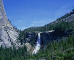
We passed several people camped midway up the Morrison Creek switchbacks, where there are good views of Hetch Hetchy, including Kolana Rock and Wapama and Tueeulala Falls. I considered that this hike would have an entirely different character if it started with an easy stroll up the canyon from Hetch Hetchy Valley instead of the knee-jarring descent from Harden Lake.
Pate Valley was lush and humid, and we passed a few groups camped near the trail east of the bridges. Above Pate Valley were a few small cascades that reminded me of Sentinel Falls. We stopped for lunch near a cascade a mile or so past Pate Valley, and just as we were finishing, it started raining and hailing. Thunder echoed down the canyon, and lightning seemed to strike the mountains above the Muir Gorge "bypass". The rain started earlier than expected--10:45am or so--and took the edge off the bugs and heat.
The rain was lighter by the time we crossed rain-swollen Register Creek, which was about crotch deep. We passed a couple who had been backpacking in Northern Yosemite at the top of the Muir Gorge "bypass"--these were the only people we saw between Pate Valley and Glen Aulin. They said the rain had turned the river black, and sure enough, the Tuolumne was raging brown at the point the trail rejoined it. In contrast to the muddy Tuolumne, the water falling into it from Cathedral Creek was pure white.
A bit below the Return Creek crossing, in a recently burned-out area, grey mud and ash "flows" buried the trail for a few hundred feet. The mud's consistency ranged from fairly solid to quicksand, and covered the ground from a few inches to a foot or so. We saw one set of footprints heading up canyon.
We wondered what had happened--or was happening--up river, and why we hadn't passed any backpackers hiking down canyon. Were they being turned back by flooding? Something was turning the river brown--a landslide? Were the meadows washed out? What would the falls, or Tuolumme Meadows, be like when we arrived at them? Our biggest concern: would the Return Creek bridge still be there?
Just below Return Creek, it was clear that all the mud was coming from Return Creek, its dark color contrasting the the typical blue-white color of the Tuolumne. A few yards' walking confirmed that the bridge was still intact, Return Creek raging under it.
The sun came out as we began the climb up the major Tuolumne falls. After another lunch (okay, closer to dinner) break at Waterwheel Falls, we continued hiking past the falls and cascades I had hiked in late June. The water was a bit lower, but the evening sun brought the falls and granite to life. Falls Ridge glistened below us. We had prepared mentally for late-evening storms and returning to our car in the dark and rain, but luck was on our side: the rain was there when it helped make the trip pleasant, but it cleared out in the evening, making the remainder of the trip enjoyable. We were surprised that no one, not even day hikers from the High Sierra Camp, was enjoying this setting except for us. One place where the water level was the same: lower Glen Aulin, where the Mattie Lake outlet was flooding the trail just like it had a month or so ago. This made my wife happy--she enjoys walking through cold water and had missed out on the earlier trip. Several groups were camping in Glen Aulin just east of the flooded section--perhaps the water or storms had held them up there.
After climbing to the Twin Bridges above Tuolumne Falls, we left the trail to take the Pothole Dome "route"--mostly now an established trail. Just where this route leaves the river we put on the headlamps again and followed the path through the woods to the Pothole Dome parking lot. The last sun light was fading as we arrived at our car.
More Pictures


