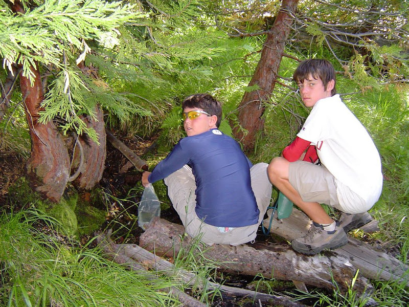
I was on the trail up to HD July 5th and spoke to the ranger at the ticket check-point ( HD Trail/JMT Trail? ) and I asked where the nearest location was for water. He mentioned two spots, down to the merced river and another spot, a spring, just up from the check-point about about 5-6 switchbacks up or about 200 yards. I have a picture of the spot but need help posting it.
To find the location of the the spring, if going up to HD, travel up from the check-point and in about 10-15min you'll start to see area's off to the left of the trail that are greener ( 5-7 switchbacks or around 200 yards ). The area is green from the run-off of this spring. Shortly after this a a large stump from a Pine tree that recently fell across the road will come into view as you turn to face. The stump is on the left side of the trail. You can't miss it as the stump is cut perpendicular to and right next to the trail. The size of the stump is large too, around 7' in diameter. The spring lies right behind the stump, only 2-3 feet from the trail. You do not get a direct view of the spring, a small puddle of water as it's located right behind the Stump, but in some ways the stump both protects and keeps the stream clean from traffic. Water perculates up from the ground to feed the spring.
I tried looking for the other pipped spring, which I believe is still higher up on the trail from this spot, but I think I went off-trail at the wrong location. I did find a spring of water near the off-trail location with a very small pool of water but the pool of water was located under and inside the base of a tree. I wish I would have taken a picture of this, but at the time I believed that I wasn't at the right location and that I needed to travel further up the ravine or higher up the trail.