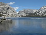
We came from the right where we had followed the creek from Lower Conness to Upper Conness. More on that later.
We ended up taking the blue line from "1" to "2." After we reached "2" it was obvious the the red line would have been much easier. At the base of the striped granite is a bench about 10' wide with grass and small rocks, an easy hike. At "2" we found a use trail and followed that up to "3." It was fairly steep with small rocks and sand. At "3" the use trail made a right turn straight up a very steep slope to "4." We judged that to be too steep for us especially since it was mostly sand. From measurements I took in Google Earth that small section was 32 degrees. The previous section was 22 degrees. It looks like a better route may be the green line where Google Earth shows the route to be about 21 degrees following the border between the rocks and the granite. It's not as steep as it looks in the picture.
I did take a few images from our highest point. Here is one.
http://panoramas.aa6g.org/ConnessLakes/UpperConnessfromAbove.html
Maybe we'll give this a try again next year. I have to chalk this up as a "scouting" trip.
One interesting thing we saw is that the majority of the water coming down the falls is coming from the left from Conness Glacier and only a little water is coming from the tarn above.
I mentioned we came up the creek from the lower to the upper lake. That wasn't too hard. We started on the south side of Lower Conness Lake and crossed the broad creek coming from Middle Conness Lake. We stayed to the left of the creek coming down from Upper Conness below the ridge that separates the two lakes. A good portion of that creek flows under the rocks. You can hear it but can't see it. We had planned to cross the creek and stay on the north side and hike on the north side of Upper Conness. That didn't work out. The outlet of Upper Conness is basically a "V" only passable on the south side. We hiked up the rocks in the creek to the exact outlet. Fortunately it was easy to cross the outlet and not get wet. The rocks leading up to the outlet were stained brown so it looks like water flows over the rocks during peak melt although most were dry when we were there.


