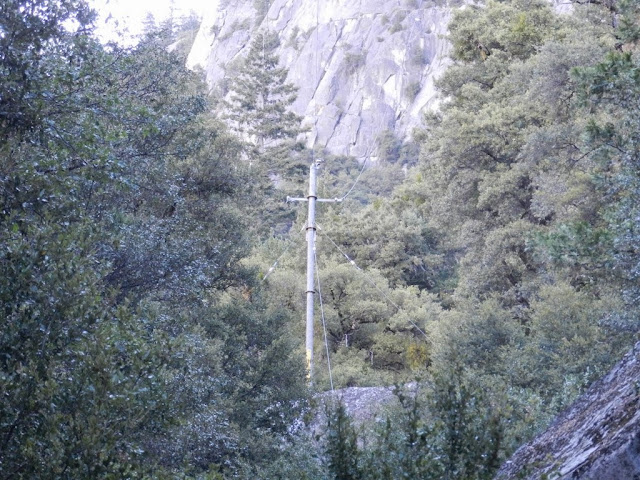
... I wonder about the history of that line:
-- When was it first put in?
-- Was it originally for the Glacier Point Hotel? For the water supply to Glacier Point? For the radio facility or facilities? For all of the above?
-- Is that the original power line (and route) or an upgrade?
-- Is the water tank (marked 3 on the topo) still in use? Does the water from it get pumped up to the water works (or whatever that is) near Glacier Point? Would it ever have been used to supply parts of the valley? Maybe the hotel(s) that used to be located near the trailhead?
-- Would the trail(s) shown here have had anything to do with installing or maintaining the power line and water tank?
-- Is there anyplace I can read more about how those facilities were put in and what it took to do it? I'm trying to picture how the poles and the wire would have been hauled up there, for instance.
The latest topo maps that I can find show that electrical line starting at Northside Drive and running above ground across the river, across Southside Drive, and across the Four Mile Trail on its way to the pole in the picture. It's been undergrounded since then, though. Any idea when that was done? At about the same time the line along Northside Drive was put underground? I remember watching when most of the electrical line into Pt Reyes National Seashore got buried -- sometime in the late 90s, I think. Was this an NPS-wide program at the time, maybe?

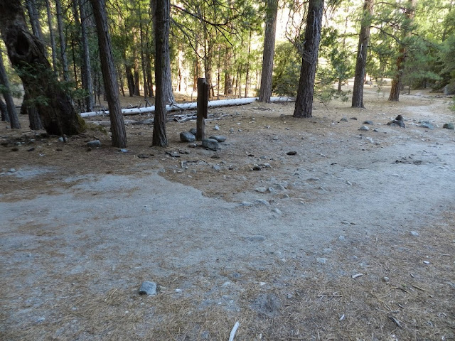
I prowled the FMT carefully at the point marked 2 on the topo. There was no sign of overhead wires but right in the middle of that bend, where the map shows the line crossing, there was a break in the asphalt. I take it that's where the line was buried:

I'm just curious -- nowhere near fanatical enough about it to try following the line through the trees to see where it comes out of the ground.
--------------------------------
I'm not the bushwhacker I used to be. Some say I never was.