Hidden Secret Tenaya Falls
Our first hike was a short-ish one, to the small waterfall that's just past the end of the Tenaya Canyon/Mirror Lake loop trail. The route to these falls follows a decent use trail which as a bonus has some nice views of Snow Creek Falls.

The hidden secret falls were nice enough despite the low-ish water levels.

More Tenaya Falls
The next day we headed to the high country, first descending Tenaya Creek towards the wonderful waterfall and cascades just past "Admonition Point". The Tenaya Creek crossing was maybe a foot deep at most.

There were a few mosquitoes along this route, and dark clouds formed throughout the day.

After returning to the car, we drove to Tuolumne Meadows, where we found that our friends were climbing Pothole Dome, which we had never done, despite having walked around it several times.
Although the clouds threatened to rain on us, we were able to make it to the river and back safely, after which we enjoyed a treat of soft-serve at the grill.
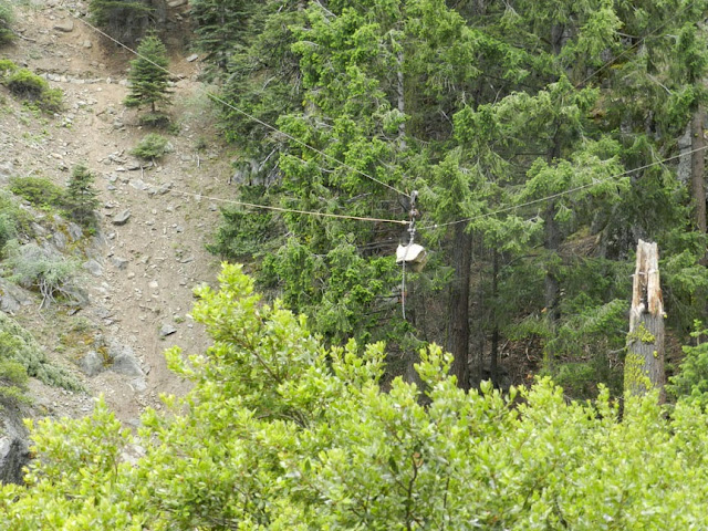
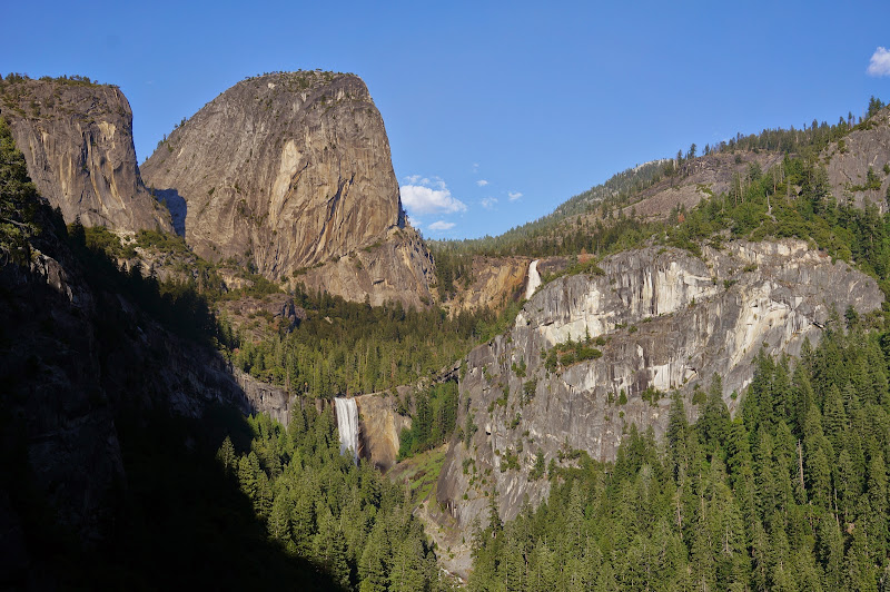
Four Mile - Panorama Trail
The next day, some in our party went up the Four Mile Trail, others came down via the Panorama Trail, and a few did both.
The CCC was busy installing a nice zip-line facility between the middle gate and Union Point.

The sky was still clear by the time we reached Glacier Point, from where we could see the Forbidden Fire smoldering away.
After a Glacier Point snack-stand treat, the descent down to Illilouette Fall was warm despite growing clouds.

After a snack at the creek, we attacked the climb to Panorama Point and Cliff in the heat, the clouds arriving too late to cool us off.

We got a few drops of rain on us right before the switchbacks down to Nevada Fall--less than we'd get on Ice Cut.

Despite recent tragic events at Nevada Fall, people continued to ignore the warning signs and railings.


Despite the nonchalant attitude of those in the water above it, Nevada Fall had an impressive amount of water in it.

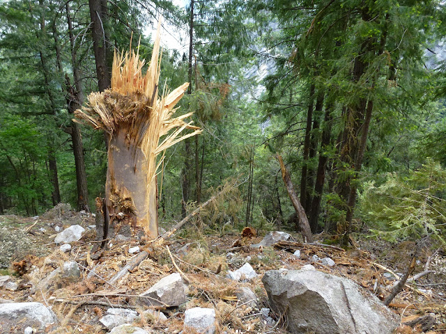
After a bird-bath stop, we descended to the area where the rockfall had closed (and subsequently re-closed) the trail.
The rockfall area showed many signs of rocks that had smashed into--and though--large trees, even hundreds of feet below the highest switchbacks.


Although we tried to make it to Happy Isles by 5:00 to enjoy a snack-stand treat, we were too late... or so we thought, until we discovered that the snack stand was open until 7:00!
Lyell - Ireland - Evelyn Loop
The next morning, we drove up early to Tuolumne Meadows and met a friend who had driven up for the day to do a long hike with us: up Lyell Canyon, right at the Ireland Lake trail junction, straight towards Evelyn Lake, then down the Evelyn Lake outlet until we hit the Rafferty Creek trail, which we took back to Tuolumne Meadows. Mosquitoes were out, but generally light--maybe 3 on a scale of 1-10. We encountered only a few patches of snow until the crest between Ireland and Evelyn, but there were a few larger snowfields closer to Evelyn. I'd guess they are all but gone by now.

As with previous days the day started clear, but clouds grew throughout the morning.

Right after our lunch stop at the Ireland/Evelyn crest, the UFO-certified pack cover and rain jackets went on, guaranteeing a mostly dry remainder of the day.

Despite some thunder, the weather actually made the hike very enjoyable.

We left the trail at Evelyn Lake and headed down the outlet, encountering some snow--and very few bugs--along the way.

By the time we were at the meadow, the worst of the storm seemed to have passed.

Despite the poor lighting, we finally got to see the waterfall where Rafferty Creek falls into Evelyn Lake's outlet--at least with water in it:
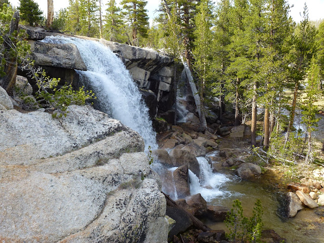
The "other" Rafferty Creek falls were flowing nicely:

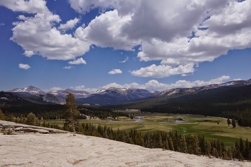
May Lake / Sierra Point
The next day involved a few sightseeing trips for my sisters. First up, May Lake. Some snow, some bugs, but mostly at the trailhead.

The views from the ridge above the High Sierra Camp were nice, as always: Photosynth
This particular day was forecast to get warm, so after May Lake we found a nice place on the Tuolumne River for a cool dip.
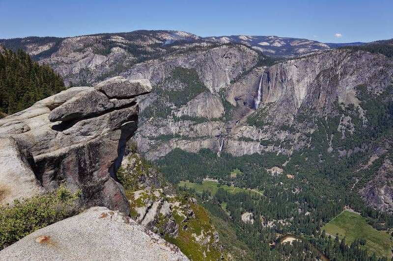
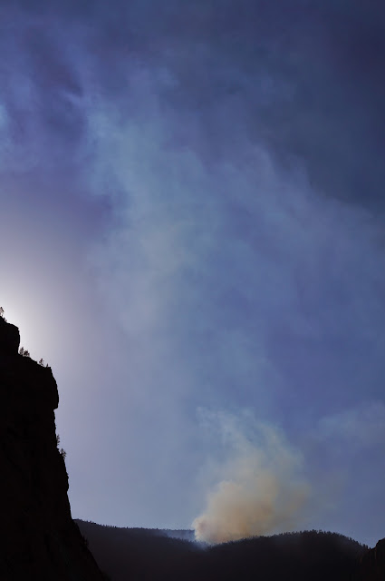
After returning to the valley, I led my sisters up to Sierra Point ("bucket list" check-off). The evening views of Vernal and Nevada Fall were very nice...
...but, the heat and dry wind were fanning the Forbidden Fire across the valley.*
There were a few other people at Sierra Point when we arrived, and one of them said something like "I guess this place is no longer a secret". To which I replied: "The internet knows about it." Unfortunately, the old, unmaintained trail isn't handing its Internet-era popularity well--the first significant rocky section has gotten a lot more treacherous, and the next set of stonework between it and the open washed-out segment (above where the Grizzly Peak use trail leaves the SP trail) has almost completely fallen apart. There are still many portions in good shape, mostly in the upper third or so of the trail above the washed-out section, but it seems every time I revisit the trail, another step or part of the original rockwork disappears. There is no sign of the original rockwork remaining along the deep, rutted bottom third or so of the trail.

North Dome
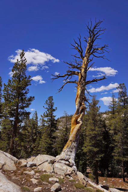
For our final day hike, another "bucket list" item: North Dome. No snow, few bugs, but it was hot (the valley hit 100F or so that day).

The small creek before the Indian Rock/arch turnoff was still flowing--perhaps for another month or so...?
We didn't stay long on the dome--no shade, very hot.

Besides the heat, aircraft and a helicopter kept flying around us... almost reminding me of Nualolo Viewpoint. I suspect they were looking for the aircraft that went missing late last year, or possibly monitoring the Forbidden Fire, but they seemed oddly interested on what was happening in the Mt. Watkins/Wahoo Dome area.

After a hot hike back to the trailhead (and a nice long stop in the cool waters of Porcupine Creek), we returned to the valley and took a nice swim in Mirror Lake, where for the final time of our trip thunderclouds formed above us.
All in all, another great trip to Yosemite!
Edit: forgot the "More Pictures" link: More Pictures
* Unfortunately, this same hot, dry air would follow my sisters back home and fan the flames of the Black Forest Fire just a few miles north of their home.
Other random observation: at some point in time, the "High Sierra Loop" trailhead sign at Happy Isles was

Also, even though sign is no longer on what is considered the "High Sierra Loop" (Yosemite Valley was removed from the HSC loop after Sunrise HSC was built), the choice of destinations still seems odd since it doesn't form a loop...
On the other hand, the hike to Mt. Whitney is highly recommended.
Edited 1 time(s). Last edit at 06/14/2013 08:33AM by basilbop.