As it ends up, due to a continuing ankle injury, we "bailed" near Merced Pass and instead took the Illilouette Trail back to the Mono Meadow trailhead.
The first day was hot and, oddly, humid, and in the distance we saw tall clouds forming over the Clark Range. At times they appeared to be threatening our first night's destination (Buena Vista Lake), but we stayed dry:
The evening was warm and calm, and (for those who care) the lake appeared to be well-stocked with fish, which enjoyed splashing around in the warm water after we had done similarly:
That day, we'd encountered only a few people at Ostrander, and another small group camping at Buena Vista.
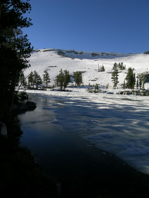
(By way of contrast, same lake, same date, much wetter year:
 )
)The next day we took the trail to Buena Vista Pass, then headed east to the saddle west of Mt. Bruce on the crest. Cooler winds provided relief from the previous day's heat, and the clouds appeared to be more subdued. From the saddle, we could see many familiar Yosemite highlights:
(And again, back in '05:
 )
)In the distance, we saw One-and-a-Half-Dome and Triple Dome:
Not far from this area, we encountered an old plane crash site. The heat from the crash was enough to have melted many of the plane's aluminum parts, but there hadn't appeared to be much if any damage to the surrounding trees or terrain. We commented on how hard it might be to locate the plane that had gone missing last winter... which of course was subsequently located.
We generally stayed south of the crest, where the terrain was generally very gentle. We did get some additional views at the saddle east of Mt. Bruce, with great views of the Clark Range:
South of the Hoover Lakes we dropped a bit lower to avoid some talus, but once north-ish of Moraine Mountain we climbed to the top of the crest to avoid some nasty sidehill and deadfall action lower down. From the crest here we could see Hoover Lakes... and much more:
Following the ridge down to Merced Pass, we passed through several wonderful open areas that all would make excellent dry camps:
More Yosemite highlights greeted us, including a few peeks at Yosemite Falls (and that odd one-and-a-half dome thing...):
At the Ottoway Lake/Red Peak Pass junction, we decided to return via Illilouette Creek instead of committing to two long days to loop through the Merced River head (and middle) waters. We quickly arrived at Lower Merced Pass Lake and, faced with a glut of decent campsites, we dithered for quite awhile searching for the perfect one: good access to water, good views of the valley domeage, and good views of the Clark Range.
After setting up camp, we took a nice soak in the outlet stream, a lovely whirlpool tub complete with a mini-fall to massage shoulders, which was very warm and soothing, even if there was a faint hint of avgas and weed in the water...

Near sunset, a deer approached camp and slowly circled the camp, completely unfazed by our presence. (Then again, the local deer in our neighborhood are similarly unfazed by human presence...)
Our location allowed us to squeeze out every last minute of day:
Day two encounters: one deer, zero people.
Our previous trip to the Illilouette Trail had not left a very favorable impression on us, but starting with the "good stuff" we enjoyed the lush valleys, small waterfalls, and other granite features along the first part of the trip:
However, as we descended, we started to encounter the burned-out areas that had formed our previous impression of Illilouette:
Still, even in these areas there was a lot to see:
We stopped for lunch just past the Clark Fork junction, where there's a nice little waterfall below the trail:
Just past this crossing, I searched the trees east of the trail for possible old cavalry "T" blazes that might indicate the start of the old Mt. Clark trail. These blazes would be over 100 years old; most of the trees were probably much younger than this (especially with the more recent fires in the area), and any tree old enough to have been blazed back then may very well have healed enough to completely conceal it: even the more recent diamond blazes along the Illilouette trail were almost completely healed.
At the next junction, I left the trail to check out some off-trail goodness that a pink bird had thought might be interesting while my wife headed for the Illilouette crossing. Soon enough, I was at the brink of a mini-"Cherry-esque" gorge, complete with many little cascades and tea-cups:
The lower-elevation heat made the pools below tempting, but instead I slogged through the burned-out areas towards the Illilouette trail crossing, where I found my wife swimming in a warm, calm section of the river.
After cooling down--and cleaning up--we loaded up on water for the final slog to the trailhead. Even the locals were trying to stay out of the heat:
Most of the trail in this section is uphill, open (due to past fires), steep, and dusty, but there were occasional views that took our minds off the climb:
Eventually we emerged at the Mono Meadow trailhead. While it wasn't the trip we had planned, it was still a wonderful excursion, and we left with a newfound appreciation of Illilouette Creek.
Stay tuned for more next week...
More Pictures


