Welcome! Log In Create A New Profile Recent Posts
Tenaya Lake, Yosemite National Park

The Moon is Waxing Gibbous (57% of Full)


Advanced

Re: Leavitt Meadows to Hetch-hetchy

All posts are those of the individual authors and the owner of this site does not endorse them. Content should be considered opinion and not fact until verified independently.

Leavitt Meadows to Hetch-hetchy
July 26, 2013 10:37AM
We finally got out on the trail this year (whew!) and had an adventuresome trip across the Sierra from East to West:

This was a through-hike, obviously, so we have to start out with thanks to Jon for helping us drop off our car at Hetch-hetchy, and Cathy for driving us to the trailhead at Leavitt Meadows.

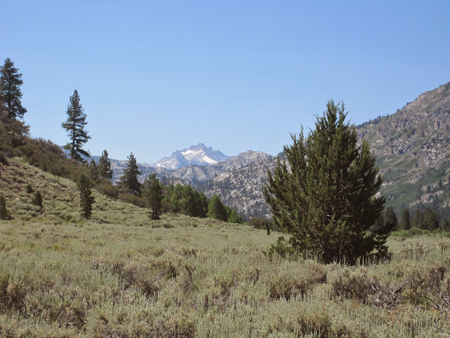
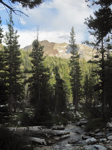
Day 1: Off to a late start, for many reasons, and on a nice hot day, as well. This was a slog. The first few miles through volcanic sand above the West Walker River, with full, heavy packs (we were planning for an eight day trip) it was real work. That's the lower canyon in the photo at right, with Crown Peak in the distance.


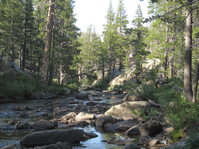
And because of my health problems, this was our first trip of the season—so we might have been a little out of shape. We sweated and trudged our way up to lower Piute Meadow, where the mosquitoes were waiting for us, and camped along the river (photo below) in the small granite area between Upper and Lower Piute Meadows. The mosquitoes still found us, and it was head-nets during dinner and afterwards. Nine miles.


Day 2; The next morning, P was putting his pack together when he felt his back go out, and was pretty much immobile for a few minutes in excruciating pain.. M pulled the Tyvek tarp out of his pack, and laid it on the ground. For the next twenty minutes, P did his back exercises and tried to relax the muscles. No fun at all. We went from trying to figure out how to get back to the trailhead (and then our car, which was 100 miles away) to slowly thinking we might be able to continue. P eventually picked up his pack, and we were off. The day included a steep climb out of the West Walker canyon up to the Pacific Crest Trail, and then a lovely climb through the lakes on the east side of Dorothy Lake Pass.

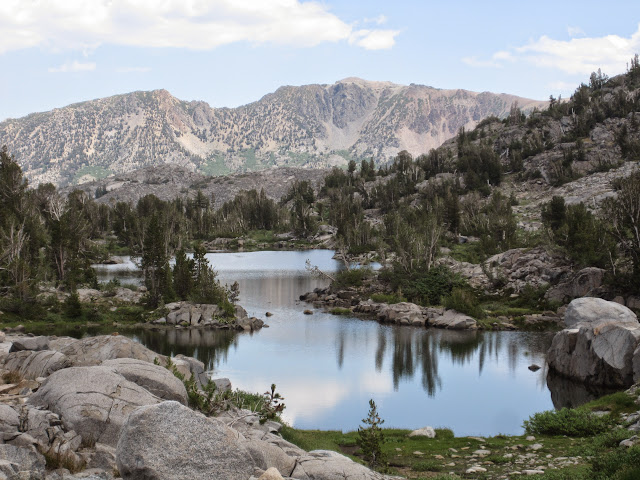
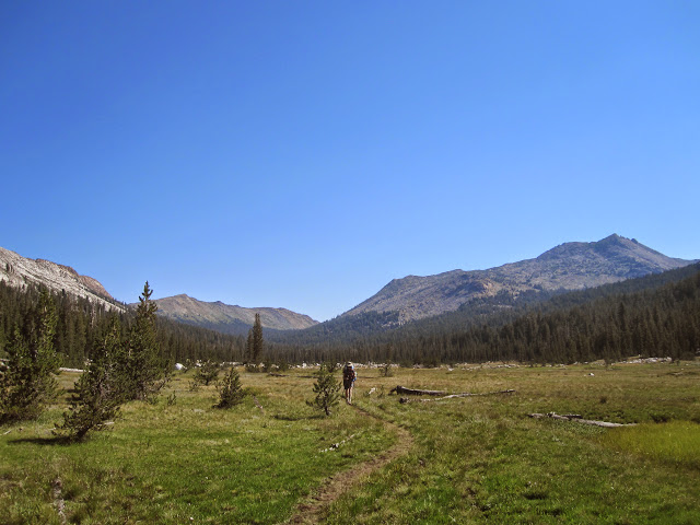
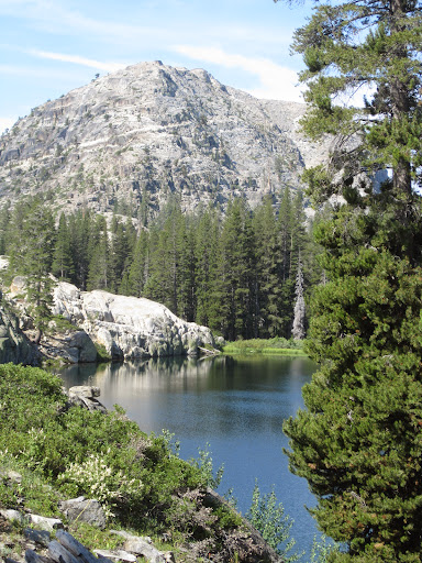
Wonderful country. This is one area we want to explore more. That's Stella Lake in the photo, in front of the dry mountains on the east side of the Walker River canyon.


And then over the pass and down to Dorothy Lake…


Full of skeeters, and camping along the banks of Falls Creek below the junction with the trail to Bond Pass. The sky was threatening, and we set up our tent a bit early, but only heard the thunder in along the crest above us—no rain. A nice spot, but another head-net evening because of the bugs.


Day 3: A good start to the day, as all is well on the back front. This was a highly anticipated day, working our way down through Jack Main Canyon on the PCT to Wilmer Lake. The trail leads from one meadow to the next, and the flowers were blooming like crazy. But where there are flowers, there are bugs. Way too many mosquitoes for us to stop and smell the lupine.


Lunch was on a granite slab on the side of the creek, and just before Wilmer Lake, the landscape changed---and we went from lush meadows to bare granite. We passed Wilmer Lake (surrounding by lush grass…hmmm) and camped about a mile below it, on the far side of Falls Creek.


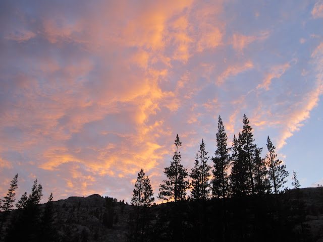
This was a lovely spot, with deep pools for fishing and swimming. This afternoon the thunderstorms hit us square, with lightning, thunder, rain, and gusty winds. Still, we were snug in our tents, napping quietly, and by six p.m. the skies were clearer, and we had a beautiful sunset. And after rinsing off in the stream, we were almost clean.


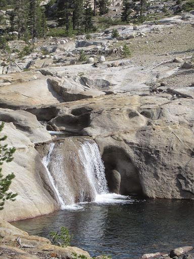
Day 4: Really looking forward to more of this amazing canyon. The first mile or so was through some of the most remarkable granite, with Falls Creek cascading down slopes into deep pools.


And then we hit the meadows and lakes. This part of Jack Main Canyon is an intimate landscape, with the trail wandering through meadows and forest to small lakes, each one delightful. And the flowers were everywhere. Alas, so were the bugs. We had hoped to explore more along here, but the bugs were so fierce that we just kept hiking through the wonderland.


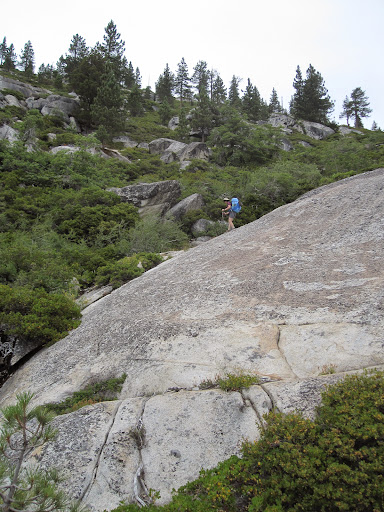
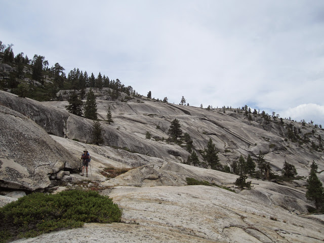
We pumped water where Falls Creek heads over the cliff to Lake Vernon, and ran into a few members of a CCC trail crew there. We asked about the route down to Lake Vernon, and they pretty much unanimously discouraged us. So when we saw the cairns leading off the trail to the left, we checked it out, cautiously. But each slab of granite lead us further down the slope, and after a while, only a tough Class 3 scramble for 15 feet separated us from the lower and flatter sections of granite. That's M, working her way down a slab.


Once through there, we headed over to the creek and followed it down to the forest, where we found a rough trail to the Snow Survey hut. And from there, an easy hike to a nice campsite at Lake Vernon. The whole afternoon it threatened to rain, but we only felt a few drops. We won’t post the route we took down to Vernon, because we don’t want to encourage everyone to try it…but we’ll answer any questions via PM or email.


Day 5; A bit of a dilemma today.

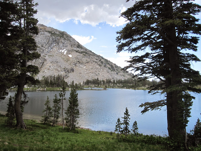
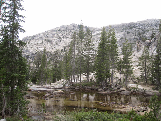
We had planned to be out longer than five days (we were carrying food for eight days) but the only way-station on the way to Hetch-hetchy was Laurel Lake, and that didn’t appeal. Plus the weather was still looking pretty dark and dreary…that's a view of Lake Vernon at right...and we started to think about our lovely cabin near Twain Harte. So we packed up and headed down, down, down. We finally found out why the Beehive has its name (the only other time we had been here, it was under two feet of snow)


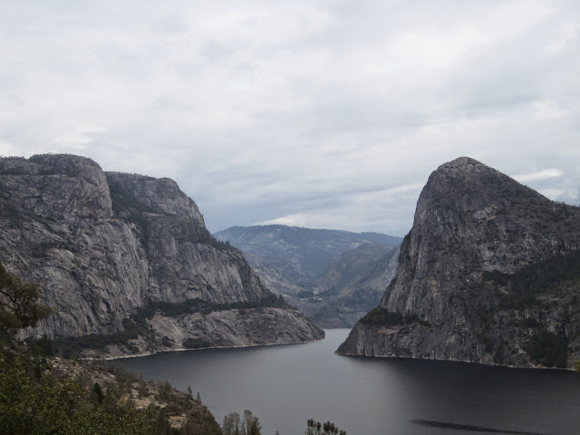
and then pounded down the switchbacks across from Kolana Rock to the dam at Hetch-hetchy. The staff at the Evergreen Lodge camp store were really nice to two smelly, filthy backpacers, and they we were off to our cabin for showers, a roast chicken, a bottle of wine, and a softer bed.


For all the photos, go to our Picasa page for this trip: https://picasaweb.google.com/balzaccom/BackpackingInTheSierraNevadaLeavittMeadowsToHetchHetchy#


Check our our website: http://www.backpackthesierra.com/
Or just read a good mystery novel set in the Sierra; https://www.amazon.com/Danger-Falling-Rocks-Paul-Wagner/dp/0984884963
avatar Re: Leavitt Meadows to Hetch-hetchy
July 26, 2013 11:28AM
I highly recommend this trip. I did it back in the second week of May. It definitely looks different without all the snow. The manzanita on the drop into Vernon isn't fun, but I'd still rather to that way. The downside from there is Vernon is the only place id want to camp from there out to Hetchy.

http://yosemitenews.info/forum/read.php?3,66444
There's some pics of it covered in snow, if anyone wants to compare and contrast.
Re: Leavitt Meadows to Hetch-hetchy
July 26, 2013 01:54PM
The manzanita drop in snow would be pretty different than what we encountered--especially since the temp was in the high 70's and we were in shorts!


Check our our website: http://www.backpackthesierra.com/
Or just read a good mystery novel set in the Sierra; https://www.amazon.com/Danger-Falling-Rocks-Paul-Wagner/dp/0984884963


Edited 1 time(s). Last edit at 07/26/2013 01:59PM by balzaccom.
avatar Re: Leavitt Meadows to Hetch-hetchy
August 13, 2013 08:00AM
I see that you posted a route down from Jack Main to Vernon.

I've never gone down that way or dragged others that way. The official unofficial "trail" with ski markers
stays pretty close to the creek itself. You can go that-a-way. (done it many times up and down)
Part of the fun is finding the way yourself, isn't it? I dunno. Maybe I got it wrong. I knock all the
cairns I see down. I recommend talking to a wilderness ranger and get their take on things.
My 2 cents.

Here's the top o Falls Creek right at the drop into Vernon. Not the ski marker on the tree:


Have fun and LNT (please) (the rangers have enough to deal with already)


Chick-on is looking at you!
avatar Re: Leavitt Meadows to Hetch-hetchy
August 18, 2013 03:41PM
Quote
chick-on
I see that you posted a route down from Jack Main to Vernon.

I've never gone down that way or dragged others that way. The official unofficial "trail" with ski markers
stays pretty close to the creek itself. You can go that-a-way. (done it many times up and down)
Part of the fun is finding the way yourself, isn't it? I dunno. Maybe I got it wrong. I knock all the
cairns I see down. I recommend talking to a wilderness ranger and get their take on things.
My 2 cents.

The route he posted is the same one I mentioned here (on the descent), which I had seen posted earlier (as noted on my post).
avatar Re: Leavitt Meadows to Hetch-hetchy
August 18, 2013 04:14PM
Well there you go. Personally I like to just go out there and wing it to be honest.
(kind of ... if I wanted a trail... well... I'd be on a trail) Much of the fun is just going
and trying to figure it out. At least for me.
I also love the poo-poo-ing of the lower elevation stuff that is rampant.
Just means that areas that I absolutely love... will be free of peeps.
(well... let's be honest... I pretty much love it all)
There's huge areas of the park which are "lower" elevation... that have no trails...
that are incredibly scenic. And then there are huge swaths of the park which
don't have trails in them... and are "higher" elevation... and are incredibly scenic.
Anyway... what am I saying? It's all good baby... go make ur own "trail" and have fun
Chick-on is looking at you!


Chick-on is looking at you!
Re: Leavitt Meadows to Hetch-hetchy
August 18, 2013 09:32PM
FWIW, the route we took down to Vernon was a bit by accident. The trail crew we met had given us a bunch of different descriptions (wildly different) and all of them (a total of seven people in the crew) discouraged us from trying it with our packs. Then again, as we are of a certain age, maybe they were just being careful.

As it was, the two cairns we saw on the whole route were right at the top, and really only led to the overlook of Lake Vernon. But as TTilley notes in the posts that he's linked here, you can work your way down the zigzags of granite if you pick your route carefully. It all worked out for us...and M is not much of a scrambler, so it needed to work out, Otherwise, we would have climbed back up and taken the long way round.

As for the cairns....I've never created one that I didn't take down on the way back (a few times I have left a marker to make sure I didn't miss a key slot or pass...but always take it down when I pass back through) but I don't knock them down either. They don't bother us they way they bother Chick-on....


Check our our website: http://www.backpackthesierra.com/
Or just read a good mystery novel set in the Sierra; https://www.amazon.com/Danger-Falling-Rocks-Paul-Wagner/dp/0984884963
avatar Re: Leavitt Meadows to Hetch-hetchy
August 19, 2013 06:29AM
Guilty. Yes, honestly I'm upset with myself that they bother me so much.
I need to get over it. I guess it's like litter in the city. Eventually you just walk right over
it without a thought... well... I think... we are a don't care society... someone
else's problem... Someone else will pick it up... but if it's in my backyard... I pick
it up... 2 streets over... it just gets to be too much and I say screw it. Maybe they will
get it someday.

Anyway, I digress. My glass is half dome full. Believe me. I'll go back to ignoring the ducks and cairns here now.

O... btw... If it matters... I think you figured it was Tower in one of your first photos... and
then later on... It's Wilma. Not Wilmer. A Brit did the translation and all the signs say
Wilmer... but it's really Wilma Lake.
(don't get me started on Olmstead/Olmsted)

Thanks for the TR and discussion


Chick-on is looking at you!
Re: Leavitt Meadows to Hetch-hetchy
August 19, 2013 08:03AM
I have to admit that we thought of you as we hiked through the junction at Virginia Lakes trail and Green Lakes. As you make the short climb up out of the canyon to Summit Lake, there is an enormous cairn--three feet high, at least. With no suggestion of what it might mean, except that somebody has seen too many Andy Goldsworthy exhibits....

But later on, as we hiked up the upper end of Virginia Canyon, we came upon another cairn--with an arrow made of rocks in front of it--this one clearly marking the trail to Virginia Pass. We didn't give it much thought at the time. But on our way back down, we met a family (Mom, Dad, four kids between maybe 6 and 11? and three llamas) who were obviously lost. They asked us if we were coming down from Virginia Pass (we were coming down from Return Lake.)

They said that they couldn't find the trail to Virginia Pass...and when we mentioned the cairn, they said that they had tried turning there and following the cairns...and couldn't follow the trail.

Chick-on...you haven't been knocking down cairns up there, have you? grin.

And as for Wilma/Wilmer Lake...do you mean to tell me that NatGeo got it right for once, and the NPS got it wrong? I sense a disturbance in the Force!....


Check our our website: http://www.backpackthesierra.com/
Or just read a good mystery novel set in the Sierra; https://www.amazon.com/Danger-Falling-Rocks-Paul-Wagner/dp/0984884963
avatar Re: Leavitt Meadows to Hetch-hetchy
August 19, 2013 11:13AM
I'm innocent.

All I can say is that the cairns in Virginia Canyon weren't there in 2009 or 2012.
Obviously they did a lot of good. Pretty sure in 2012 we followed a few... then I said "this is b.s.... I know
the trail is over there... but we'll just go up..."
the pass is easy to find... and eventually we hit the trail... and down Glines we went...

If they had so much trouble... I'm guessing they prob. shouldn't go down Glines (gorgeous canyon btw)

Anywho... no more talking Cairns for me.


Chick-on is looking at you!
avatar Re: Leavitt Meadows to Hetch-hetchy
August 19, 2013 11:17AM
Sigh... w/r to maps. I have no idea what the deal is. Tom Harrison maps have some errors too.
USGS maps have lots of errors... the trail has been moved in many places. etc. etc.
I'd really like to know what the big deal is with National Geo maps. I'd like to hear about all these errors
that make them totally useless. I just don't get it. And I'm serious about this.


Chick-on is looking at you!
Re: Leavitt Meadows to Hetch-hetchy
August 19, 2013 02:34PM
I don't think that Nat Geo maps are totally useless--after all, we take them a long on some of our trips, mainly because they DO cover a lot of territory on one sheet.

But they also do have quite a few errors in mileage etc. Off a mile here, half a mile there, and maybe a trail that used to be here but doesn't exist any more... We've come to not trust that part of them. And once you find one or two errors, you start thinking about how many there might be that you haven't found.

My real beef with them is that the intensive color shading that they use often obscures the topo lines. And that seems downright dysfunctional


Check our our website: http://www.backpackthesierra.com/
Or just read a good mystery novel set in the Sierra; https://www.amazon.com/Danger-Falling-Rocks-Paul-Wagner/dp/0984884963
avatar Re: Leavitt Meadows to Hetch-hetchy
August 19, 2013 04:31PM
Examples of these mileage errors on the Yose Park one?
Topo map of that size isn't much use other than figuring out the total gain or loss to go.


Chick-on is looking at you!
Re: Leavitt Meadows to Hetch-hetchy
August 19, 2013 09:50PM
McCabe Lake Trail: Nat Geo says 1.5, NPS says 2.0

Short section between Benson and Smedberg, Nat Geo says 0.6---it's about 100 yards, max...

Hetch-hetchy to Lake Eleanor Road, Nat Geo says 2.8, NPS says 4.0...


Check our our website: http://www.backpackthesierra.com/
Or just read a good mystery novel set in the Sierra; https://www.amazon.com/Danger-Falling-Rocks-Paul-Wagner/dp/0984884963
avatar Re: Leavitt Meadows to Hetch-hetchy
August 20, 2013 06:25AM
Quote
balzaccom
McCabe Lake Trail: Nat Geo says 1.5, NPS says 2.0

Short section between Benson and Smedberg, Nat Geo says 0.6---it's about 100 yards, max...

Hetch-hetchy to Lake Eleanor Road, Nat Geo says 2.8, NPS says 4.0...

Not like I'm one to nit pick... hahahaha

Seriously though. Ok, I'll give you the McCabe one... my track says about 2.1-2.2
HH to Lake Eleanor... sorry... but NG is right. 2.8 is pretty much spot on from the start
of the damn to Eleanor Rd Jct. The metal signs from the 1950's definitely are not
entirely correct. Again, the trail has moved around a bit here and there and sometimes
even the signs themselves.
PCT section from Rodgers Lake to Rodgers Mdw trails... prob about .4 ...
last couple times in that area skipped that section... def. is far greater than 100 yards.
Maybe for fun I'll do that section later this week.

Anywho. Thanks for the examples. I bought the Tom Harrison Hoover Wilderness
one this last 4th of July on way to Stubblefield... and used it to cajole with wife into
alternate routes back... it had definite errors...
unfortunately she could not be convinced that we HAD to go see Secret Lake
b/c The Old Dood had said he'd been there.
She didn't bite on the "it's only two tents away" and all downhill argument.

Anywho. As they say... a map is only as good as...

Have fun


Chick-on is looking at you!
Sorry, only registered users may post in this forum.

Click here to login