Drizzle continued intermittently into morning as we prepared for our three-day hike around the Alta Peak complex where we planned on hitting the usual highlights: Alta Meadow, Moose Lake, the Tableland, and Pear Lake. As the rain was light and warm, we pressed on, obtaining our permit at the ranger station and driving up to the trailhead at Wolverton. By the time our packs were on, ready to hike, the rain had all but stopped. Perhaps the message about this being a special trip had gotten through...? As we headed up to Panther Gap, then traversed past (dry) Mehrten Creek and the Alta Peak junction, the clouds were quite low, obscuring the views of high points like Tharps Rock.

Unfortunately, the views of the Great Western Divide from near Alta Meadow were similarly obscured:

After a lunch stop at the top of Alta Meadow, where many people camp due to the proximity to water (which was still flowing) and the good views, we followed the faint, overgrown trail to where it ends on the topo map, near the "bottom" or eastern end of the meadow. (As has been previously explained, the reason the trail drops almost 400 feet while crossing Alta Meadow, only to climb 1600' back to Moose Lake, is that the trail originally continued down to the current High Sierra Trail near Buck Creek; the spur to Moose Lake was a later development.) Despite the dry conditions, Alta Meadow was still quite lush, and our pants and shoes got very wet from the damp foliage we brushed through.

We transitioned to the unmaintained Moose Lake trail, and except in one early overgrown section and at the rocky (first) creek crossing, we were always on the old trail. Despite it being well-publicized on the Internet, the trail doesn't appear to get much use at all, and is if anything more faint that it was the first time we followed it.
At the second creek, where the trail drops into a small meadow (which I've seen called "Last Chance Meadow"
 , it faded into the meadow past some flagging tape; we headed for the sandy gully across the meadow where the trail continued. Someone had flagged this segment of the trail, and we managed to mostly follow the steep and rutted trail to the top of the ridge, where we got our first views of "Little Moose Lake", the upper reaches of Buck Creek, and the ridge along the south end of Moose Lake. This being our third (or fourth) trip to Moose, we have found almost all of the old trail; only the short section along the ridge remains un-rediscovered.
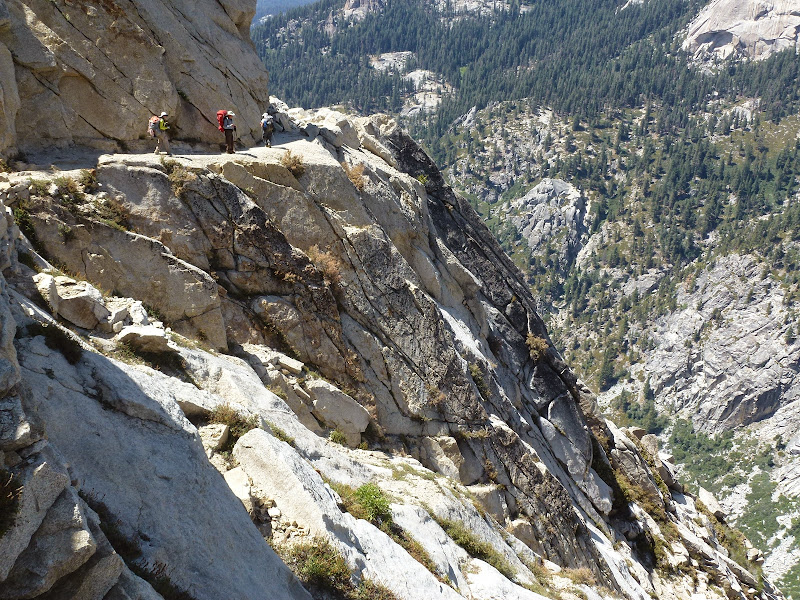
We followed the ridge maybe 1/4 mile to the northwest to where the trail drops into the rocky basin south of Moose. From here, the trail is mostly obvious and well-ducked. (Of course, there are--or were--also well-ducked routes that are not on the trail...)

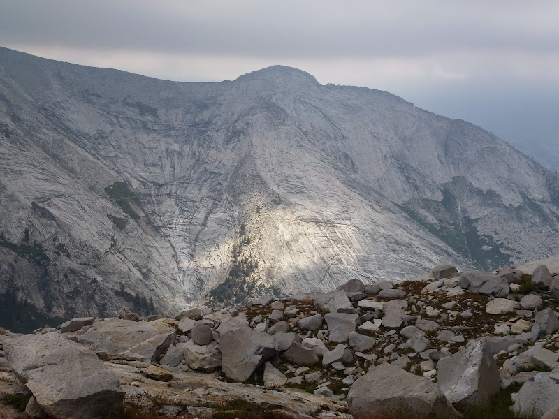
To the east we saw the large granite face that forms the east wall of Buck Creek's small canyon, which reminded me a bit of Clouds Rest and Tenaya Canyon.
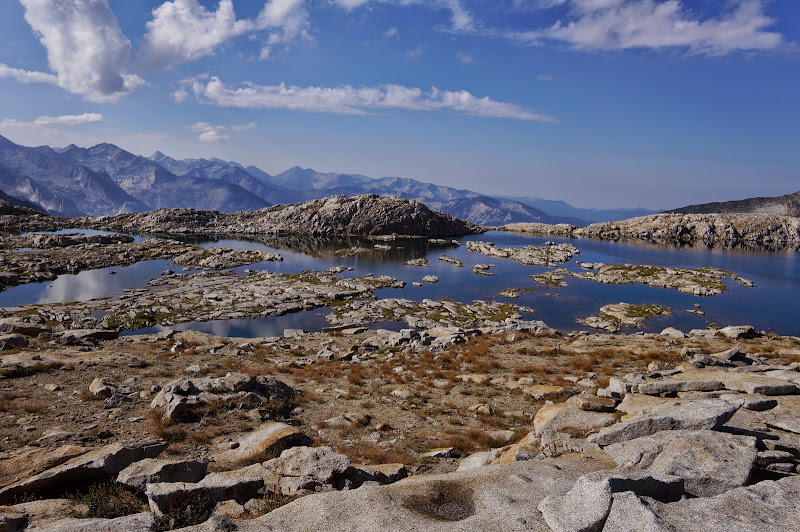
Eventually we reached the small gap where the trail ends, high above the south end of Moose Lake. There is very little camping near this location; we'd have to circle around the southeast of the lake to our desired destination on the north-east "corner" of the lake.
In our previous trips, this stroll around the lake was complicated by snow banks clinging to the north faces of the ridges surrounding the lake. Not this year.

After setting up camp (Photosynththe clouds started to dissipate, and in fact a few times we experienced our only direct sunshine of the day.

Eventually, a golden glow bathed the granite surrounding us, and soon thereafter, the sun disappeared behind the ridge we'd be traversing in a few days. Not long thereafter, we were asleep in our tents and sleeping bags.


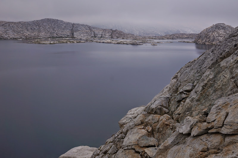
The next morning we were welcomed by mostly clear skies reflected by the glassy-smooth lake.

As the night had been quite humid (at least by Sierra standards), we dried out our gear in leisure.

Two of our friends had to return that day, so we bid them good-bye (Photosynth); not long thereafter, we started climbing over the ridge north of the lake en route to the Tableland (or is it just "Tableland"? or "The Tablelands"?) (Photosynth). We paused at the top for what we thought would be our last views of Moose Lake. (In fact, we'd get several glimpses of it from various places in the Tableland.)
Travel around the north was straightforward, something that would be a recurring theme in the Tableland area--it seems that whenever we needed a "miracle" grassy ledge or gully, we found one, never getting hung up or cliffed out. Or, perhaps we were lucky, or it was the Tableland's birthday gift to my wife.

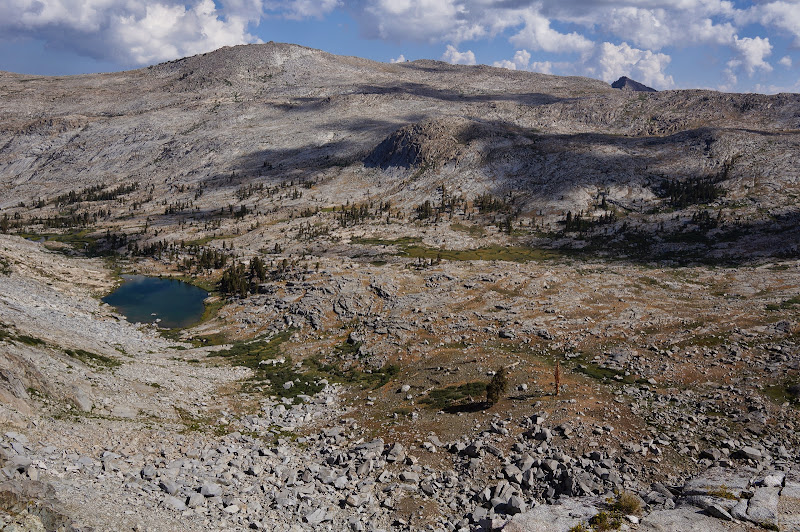
At the top of the ridge that separates the Buck Creek drainage from the Marble Fork (Photosynth), we got our first views down into the Table Meadows area. On our first Moose Lake excursion we had returned to Pear Lake via Marble Fork, a route that is like a broader, gentler Cherry Creek Canyon--as long as you manage to exit by Pear Lake. However, for this trip, we would stay high above the Marble Fork.
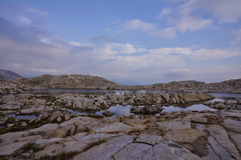
If you are not into grassy meadows, small lakes and tarns, and large expanses of granite, you'd find the Tableland tedious. But if hands-in-pockets cross-country travel through open terrain is your thing, it's paradise.

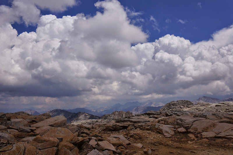
We didn't really have a route in mind, and only a vague sense of heading towards lake 10559 for the night. So we wandered around, enjoying the easy travel, but also keeping our eyes on the growing stormclouds all around us.

Behind us in the distance was the Alta Peak complex, where we would be returning the next day.

At the gentle ridge that forms the Kings Canyon-Sequoia boundary, we got our first views of the high peaks to the north; in contrast to the sunshine we were enjoying, they were cloaked by dark clouds.
Instead of continuing to lake 10559, we decided to head down to some small tarns we saw and set up camp before the storm hit us. Before dropping off the ridge, we looked back on Moose Lake, precariously perched on a granite ridge in the distance.

We set up camp at a LNT-approved "durable" location and mostly just took it easy for the rest of the afternoon and evening, bathing, cooking, reading, and playing cards.

(Yes, that large black monolith center-left is the new Bearikade, behind a Bearvault 500 (for comparison)...)

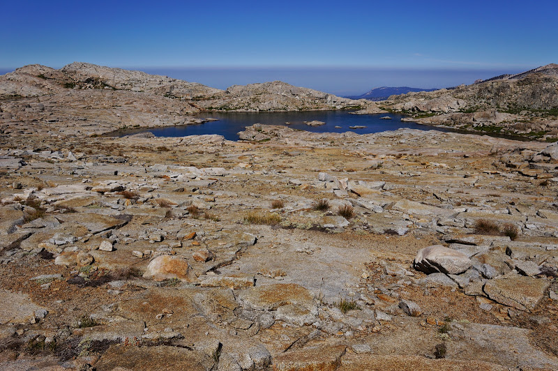
The next morning started out clear and cloudless, and after another leisurely round of packing up our campsite, we strolled back towards the Alta Peak complex, passing by several small tarns and lakes.

Eventually, we made it back to the place where we had first seen the Marble Fork drainage the previous day. Facing us there was a steep-looking climb up the ridge. Another birthday gift was revealed: a straightforward grassy ramp that led easily to the top of the ridge, whose broad, flat top provided panoramic views.
From this ridge, the route to Pear Lake was mostly familiar--mostly, because the lack of snow made it simple to drop down to the lakes near "peak" 10824, where we stopped for lunch before continuing westward towards Pear.

After a short "climb" of maybe 50', we reached the top of the first of two major descents to Pear. To the north was the landmark tree trunk that serves as a guidepost for other Pear - Moose travelers.

In the distance, we could see the "Green Mile", a grassy slot with a use trail that leads to Pear Lake.


As the "Green Mile" trail steepened, we got the first glimpses of granite-rimmed Pear Lake. The eastern shore of this lake is particularly inviting and should make a fun scramble (or swim) destination for a future trip.
After the final steep descent down granite slabs to Pear Lake, we stopped by the shore and enjoyed a brisk swim in Pear's inviting waters. (Photosynth)


We could have stayed at Pear all afternoon, but we still had several miles' walking, and a long drive, facing us. We followed the trail past Aster, Emerald, and Heather lakes, then continued along the Watchtower Trail, which clung precariously above the Tokopah Valley.
The namesake falls below the trail were unfortunately all but dry.
From near the Watchtower, we got our last views of the Tableland area before the trail left the open granite and descended into the Wolverton-area forest.
In hindsight, the unusual weather we had made the trip more special, and it was a great way for my wife to share her birthday with friends and familiar country.
More Pictures
(edit: now with Photosynths!)
Edited 1 time(s). Last edit at 08/01/2013 09:09PM by basilbop.
 His attitude combined with his aptitude, not just for hiking, but for cross-country hiking... well, I'll hike with him and Old Dood any freaking day! I bow to both of them and to any like them!
  More power to you and know you are an inspiration to me and Basilbop! We thank you both for sharing your time, wisdom, and humor with us on our trips so far, and we look forward to more.