Welcome! Log In Create A New Profile Recent Posts
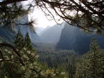
Vernel Fall, Merced River, Yosemite National Park

The Moon is Waxing Gibbous (60% of Full)

Rocketlawyer.com


Advanced

Hazardous weather outlook

All posts are those of the individual authors and the owner of this site does not endorse them. Content should be considered opinion and not fact until verified independently.

avatar Hazardous weather outlook
February 29, 2016 12:39PM
National weather service san joaquin valley - hanford ca
608 am pst mon feb 29 2016

Caz096-097-011415-
Sierra nevada from yosemite to kings canyon-
Tulare county mountains-
608 am pst mon feb 29 2016

This hazardous weather outlook is for the higher elevations of
The southern sierra nevada.

...Snow returning for late next weekend...

.Day one...Today and tonight

No hazardous weather expected.

.Days two through seven...Tuesday through sunday

* snow accumulations: one to two feet possible

* elevation: above 7000 feet

* timing: starting late saturday night and continuing through
Sunday night

* locations include: yosemite national park...Sequoia and kings
Canyon national parks...Sierra and sequoia national forests

* impacts: snow covered roads with dangerous travel conditions.

* stay tuned to noaa weather radio...Or your favorite news
Source...For further information.


.Spotter information statement...

Skywarn spotter activation is not anticipated.

Weather spotters are encouraged to report any significant or
Unusual conditions to the national weather service.

$$
Jdb
avatar Hazardous weather outlook
March 02, 2016 06:47PM
National weather service san joaquin valley - hanford ca
505 am pst wed mar 2 2016

Caz096-097-031330-
Sierra nevada from yosemite to kings canyon-
Tulare county mountains-
505 am pst wed mar 2 2016

This hazardous weather outlook is for the higher elevations of
The southern sierra nevada.

...Snow returning for the weekend...

.Day one...Today and tonight

No hazardous weather expected.

.Days two through seven...Thursday through tuesday

* snow accumulations: one to two feet possible.

* elevation: mainly above 7000 feet.

* timing: starting late saturday night and continuing through
Sunday night.

* locations include: yosemite national park...Sequoia and kings
Canyon national parks...Sierra and sequoia national forests.

* impacts: snow covered roads with dangerous travel conditions.

* stay tuned to noaa weather radio...Or your favorite news
Source...For further information.

.Spotter information statement...

Skywarn spotter activation is not anticipated.

Weather spotters are encouraged to report any significant or
Unusual conditions to the national weather service.

$$
Sorry, only registered users may post in this forum.
Click here to login