I have a question I was hoping to get some help on. My friends and I would like to hike the Grand Cyn of the Tuolumne, dropping off one vehicle at Hetch Hetchy and hiking in from Tuolumne Meadows. The thing is that we only have 4 full days to complete the route. Does this sound reasonable? And does anybody know the accurate mileage (I see different mileage info listed on different places on the net) and have any suggestions as far as where to camp each of the 3 nights?
Any help would be greatly appreciated. I've been trying to do this route for a decade and would like to go for it in 2 weeks.

The Moon is Waning Crescent (39% of Full)
Home
>
General Discussion
>
Topic
Re: Grand Cyn of Tuolumne route
All posts are those of the individual authors and the owner
of this site does not endorse them. Content should be considered opinion
and not fact until verified independently.
|
Grand Cyn of Tuolumne route May 18, 2009 03:17PM | Registered: 16 years ago Posts: 109 |
May 18, 2009 03:41PM | Registered: 16 years ago Posts: 1,918 |
Steve,
From what I think that you have done in the past I feel it's do-able for you..
It's approx. 45 miles.
This is what I would do if I had 4 days to do it in:
Day 1: Allllll the way beyond the Muir Gorge to the Cascade ... about 16 miles
Day 2: On to Table Lake ... approx 10 miles
Day 3: Up and over Rancheria Mountain... 8 miles
Day 4: Out ... 12 miles
Crossing Piute is the only big unknown. More than likely there are still trees across
the river that make it fairly simple to cross.
If you go to Table Lake please report back your experience. Certain people like to
bad-mouth this lake.
May 18, 2009 04:01PM | Admin Registered: 16 years ago Posts: 17,140 |
May 18, 2009 04:11PM | Registered: 16 years ago Posts: 2,321 |
Steve,
I've only done that route from HH to TM and it took five days.
Something to give a lot of thought to is that once you leave Pate Valley you are not in the GCT any longer. You don't pick the river up again until you get to the north edge of Hetch Hetchy after Tiltill Creek. If you come up and out at White Wolf you will have seen all of the GCT and can have a steak dinner at White Wolf. At least a beer there or ice cream or whatever The only downside to coming out a White Wolf is your missing Table Lake. Oh, wait a minute, that's not a loss at all.
It's very close to 42.5 miles from TM to HH.
It's 26 miles from TM to WW.
From TM to Pate Valley is 17.5 miles and Pate Valley to WW is about 9 miles.
Camp night one between Return Creek and Register Creek (I don't remember is there is a bridge at Register)
Night two at Pate Valley
Night three at Morrison Creek on the way to White Wolf
If you choose to go to HH you're on your own. I don't know your ability but I will tell you that TM to HH in four days is a push.
Bill-e-g will have something to say. He remembers better than I.
See! He did it.
Old Dude
Edited 1 time(s). Last edit at 05/18/2009 04:14PM by mrcondron.
May 18, 2009 04:18PM | Registered: 16 years ago Posts: 1,918 |
May 18, 2009 04:27PM | Registered: 16 years ago Posts: 2,321 |
May 18, 2009 04:41PM | Registered: 16 years ago Posts: 1,918 |
May 18, 2009 05:16PM | Admin Registered: 16 years ago Posts: 17,140 |
|
Re: Grand Cyn of Tuolumne route March 03, 2015 03:26PM | Registered: 12 years ago Posts: 315 |
Reviving this old thread as I am looking for some advice from the experts about how to cover Table lakes over a 3-day backpacking trip. I am thinking of heading there in early July instead of Memorial day weekend to avoid the tricky stream crossings though bugs might be more prevalent in early July. For the sake of time, I am contemplating an in and out trip from White Wolf with the tentative plan of:
Day 1: WW to Pate Valley (~9miles)
Day 2: Pate Valley to Table Lakes (~6 miles)
Day 3: Table Lakes to WW (~15 miles)
I will check the topo map for elevation change/gain. Any tips/suggestions about the trip and the terrain based on your prior experience in the area?
Thanks a lot!
Day 1: WW to Pate Valley (~9miles)
Day 2: Pate Valley to Table Lakes (~6 miles)
Day 3: Table Lakes to WW (~15 miles)
I will check the topo map for elevation change/gain. Any tips/suggestions about the trip and the terrain based on your prior experience in the area?
Thanks a lot!
March 03, 2015 03:52PM | Admin Registered: 16 years ago Posts: 17,140 |
March 03, 2015 05:03PM | Registered: 16 years ago Posts: 670 |
|
Re: Grand Cyn of Tuolumne route March 03, 2015 06:46PM | Registered: 12 years ago Posts: 315 |
Quote
qumqats
There's a LOT of downhill from WW to Pate that you'll have to come back UP on Day 3.
Thanks, that's a great point and I didn't realize that.
Just got an email from Mike that has the elevation profile. Looks like it's 11 miles one way from WW to Table lake with an elevation loss of approx 3500' and gaining it back up near the Table lake. As such, I am thinking of maybe going all the way to Table lake on day 1 and either staying their two nights or do the return trip over two days.
I was looking for more information online and looks like "Yosemite National Park : a complete hiker's guide" has some info and for a change google books was able to direct me to local library in SF where they have this guide.
Edited 1 time(s). Last edit at 03/03/2015 07:11PM by nwhkr.
March 03, 2015 08:09PM | Moderator Registered: 16 years ago Posts: 2,321 |
Quote
nwhkr
Quote
qumqats
There's a LOT of downhill from WW to Pate that you'll have to come back UP on Day 3.
Thanks, that's a great point and I didn't realize that.
Just got an email from Mike that has the elevation profile. Looks like it's 11 miles one way from WW to Table lake with an elevation loss of approx 3500' and gaining it back up near the Table lake. As such, I am thinking of maybe going all the way to Table lake on day 1 and either staying their two nights or do the return trip over two days.
I was looking for more information online and looks like "Yosemite National Park : a complete hiker's guide" has some info and for a change google books was able to direct me to local library in SF where they have this guide.
If you do this hike you will get a T-shirt from Chick-on that says:
"I hiked from White Wolf to Table Lake and back and now that I've done it I have no explanation for why I did it other than to get this T-shirt."
Old Dude
March 03, 2015 09:00PM | Moderator Registered: 15 years ago Posts: 7,421 |
From my track it's 16.5 miles from WW to Loch Tablae.
In late Sept. of 2009 I went to Loch Table on day 1.
Took me from 9am to 5:30pm. On day 2 I dayhiked over to
Saddle Horse and back to Loch Tablae and then grabbed
my stuff and headed to Pate to find some Petros..
Pate to Loch Tablae is about 8 miles. I was just lounging
from 2pm on. Contemplated just hiking out... but decided
I had a 3rd day so just hiked out next day. Was back at
WW before noon.
Problem is... in July... it can be hotter than the dingle dong.
So you might have to factor that in. something like 3800 ft. climb to
Table Lake... and 4500 climb back out...
So... in conclusion... it could really be done in 2 days... since
the days are a lot longer than in Late Sept. ... but you might
want to simply alot 4 since the heat may take it out of you... and
you may want to go to Register to see some of the GCT.
Have fun
|
Re: Grand Cyn of Tuolumne route March 03, 2015 09:28PM | Registered: 13 years ago Posts: 31 |
Anyone counting on food of any kind at White Wolf might want to check out this link.
http://www.tripadvisor.com/ShowTopic-g61000-i315-k7723596-White_Wolf_to_be_closed_for_all_of_2015_season-Yosemite_National_Park_California.html
http://www.tripadvisor.com/ShowTopic-g61000-i315-k7723596-White_Wolf_to_be_closed_for_all_of_2015_season-Yosemite_National_Park_California.html
|
Re: Grand Cyn of Tuolumne route March 03, 2015 11:36PM | Registered: 12 years ago Posts: 315 |
Quote
chick-on
From my track it's 16.5 miles from WW to Loch Tablae.
Problem is... in July... it can be hotter than the dingle dong.
So you might have to factor that in. something like 3800 ft. climb to
Table Lake... and 4500 climb back out...
Have fun
Thanks chick-on, looks like permits for early July are all gone. I will shoot for end of May to avoid the hot weather too as I am still adjusting to CA weather after 7 years in PNW. Appreciate all the information and I will plan for 3 full days. If the stream crossings are tricky for the group or something, we can just hangout around the Pate and Harden Lake

March 04, 2015 07:15AM | Moderator Registered: 15 years ago Posts: 7,421 |
Quote
nwhkr
Quote
chick-on
From my track it's 16.5 miles from WW to Loch Tablae.
Problem is... in July... it can be hotter than the dingle dong.
So you might have to factor that in. something like 3800 ft. climb to
Table Lake... and 4500 climb back out...
Have fun
Thanks chick-on, looks like permits for early July are all gone. I will shoot for end of May to avoid the hot weather too as I am still adjusting to CA weather after 7 years in PNW. Appreciate all the information and I will plan for 3 full days. If the stream crossings are tricky for the group or something, we can just hangout around the Pate and Harden Lake
If you get to Pate then you have done all the stream crossings of any significance (The Tuolumne has bridges over it).
Morrison was a non-issue last year in mid May ... though I crossed it higher... there wasn't much snow left beyond
there really that end of May would have been any issue either. Middle Tuolumne also has bridge at WW.
So, stream crossings should not be an issue. Mainly it'll be all the up and down. If not been, well, and even if been,
well worth it to hike the bit up to Register.
The infamous Loch Tablae ... should be gorgeous then. But please don't throw too much at me if your group
doesn't like. Enjoy the journey...
Have a couple of "plans" to go by there this year... So... will probably post something if/when do. Have fun
|
Re: Grand Cyn of Tuolumne route March 04, 2015 04:00PM | Registered: 12 years ago Posts: 315 |
Quote
chick-on
well worth it to hike the bit up to Register.
Thanks for the info about the stream crossings and I will definitely shoot for Table lake. Is Register on the way to Table Lake? Now I have the permits for May 23 - 25 and waiting to see if I can get a campsite at Crane Flats for Friday, May 22nd. Will keep everyone posted if I hear about the Crane Flats' opening date.
March 04, 2015 10:07PM | Moderator Registered: 15 years ago Posts: 7,421 |
Quote
nwhkr
Quote
chick-on
well worth it to hike the bit up to Register.
Thanks for the info about the stream crossings and I will definitely shoot for Table lake. Is Register on the way to Table Lake? Now I have the permits for May 23 - 25 and waiting to see if I can get a campsite at Crane Flats for Friday, May 22nd. Will keep everyone posted if I hear about the Crane Flats' opening date.
No, Register is up Z Tuolumne a bit. That time of year... you really should go upstream a bit... unless you have been there, done that...
It's the area where Rodgers Canyon Creek and Register Creek and the Tuolumne converge...
here:
http://www.mappingsupport.com/p/gmap4.php?ll=37.940305,-119.532924&z=14&t=t4
There is a nice campspot about 1 mile before there ...
These crossing are not bridged and could cause issue depending on the time of day and runoff...
Instead of Table Lake, you may want to consider going up to that spot on day 1 and camp... and then
go look to see how easily Register is to cross... if non-issue you may want to simply dayhike up to
where Cathedral Creek comes in and back... but if you got your heart set on Table Lake. Go for it.
Have fun
Edited 2 time(s). Last edit at 03/04/2015 10:10PM by chick-on.
|
Re: Grand Cyn of Tuolumne route March 05, 2015 12:52PM | Registered: 12 years ago Posts: 315 |
Quote
chick-on
There is a nice campspot about 1 mile before there ...
Thanks for the tip, that totally makes sense. I am keeping the option open for exit via Glen Aulin (starting at WW). In that case, any recommendation for a second night camping spot? I did the Glen Aulin to Waterwheel Falls 2 years back as an overnighter and met Basilbop and JKW at California Falls.
Thanks a lot for all your tips
March 05, 2015 02:34PM | Moderator Registered: 15 years ago Posts: 7,421 |
Quote
nwhkr
Quote
chick-on
There is a nice campspot about 1 mile before there ...
met Basilbop and JKW at California Falls.
Thanks a lot for all your tips
hmm... I kinda figured you would find them sloshing around in Mattie Creek outlet.
If perchance you ever do see them in there.. and they have (c-o tm)Garbage-bag Gaiters
please let me know. I need to start making some money off them and am on the
lookout for tm infringement...
You didn't find a campspot you liked? Lemme guess.. you camped at Return Creek.
Maybe go upstream from there... a bit more...
Glen Aulin proper has lots of great spots too... typically dis bird like to go up high where there a view.
Dingley and Delaney crossings in May like that could be very interesting... but if things continue as such...
should be non-issue... you should ask ranger or here and somebody will prolly know more... or you can
just take Pothole Dome route out ... and avoid the crossings... how much other goodness along that
way is ... well... we will see how much more snow we get. Looking really bad at the moment.
Edited 1 time(s). Last edit at 03/05/2015 03:12PM by chick-on.
March 05, 2015 02:39PM | Moderator Registered: 15 years ago Posts: 7,421 |
Found your TR:
http://yosemitenews.info/forum/read.php?3,66183,66183#msg-66183
Nice
Have fun n I see you know about Dingley and such.
http://yosemitenews.info/forum/read.php?3,66183,66183#msg-66183
Nice
Have fun n I see you know about Dingley and such.
|
Re: Grand Cyn of Tuolumne route March 05, 2015 03:02PM | Registered: 12 years ago Posts: 315 |
Thanks! That video was a great refresher. Last time we camped at Glen Aulin, little off from the main camping area. That site was awesome and it might be a long way from Register creek to cover in one day. Thanks, will check with Rangers and others about the stream crossings closer to the date.
Yeah I was impressed to see that they were minimalists
.|
Re: Grand Cyn of Tuolumne route March 06, 2015 09:49AM | Registered: 10 years ago Posts: 74 |
If you do head upstream through Muir Gorge, the trail along the T should be passable without wading if the Gauge Height above Hetch Hetchy (http://waterdata.usgs.gov/ca/nwis/uv?11274790) is below ~13 feet. During higher flows, there may be some easy (ankle deep, level ground) wading in the vicinity of the creek coming down from Mattie Lake, about a mile or so downriver of Glen Aulin.
|
Re: Grand Cyn of Tuolumne route March 10, 2015 09:59AM | Registered: 12 years ago Posts: 315 |
Quote
Dave_Ayers
If you do head upstream through Muir Gorge, the trail along the T should be passable without wading if the Gauge Height above Hetch Hetchy (http://waterdata.usgs.gov/ca/nwis/uv?11274790) is below ~13 feet. During higher flows, there may be some easy (ankle deep, level ground) wading in the vicinity of the creek coming down from Mattie Lake, about a mile or so downriver of Glen Aulin.
Thanks Dave, that's great info. Will keep this in mind and great point about correlating it with the gauge height at Hetch Hetchy.
|
Re: Grand Cyn of Tuolumne route May 25, 2020 06:02PM | Registered: 16 years ago Posts: 109 |
|
Re: Grand Cyn of Tuolumne route May 25, 2020 06:03PM | Registered: 16 years ago Posts: 109 |
|
Re: Grand Cyn of Tuolumne route March 03, 2015 06:39PM | Registered: 12 years ago Posts: 315 |
March 03, 2015 09:08PM | Moderator Registered: 15 years ago Posts: 7,421 |
Quote
nwhkr
Quote
eeek
Quote
nwhkr
Day 2: Pate Valley to Table Lakes (~6 miles)
Is that vertical?
I was eyeballing it, seems like the actual distance is less than 6 miles.
From my track it's more like 7. And it includes the most delicious 75 switchbacks
in the park imo.
Uh... ok I said it was 8 above... let's call it 7.5. It's def. not 6 tho.
Edited 1 time(s). Last edit at 03/03/2015 09:09PM by chick-on.
May 18, 2009 05:16PM | Admin Registered: 16 years ago Posts: 17,140 |
|
Re: Grand Cyn of Tuolumne route June 05, 2009 09:35PM | Registered: 16 years ago Posts: 109 |
June 05, 2009 09:48PM | Registered: 16 years ago Posts: 2,321 |
June 05, 2009 10:02PM | Registered: 16 years ago Posts: 1,918 |
Quote
mrcondron
White Wolf could be open then. Think about that steak dinner. Plus coming up from Pate Valley offers great views of the GCT.
No!!!!!
Table Lake.
It's a great route. I'd do it.
The yose website is reporting some flooding in GCT and some scrambling required and walking in trail under water.
I wouldn't even give pause to any of that. I'd worry about Piute. The other stuff is small potatoes and
may even be overblown by some. (We were told that Eagle Creek was up to the waist by someone recently)
(I quit listening to anything the person said after that after I questioned it)
Do it... Table Lake...
|
Re: Grand Cyn of Tuolumne route June 07, 2009 10:31PM | Registered: 16 years ago Posts: 109 |
June 07, 2009 10:59PM | Admin Registered: 16 years ago Posts: 17,140 |
Quote
SteveHall
What's with all the hype regarding Table Lake? It's either got to be one of the best places in Yosemite, or one of the worst places, based on everybody's comments. You're making me curious enough to make sure I go and find out for myself.
The pictures sure make it look good. But it's hard to get to.
June 08, 2009 06:40AM | Registered: 16 years ago Posts: 1,918 |
Quote
SteveHall
What's with all the hype regarding Table Lake? It's either got to be one of the best places in Yosemite, or one of the worst places, based on everybody's comments. You're making me curious enough to make sure I go and find out for myself.
Steve, truth be told... my guess is that there are two people out there that read this forum that
have been to Table Lake. One is me. The other is some "seasoned" old dude that due to
dotage seems to get things mixed up a bit.
When we went to Table Lake nearly 10 years ago. Came from Smedberg Lake all the way to Table Lake.
It was in August and it was hot. There was alot of whining going on that day by the misses and
said old dude. Due to the whining and the next day climb out and over Rancheria Mountain some sort
of twisted bond developed between the two to trash Table Lake. Yes, it was hot. And yet, it was
maybe a bit dusty in places.... but I still loved the place.... loved every minute of that trip in '99.
From getting hailed on at Tilden Lake, rained on in Kerrick, spending an hour retreiving some
unlucky fools bear bag hanging gone bad at Smedberg, catching booocko fish at Benson,
to Table Lake and beyond. It's ALL good.
So... for 8 years I had to hear the constant thrashing of Table Lake. In '07 we went back ...
going in from Hetch Hetchy in May. I told the old guy that he can no longer trash Table Lake
if it is nice. And.. it was beautiful... I have pictures of him with the thumbs up ...
And still he disobeys the 'bet' and thrashes Table Lake.
Personally I do not think you can say a place "sucks" if there were mosquitos there... so
if he comes back with that or that is 'why' the area is not 'great'... that doesn't cut it in
my book...
Anyway, please go... but... if you hate it... don't tell me... I love all of Yosemite.
June 08, 2009 11:37AM | Registered: 16 years ago Posts: 1,882 |
July 15, 2009 07:40AM | Registered: 16 years ago Posts: 1,918 |
|
Re: Grand Cyn of Tuolumne route February 10, 2010 04:29PM | Registered: 16 years ago Posts: 109 |
February 10, 2010 07:17PM | Registered: 16 years ago Posts: 2,321 |
Steve,
Two things to consider that would require some flexibility in your plan.
1. Highway 120 may not be open by mid June.
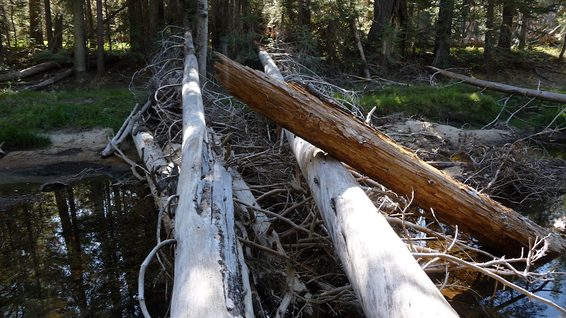
2. Piute Creek may be a roaring torrent then. No footbridge but there may be logs as Bill-e-g mentions.
If 1. then no plan
If 2. then maybe go out via White Wolf, still a great hike.
Old Dude
Two things to consider that would require some flexibility in your plan.
1. Highway 120 may not be open by mid June.
2. Piute Creek may be a roaring torrent then. No footbridge but there may be logs as Bill-e-g mentions.
If 1. then no plan
If 2. then maybe go out via White Wolf, still a great hike.
Old Dude
February 10, 2010 07:25PM | Registered: 15 years ago Posts: 7,421 |
There's still big ol logs across da reev-er.
Steve, in case you missed it... here is beautiful loch table... last year...
http://yosemitenews.info/forum/read.php?3,20415,20415#msg-20415
Steve, in case you missed it... here is beautiful loch table... last year...
http://yosemitenews.info/forum/read.php?3,20415,20415#msg-20415
|
Re: Grand Cyn of Tuolumne route February 11, 2010 02:59PM | Registered: 16 years ago Posts: 109 |
February 11, 2010 03:12PM | Registered: 16 years ago Posts: 670 |
February 11, 2010 04:41PM | Registered: 16 years ago Posts: 1,882 |
February 11, 2010 05:17PM | Registered: 16 years ago Posts: 2,321 |
February 11, 2010 05:31PM | Admin Registered: 16 years ago Posts: 17,140 |
February 11, 2010 05:34PM | Registered: 16 years ago Posts: 2,321 |
February 11, 2010 05:37PM | Admin Registered: 16 years ago Posts: 17,140 |
February 11, 2010 06:02PM | Registered: 16 years ago Posts: 2,321 |
|
Re: Grand Cyn of Tuolumne route February 11, 2010 06:52PM | Registered: 16 years ago Posts: 109 |
February 11, 2010 08:22PM | Registered: 15 years ago Posts: 7,421 |

|
Re: Grand Cyn of Tuolumne route May 25, 2020 06:04PM | Registered: 16 years ago Posts: 109 |
Coming back to this thread a decade later to let you know that I never made this trip.
This summer I had plans to backpack Baffin Island in Nunavut but that looks to be closed to visitors indefinitely and we will have to delay by a year.
Thus, I circled back to this forgotten trip and just booked some permits for late August.
This summer I had plans to backpack Baffin Island in Nunavut but that looks to be closed to visitors indefinitely and we will have to delay by a year.
Thus, I circled back to this forgotten trip and just booked some permits for late August.
|
Re: Grand Cyn of Tuolumne route June 01, 2020 02:49PM | Registered: 16 years ago Posts: 109 |
Hey chick-on (or anybody else), do you think this route would be passable as far as creek crossings go if I went ahead and did it in late June? I'd like to go when there is something left to see at Waterwheel Falls.
Also, are the side trips to Le Conte Point and Rancheria Mountain summit worthwhile?
Edited 1 time(s). Last edit at 06/01/2020 04:02PM by SteveHall.
Also, are the side trips to Le Conte Point and Rancheria Mountain summit worthwhile?
Edited 1 time(s). Last edit at 06/01/2020 04:02PM by SteveHall.
June 01, 2020 06:41PM | Registered: 13 years ago Posts: 269 |
June 10, 2020 02:13AM | Moderator Registered: 15 years ago Posts: 7,421 |
Quote
SteveHall
Hey chick-on (or anybody else), do you think this route would be passable as far as creek crossings go if I went ahead and did it in late June? I'd like to go when there is something left to see at Waterwheel Falls.
Also, are the side trips to Le Conte Point and Rancheria Mountain summit worthwhile?
Sorry didn't respond until now. Wanted to see something first hand first. Judging by
that... Shouldn't be a problem at all...
LeConte doesn't give you more incredible views or different geology to explore so
I won't recommend unless you have extra time and are staying nearby.
Rancheria Mountain has a fair amount of geology that is interesting including
some quartz veins and postpiles. My understanding is that it wasn't entirely glaciated.
Maybe check out due east ne of trail just before it drops towards bear and pleasant
valley junction. Summit itself may take alot longer than you think.
But yeah it's all worthwhile imo but I love it all.
Have fun and be safe. No fires allowed in Yosemite Backcountry this year.
|
Re: Grand Cyn of Tuolumne route June 10, 2020 02:59PM | Registered: 16 years ago Posts: 109 |
|
Re: Grand Cyn of Tuolumne route June 14, 2020 09:33AM | Registered: 16 years ago Posts: 109 |
|
Re: Grand Cyn of Tuolumne route July 02, 2020 11:32PM | Registered: 16 years ago Posts: 109 |
I recently returned from completing the entire route from Hetch Hetchy to Tuolumne Meadows. I filmed the journey and will put together a 30-45 minute hiking report video in the coming weeks (or months as time allows) to share with you. Until then, here is a little info about our hike. Our group saw 5 bears in total. Never bothered us at camp and mosquitoes were a minimal nuisance.
Day 1: Hetch Hetchy to Rancheria Falls - Very hot day made the hiking difficult. But the views were great and we enjoyed Wapama Falls as well as the Rancheria Creek cascades.
Day 2: Rancheria Falls to Pleasant Valley - Long climb up Rancheria Mountain but it was very pretty with lots of wildflowers. The drop into Pleasant Valley was stunning and found an excellent campsite there next to a Piute Creek cascade.
Day 3: Pleasant Valley to Pate Valley - Fun creek crossing to start the day and then a visit to scenic Table Lake. Great views dropping into Pate Valley.
Day 4: Pate Valley to Waterwheel Falls - First time hiking this portion of the GCT. Very impressive so many great river spots. We camped right above Waterwheel Falls.
Day 5- Waterwheel Falls to Tuolumne Meadows - First time hiking from Waterwheel Falls to Glen Aulin and enjoyed the waterfalls very much.
Visiting the legendary Table Lake:

Edited 1 time(s). Last edit at 07/02/2020 11:33PM by SteveHall.
Day 1: Hetch Hetchy to Rancheria Falls - Very hot day made the hiking difficult. But the views were great and we enjoyed Wapama Falls as well as the Rancheria Creek cascades.
Day 2: Rancheria Falls to Pleasant Valley - Long climb up Rancheria Mountain but it was very pretty with lots of wildflowers. The drop into Pleasant Valley was stunning and found an excellent campsite there next to a Piute Creek cascade.
Day 3: Pleasant Valley to Pate Valley - Fun creek crossing to start the day and then a visit to scenic Table Lake. Great views dropping into Pate Valley.
Day 4: Pate Valley to Waterwheel Falls - First time hiking this portion of the GCT. Very impressive so many great river spots. We camped right above Waterwheel Falls.
Day 5- Waterwheel Falls to Tuolumne Meadows - First time hiking from Waterwheel Falls to Glen Aulin and enjoyed the waterfalls very much.
Visiting the legendary Table Lake:
Edited 1 time(s). Last edit at 07/02/2020 11:33PM by SteveHall.
July 15, 2020 10:00PM | Moderator Registered: 15 years ago Posts: 7,421 |

Awesome!
Tanks!
Sorry I missed this until now! (we have been going backpacking every weekend +++ ever since the park re-opened to backpacking June 5)
(since not going since mid Feb ... was going cra cra! so once reopened.... not not going every chance get)
Anywho! Awesome awesome awesome. Glad you enjoyed the trip!
|
Re: Grand Cyn of Tuolumne route July 29, 2020 07:41AM | Registered: 4 years ago Posts: 1 |
Sorry, only registered users may post in this forum.

