http://yosemitenews.info/forum/read.php?3,44814,44951#msg-44951
First, this not about the fastest route. From either Happy Isles or Little Yosemite Valley, that would be the climbers trail:
http://yosemitenews.info/forum/read.php?17,72545,72558#msg-72558
http://yosemitenews.info/forum/read.php?17,72545,72643#msg-72643
It's also not about the slowest route. That would be to take the Half Dome Trail to the sub-dome, then down the climbers trail to the base of the face, then across that and up to the Diving Board. Steve Roper's book says it's a walk. He's crazy.
http://yosemitenews.info/forum/read.php?3,44869,44955#msg-44955
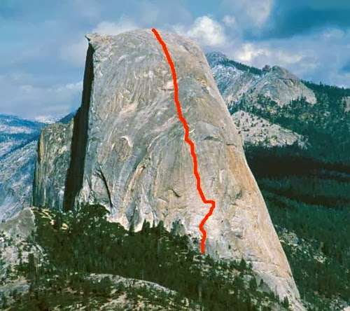
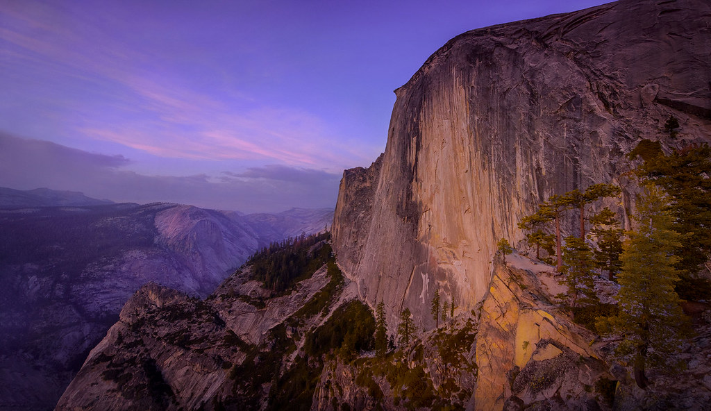
I've done both of those. This thread is about what to do when your fit grandchildren and photographer friends want to go up to the Diving Board and retake Ansel Adams' famous photo of April 17, 1927:
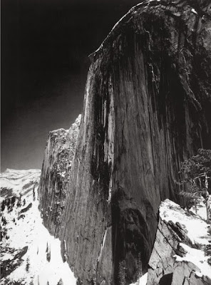
This thumbnail is off the web, and the photo is copyrighted, so a decent resolution copy will cost you money. But why do that, if you can just walk up there and take your own photo? (Warning: you need a very wide angle lens for this one.) (Warning: this off-trail hike is as much effort as taking the regular trail up Half Dome. Don't try it if you aren't fit.) (Warning: There is not a drop of water up there. Take twice as much as you think that you will need.)
If you are still interested, then the question for this thread is how to get non-climbers up there without experiencing very much vertical exposure, and without exhaustion. The most commonly used method is to follow the climbers' route past Lost Lake, then stay left at the climbers' uphill turnoff, and go downhill a bit, until you get to the nasty, steep, loose, uphill gullies that lead up to the nasty bushwhack that leads up to the steep loose sand that leads you to the Diving Board. Don't worry about finding cairns: They are everywhere, leading in all directions.
http://yosemitenews.info/forum/read.php?3,54286,54300#msg-54300
People justly hated that bushwhack. But I haven't done that route since before some climbers left a fire going at the bivouac site at the base of the Snake Dike climb less than a decade ago. That burned much of the grove of trees there and most of the underbrush.
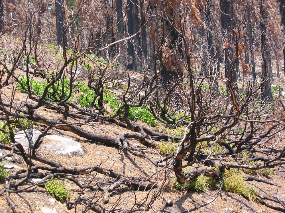
Some people say it's much better there right now, at least until that stuff grows back. You can get to those gullies and that brush from the Lost Lake trail or up from the Emerald Pool.
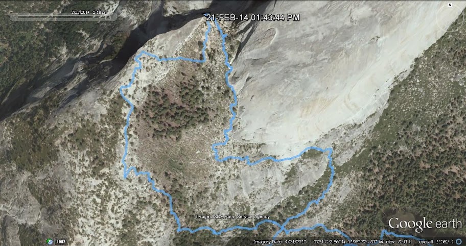
AmostThere posted a gps track below the photos at this link that shows both variations:
http://yosemitenews.info/forum/read.php?3,65836,65866#msg-65866
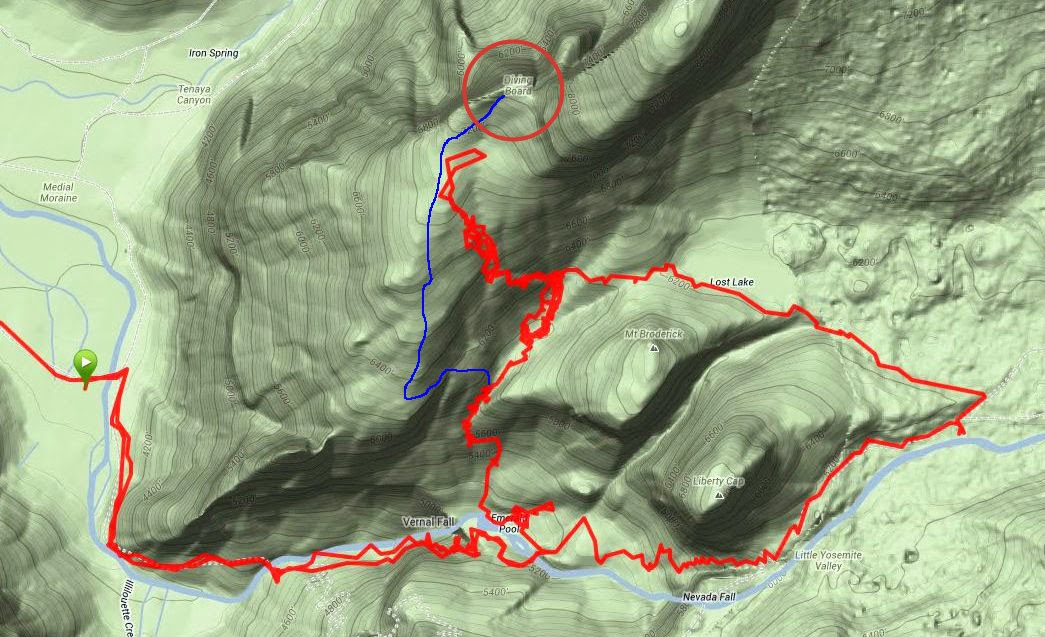
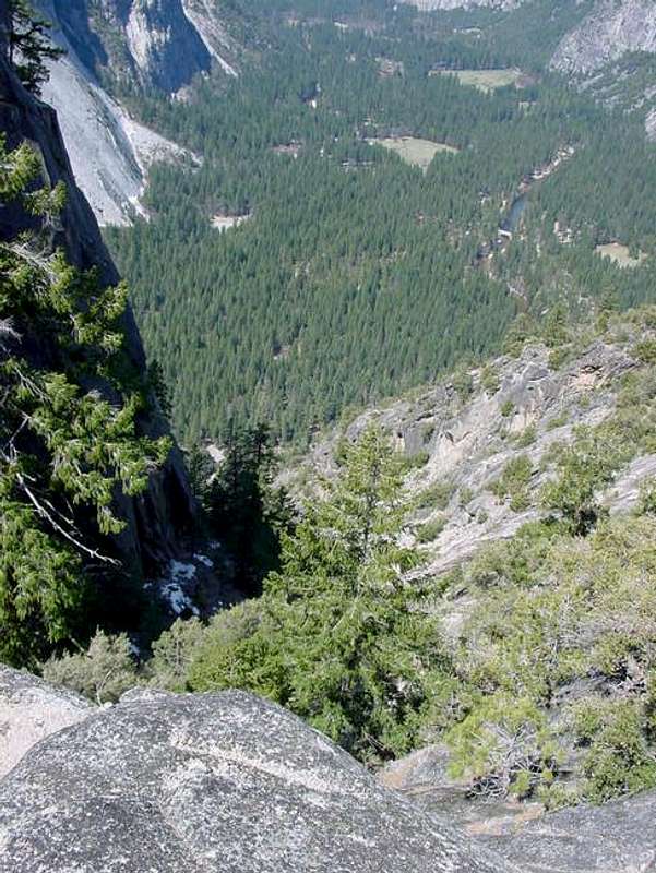
This shows what Chick-on calls "the brush route" pretty well. You can either come up from the Emerald Pool or take the climbers' trail behind Liberty Cap via Lost Lake. Last time, my buddy and I went up the cleft between Broderick and Liberty Cap, but once you are at Lost Lake it's all the same. Then he went up to scout the climbers' route to Snake Dike and I went exploring off to the west. I have drawn in blue a free-hand version of my usual preferred route. It is the same as the Emerald Pool route shown above, until you get to where I head up and then onto a ledge westbound to the bare ridge overlooking Yosemite Valley. From there on up, it's all scenic and open until you get to the last bit. Then you get to choose between safe sand or a more exposed rock walk to the top.
The wiggles above are because gps receivers don't do well in cliffs that reflect the signals.
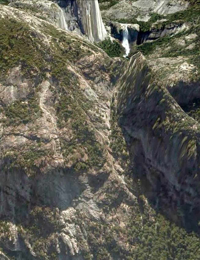
Chick-on has sent me a gps trace of his trip to the Diving Board last weekend. Here it is in Google Earth. Note that the usual vertical exaggeration is turned off. It is exactly as steep as it looks.
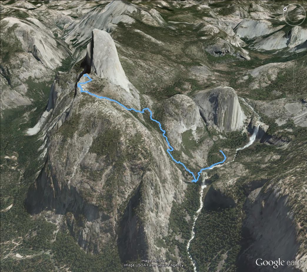
I have also sketched in my preferred route on this view from the side.
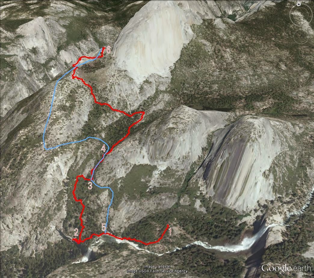
Here's what's going on in this view: Chick-on was tracing out the old Anderson Trail from 1 (the site of Snow's Hotel) to 2 (where Anderson gave up). See
http://yosemitenews.info/forum/read.php?3,72638
He then went up the wooded hillside until it got seriously steep, at which point he went over to the usual route at 3.
Here are comments on my preferred route: 5 is where one usually leaves the Emerald Pool. It is easy going on open, low angle slick rock. It is just west of where the Anderson Trail was forced right down to the river. If that spot is under water, then one should back up a bit, head up the hill, and find a short friction scramble going west over the rib of rock there. Beginners will accept a hand line in order to do this with confidence. After that you are again on low angle slick rock until you can meet up with the regular route.
At 3, you skirt a cliff and enter a gully. Just beyond that point there is a rib of rock running down the gully. Take the left hand (west) side to avoid a difficult spot.
At 4, you turn up the hill. As far as I can tell, it is at N37.733°, W119.5419°. It is steep, but not exposed, and not nearly as steep as it is farther to the east. When you come up under a slick rock cliff, you have a choice. You can follow along the base of the cliff up to the right, which is easy terrain and will put you in the woods leading to the top. But last time I tried it there was serious brush whacking to do in there. It's probably better to follow the cliff base to the left, which will take you along a ledge until it opens up at the ridge line. Great views and all that. Above there, the only obstacles are a couple of ten foot steps on the ridge, which are easily passed on the right (east) side.
Be careful. Don't get lost coming back down. For worry wart friends, I actually have some orange water-soluble marker tape that you can tie to a branch. If you miss removing it on the way back down, it will dissolve in the next rain. It's better than relying on ducks, which are everywhere up there.
Edited 3 time(s). Last edit at 03/01/2014 07:02PM by wherever.

