

While it is shorter than nearby Mauna Kea by under 200', by volume it is larger than the entire Sierra Nevada. And while the glacial polish of the Sierra is thousands if not millions of years old, many of the similar polished surfaces of Mauna Loa are only centuries--if not decades--old.

There are several trails to the summit of Mauna Loa, including a multi-day route from within Hawaii Volcanoes National Park. The most straightforward "day hike" route is named the Observatory Trail since it starts at the Mauna Loa observatory. (This observatory specializes in climate observation--nearby Mauna Kea is the peak with the big astronomical observatories.)

In fact, when we started from the observatory, we weren't planning on hiking to the summit until a few days later; this was supposed to be a short recon and acclimatization hike. So, we had a leisurely morning and arrived at the observatory mid-morning.
Before continuing: some updates to information in older guidebooks and websites. The "Saddle Road" is no longer the death trap that it used to be. It is now the best highway on Hawai'i and is definitely safe for all cars. The speed limit is almost always 55, but could easily be 65. Second, the road to the Mauna Loa Observatory has been repaved recently. It is still one lane, but except for short stretches at the beginning and near the end it is nice and well- marked, with fog lines on each side. There are still blind hills and turns, so head-on collisions are always a risk, but based on our limited experience, the road gets fairly little traffic. I think we saw two vehicles on it--one bicyclist doing a practice ride, and one van carrying people to the observatory.
At the observatory is a small signed parking lot with maybe room for six cars; across the road is the signed trailhead where the hike begins. A gate prevents driving to the observatory (supposedly to protect the sensitive equipment), but apparently you can walk to it, and a restroom is sometimes available for public use.
The trail follows an old (and presumably still open, at least to the park/wilderness boundary) 4wd road for a few hundred yards, then heads straight uphill toward the summit, following a series of mostly conspicuous cairns (ahu) and faint old yellow paint splotches.

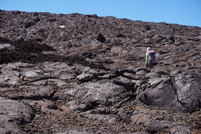
The surface is mostly pahoehoe lava, sometimes reminiscent of polished granite and others times more like thick, fossilized taffy.

In others it's more like roots oozing out of the earth.

The grip was almost always good and the footing secure--anyone comfortable with Sierra granite should have no problem on pahoehoe lava. Loose rock was encountered only in a few places where the trail crosses fields of a'a lava.

During the entire hike we saw very little dirt and no plants or animals. Despite the fact that from a distance Mauna Loa barely seems to be a hill--nearby Mauna Kea by contrast always looked like a real mountain--the climb is still steep, and the air is thin.
The trail re-crosses the 4wd road, then approaches it again near a switchback higher up. The cairns and topo map keep the trail west of the road here, but signs directed us to the road. (Later, I would read that the park service had re-routed the trail here due to the difficulty of the more direct route.) We followed these signs to the road, but chose to traverse back to the old ducked route, since the road surface was mostly loose lava rock, while the off-trail pahoehoe lava had been mostly easy to walk on. Photosynth

The trail touched the road again near 13,000', where we had lunch on a flat rock near a benchmark. During the hike up we felt strong and the altitude was not affecting us, so our warm-up/recon trip at some time evolved into being a "reach the crater rim" trip.
Somewhere around lunchtime we decided to push for the summit--after adjusting our turn-around time from 1:00 to 2:30. We estimated that we might be able to reach the summit by then. The elevation wasn't a problem--we had only 500' or more to climb, but we still had a few miles to hike to the unseen summit.

After lunch, we followed the road (which used to go to a former, higher location of the observatory but is now just the Crater Rim trail) for a few hundred yards, then cut up to the nearby Summit Trail, where a sign confirmed the remaining mileage to the summit: 2 miles.

Just past this junction, we could see into the broad North Pit; the large summit crater (Moku'aweo'weo), and the summit itself, were still not visible.
As we continued toward the summit, our turnaround time approached, so we rushed across snow and lava fields.

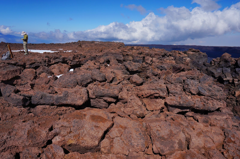
Despite the near-perfect weather, we encountered the only hiker we'd see that day--we was returning from the summit. In a few places, we could peer into the huge summit crater, and along the trail we passed a few clusters of scientific instruments.

Along the way our turn-around time became 3:00, and soon after this time passed, we reached the summit. Well, we reached the named summit; the actual high point (only 20' higher) was still maybe 1/4 mile or so away. To paraphrase Ed Veisturs: "Getting to the top is optional, but getting back to the house in time for a Longboard (or Fire Rock) is not."
We decided to leave this final stretch for a future trip (you always need a reason to return), and after a few pictures and a quick snack, we headed back "down" hill.
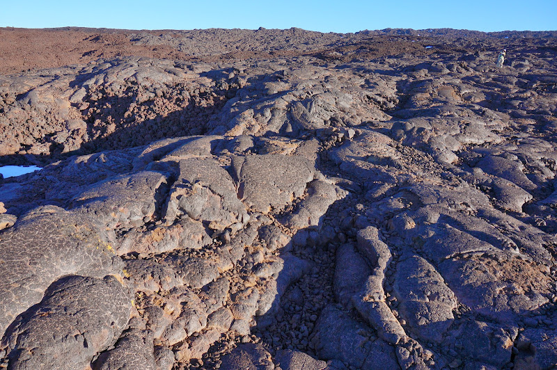
We followed the ducked, direct route the entire way down--including the rerouted segment between 12,400' and 13,000'. This segment is one of the more spectacular of the trip, especially the large lava fields just above the signs re-routing the trail onto the road.

The cairns and fading yellow paint splotches still mark the route, although perhaps one or two stone piles near the signs were removed to avoid confusion.
All day we had had excellent views of Mauna Kea, and a few times we could even see distant Maui--another mountain for another day. Photosynth

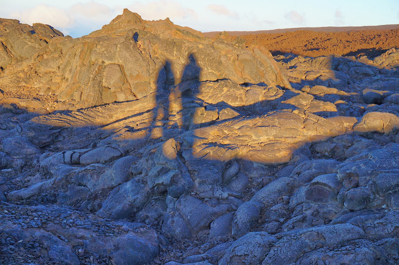
As the day faded, a golden cast overcame the vast sea of lava we were hiking through.
We were running out of time, but there was no reason for us to rush; in fact, the warm light was inviting.
We reached our car just as the last light of day left it--and just after a van had arrived at the observatory. Ours was still the only car in the parking lot--and probably the only one that had been there on that beautiful day.
In a few days we planned on attempting the hike up Mauna Kea. It would involve more climbing along a steeper trail, but we felt confident that the thin air would not be a factor.
More Pictures


