The Grand Canyon of the Tuolumne (or the GCT) was one of the first extended backpacking trips my wife and I did. For some reason, the canyon itself didn't really resonate with us then; we much preferred the "return" portion of our loop, passing by the Tuolumne Tarns, the South Fork of Cathedral Creek, and the Ten Lakes Basin. Perhaps it had been too hot, or too buggy, or perhaps we just weren't ready to appreciate the GCT.
Years later, after some friends had planted the seeds of insanity with us, we attacked the canyon in a single day from White Wolf to Tuolumne Meadows. Despite being a whirlwind tour, that trip became a memorable classic, if only because of the violent weather that somehow managed to avoid us, but transformed Register Creek into a raging torrent, muddied the grand Tuolumne and Return Creek, and covered a portion of the trail in an ash-like mud flow. I repeated the day hike a year later with those who had sown the original seeds, but conditions were much different--a dry winter had reduced the torrential flow to more of a trickle. Even without the exceptional weather, the trip had been enjoyable, and I appreciated more and more of what the canyon had to offer: the south wall between Pate Valley and the Ten Lakes outlet, the two cascade areas between Pate and Rogers, the rugged gorge below Return, and of course the continuous chain of cascades from Return to the Twin Bridges.
It's interesting to note that the GCT is almost as deep as "the" Grand Canyon; it is most impressive from Double Rock or Colby Mountain, where the river is nearly 5,000' below the canyon "rim". However, unlike "the" Grand Canyon, there are no easily-accessible drive-to, guardrailed overlooks with throngs of tourists temporarily departing their autos or busses for a two minute glance into a chasm they'll never visit up close. The near-road views from the Hetch Hetchy dam or Tuolumne Meadows offer just hints of the majesty of the canyon itself. This is OK; the GCT can remain relatively obscure, known only to those willing to pound down the knee-jarring Morrison Creek switchbacks or hike over a dozen miles downriver from the relative bustle of the Glen Aulin HSC/campground. Despite being a signature trail in the deepest canyon in one of the signature National Parks, the GCT is still very wild: in places nature is attempting to reclaim the trail, and in others the trail has to twist and turn to her whims.
(It is also interesting to wonder if the Grand Canyon is named because of its grandness, or in deference to the former name of the Colorado River; if the latter, should the GCT instead be The Tuolumne Canyon...?)
Anyway, the GCT is the itinerary that my sister chose as her first real backpacking trip. (I still remember the only other backpacking trip I did with her, decades ago, when we camped off an abandoned section of trail at the Lost Creek/Refrigerator Gulch confluence. In true Colorado fashion, we were hit with afternoon thunderstorms...) We were joined by a few familiar hikers and a new, young addition.
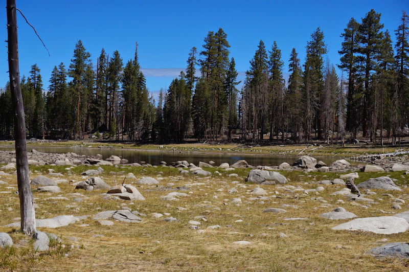
The road walk from White Wolf was uneventful, although the already low flow of the Middle Tuolumne "River" makes me wonder how long White Wolf will be open this year. Harden "Lake" made it abundantly clear how dry this year is.
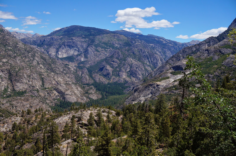
Just past the lake we got our first real views of the canyon and northern Yosemite, including some glimpses of the Sawtooth Ridge area and vicinity.

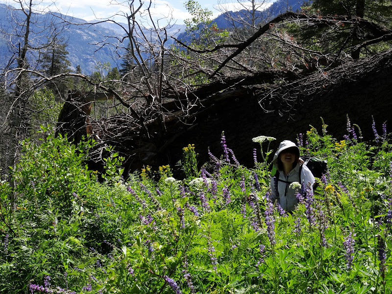
The "Harden Gardens" area was surprisingly lush, all but hiding the trail in sections.
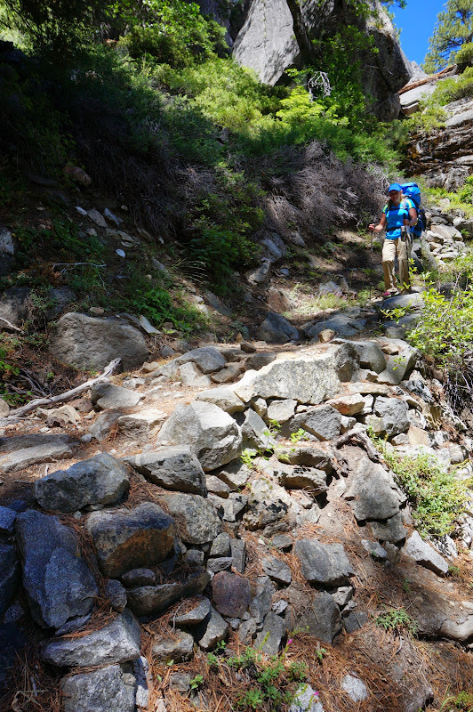
Most of the small creeks along this section were all but dry; only Morrison Creek and an unnamed tributary encountered near the canyon floor had sufficient flow to allow refilling our water bottles. The switchbacks along Morrison Creek were as steep as advertised. To date I have never ascended these, nor do I have any interest in doing so. (Okay, that's a lie... should someone suggest a Muir Gorge trip, I'll already be packed and ready to go...)
The day was clear and warm, and below us we could see forested Pate Valley and the canyon beyond.
We stopped for lunch at an overlook that provided views down the portion of the canyon that is no more, at least for the past century or so; in the distance we saw Kolana Rock and the dry stain of Tueeulala Falls, Falls Creek being far too low already to afford overflowing into this tributary fall.

We eventually crossed Morrison Creek; unlike years past, our shoes were never in danger of getting wet on this trip.
Eventually, we reached the Tuolumne River, our companion for the next few days. The steep bank and rounded river rocks hinted of the massive flows we had encountered a few years ago.

We stopped for another lunch break just past the second bridge. The Schaffer book (at least my old tattered edition) suggests that Pate Valley is like a Yosemite Valley without the crowds or traffic. (He also makes a comment that TP is to be found under every rock--fortunately, this does not appear to be the case, perhaps a result of the "pack-it-out" policy or the reduction in pack trips to Pate Valley over the years...) Indeed we observed that our rest area was not unlike Happy Isles-except that it was as if we had the entire valley to ourselves.

After we resumed our trek, we encountered evidence that despite our current solitude, others had been in Pate Valley in the past, and like us, they preferred cooler, shady areas.

How far in the past? Probably a century or more, or perhaps they had just left...
Heading out of Pate Valley, we looked up at one of the premier "viewpoints" on the rim of the GCT:

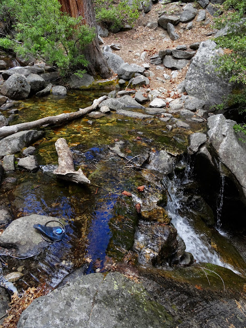
Just past a nice cascade section, we did encounter a local resident, clearly not finding much success in the arts of separating hikers from their food.

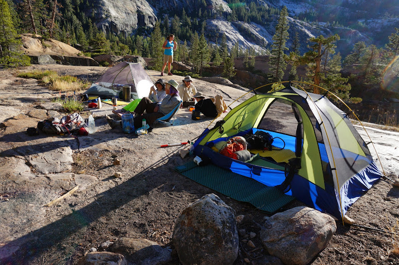
Eventually, we reached our desired camping area at the base of another wonderful cascade.

Interestingly, this campsite was almost immediately under the hanging valley we had visited only a month or so ago.
The first day had been long, and many in our party were tired, but all arrived in camp safely. By the time camp was set up, the sun was behind the canyon wall, but the shade was welcome, and the granite around us radiated the warmth retained from earlier.
Our next two days would have less mileage, so we were in no real rush to hit the trail the next morning, although we did want to "beat the heat" climbing up and around Muir Gorge.

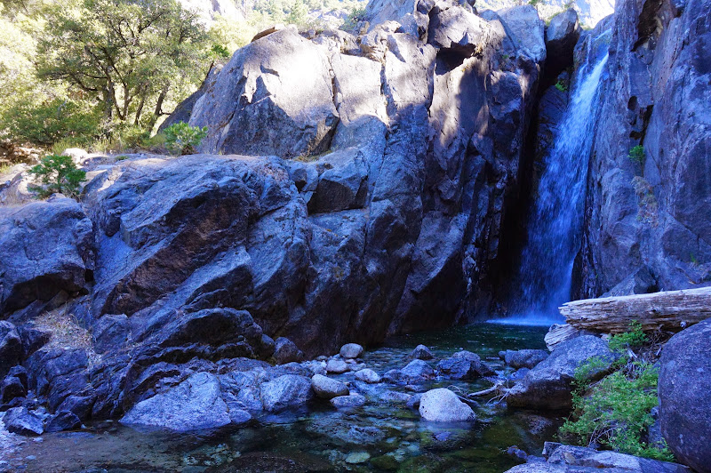
The stretch from our campsite to the upper end of Muir Gorge is in some ways the "heart" of the GCT, in that this is where the canyon is deepest, with Double Rock and Colby Mountain forming the high southern rim. After a pleasant stroll through the valley below Rogers and Register Creek...

...we got a glimpse up the Muir Gorge, which the trail would shortly climb several hundred feet above to bypass.

The unbridged crossing of Register Creek was uneventful, although we were too early for the nearby waterfall and pool to be refreshing.
After crossing Register, we started the Muir Gorge bypass climb; from the top, we could see the Ten Lakes Basin outlet steeply descending to the river.

Above Muir Gorge, the canyon is not quite as deep, but absolute depth is replaced by even more of that Yosemite staple: glacial polished rock.
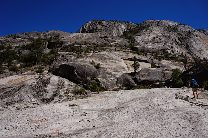
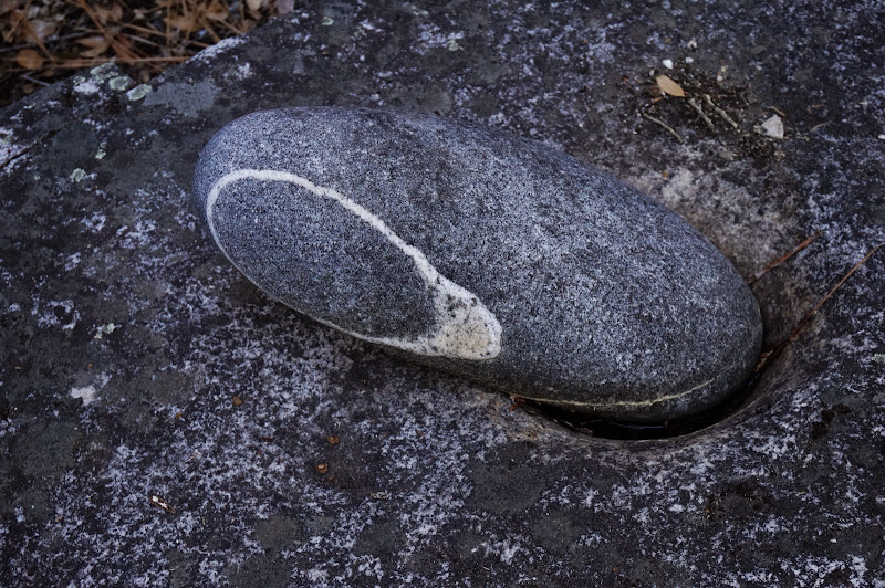
One thing became clear: while it is called the Grand Canyon of the Tuolumne, the canyon rarely appears to be the product of its namesake river, except perhaps for the small rounded rocks in the river itself. Other forces far stronger than the Tuolumne's feeble waters shaped this majestic canyon, and the horizontal abrasions and polish thousands of feet above the river only highlight its comparable insignificance. Even the mile-deep ice, however, were no match for the hard Yosemite granite, its impact limited to polishing, but not significantly shaping, the rock. Classical glacial canyons have a "U"-shaped cross section; many miles upriver Lyell Canyon is a good example. The GCT's cross-section, however, is more a product of the whim of the rock and the fractures within it than the massive glacier that once flowed down it.

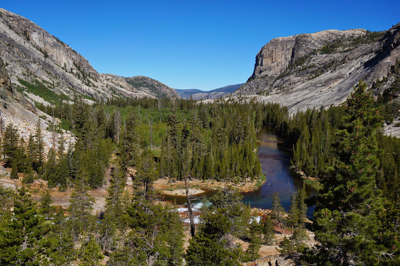
One of the key aspects of the Tuolumne and Merced Rivers is a "stairstep" morphology--since the water and ice were so ineffective at shaping the underlying rock, any granite "dams" that created basins or valleys remain. These eventually fill with sediments that support rich, dense forests of massive trees that take advantage of the ample water. Perhaps it's these lush valleys that the river can lay claim to having formed and fed.

Around mid-day, we reached an important milestone on our trek--we were opposite Cathedral Creek, which dropped from its hanging valley into the Tuolumne.
https://lh3.googleusercontent.com/-yRVOsToRl_g/U7y2Uauhy_I/AAAAAAAAPkY/hRz_OBAdnXo/s640/DSC01215.JPG
From Cathedral Creek, the south "rim" of our canyon would be Falls Ridge; we were close to perhaps the most famous section of the GCT, one known more for falls and cascades than steep canyon walls. This is also a section where it's abundantly clear that the rock, not the river, is in charge.

The afternoon was quite warm, if not hot, so we stopped to cool off in the water just below the Return Creek bridge.

After cooling in the river, we started the second climb of the day, up towards Waterwheel Falls. The trail in this section is mostly open and exposed to the hot sun; fortunately, there was a cool breeze at the top of the falls.

In wetter years this cool breeze would power the infamous Waterwheel, even tossing the water a quarter mile upstream. Not this year.

We confirmed with a group camping just above Waterwheel that the waterfall they had passed earlier was in fact LeConte. My wife and I had made the same mistake the first time we visited "Waterwheel Falls"; in most years LeConte has impressive waterwheels.

We finally reached our second campsite above LeConte, one we had camped at before. The views were great, but we all wanted relief from the harsh sun--quite the contrast to our previous visit, where snow flurries falling in this section rushed us back to camp.
Eventually the sun was low enough that it was more welcome than not; shortly thereafter, we were sound asleep.

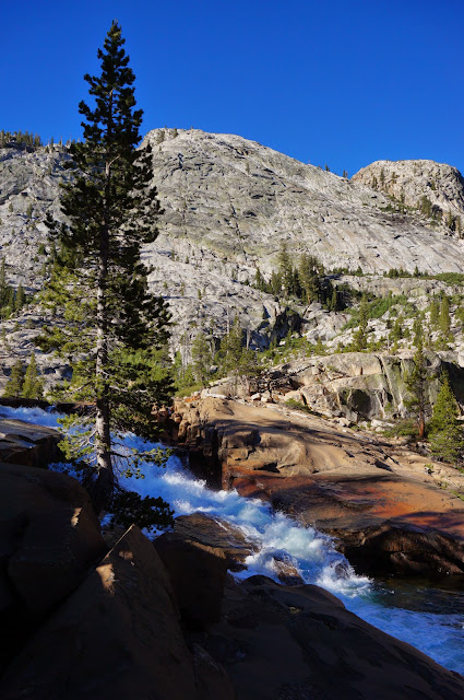
The next day's hike on paper was about as long as the previous one, but without as much elevation gain; in fact, once past the Twin Bridges we would have little climbing to do. So, refreshed by a good night's sleep, we continued up canyon, climbing an almost unbroken chain of cascades.

Eventually we reached the smooth, reddish rock near California Falls; our climbing would soon come to a temporary reprieve in Glen Aulin.
Unlike the previous trip through Glen Aulin earlier this year, the trail was dry and my shoes were fully thawed out.

We rested and had a snack on the small knoll overlooking Glen Aulin, our third visit this year. It was still worth it, and I'd visit it again.

Down canyon we could see Rancheria Mountain, which had loomed over us when we first encountered the Tuolumne River.
The trail from Glen Aulin HSC to Twin Bridges exhibited ample evidence of the open status of the High Sierra Camp. Supposedly there is a program in place to sweep and collect the various "road apples" to protect the water supply, but the numerous piles along the trail contradicted this. Still, we enjoyed the climb up the two remaining major Tuolumne waterfalls: White Cascade and Tuolumne Falls.

Given how dry the "Pothole Dome" route was a few weeks ago, we opted for it again, passing by Little Devils Postpile.

The water levels were such that it seemed that a hiker who had ended up on the wrong side of the river could have crossed safely.

The remaining trip through the meadows, along the river, and around the dome was uneventful.

By mid-day, we were back at our cars. Compared to the first two days, the final spring up the GCT had been a breeze.

Unlike our previous late arrival from Glen Aulin, we had ample time to enjoy burgers, hot dogs, and soft-serve ice cream at the grill--a fine way to end a wonderful trip! Everyone had done exceptionally well on the hike, and my appreciation of the GCT grew even more.
More Pictures
 And as Basilbop indicated, that canyon has really grown on me.

