
The rain and hail had started falling lightly as we passed Timberline Lake, but as we neared Guitar Lake the storm had become more insistent, a chilly mix of rain and hail. We quickly pitched our shelter near that of our trail companions who had arrived before the weather took a turn for the worse; the third group of our party pitched not far from us not soon after we were comfortably under our shelter. We made tea and tried to stay warm as the rain and hail continued to fall, occasionally teasing us with a brief pause or a patch of blue sky that made us look hopefully towards the summit of Mt. Whitney, but also occasionally pushing us together for warmth under our shelter with a brief downpour or a distant clap of thunder. We would get out of our shelters when the rainfall lightened enough to look around, trying to guess what we should expect next: the small patch of blue sky over Crabtree or the dark clouds over the Kaweah Range.

Eventually one pause in the weather lasted longer... and longer... and we debated what to do--stay or move on. Staying still was chilly--we'd have to put on our warm clothes and climb into our sleeping bags to stay comfortable. But, it wasn't too chilly, especially if we were moving. Somehow, after 200 miles, moving was more attractive than staying put.
So, after much discussion and guesswork, we decided to move on, and after loading my pack with the damp shelter and 8 liters of water, I slowly followed my hiking partners up and away from Guitar Lake towards... well, we really never quite decided that. Trail Crest? The summit of Mt. Whitney? Up and over to Trail Camp and down to Whitney Portal?

The sky appeared to be clearing a bit as we headed up the long, well-engineered switchbacks up the "back" of Whitney. There were still dark clouds, but they were always somewhere else in the distance--the Kaweahs, The Great Western Divide, some unknown location across the Owens Valley.
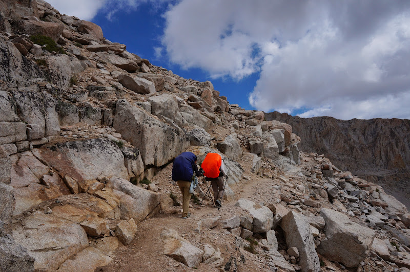
Our progress gaining elevation was slow but steady; I called out the elevation every 500' or so based on my altimeter. We still didn't know what our destination elevation was--13,600' at Trail Crest or 14,500' at the summit--but we were making slow, steady progress. The weight of the water I was carrying started to take its toll on me; near 13,000', I announced on the radio that I had only 1,500' of climb left in my legs. Near this elevation the terrain becomes much more interesting as the trail weaves between and around various granite pinnacles--enough so that the final 600' or so went by quickly. When we did make it to the junction with the Main Whitney Trail, the typical sea of stashed backpacks was nowhere to be found, and no one was camping on the flat "pads" below this junction. There was only one small day pack stashed, and the sky was mostly blue, at least around us.

There may have been a debate as to what to do next, but there really wasn't. E didn't want to be "2 for 5" in summit attempts, and two of the aborted attempts had been shared with JKW--one at the end of the JMT, the other at the end of the High Sierra Trail. The weather didn't look that bad, and we knew that the H party wanted to summit either today or tomorrow. I had been carrying a piece of paper with "Mt. Whitney or Bust!" written on it for 200 miles, and we didn't seem to be facing "bust" conditions. Overall Whitney was more inviting than not, and with perhaps not quite enough discussion and perhaps a bit too much summit fever we decided to continue to the end of the JMT.

At one point we could look over Mt. Young at where we had started the day on Bighorn Plateau, and could follow our circuitous route around this mountain towards Crabtree, then up Whitney Creek past Timberline and Guitar Lakes to the base of the mountain itself.

Given the abundant blue sky, it was odd that we were the only party on the trail that we could see. We knew via radio that the H's were not far below us, but we didn't see anyone else who had started up from Guitar Lake...

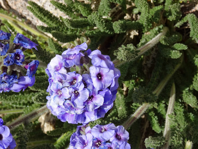
Perhaps for the first time, among the numerous blooms along the trail, I noticed the smell of Sky Pilot.
Through one of the "windows" we could see Lone Pine far below--where we would be the next day, and storms--perhaps worse than we'd expected to see--over the White-Inyo Mountains in the distance.

As we neared the summit, the blue sky that had teased us towards the top gave way to darker clouds; a light hail fell on us as we rushed the final distance to the top.

Perhaps we had been a bit crazy to push for the summit, but fortunately, we had been the only crazy party pushing for the summit that day, so the summit shelter was all ours.

We huddled in it to cook dinner and ride out the light storm. Occasionally we heard thunder in the distance, but it didn't seem like we'd need to test the grounding of the shelter. Still, we put in earplugs just in case.

The H party arrived a bit after we had settled into the shelter. Although neither the wind, temperature, or precipitation were that bad, we decided that we'd find a way for all seven of us to sleep in the shelter. (Pro tip: someone, hopefully short, has to sleep on the stone "bench", which is almost exactly the height of a Bearikade Expedition... the rest have to go head-to-toe.)
The next day was JKW's birthday, and on the eve of that day the H party presented her with a birthday crown crafted out of used food packets and a peanut butter cup with a candle. We had had only two "firm" dates for the trip: our reservation for a cabin at Reds Meadow (the patty melt and shower there a distant memory, albeit only a dozen or so days ago) and JKW's birthday, which we really wanted to celebrate on the summit of Mt. Whitney. We had to wait out the weather a few times over the past few weeks, but in the end we had finished the JMT exactly on schedule--even arriving at "camp" at the summit around 6:00pm--our unofficial "start looking for a good campsite" time.

After dinner and evening tea, we left the cramped shelter to watch the sun set over the distant Great Western Divide. A thin sliver of bright red lit the entire western horizon.

The weather may not have been perfect during our two week adventure, but it seemed to wait until we were safely in our shelters before hitting us hard. The skies were clear on the days when we had to make many miles, so we couldn't complain that we had to wait out storms a few times on our shorter days.

At one point I asked myself: would I hike the same trail, with the same weather, and especially with the same people, again, if I had a chance? Absolutely! Despite everything, it had been a great trip.
(Many!) More Pictures
Edited 1 time(s). Last edit at 08/04/2014 08:44PM by basilbop.
 ...
...

