
We started from the Snow Flat/May Lake trailhead, but were soon enough past the High Sierra Camp crowds. In fact, I think we saw five people total from when we left May Lake until we returned--impressive given that we could see the majority of Yosemite from our campsite.
May Lake Photosynth
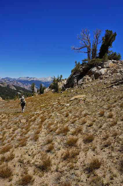
The southern half of the Mystery Trail is still in remarkably good shape, undoubtedly due to use from the High Sierra Camp and people bagging Tuolumne Peak. The small creek crossed after the initial downhill was still flowing, and there was a trickle in the smaller stream that the trail follows to the saddle.

Once at the saddle we stopped for lunch and enjoyed the views. The sky was crystal clear, but we could see a fire burning just north of Cathedral Creek.
Mystery Saddle Panorama
The northern segment of the Mystery Trail gets much less use; there are a few overgrown sections just past the saddle, and several major deadfalls towards the bottom. These obstacles made following the trail tedious. Without them it would be a wonderful trail to hike up or down; as with the southern segment, the trail is well-engineered with long, gradual switchbacks.
Still we managed mostly to stay on or near the trail, and rejoined the Ten Lakes trail right where the redundant trail signs are; the junction would have been between them. Since we know where the trail starts and ends, the only real mystery about the Mystery Trail is: why was such a well-constructed trail abandoned?*

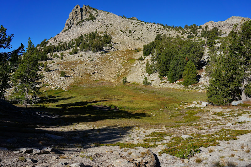
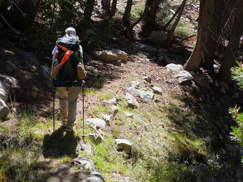
We made slow and steady progress to the Tuolumne Peak tarns; JKW was recovering from a recent illness and I was feeling the effects of having given blood earlier in the week. We eventually reached the "pass" where the trail crests.

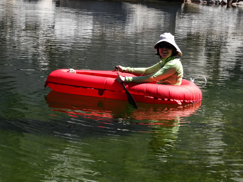
We opted for the more private upper tarn to take a swim and test out the boat.
We had decided to camp up higher to have better views of the Cathedral and Clark Ranges, so we packed up the boat and hauled water to our camp. The views were worth it.

There was a surprising amount of smoke in the South Fork/Ten Lakes area.

The smoke resulted in an odd sunset as parts of the Cathedral Range were lit with light filtered through the smoke, while others weren't.


Even to the north the haze from the smoke was visible.

Fortunately, the nighttime sky was crystal clear--it seems we saw more stars that night than we did on any night of the JMT.

After a lazy (no 5:00am wakeup call!) start the next morning, we decided to return via Tuolumne Peak.
We took it easy--there was no need to rush--and eventually reached the summit.
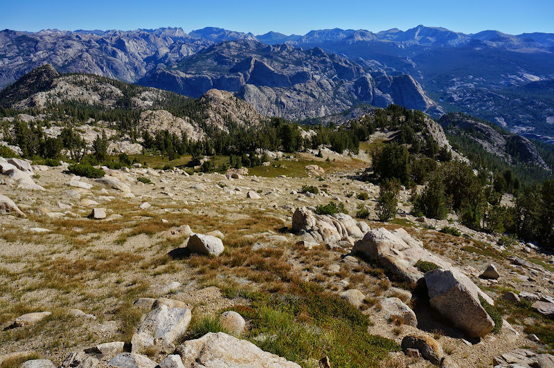
The views from Tuolumne Peak are at least as good as those from Hoffman, especially since the view to the north isn't blocked. We could see most of Yosemite, but also could not see anyone else; only in a few places around Tuolumne Meadows could we see hints of civilization: a few sections of the Tioga Road, the roof of the store/grill, the septic ponds.
Tuolumne Peak Panorama

After a snack and just taking time to enjoy the scenery, we headed back down to the Mystery Saddle. After dropping a bit from the summit, the travel was mostly straightforward.

Judging by the number of footprints in this area, it's clear that Tuolumne Peak is a popular peak-bagging destination; fortunately, the only signs of this popularity were footprints in sand.

We chose not to stop again at the saddle--we wanted to take a final swim in Tenaya Lake, so we were soon descending the nice switchbacks of the southern segment of the Mystery Trail.
We saw our first hikers of the day at May Lake; there would be a steady stream of camp guests and day hikers all the way back to the car. Once there, we packed up and headed to Tenaya Lake, where we were fortunate to find a parking spot near the lake. The water was cool and refreshing--the perfect, relaxing end to a relaxing trip.
More Pictures
* Current hypothesis: the trail was constructed when the Tenaya Lake HSC was relocated to May Lake to provide a direct route between these lakes, but this route proved to be less-than-optimal due to snow north of the Mystery Saddle resulting in it being impassable to stock even after Glen Aulin and May Lake were open. With much more dynamite, the current Raisin Lake trail was created--it stays lower and is generally snow-free much earlier than May Lake itself--except for the short segment between the Murphy Creek and Ten Lakes trail junctions.


