Leaving the Bay Area very early on Thursday morning, we were at the Quartz Mt. trailhead just outside the southeast boundary of Yosemite ready to start hiking at about 10:30.
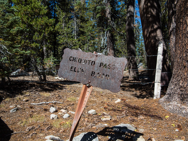
There were about a half-dozen cars at the trailhead, but not a soul in site. Avoiding the local wildlife (cows) we surmounted (by walking generally downhill from the parking area) one of the least impressive of Yosemite’s Passes, Chiquito Pass,
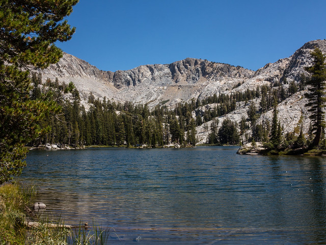
and continued on through the forest to the middle of the Chain Lakes,
where we had lunch. Leaving the trail system behind, we headed north, skirting the base of the ridge west of Breeze Lake
and then generally up the South Fork of the Merced River into HorseThief Canyon, the goal being the pass between Triple Divide and Merced Peaks.
The early start (and my poor previous night’s sleep) had me in a zombie–like state after lunch, and I didn’t want to think about the possibility that the Bird might want to actually get over the pass. Fortunately, by the time we got to the first major meadow in HorseThief Canyon, the Bird admitted that he, too, was pretty zonked. We decided to keep going to the next meadow
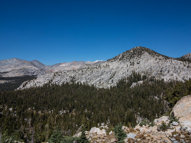
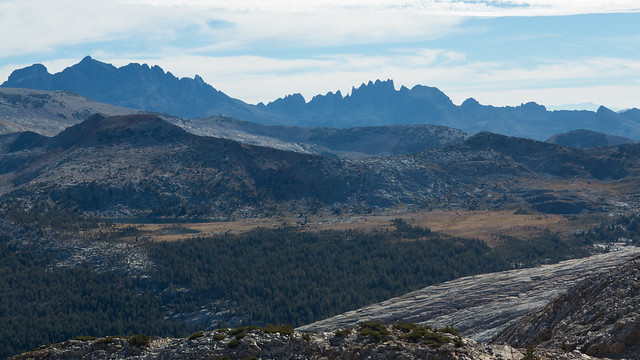
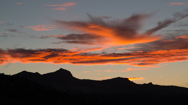
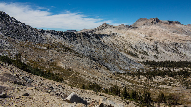
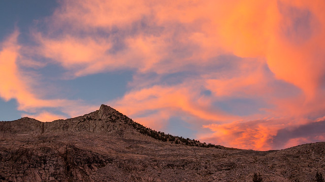
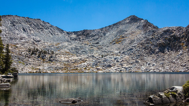
…and then to continue on even further. I was concerned about a lack of water the close we got to the pass, but we did find both a trickle flowing in the stream as well as a couple of small unnamed lakes, and camped Thursday night a hundred feet or so higher than the couple of lakes, at an elevation of about 10,400 feet. This is from above the campsite looking back down the way we came:

We hadn't seen another person all day.
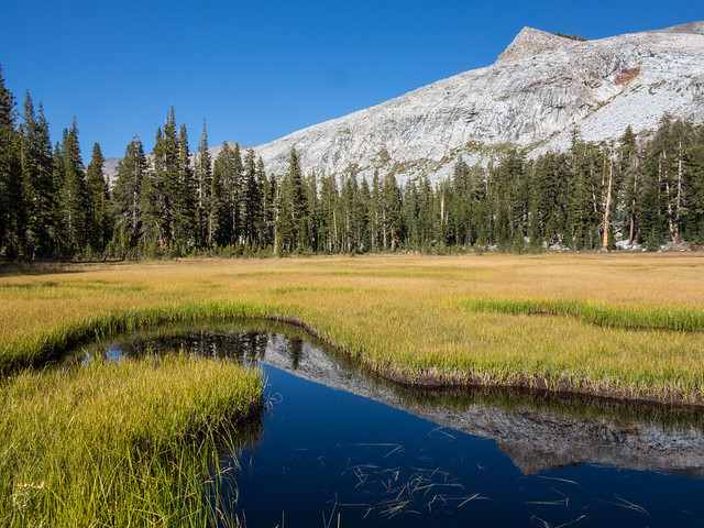
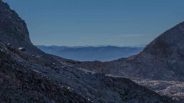
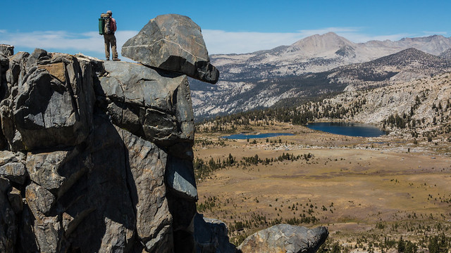
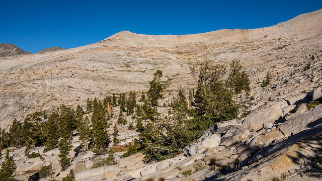
After a great night’s sleep, we set off to continue over the pass. The hike up was pretty easy, and the views were amazing and only diminished by the high clouds that were starting to appear. The Clark Range was immediately to our west.
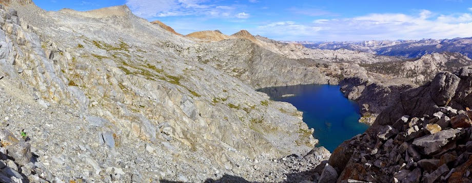
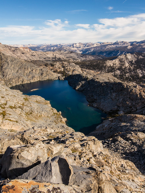
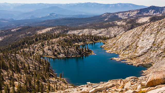
Edna Lake was right down below us, and beyond it we could see all the way across Yosemite to the north-northwest, with Tower Peak clearly visible.
Ritter, Banner and the Minarets were just to our east
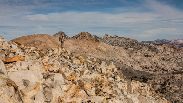
and looking south-southwest along the Sierra Crest to perhaps Mt Goddard and the Black Giant near Muir Pass
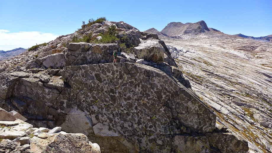
The Bird said that Roper indicates that this pass is not doable without climbing gear. I haven’t found any Roper reference to that statement one way or the other, and we found a couple of class 2-3 ways to get down the north side, which is certainly the trickier side. We both agreed that we were fortunate to have no snow to deal with. I imagine that the lingering snowfield of a normal snow year would have made the descent a whole different story.
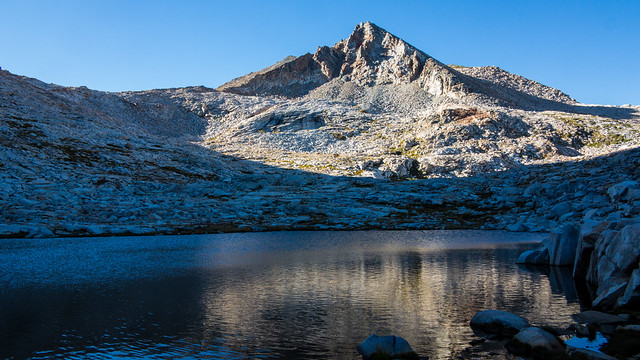
We worked our way down to the lake just north of Triple Divide Peak and then followed the Merced Peak fork of the Merced River, stepping over the Red Peak Pass Trail and continuing downstream
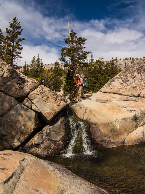
to Whirlpool Lake. I had stumbled upon this lake in 2004 while on an annual backpack trip with my buddy and his 3 boys and my 2, and we had a great time swimming there, but most memorable at the time was the outlet…what looked like a giant bathtub whirlpool as the water was sucked down through the sand and through a crack in the granite somewhere, to emerge down below. Back then it looked like this
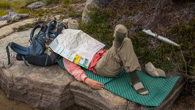
Sadly, no whirlpool this time, Certainly the water was lower in the lake and there was not as much water flowing in as there was back in 2004. Maybe we were just lucky back then to see the whirlpool, or maybe just unlucky in having no whirlpool this time. So we had lunch, rested, and the Bird studied the map....first destination dreamland:
Carrying on, with the clouds starting to look a bit more threatening despite the weather reports promise of “mostly cloudy”, we decided to cruise along the ridge between the Merced Peak Fork and the Triple Peak Fork of the Merced River towards its northerly terminus. While looking pretty easy from afar (“looks easy from here”) the ridge ended up having numerous gullies to drop into and climb out of
which earned the ridge the name “Gullible Ridge” in our books. Stopping to top of our water supplies late in the afternoon at some pond-like lakes just west of the crest of the ridge, the Bird, being an expert in all things avain, correctly identified this bird
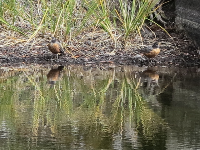
As the American Robin. The fact that this is also the State Bird of Wisconsin probably assisted with the ID.
Heading back up the ridge (and down into gullies and back up and down and up) we finally got to a good camp spot
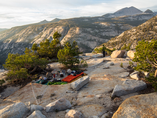
and enjoyed a Technicolor sunset courtesy of the clouds that we hade worried about earlier in the day
And btw we did not see one other person that day.
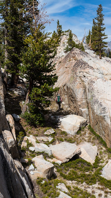
Saturday morning was mostly cloudless as we dropped down to the south-southeast from our ridge, hitting the trail along the Triple Peak Fork in short order. We followed the trail for a bit and then decided to walk up the creek, which was a mere trickle over big granite slabs
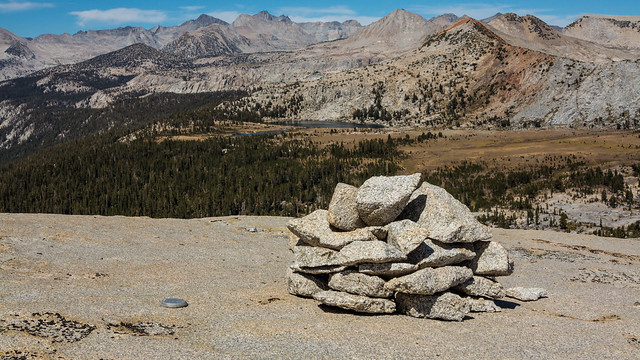
Shortly after the trail junction, we returned to the trail up towards Isberg and Post Peak Passes, encountering a group of 3 heading down the trail. After the intersection with the High Trail we again headed cross country east to the unnamed lakes just below Isberg Peak. Circling along the High Sierra beach of the largest of the two on the north
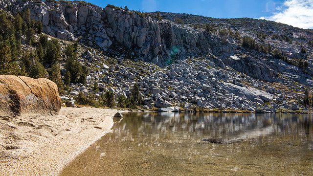
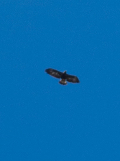
we watered up, as we were planning to spend most of the rest of the day up high. Heading up to Isberg Pass, we enjoyed the site of a Golden Eagle high overhead.
At Isberg Pass we went south, following the ridge rather than the trail (go figure) to Post Peak Pass, and then continuing west along the ridge towards Triple Divide Peak,
with great views of the lakes we had passed by an hour or two before
until we left the Park, dropping down into Ansel Adams Wilderness, and passed Walton Lake
and Frying Pan Lake, and decided to camp at Slab Lakes. It was Saturday night of Labor Day weekend, and, to our great surprise, there was not another soul there. We watched the fish jump and the sunset's glow on the clouds above Post Peak.
Sunday morning we headed cross country due south, got around and over a short ridge south of Slab Lakes, and saw this giant granite bowl
which is north of Rutherford Lake and south of peak 11,261. We chose the relatively mellow cross country travers around this bowl, encountered the "Prince Albert in a Can Tin” (thread here) above Anne Lake somewhere, and continued high above Rutherford Lake
to the saddle just west of Alpine Lake. After a short debate as to whether we would continue west and drop back into Yosemite (which would force us to retrace our steps), we decided to head due south and up over a short but steep notch (this is looking back at it from Fernandez)
and then drop down to the Fernandez Pass Trail, which we followed, taking the cutoff to Breeze Lake
where we stopped at the west shore, lunched and I swam. And where, on the Sunday of Labor Day weekend, we some nobody.
After lunch we hopped over the ridge into the Chain Lakes basin, getting to the trail just up from the lowest of the Chain Lakes, and we followed the trail back to the car. By now, there were about a dozen or so vehicles at the parking area. But again, like three of our four days out, we saw no other people but ourselves.
In total, we were out for four days and saw three other people. It was a beautiful, and uncrowded, part of the park. All the pictures here.