
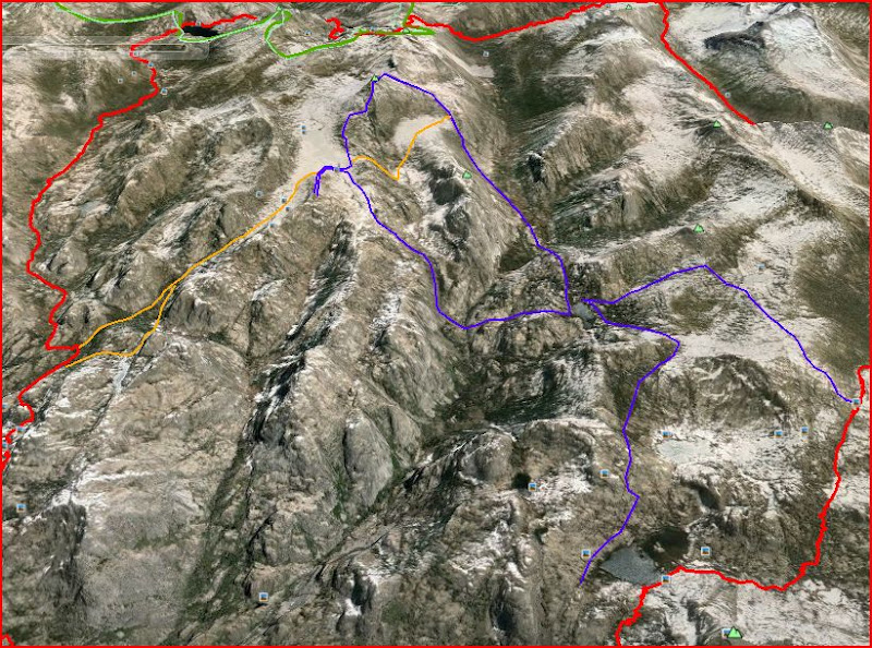
So, from the above image routing, is it a doable xc backpacking route to go from the Seavey area, up to Rock Island Lake, down into Piute Creek from Rock Island, then over to Dog Lake?
Red line is main trip loop on park trails.
Blue lines are: camp at smedberg, xc to dog lake camp, then day hike loop to rock island, then xc from dog lake to benson pass.
Orange lines: Seavey camp, then xc to rock island, into piute creek from slide area, then up to camp at dog. xc to camp at smedberg after that.
Plan has been to camp around Seavey, then trails to Smedberg camp, then follow the blue routes.
But, if it won't be a technical problem-solving challenge, I'd like to change it up and pack xc from Seavey to Rock Island to Dog to Smedberg.
Topos and Google Earth seem to suggest it will work.
And, I've seen several GE 'chicken' pics of the area, but I can't see the particular details I need heading into and out of the Rock Island Lake area.
Edited 1 time(s). Last edit at 06/14/2015 10:52PM by Zapato Brie.


