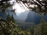
After pausing for a few obligatory pictures at Tunnel View, I was on my way to Badger Pass. After getting my permit there, I was on the Old Badger Pass Road, trudging, well, somewhere (Peregoy Meadow?), with a crisp breeze encouraging me to keep moving.
The Advance Party and I did manage to make contact via radio and agreed on a meeting place: a ski trail junction. The Advance Party had had a very cold night, but fortunately they had chosen a campsite that had good morning sun exposure, so the ice on the tent and their sleeping bags had a chance to melt away before they had to pack. Perhaps because they had to deal with this, despite having started in the Bay Area, I was actually ahead of them and reached the junction first. Since it was in the shade I said I'd be waiting for them in a nearby meadow, where I took a bit of a nap on my foam pad.
I rested for about 20 minutes until they arrived, then we followed the well-traveled route back to the Glacier Point Road. After walking down it a few hundred yards, we branched off at the McGurk Meadow trail, which hadn't been broken yet... and was covered in snow.
An old cabin in the meadow made it appear as if the snow were several feet deep, but instead, the cabin's former occupants appear to have been quite short--the door was maybe 3' high.
Past the cabin we merged onto a recently-broken set of tracks and followed them a bit before stopping for lunch near the meadow.
We were well away from any of the marked ski trails; any footprints in the snow were ours--or some animal's.
We followed the tracks to a trail junction, whose signs were barely visible in the not-very-deep snow. Yosemite summer trails are not well-marked for winter travel.
We were in fact heading in the general direction of Taft Point, so we continued that way. A bit past the junction we crossed Bridalveil Creek via the sturdy trail bridge. We could hear the creek flowing, but it was almost completely beneath ice and snow.
After crossing the creek, we started the climb towards our campsite.
After several hundred feet of climbing through forest, we emerged at the valley rim, where we could see familiar landmarks in the distance.
The Great Pink One had camped here just a few days ago, so we checked out that campsite, but it was a bit small for our bigger party.
After scouting around a bit, we selected our campsite, choosing views over protection from the wind. After stomping down the snow to make a platform for the tent, we set it up and unloaded our gear.
Fortunately we had arrived at camp early enough to enjoy the evening and sunset before climbing into the tent for the long night.
Our campsite was well-situated to get the last light--long after the valley itself became cloaked in darkness.
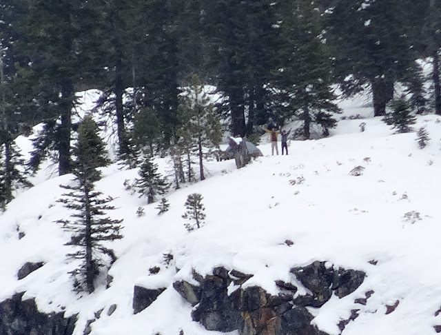
The next day the Great Pink One had to return to civilization, so he left JKW and me as we were taking it easy around camp. He did reach us via radio when he was at Dewey Point, and we took mutual zoom photos of each other.
He is the one on the highest knoll to the right of the others.
After some deliberation, JKW and I decided to take a day "hike" to Taft Point--fortunately, the trail there had been broken recently. The sky was mostly overcast, but it cleared a bit when we got to Taft.
Although there was ample evidence that others had been there, we saw no one during our brief stay there.
Unfortunately the party that had broken the trail previously had deviated from the Pohono Trail in a few places. Since we were hoping to check off another Trail Quest segment, we instead followed the more-trail-savvy deer path on the way back to camp.
This is actually the Pohono Trail.
On a previous thread I mentioned that the Pohono Trail isn't really marked for winter travel and isn't blazed; in fact, there are very old blazes along the route, but they are almost impossible to see unless you are already on the trail At best, they confirm that you are on route.
We got a few more glimpses of sun on the way back.
We saw no one the entire day, and the only sounds were the occasional chunk of ice falling from a tree or our snowshoes crunching the snow.
We arrived back at camp with enough sunlight left to take care of a few last-minute tasks before climbing into the tent for dinner, some TV binging, and well-deserved sleep.
The next day, after breakfast (no pancakes or bacon :-( ) and packing up, we retraced our steps to the place where we had left the Pohono Trail the previous day.
Our goal was to complete the segment from near camp to Dewey Point--and thus the entire Pohono Trail from Glacier Point/Sentinel Dome to Inspiration Point.
The section of the trail south of camp hadn't been broken, and in places the powdery snow was up to a few feet deep. Fortunately, it was all downhill. We documented our route well for the Trail Quest judges (old blazes, cut logs), but in fact the resident deer seemed to know the trail's route well and we could have just followed their tracks.
We rejoined our tracks from a few days ago, and a bit later were back at the bridge.
At the nearby junction I had to walk, then retrace, one side of a small triangle (the judges are harsh and exacting...), then continued on towards Dewey Point.
From near Dewey we could look back towards our camp--which was quite near a precipitous cliff.
Our tent was behind the dead stump that is about 1/2 way from left to right, just below the trees.
There were of course a few dozen people at Dewey Point, and numerous ski and snowshoe tracks heading everywhere.
We decided to take the well-traveled direct route back. Surprisingly there were still parts of Summit Meadow that didn't have tracks in them.
Most of it was a well-traveled thoroughfare, though.
Just past the meadow we were on the equally-well-traveled Glacier Point road, which we followed back to Badger Pass. The afternoon ended up being sunny and warm enough to melt some of the snow and ice. We were at the car early enough to have a relaxing drive back home. It had been a great start to the new year! Oh, and bonus: for perhaps the first and last time ever, JKW and I were ahead of the Great Pink one for days and nights in the backcountry for the year. But we did appreciate all the trail-breaking he had done!
More Pictures


