Despite the downright fall-like cool temperatures I had experienced in Buck Meadows (37F), the start of my climb up the Beehive switchbacks was quite warm. Only near the top did a cool breeze provide relief while I rested and had a snack.
For whatever reason, I struggled heading up the trail from the top of the switchbacks to the bone-dry "Frog Pond" where the trail's gradient eases a bit.
I stopped at Beehive to top off my water bottle with its spring's cool water. I had planned on stopping for lunch, or at least a snack, but I was feeling better and pressed on so that I could inform the Advance Party via radio that I was on the way.
I was able to reach them just past the Lake Vernon / Moraine Ridge junction, and as I was feeling OK, I pressed on to meet up with them for lunch at Lake Vernon, where they were waiting for me.
I got my first glimpse of the lake, and the route to Branigan Lake we would be taking after lunch, right before the final drop to the lake itself.
The Advance Party was resting on some open granite near the lake when I arrived. I quickly ate my sandwich and chips, then laid down a bit to rest. The sandwich I had brought in for them would have to wait for the next day; they had already eaten lunch.
After I was recharged by lunch and a short rest, we hiked toward the snow survey/ranger cabin near the lake, finishing off a short spur trail JKW had never done in a dozen or so visits to Lake Vernon. Along the way, I discovered that the Advance Party had invented a "game" of identifying trail signs or markers. I still can't say I understand how this "game" is scored, or who was winning it. A ranger was doing some housecleaning at the cabin.
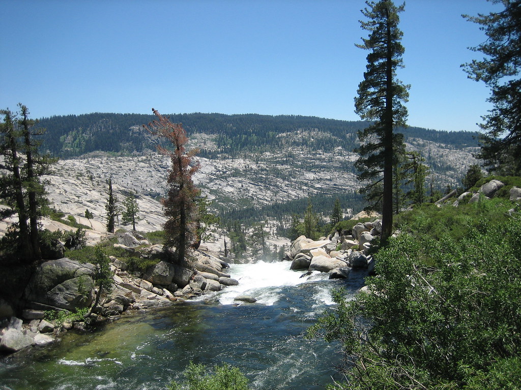
After chatting with the ranger a bit we headed toward the Lower Branigan Lake outlet. Falls Creek was reduced to a few pools with no discernable flow. The terrain between this dry creek and the also-dry Branigan outlet consisted of a lot of flat, open granite--lots of great camping for those who didn't require lakeside accommodations.
Our route to Lower Branigan Lake was more or less directly up the all-but-dry outlet.
Looking back, Lake Vernon appeared quite small compared to the large valley surrounding it.
The climb up the outlet had been steep, but in most cases it was possible to work various cracks and ledges to avoid any uncomfortably steep sections. We eventually reached the top where the gradient eased quite a bit.
After working around a small valley and a bit more climbing, we arrived at our destination for the evening: Lower Branigan Lake.
Unfortunately a cool breeze discouraged an evening swim or boat, but we enjoyed another nice dinner as the sun went down for the evening.
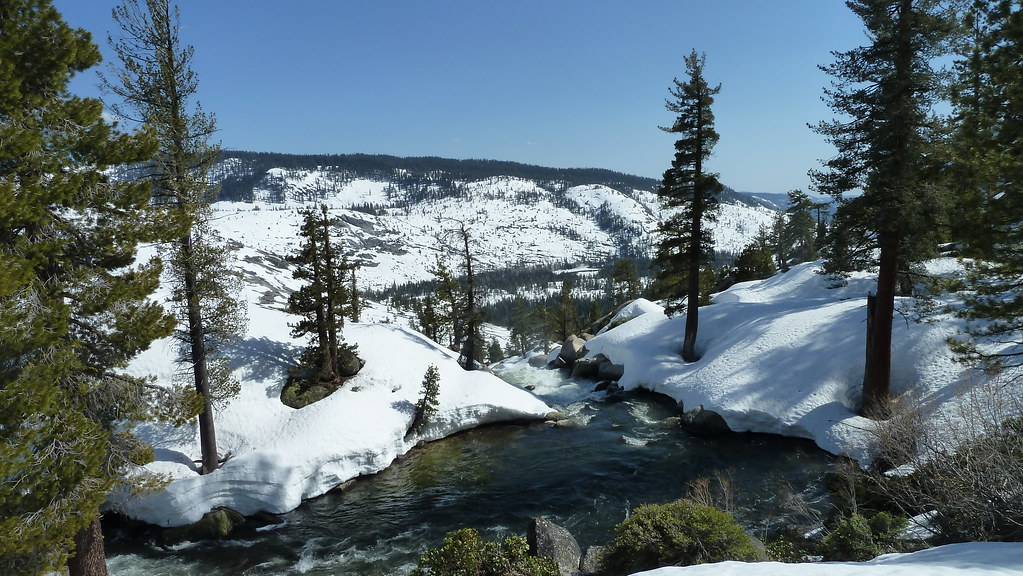
There were several strong gusts of wind during the night, and as the wind had not died down in the morning we had breakfast of tortilla-less breakfast burritos, bacon, and bonus pancakes in the tent. Our plan for this day was short, at least on paper: we would boat across all three Branigan Lakes, hit the trail to Jack Main Canyon, then continue down the canyon to a to-be-determined place.
The strong winds had threatened to make boating Lower Branigan Lake a challenge, but by the time we were ready to hit the water, the wind had mostly died down.
JKW's inflation hose had a bit of a leak in it, so we stayed close to shore; fortunately, her boat held enough air to remain buoyant until we found a place to exit the lake.
After packing our boats, we carried them over a small ridge instead of following the brushy outlet.
From the top of this ridge we could see the high point of Moraine Ridge--a view we would reverse the next day.
As we dropped down to the Middle Branigan outlet the real fun began.
Eventually after a slow and tedious bushwhack, we arrived at the south end of Middle Branigan, where we inflated our boats on its small south "shore". While it may have been possible to get around Lower Branigan on land, the middle lake had steep cliffs on both sides.
Fortunately, the breeze helped push us across the lake to the north: this was by far the best way "around" the lake.
There was barely enough open shore for our three boats, three packs, and the three of us where we took out. After packing the boats again, we faced another thicket.
As before, we made slow progress towards the next lake.
Eventually we reached the Upper lake; as with the Middle one, boating did seem to be the only sane way to get from one end to the other. It was near lunchtime, but as the south shore was quite cramped, we decided to boat to the north end, where we could see some nice open granite that the Pink One had camped at years ago.
The breeze helped push us to the north end of the lake, where we took out near a large log that provided enough extra space for us, our packs, and our boats. We carried everything through a final short stretch of brush before hitting the open granite. There were no signs of any prior visitors--except for several clearly-artificial holes drilled into the granite--perhaps a previous scientific granite core study?
We all enjoyed sandwiches and chips--and a nice view--for lunch.
Feeling much stronger than the previous day, I decided I would finish off a stretch of trail that the Advance Party had a few weekends ago, so I packed up and left them so I wouldn't slow things down too much. The climb out of the lake was first over intricate erratic-covered granite.
The final bit of climbing was up a gully lined with large, stable blocks of talus.
The stroll down the north side of the gully was nice, and eventually my route became a well-worn use trail... only when I passed a cut log did I realize I was on the real trail that connects Jack Main Canyon with Tilden Canyon Creek. As I was heading the wrong way (at least for now), I retraced my steps a bit and began the climb towards the point near where I had stepped off this trail a few weeks ago.
Not far along the trail I spotted what I thought was a piece of glass or other trash, but was in fact an old obsidian arrowhead. Normally I would have left it in place, but I was afraid that this artifact would be accidentally crushed by foot or hoof, so I recorded the GPS location and picked it up for safekeeping. (I turned it in at the entrance station with a note as to where I had found it when we drove away...)
The trail alternated between open forest and granite, with nice views at almost every point along the way.
After a final steep climb I reached the turn-off location from a few weeks ago. After a short rest, I headed back down the trail to catch up with the Advance Party.
Although in theory the trail to Jack Main Canyon should have been all downhill, it was surprisingly intricate, especially the final half mile or so where it weaved over and around several granite ridges. After successfully completing this section, I headed south on the Jack Main Canyon trail and immediately entered Paradise Valley.
Not far past Paradise Valley I joined up with the Advance Party. As before, the trail in theory should have been a gradual downhill trek, but it too had to work over and around various granite features.
In one place it followed a narrow brushy ridge between a pond and Falls Creek.
We had decided to head to Andrews Lake for the night.
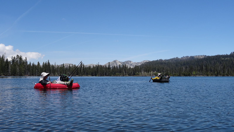
Once at the lake, we set up camp as the sun disappeared behind a ridge, then inflated our boats and hit the water for the fourth time that day.
After returning to camp we prepared and ate dinner, enjoying the mild, calm evening and the warm glow of the sunset.
A warm but gusting wind had picked up during the night, and the morning was breezy enough that we had our pancakes and bacon breakfast in the tent. I decided that I would hike with the Advance Party to the base of the infamous "Golden Staircase"--where the climb from Jack Main Canyon to Moraine Ridge begins--then run on ahead so I could complete the loop around Laurel Lake that they had finished the day before I met up with them.
The lower part of Jack Main Canyon was just as nice as the section we had hiked through the previous day. The Advance Party continued their "trail sign" game, but I lost count of the score, not that it seemed to have any bearing on who was claiming to have won anyway.
Eventually the canyon narrowed to a point where the trail was right above the dry creek bed, and the ridge opposite us became low enough that Falls Creek could take a sharp turn to the east and spill into the Lake Vernon basin. I suspect this would have been very impressive during high water.
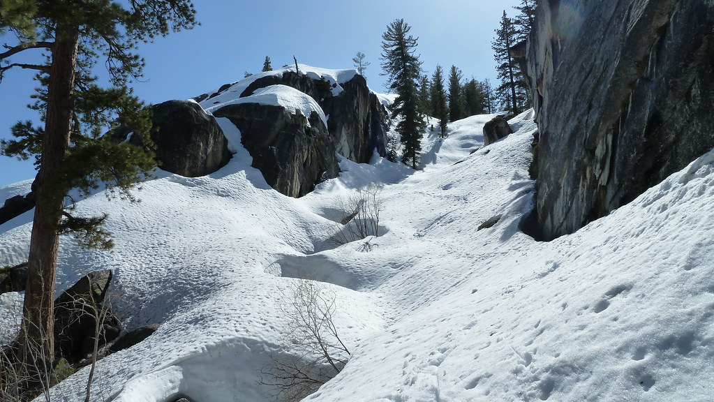
After spotting the final "trail sign" for awhile (the flagged snow survey trail descends to Lake Vernon instead of climbing over Moraine Ridge), I left the Advance Party and headed up the "Golden Staircase", a 200' climb up a narrow gorge. The trail was steep but well-constructed, but overall I didn't think it was exceptionally steep or rocky by Sierra standards.
The steps eventually became a normal trail, and just past this point I took an off-trail detour to check out some nice granite camp and view spots.
When I returned to the trail the Advance Party had caught up with me... I ultimately had to get ahead of them by about 4 miles to be able to finish the Laurel Lake loop without holding them up, so I had to pick up my pace. I pushed on to the high point of Moraine Ridge, but I couldn't resist the temptation to wander off-trail again to check out another viewpoint.
I looked back at my last views of Jack Main Canyon... for now, at least.
Lower Branigan Lake and Lake Vernon were also visible.
The walk down Moraine Ridge was generally nice, although there were a few surprising uphill sections on the way down. I finished the new trail segment at the Lake Vernon junction, then cruised to Beehive.
After filling up again with cool water from the Beehive spring I headed off towards Laurel Lake via the "north" trail. Given the short signed distance, it seemed to take awhile to get to the lake, and even longer to get around it.
I returned to Beehive via the "south" trail. On the way a few hikers asked how "the lake" was. Andrews? Laurel? It didn't matter: "Very nice!" I had now been on all the trails to Laurel Lake, and it hit me than none followed the ideal route. I reached Beehive shortly after the Advance Party had just started cooking a nice lunch of chicken breast, mashed potatoes, and broccoli. They had done me the favor of doing some exploring to give me time to finish the Laurel Loop.
After lunch and a nice rest, we retraced our steps back to the trailhead, re-claiming "first" on "trail signs" that had been discovered many times previously.
The Advance Party had had a cold, frosty first night at Laurel Lake, and we had had a cool breeze at Lower Branigan Lake. The cold spell was long gone by the time we were heading back down the switchbacks, and we were thankful that we were late enough that a lot of the trail was in the shade.
It was downright hot when we were at our cars. But, despite the 18+ mile final day, it had been a great trip, and JKW and I had knocked off a lot of TrailQuest mileage and BoatQuest lakes.