Mike had introduced me to the Cactus to Clouds route (C2C) as a challenge, and of course I had to do some research on it. Challenge indeed…a hike that starts basically in downtown Palm Springs, at an elevation of about 500 feet above sea level, to the top at 10,839 feet over the course of 14.5 miles, with another 5 or so miles back down to the top of the tram for the easy way back down. The hiker reports warn of heat, elevation gain, heat, lack of water, heat and more heat, and too large a number of people whose hikes come to an inglorious end. It is typically listed as one of the hardest day hikes in the US. Seriously, this is not a hike for beginners, or even experienced hikers used to moderate elevation gains (moderate being a climb out of Yosemite Valley to the top of Yosemite Falls). The vertical here is like climbing from Happy Isles in Yosemite Valley to the top of Half Dome…twice…and then doing a 1200 ft climb on top of that! Challenge accepted!
My wife, son and I drove down to Palm Springs on the Sunday before Halloween, dodging rain most of the way, with me worrying about conditions on the trail. Fortunately, webcams and weather reports showed little if any rain, and temps in Palm Springs in the mid seventies with well above freezing temps at the top, and I decided to forego the microspikes. Otherwise, we were carrying a fair amount of weight considering we were on a day hike (with the advantage of a resupply by the wife at the top of the tram)…the reports of heat and dehydration had our attention, and as it turned out we had more than enough water.
Unlike most serious hiking and peakbagging days that I have done, this one started with an alarm clock going off in a hotel room, a quick change and a stroll to the Starbucks a couple of blocks away for a quick breakfast and coffee at 5:30.
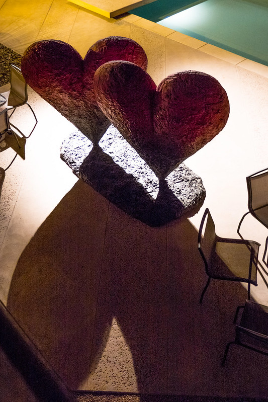
We walked past the Palm Springs Art Museum, spotting this installation in the dark of the courtyard
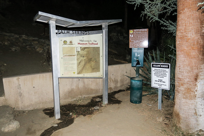
And came to the Museum Trailhead at the parking lot near the rear of the museum.
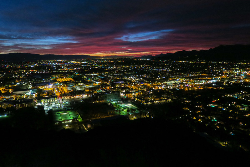
The maintained trail heads up steeply to a picnic table area at about 1400 feet elevation fwhere we got a view of the pre-dawn cityscape
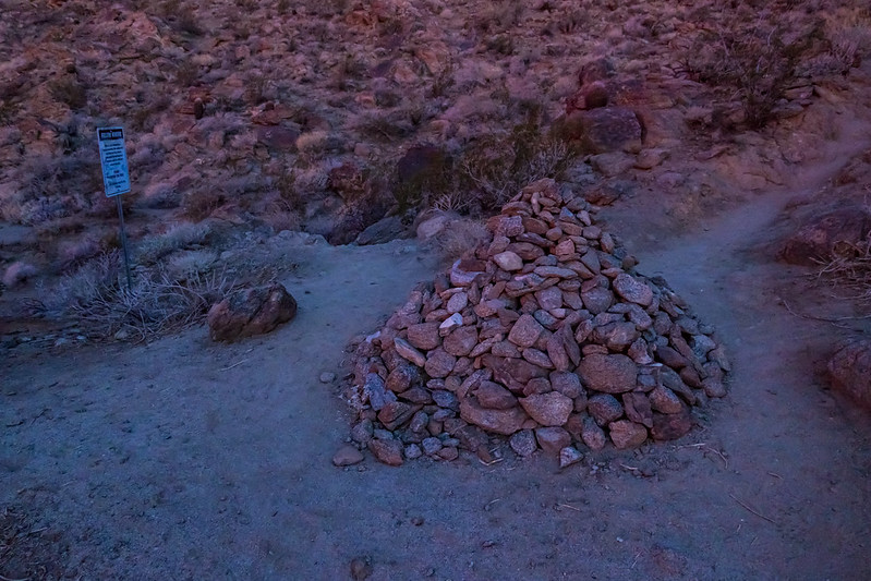
Good thing that Chickon was not on this trip…we probably would have lost him for good at this pile of rocks
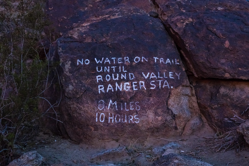
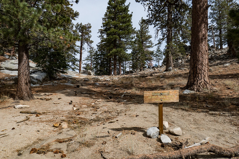
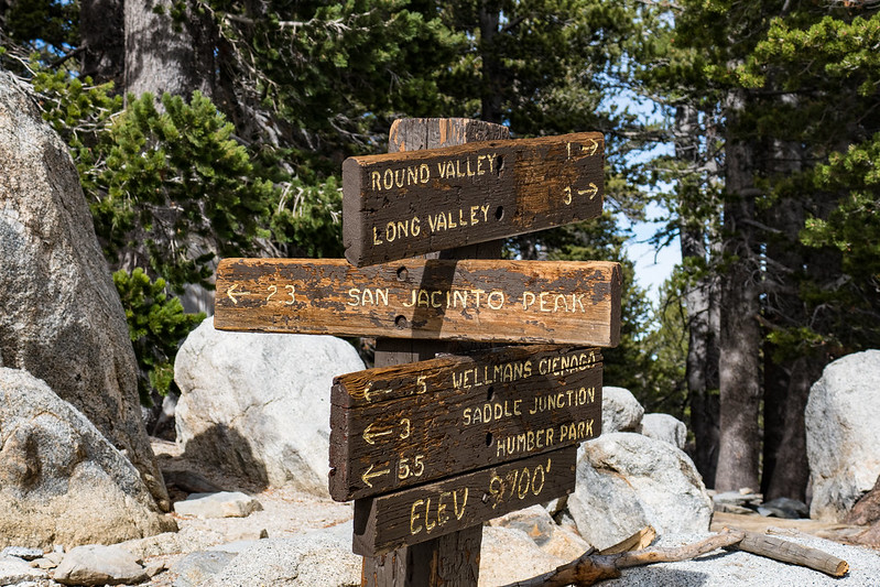
The trail signs were effective…the mileage and time estimates give an idea of the steepness of the trail and the difficult going in the usual heat.
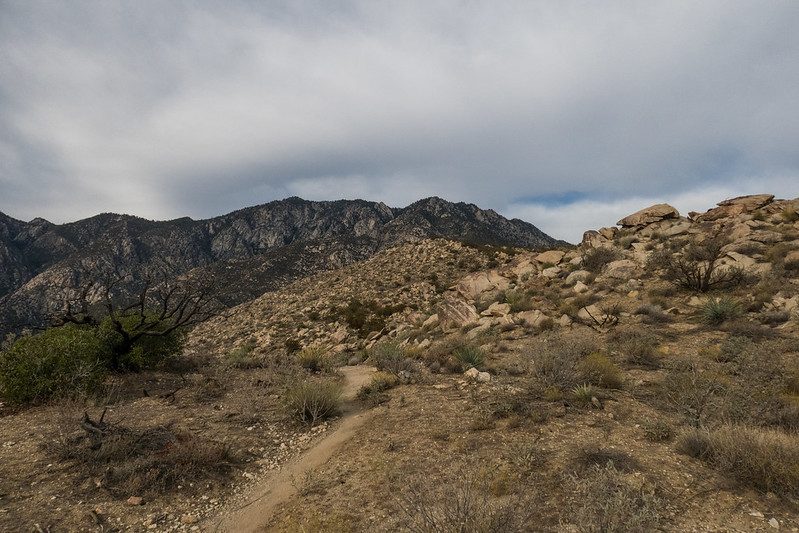
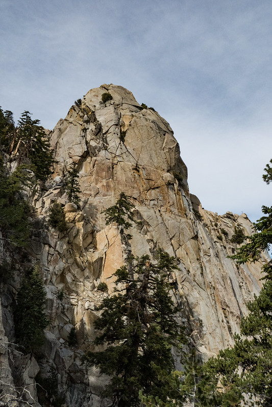
As day broke, we passed out point of no return…the intersection with the North Lykken Trail which starts a bit further south in Palm Springs. We forged ahead, always up, through a mountainous, desert landscape
Fortunately for us, we had a perfect day for this hike. The storm that had passed through the previous day left a cool day for us, with a high cloud cover that kept the trail from heating up in what usually is a brutal, exposed section roasting in morning sun and heat. The local trail folks who care for this trail have left some “Rescue” boxes, filled with basic medical supplies and water for those who need it. Rescue 1 was at about 1400 feet up.

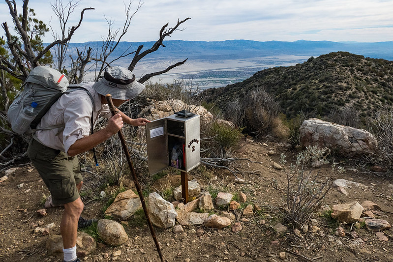
Rescue #2 at 5400 feet elevation was similarly stocked.
As we got closer to the last steep section, we could see the top of the tram. We were making good time, but the wife and kid on the tram were going to get to the top before we would.
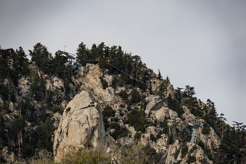
Below the tram, the pines and granite were a scene out of the Sierra…I was feeling a bit more at home here, though the legs were getting tired.
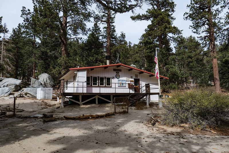
We crested Grubbs Notch at a little past noon. The steepest section and almost 8000 feet of vertical were behind us and we had family and lunch waiting for us at the ranger station, and easy walking for a little while thereafter.
The Ranger Station was well equipped and there was a CCC group camped nearby doing their good work.
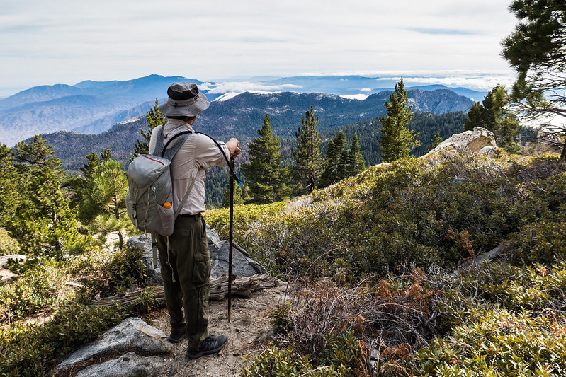
After a quick lunch, we walked on through a very Sierra looking landscape of pines and fir to the Wellman’s Gap trail intersection
and enjoyed the views from a nearby spot. This looks generally southwest towards San Diego. But for the coastal clouds it certainly could be the central Sierra.
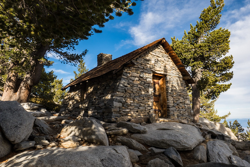
Just short of the summit we passed the Peak Hut. It is set up as a year round hut for those who may need it, complete with a couple of bunk beds and some basic necessities.
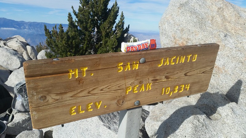
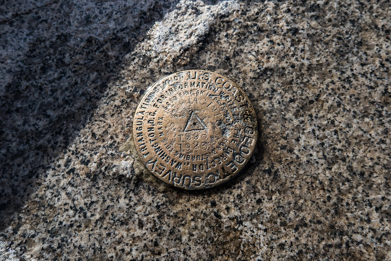
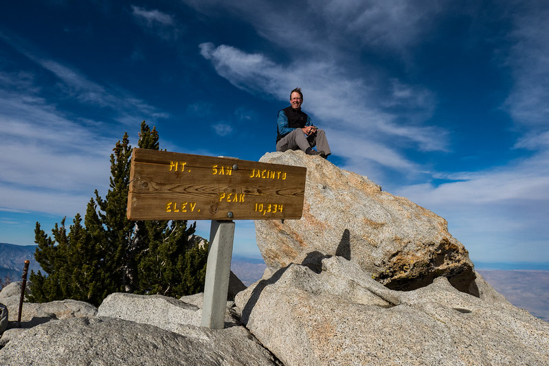
The benchmark at the top was stamped 1898..one of the older ones that I have seen.
We were at the summit at about 3PM or so and spent just a short time. While I didn’t feel too chilly, the ice on a couple of puddles gave notice that it was probably colder than we thought.
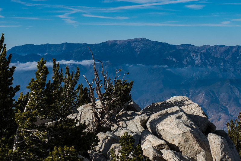
This is a view out to San Gorgonio, another good hike, which I had done in 2013
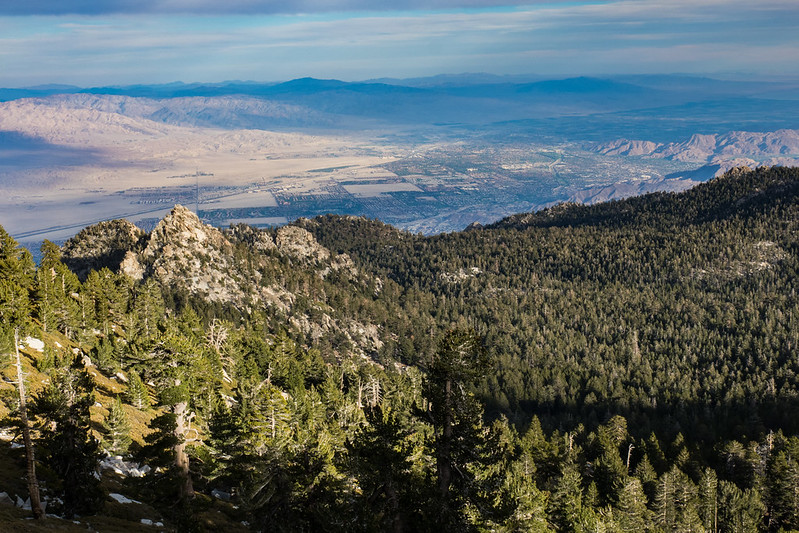
The Coachella Valley was visible way down there in the distance.
We made quick work of the hike back down to the top of the tram, getting there about 6PM, just as the sun was lighting up the clouds to the west behind the summit area
We took the tram down, were met at the bottom by my wife and son, drove back to the hotel for a quick shower before a nice dinner in downtown Palm Springs, replete with festive Halloween partygoers in all kinds of strange costumes. Certainly an interesting way to end a big hiking day!