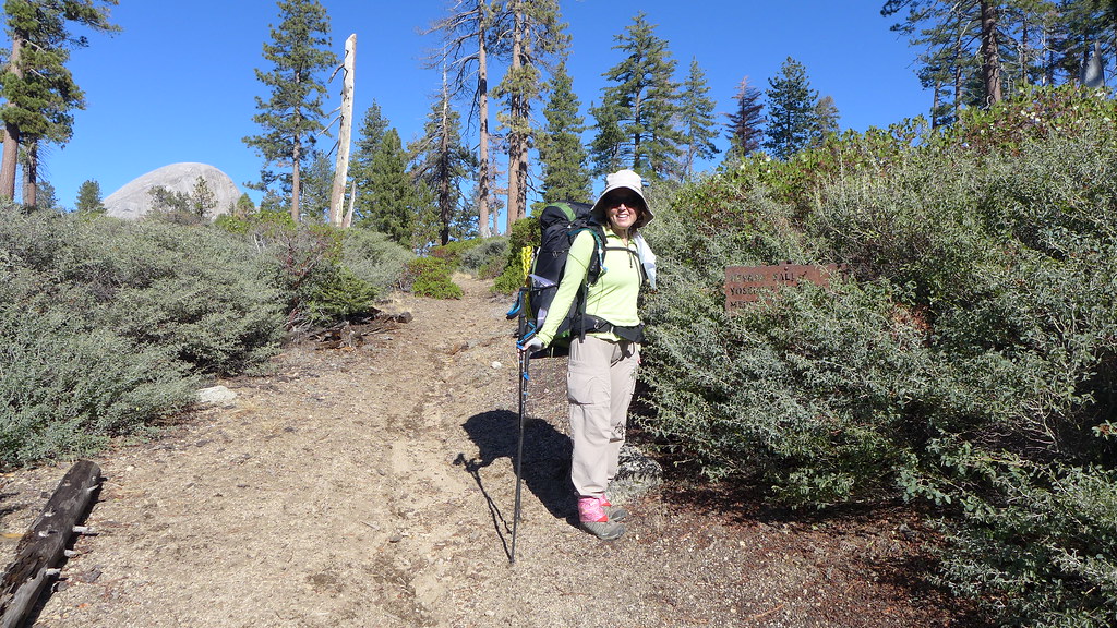
For perhaps the last time this year, I headed to the mountains Friday afternoon to catch up with the Advance Party. The drive from the Bay Area had been pleasant, and the temperature in Oakhurst was actually quite mild for early November. I arrived at the trailhead in Wawona with enough daylight to climb the first several switchbacks without a headlamp. I was able to contact the Advance Party on the radio who informed me of the location of their campsite.
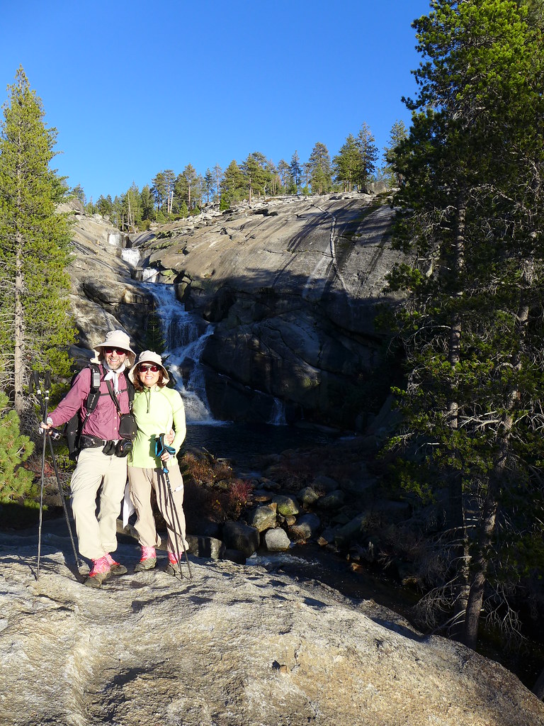
The recent storms were making Chilnualna Creek's waterfalls quite impressive; this creek had been almost completely dry a few weeks ago.
Wawona Dome glowed dull red as the sun set.
Not long after the sun disappeared below the horizon. The air at the beginning of my climb had started warm, calm, and somewhat humid, but near the top of the climb there was a cool breeze.
The campsite was perfect--lots of clean, flat granite to make unpacking and getting ready for bed much easier. Not too long after I arrived in camp I was comfortably in my sleeping bag. After watching a little "TV" I was asleep.
The next morning, after a breakfast of biscuits and gravy and breakfast skillet--and of course coffee--we set out for a day hike. The goal was to finish the last "significant" portion of JKW's TrailQuest. The day was perfect for hiking: clear, calm, and not too hot.
Our forested climb eventually emerged onto open granite, where we could see the hills and mountains surrounding us. We had seen a few traces of snow, and in the distance could see that higher places had received a bit more.
As the trail dropped a bit, we passed through a bit of snow.
A month or so ago we had been unable to complete one segment of trail due to fires; the recent storms had extinguished them.
Almost all of the forest along the trail was unburnt; there were only a few minor places where what was mostly a ground fire had burned. Unlike the "big" fires like the Rim or Meadow, this one claimed comparatively few trees.
We stopped for lunch on a broad granite opening that was dotted with many large erratics.
We continued into and out of burnt-out areas; even in the worst of these there were trees and logs that didn't seem to have been touched by fire.
By the time we passed a lake near the trail we seemed to be past most of the fire area.
After finishing the TrailQuest segment, we returned via the "detour" route we had followed a few weeks ago. We had to make some alterations to this route: granite slabs that had been bone-dry then now had a light dusting of snow, at least on their northern-facing sides.
We passed through the only significant snow patch of the trip. The snow was just an inch or two deep and was easy to travel through.
We eventually started the drop to Grouse Lake where there was no snow in sight.
The lake was a bit higher than it had been a few weeks ago, and its outlet was now a significant stream.
We hiked the trail from Grouse back towards Chilnualna Creek, reaching the junction with the final major TrailQuest segment.
This trail eventually reached the former location of the Chilnualna Ranger Station (according to old maps); all that is left of this facility is an odd "oven" and the flat cement pad for the former cabin.
The final creek crossing was a mostly dry-shoes affair with some careful rock-hopping.
We soon reached the trail junction near camp. The remaining TrailQuest mileage was now officially under 10 miles. Our day hike had been about 14 miles, most of which was "new" TrailQuest mileage.
Before returning to camp, we took a slight side trip to take some photographs of the nearby falls before the sun set.
We reached camp with plenty of time to prepare for dinner and another well-deserved night of rest.
We didn't have much planned mileage for the next day, so we took our time with breakfast and packing. Unlike the previous clear day, this day started out lightly overcast.
The hillsides around the Wawona area had many "bands" of recently-dead trees.
Of course, there was an old trail segment to explore, and of course we followed it from end to end.
Partway down the trail, we headed across the creek to search for a boundary marker. We had to look around a bit for a place to cross the creek, but we eventually found a series of rocks and logs that led us safely across.
The Pink One identified a recent witness marker on a tree that had older blazes on it. We were close, and the Pink One and I wandered around looking for the typical post-and-pile-of-rocks. Eventually I decided to read the survey notes to see if I could get a sense of direction and distance from the witness tree. Just as I yelled to JKW that the marker was in fact an aluminum tablet set in stone, she said "I know! I found it!"
The survey notes had the rock and the mound it was on being much larger than what we found.
The notes also mentioned a "twin oak" tree as another witness tree, and the only such tree near the marker had a faint rectangular mark on its trunk where presumably a blaze had once been.
With any other group we probably would have headed back to the trail, but the Pink One and JKW had discovered a nearby trail (nicknamed the "Lilyvader"--something about altering the deal...), so we headed up a steep hill towards it.
We soon found an old roadbed that they hadn't been on, and we followed it to the Lilyvader itself. This old road had switchbacked up a steep hill; it was now severly rutted and overgrown with mature manzanita.
Despite the fact that the road must have been decades old, it was punctuated with odd culverts that looked almost brand new. Also, in a few places someone (maybe Wawona locals) had installed rock or even wooden stairs at some of the steeper places on the road.
We followed this road all the way down, then headed back to the trailhead.
From the trailhead, we had one more short section of trail to finish.
JKW and the Pink One wanted to go marker hunting, and they offered to drop me off at the top of a closed road for my TrailQuest mission. This road made for a very pleasant stroll back to the Wawona area.
After this section, I was dropped off again so I could finish another short section of trail, ending again near the not-Wawona Hotel.
It had been another great weekend of hiking, and JKW's TrailQuest was almost finished!