Saturday was in fact warm and somewhat humid. Our fears had been that the Hockett Trail would be a poison-oak shrub-fest, but it appeared to have been reasonably well maintained and there was very little PO to be found. The lower portions were definitely more "coastal Diablo range" in nature than "Sierra sequoia groves", but the trail's grade was pleasant and made for enjoyable hiking.
Although in most places the trees and underbrush blocked our views, in a few places we got glimpses of Homers Nose (high point on map) and Homers Nose (the dome that most likely resembled Homer's nose).
As we climbed the trail, we got our first glimpses of the snow high up on Dennison Ridge.
Just before reaching Snowslide Canyon, we encountered scattered sequoias. Not surprisingly, this is where we also encountered our first significant snow, but only near the creek itself.
In the 1870s, a warm winter rain caused a massive mudslide down this canyon. Apparently it created a temporary dam that stopped the river... until it overflowed and flooded everything downstream, including Visalia, washing uprooted sequoias downstream with it. Early reports are that this event took out a significant portion of the Garfield Grove, but in fact there are fairly mature sequoias near the creek on both sides. The creek itself was in a rocky gorge--certainly any trees right next to it were washed down.
Not far past Snowslide Creek we passed Snowslide Camp, a handful of small campsites located near a few medium-sized sequoias. We had considered stopping here, but we wanted to explore farther up the trail and the campsites here were OK but not great.
The trail past Snowslide was significantly steeper, and we climbed slowly to what we hoped would be our campsite. Along the way we passed more scattered sequoias.
Eventually the trail reached the top of a ridge and leveled out a bit. We looked around a bit for a decent campsite, but the ground was littered with deadfall, both from the recently-dying pines and incense cedars and branches from the still-alive sequoias.
After failing to find a decent site, we returned to the trail and stopped for lunch. The area on the "other" side of the trail looked promising, and a short stroll confirmed a nice campsite awaited us.
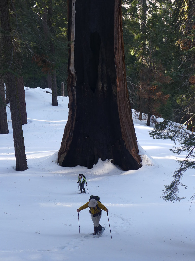
After pitching our tent and unloading much of our packs, we headed up the trail for our next target--or rather targets. Along the way we passed several impressive, mature sequoias.
One specimen had an unusually large burl on the downhill side.
Based on some directions the Pink One secured from another forum, we left the trail at the right place and headed uphill about 500 vertical feet. The snow was deep here, but under the top few inches of recent powder it was quite firm. After climbing for a bit, we reached our first target: The King Arthur Tree.
At just over 40,000 cubic feet of trunk volume, this tree is the 9th largest sequoia. Its base didn't have the huge flare that some huge sequoias do, but it maintained its significant girth for most of its height.
Our next objective was nearby: the "Floyd Otter" tree, a/k/a "Unnamed" at #11 on the sequoia hall-of-trunk-volume list. This one is a bit more controversial, at least if one believes the Wikipedia edit discussion. While it is a bit odd that the tree was only "recently" added to the list, despite the fact that it seems the old Summit Trail went right around it, its more oval cross-section may have resulted in inaccurate volume measurements via earlier methodologies. It is similar to the Hart or Roosevelt/False Hart tree in that it has a large burn scar on the uphill side.
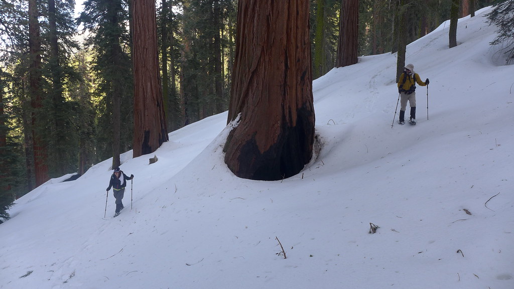
After finding these two trees, we decided we had enough time to check out more of the "upper" Garfield Grove. After putting on our snowshoes, we walked past many wonderful, albeit non-record, specimens.
We eventually reached a saddle with several large trees, and could see that the grove continued to the south--now as the Dillonwood Grove--for as far as we could see.
Somewhere along the way, we started a new "game" of walking up to and touching sequoias--always with a "boop" sound. I don't think anyone really kept score--it was a reason to check out the various trees instead of following a more direct route down.
On the way down, we passed by the Floyd Otter and King Arthur again to measure their circumference with some rope. The Floyd Otter was nearly 90' around, while the King Arthur was about 85' around. Neither measurement was scientific, especially since we didn't know where "breast height" was relative to the bare ground, but it confirmed that these trees were huge.
Since our campsite was "dry", before returning to camp we loaded up with water from a small creek near where we had left the trail.
We reached camp just as the sun was setting for the evening.
The weather forecast had called for strong gusts of wind, and while we would have preferred a campsite far from any trees, our site was surrounded by tall trees with high branches. Fortunately, it was calm for most of the night, but around 4:30 or so in the morning, we all woke up when we heard a loud crack followed a while later by a loud thud not too far away.
A few hours later the main weather event started as we heard snow start to hit the tent. We had breakfast and packed as much as we could while still protected from the elements, but eventually we had to get outside to pack the tent itself.
Soon enough, the tent and everything else was packed, the umbrellas and UFO-grade pack covers were deployed, and we started our hike back to the trailhead.
The new accumulation was only a few inches. At first JKW was wearing her micro-spikes, but the wet, clumpy snow was sticking to them so much that they were a pain to walk in, so they came off after awhile.
We eventually reached the bottom of the Garfield Grove and left the sequoias behind.
The snow level was quite low--perhaps to a bit over 4000'.
Along the way we encountered a few strong gusts of wind. We could hear them in the distance blowing up the canyon, giving us enough time to prepare our umbrellas for the strong winds.
Near the trailhead the "snow" was more like wet hail, and eventually it became just rain.
We wasted little time getting into the car. Just as we started to drive away, heard a few thunder claps and were hit by a strong hailstorm. The hail itself had fallen almost all the way to Three Rivers. We didn't complain--overall we had gotten lucky with the weather and were now safe, warm, and dry. And while we had thought the Hockett Trail would be a "one-and-done" due to the elevation and poison oak, it instead ended up on the "definitely will revisit" list: there were many, many more trees in the Garfield/Dillonwood grove that needed to be "booped".