As our planned departure date approached, condition reports varied widely, and were generally indicating that snow - or more importantly, water crossings - would require that we be prepared to alter our plans as needed. With that in mind, we set out on our adventure with the added excitement of knowing that we'd almost certainly have to make some on-the-fly decisions that might result in a trip that didn't remotely follow our desired track. Our plan was to enter (permit already secured months ago) at the Chilnualna Falls trailhead, follow the creek to Buena Vista Lake, then XC over Buena Vista Crest to Merced Pass, north along Illilouette Creek, south along Buena Vista Creek, then head back by way of Hart/Ostrander Lakes, (on Horse Ridge) to Turner Meadow and finally back down Chilnuala Creek to our entry point.
Monitoring the official YOSE/NPS reports for weeks in advance, we learned that most every water crossing we'd need to make was reported as "impassible" and snow cover approached 100% above 8500'. Nonetheless, prepared for the possibility of only a single-night stay, we picked up our backcountry permit at Wawona and while there, inquired regarding any updates to the water/snow conditions. Remarkably, we were told that: a) Mono Meadows is still completely flooded; b) a ranger had just returned from the area and reported that crossing over to the south side of the Illilouette was possible (mid-calf height). With great relief and optimism, we set out.
After a challenging hunt for a legal place to park, we were on the trail - later than we had hoped for, which is typical. It was the weekend before July 4th, and unsurprisingly the trail was loaded with people. I was happy to see so many people out enjoying the park, particularly with young children that may themselves become advocates for the value of wild places and the need to protect them. I was also hoping for solitude once above the falls. After about a mile we passed what some were calling "the first Chilnualna Fall". It was packed with people around the water's edge, and unfortunately several people in the water just above the fall itself. They did not appreciate, or heed, any suggestions I made regarding the force of tons of water per second and the inevitable outcome of being sent over the edge. Having not read any tragic reports after returning back to the grid I presume they were uninjured, but unfortunately they were role models for many others there that day.
After passing the "first fall" the crowd thinned significantly. After what seemed a rather long, enjoyable but unremarkable climb, the string of several falls which I thought were referred to collectively as "the Chilnualna Falls" came into view. They are... unusual, different than any others I've seen in the park. More like meandering off-angle, oddly-located falls of various height and visibility. They were beautiful and we were glad to see them:
There was a large (20+) group of teens at the top of the falls, We stopped for a (very) late lunch, watching their energy, interactions and antics, then continued on. Shortly afterwards we were at the first potential obstacle, the crossing to the south side of Chilnualna Creek. Presumably due to being later in the day, the water was now about knee height, but the ford was wide and the water not very fast. No problem - victory #1. We followed the creek and eventually made camp on a nice flat spot quite a bit above the creek. Later we noticed that there was a tent on the other side of the creek, upended on its side. Even later we saw the presumed owner breaking down camp. I'm curious if the upended tent was due to poor staking or if that is a known signal used by rangers to indicate "you are nowhere near 100 feet from the water - move now!". Does anyone know?
The next morning we set out with Buena Vista Lake as our destination. It was a short distance (relatively speaking) so along the way we wandered off-trail, and found some nice water play spots which reminded me a bit of our beloved Cherry Creek. It was pretty hot, and the water felt great; air-drying in the sun on the flat granite felt even better:

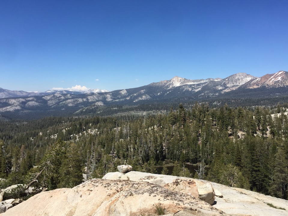
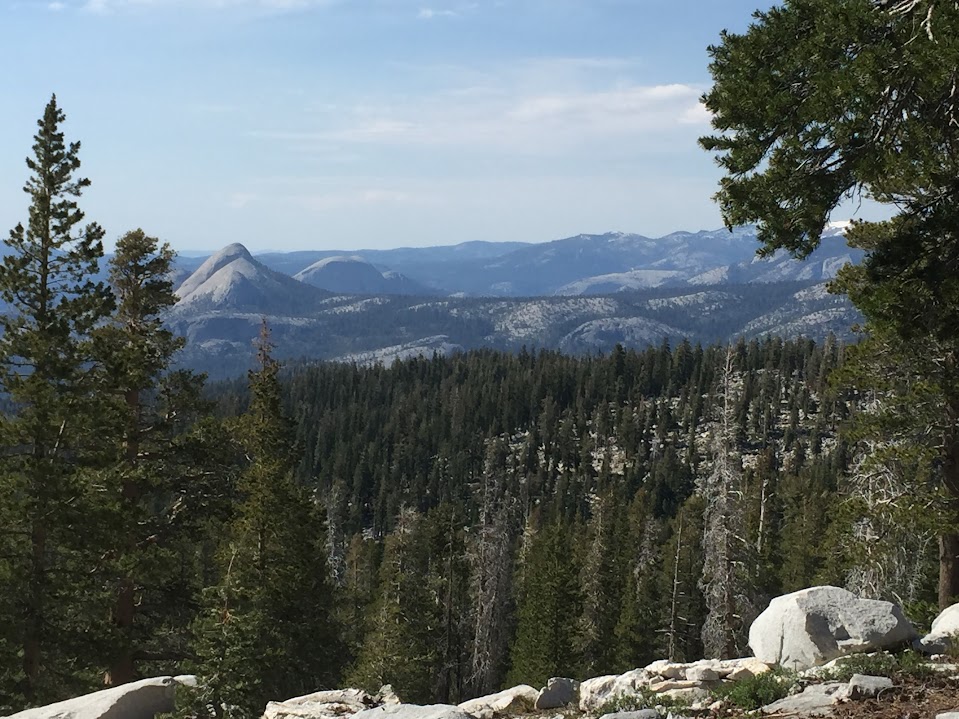
We continued on, and at the junction to the trail to Glacier Point the view to the north opened up. This was the first time for me seeing some easily-recognized icons from this angle:

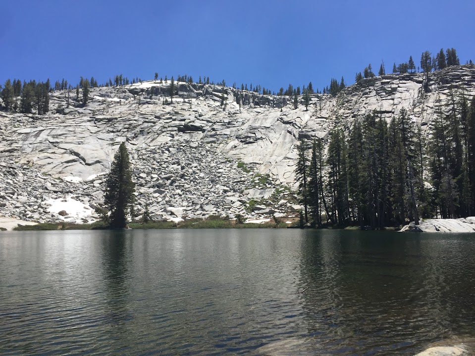
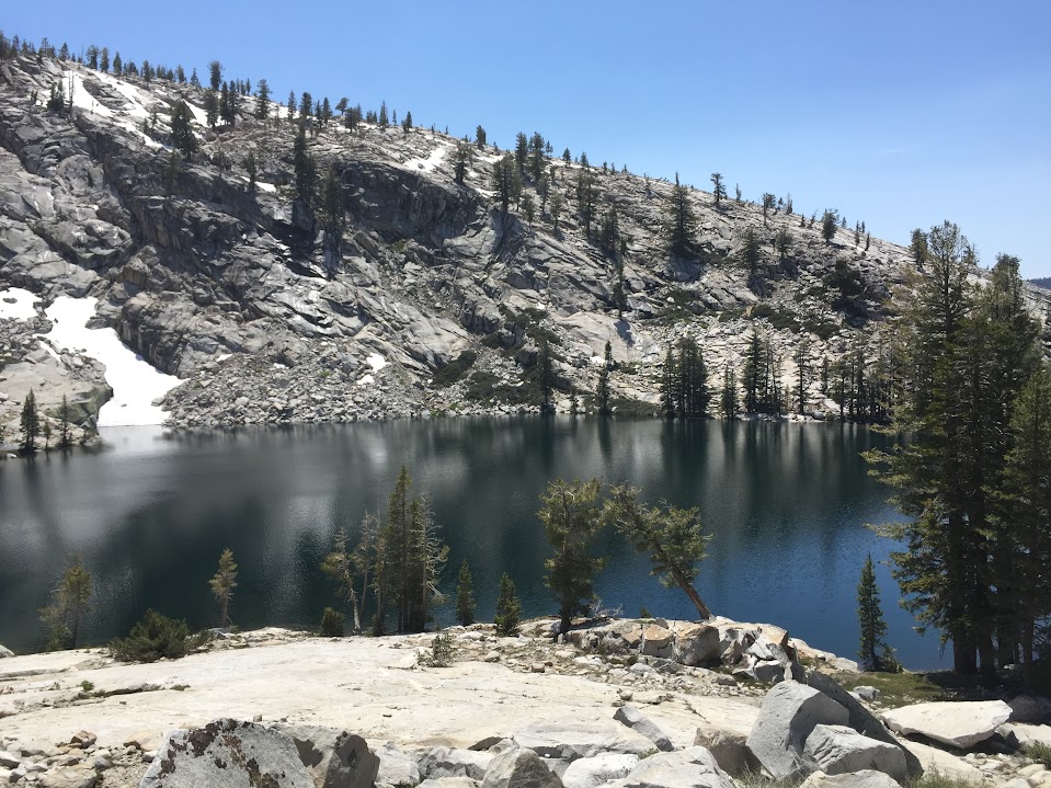
We had not seen anyone since breaking camp that morning - a benefit of the XC travel. Returning to the trail to BV Lake we passed a group of three people who volunteered that Buena Vista Lake is beautiful! - and mostly ice and snow. After finding a suitable camp site in about 40% snow coverage (elevation: 9077') we relaxed and enjoyed a bit of alpenglow. We saw many (hungry?) trout patrolling the 10' wide northern perimeter of the lake that was not under ice but didn't get out the fly rod. The snow covering the granite leading to Buena Vista Crest continued down onto the ice on the opposite shore and made for a beautiful evening view:

We had been given ample chance for a good view of the crest and the next morning decided that without crampons, ice axe or any other equipment we'd avoid the temptation of exceeding acceptable risk and opt for plan B. We decided to visit the area north of the crest, which has several lakes, granite, and allowed for more XC adventure. Heading north on the trail out of BV Lake I noted that rather than an "outflow stream" from the lake, it was more like a "wide sheet of water" - which would be repeated several more times on this trip:

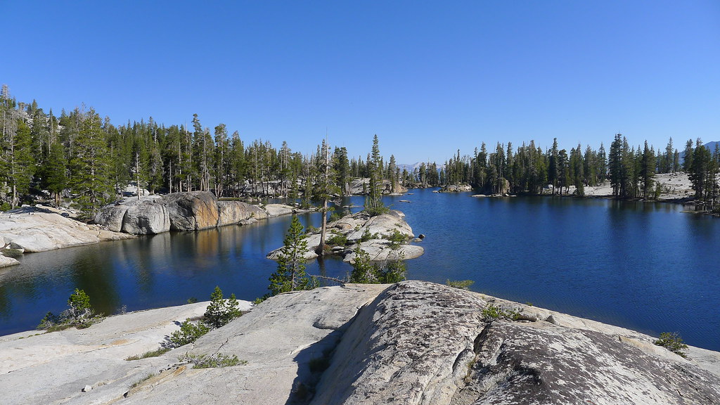
Leaving the trail to the east we chose to stay high and enjoy a boulder scramble along the edge of a granite ramp, and eventually reached our first lake:
As we arrived, I noted that it would have been an easier route to have lost more elevation and stayed in the flatter wooded area longer, then ascended directly back up to the lake level. I noted this for future reference. We had a nice lunch and continued on. We enjoyed the views to the north, perhaps a tease of what is in store for us when we return and walk the crest as originally planned:
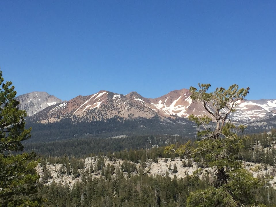
Much less snow on the southern face of Red Peak compared to others' pictures of the northern face this same week:
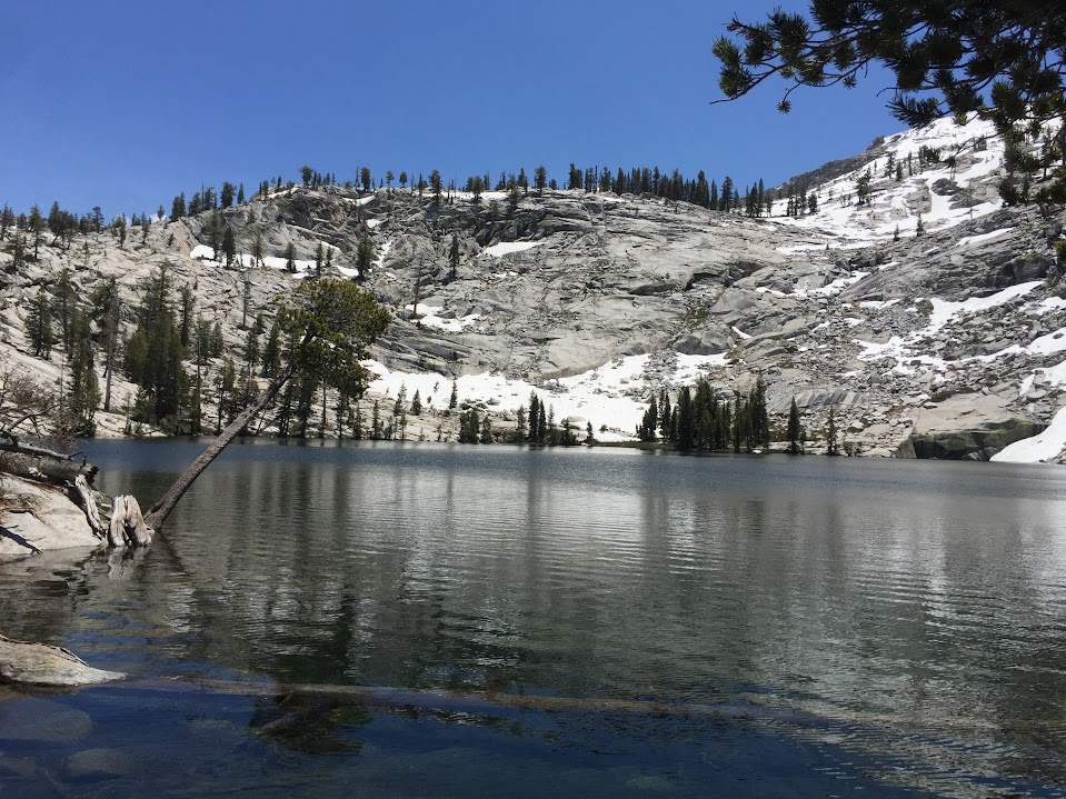
We eventually stopped looking around long enough to walk to the next lake, where we stopped for the night:

The next day we continued XC along and below the crest to another lake. This time, remembering the lesson from the previous day, I opted to take the low route, losing elevation for flat terrain and climbing back up later - rather than traverse the granite slope as I had eventually regretted. This required that we cross the outlet stream and then climb back up to lake level. After a reconnaissance mission, route selection, and backpack shuttle we reached the lake. And I decided it would have been much better if we had traversed the granite slope. Oh well, it was beautiful anyway:
After a relaxing lunch, and catching (and releasing) 5 fish in 10 minutes (they apparently hadn't had much to eat all winter...) we went up-and-over the ridge to the next lake. View looking back on this nice little lake:
The last unknown on this XC section was the final segment to Lower Merced Pass Lake. The BV Crest watched over us as we made our way east:
And we continued to get new views of old friends:
We reached Lower Merced Pass Lake as our final stop for the day, our first time here. On a previous trip we headed east from Merced Pass towards Ottoway Lakes. Despite being "on the trail", we had it all to ourselves. It was not our favorite, being somewhat swampy - but few flying insects, remarkably. I hunted around for a while but found no airplane parts nor other artifacts :-) I guess I'm about 35 years late to that party.
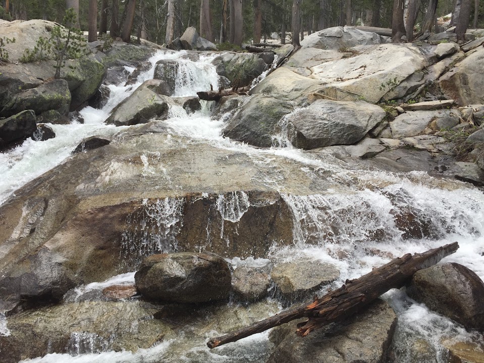
The next day before strapping on the backpacks I scouted a route across the lake outlet to the trail. As we had seen before, the "outlet" was really a sheet of water flowing downhill with a few dry areas in between. I eventually made it across, but decided it preferable to stay on the original side and rejoin the trail further north. It was another fun XC adventure with innumerable cascades, small falls and water features:
Edit: shortly after rejoining the official trail north of Lower Merced Pass Lake we crossed the Illilouette. This close to the headwaters I expected it to be much easier than our crossings of Chilnualna Creek earlier on this trip. As a data point (which is likely already irrelevant a week later as conditions seem to be changing so quickly) the crossing was pretty wide and not deep - only about knee high or a bit above. However, the water was very fast, and although there were no falls nearby to be tossed over, it was not far from what I'd consider a reasonable limit for safety. At that flow another foot of depth would probably have made it very sketchy. And even just being tossed along the rocky bottom would not be fun.
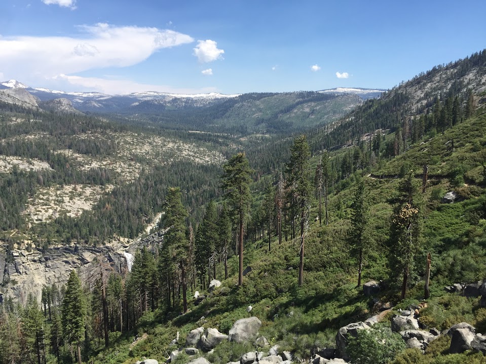
At this point I began to formulate a theory about why the mosquitoes had not been unbearable at the previous lakes: it wasn't that they were gone, it was that they hadn't gotten there yet. As we descended down the Illiloute the flying pests increased dramatically. Still, they weren't unbearable (requiring donning of the very annoying head nets) as they could well have been with all the water around. This was also our first time along this trail and it did not disappoint. More views from new angles, and the clouds punctuating the pristine blue skies added to the beauty:

The previous night we had conducted a rain-fly fire drill. It's always laid out just in case, and this was a reminder of why. The cloudburst had been short enough to not be too much of a soaking bother, but long enough that without protection it would have made our down gear pretty useless. The skies today offered full compensation for our effort and we had no complaints:

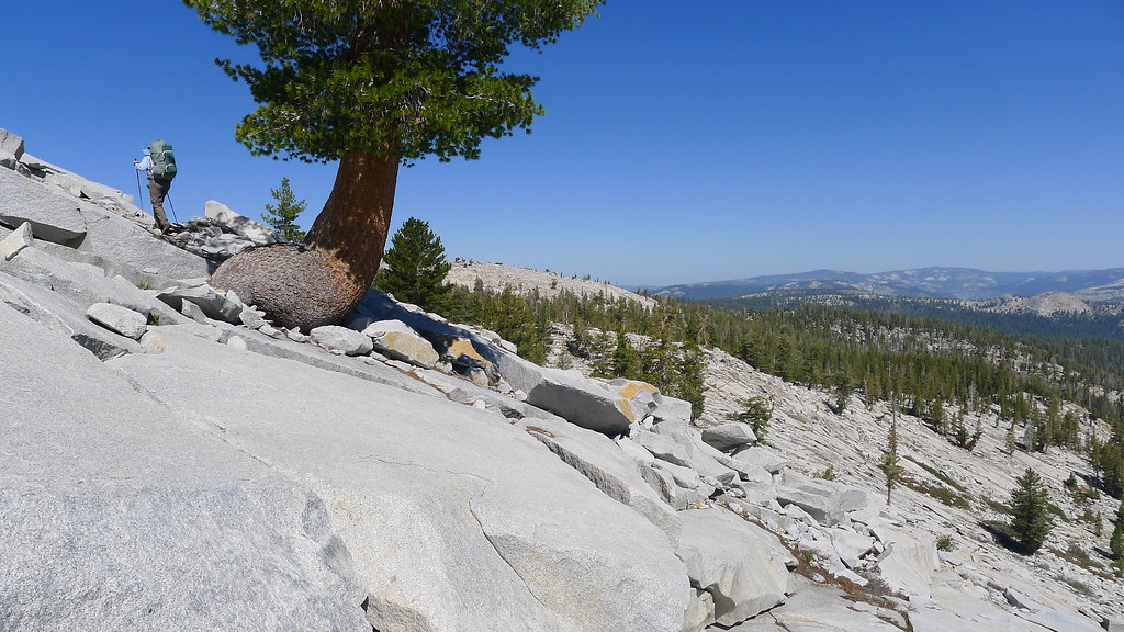
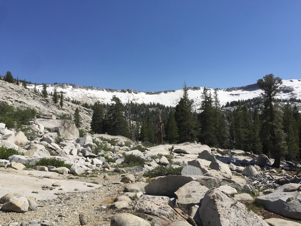
I was surprised at the variety of topology and flora along this trail, and enjoyed the unpredictability of what was around the next rise, bend or slope. Not only granite, but also pleasant, shaded sections of open forest:

I did not expect to see that a very large portion of the canyon containing the Illilouette showed signs of recent fire events. Others here can probably detail each one.
Edit: After one last night in the wilderness we broke camp and set out in our water shoes, as our last fording of the Illilouette was just around the corner. This crossing is near the junction of trails leading to Mono Meadows, Glacier Point, Buena Vista Lake and Hart Lakes. Since we had been lazing around camp doing nothing but enjoying being out in nature (read: avoiding leaving), our crossing was a little after noon. Unexpectedly, despite being downstream of many other streams joining the flow of the Illilouette, it was easier than the first crossing just north of LMP Lake. The water was deeper - about hip-high - but the creek was much wider here, and the flow was slower. FYI - and again, probably already out-of-date.
I was able to (finally) determine the source of a sweet scent that we enjoyed many times. I'm not sure what it is, but it looks like a form of azalea - I'm calling it "Mountain Azalea" until I learn better. It's better than anything that comes in a bottle, particularly against the background of that sweet Sierra smell of granite, dirt and needles that I crave so much during the winters:

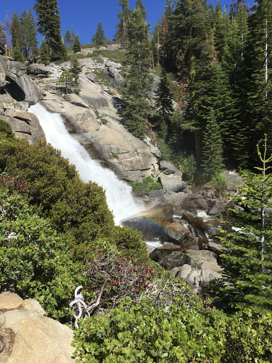
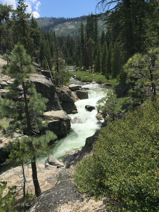
Not to disappoint, the Illilouette did provide spectacular water features as it coursed down its path - I wonder when -- or if -- I will ever see this amount of water here again:
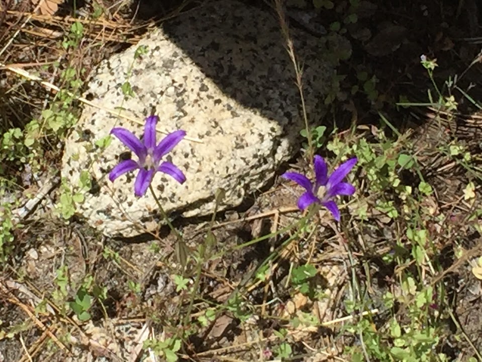
It wasn't all water and granite; the wildflowers were abundant throughout the trip, as if it were Spring. This is the first I've noticed this specimen, looking like a violet-colored day lily:
As we continued along the trail the biggest challenges were: a) dealing with the inevitable but sad reality that our adventure was almost over, and b) trying to not take pictures of every new vista:

Looking back up the Illilouette and it's unusual 90-degree bend before falling:
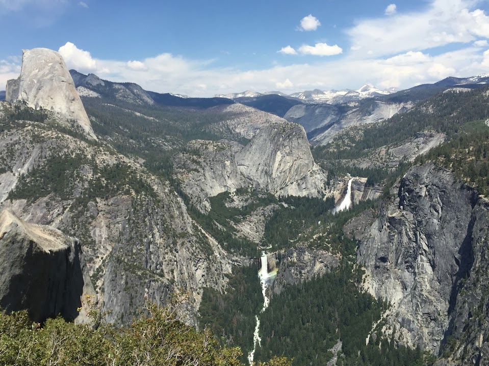
...and the singular beauty of the well-known falls, iconic granite domes and distant peaks - when can we go back?
Edited 5 time(s). Last edit at 07/18/2017 03:09PM by ags.