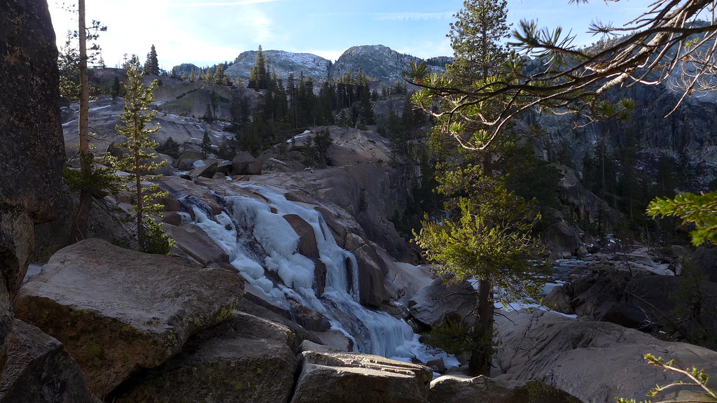
Headed up to the Eastern Sierra on Memorial Day.
Thought about hiking up to Green Lake Bishop, but there was more snow than I wanted to deal with.
https://www.youtube.com/watch?v=M7wkI_G39Yc
Checked out the Gable Lakes trail at Pine Creek
https://www.youtube.com/watch?v=J9mQ5gsVYA8
Headed up to Tuolumne and looked around Tenaya Creek and Polly Dome.
https://www.youtube.com/watch?v=SlDBdrI0ZmA
https://www.youtube.com/watch?v=VdQyivfHUmQ
https://www.youtube.com/watch?v=Tt6KzVa_aSA
Went to Waterwheel the next day.
Wasn't flooded too bad around Mattie Lake Falls. Stayed dry weaving around and crossing downed logs.
https://www.youtube.com/watch?v=c9eoKbqX6CI
https://www.youtube.com/watch?v=-Lnz4n_XyHk
https://www.youtube.com/watch?v=lsUPimcOvHg
Went to Big Pine on the way home
https://www.youtube.com/watch?v=6gAHmxy2RAc
https://www.youtube.com/watch?v=EIPkTd-0jNQ
https://www.youtube.com/watch?v=HQif65Cpx-Q
Waterwheel n More
All posts are those of the individual authors and the owner
of this site does not endorse them. Content should be considered opinion
and not fact until verified independently.
June 12, 2018 04:27PM | Registered: 12 years ago Posts: 578 |
|
Re: Waterwheel n More June 12, 2018 07:09PM | Registered: 9 years ago Posts: 406 |
June 13, 2018 06:05PM | Registered: 12 years ago Posts: 578 |
|
Re: Waterwheel n More June 12, 2018 08:50PM | Registered: 12 years ago Posts: 953 |
June 12, 2018 09:02PM | Moderator Registered: 14 years ago Posts: 7,421 |
June 13, 2018 05:36PM | Registered: 12 years ago Posts: 578 |
Oh Man, I get so confused in the GCT. I thought the bottom of that cascade looks like the bottom of Waterwheel. So many cascades on the Tuolumne that it gets kind of mind numbing.
First went to the GCT about 15 years ago. We reached California Falls, and a friend didn't want to go any further, and we thought oh that must be Waterwheel.
Returned in 2011. Definitely went past Wildcat Point and the big bend in the Tuolumne. Very aware of all the confusion between Le Conte and Waterwheel.
Didn't make it back until this year. Wasn't planning on doing the GCT, but turned out to be a great early season hike. No wonder I keep missing the spur trail to Le Conte Falls.
Any specific info on finding spur trail to Le Conte? Don't need too much excuse to get back to the GCT, because it is always incredible. Hopefully won't be more than a couple of years.
June 19, 2018 01:46PM | Moderator Registered: 14 years ago Posts: 7,421 |
You'll spy LeConte before Waterwheel. There's a spur that is pretty obvious.
You know you've reached Waterwheel when you hit the LARGE switch back heading to Return.
Lots of open and switchers after that.
This spot above Waterwheel should be "obvious"
https://mappingsupport.com/p/gmap4.php?ll=37.927853,-119.458763&z=16&t=t4
The spur to LeConte is here:
https://mappingsupport.com/p/gmap4.php?ll=37.924181,-119.451703&z=16&t=t4
Good luck
If this post is obvious.... sorry... you asked a question... and it deserved at least some sort of response imo

Edited 1 time(s). Last edit at 06/19/2018 01:47PM by chick-on.
You know you've reached Waterwheel when you hit the LARGE switch back heading to Return.
Lots of open and switchers after that.
This spot above Waterwheel should be "obvious"
https://mappingsupport.com/p/gmap4.php?ll=37.927853,-119.458763&z=16&t=t4
The spur to LeConte is here:
https://mappingsupport.com/p/gmap4.php?ll=37.924181,-119.451703&z=16&t=t4
Good luck
If this post is obvious.... sorry... you asked a question... and it deserved at least some sort of response imo

Edited 1 time(s). Last edit at 06/19/2018 01:47PM by chick-on.
June 19, 2018 05:59PM | Registered: 12 years ago Posts: 578 |
Sorry, only registered users may post in this forum.


