
xxxxxxxxxxTwin Lakes > Barney Lake > Peeler Lake > Kerrick Meadow > Seavey Pass > Benson Lake…
xxxxxxxxxx…then I tacked on a night at Rodgers Lake and an ascent of Volunteer Peak…
xxxxxxxxxx…then continued the loop Smedberg Lake > Benson Pass > Matterhorn Canyon > Burro Pass > Mule Pass > Crown Lake > exit Twin Lakes.
Total distance is around 53 miles, with about +/- 13,500 ft elevation gain/loss, with full days typically over 2,000 ft up and down. I took 6 nights, which, with the Rodgers/Volunteer add-on, was a very good pace for me. My specific itinerary was:
xxxxxxxxxxSUN 7/18 – Twin Lakes to past Barney Lake (half day)
xxxxxxxxxxMON 7/19 – Peeler Lake, Kerrick Meadow, Seavey Pass
xxxxxxxxxxTUE 7/20 – Benson Lake, Rodgers Lake
xxxxxxxxxxWED 7/21 – Volunteer Peak, Smedberg Lake
xxxxxxxxxxTHU 7/22 – Benson Pass, Matterhorn Canyon
xxxxxxxxxxFRI 7/23 – Burro Pass, The Sawtooth Range, Mule Pass, Crown Lake
xxxxxxxxxxSAT 7/24 – To Twin Lakes, exit (half day)
I ran up against the length limit for this forum so had to post by trip report in three parts. This is part 1, here are links to part 2 and part 3.
If you’ve read my previous trip reports, you know that I have had problems with getting sick early in my past trips and then continuing to have no appetite even after feeling better, so basically not tenable for a weeklong trip.
So this time I was determined to ease myself into this trip to prevent what has made me sick in the past, which I believe to be a combination of causes that compound each other: altitude, dehydration, dry air compared to back home, over-exertion, and electrolyte loss. I’ve been joined on the first few days of past excursions by some famously feathered forum members, and keeping up with them on the first day of those trips took its toll on me.
So I really planned to ease myself into trail conditions this time. On my travel day to the West Coast I purposely camped at Kennedy Meadows in order to sleep at 6200’, then got to Twin Lakes and spent an easy day there to sleep at 7100’, then only a half-day for first day on the trail, keeping myself to about 5 miles and camping at 8300’. And it worked! This trip I didn’t get sick, once acclimated I could do full hard days, I was able to stick to my itinerary, I maintained a semblance of an appetite, and I had a glorious time!
CONDITIONS
Water was plentiful on this loop, which passes about 10 large lakes and tarns with clear water (and a few other murky ones), the trail usually is following along a major creek, and there were countless streams, rivulets, and generally water was very available.
Weather mostly was great – high temps on the trail (9k-10k) were high 70s to about 80, nights were cool but not terribly chilly, probably no lower than mid 40s. It rained the first night on the trail and on-and-off the next day, then clear skies for several days, with the last full day of the trip clouding up but no rain, and smoke from the recent fires only beginning to roll in on my exit day, which was less than half a day on the trail.
There’s not a lot of shade on this loop, I would estimate about one-third of the trip is shaded and two-thirds exposed. Glad I had my trekking umbrella, and I had it up and attached to my shoulder strap pretty much the entire trip.
Trail conditions varied. It is mostly very easy to follow, but it does get hard to find in places. Surprisingly little blowdown on the trail to contend with.
Bugs were not a big problem on this trip, but good campsite selection is key.
FRI 7/16 – FLY TO SMF, DRIVE TO KENNEDY MEADOWS
The trip started with a long day of travel from Atlanta to the Sierra. Cross-country flight ATL-SMF, then got a rental car and drove to visit Old Dood and then out Hwy 120 / Hwy 108 to camp at Kennedy Meadows. I got there close to 6:30p, and I had woken up that morning at the equivalent of 1:40a PDT, so I was tired. I had dinner at the KM restaurant and then camped at the trailhead parking area -- not exactly picturesque, but it served the function of sleeping at an altitude that I could handle but still high enough to start acclimatizing.
SAT 7/17– HANG AT TWIN LAKES
2 miles
+/- 200’
(all mileages and elevation changes based on Caltopo)
This was a lazy day, I only had another couple of hours driving to get up and over Sonora Pass to Twin Lakes. This drive along 108 and then 395 is stunning:


I stopped in Bridgeport at Jolly Kone for a quick breakfast and photo op:

Once at Twin Lakes I picked a campsite, had lunch at the Mono Village café, then did a little dayhike along the eastern shore of upper Twin Lake. Dinner at the Mono Village Café again.


The Mono Village campground at Twin Lakes is not a great place for backpackers. Sure, it’s nice to have flush toilets and coin showers and amenities on hand, but the place is populated by families in monster 5th wheel RV trailers, just a VERY different idea of a “campground” than I was looking for. And dogs – every family there brings a dog, and they bark. A lot. And the sites are slopey, with the expectation that a camper will have leveling legs. But my site was flat enough for my sleep area, and I slept hard that night.
SUN 7/18 – TWIN LAKES TO PAST BARNEY LAKE
5.2 miles
+1625’ / -400’
This was my first day of the actual backpacking trip, and I purposely planned for it to only be about a half day – I didn’t want to over-exert, and I didn’t want to end up gaining too much altitude. So I had a leisurely morning and hit the trail around 11:00a.
I had read that it is confusing to navigate through the campground to the trail. True that the campground is a maze, but I did not have any difficulty finding the trail – from the entry gate there is a main road straight up the middle of the campground that has yellow blazes on the trees that leads right to the trailhead, it was easy to follow that and get out to the trail itself.

The sky was overcast, but it didn’t rain until later that night.
The trail starts off pretty flat, slowly gaining altitude through rolling meadows, and gaining views as well.


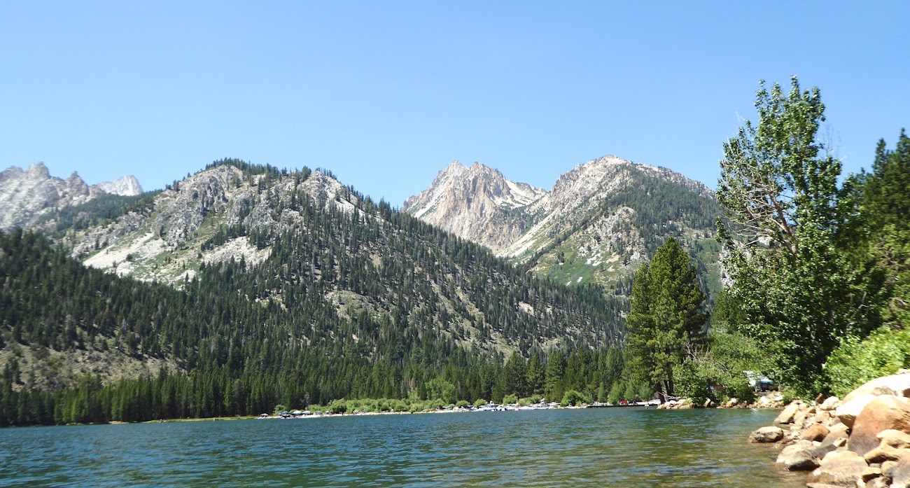
Eventually the climb begins in earnest, and being my first day of any kind of climbing my legs complained painfully, especially my glutes. After about 4 miles the trail comes out to the beach at the north end of beautiful Barney Lake. After a brief rest here I continued on, with the trail climbing 100-200’ above the lake’s western shoreline. South/upstream of Barney Lake is a beautiful, lush meadow.


Made camp by about 3:30 that afternoon in a non-picturesque area just before the Robinson Creek crossing at about 8300’. It rained that night, but after I had gone to sleep.
MON 7/19 – PEELER LAKE, KERRICK MEADOW, SEAVEY PASS
10.4 miles
+2350’ / -1550’
This was my first full day on the trail, finally. I had slept the prior three nights at 6200’, 7100’, and 8300’ without over-exerting, and I was feeling good and was now ready to tackle full, challenging days at altitude.
Ascent to the Crown/Peeler junction is pretty steep with many switchbacks, but somewhat to my pleasant surprise I bopped through it pretty easily – my legs got tired but didn’t hurt this day, which I was very happy about. At some point it started raining, which would be the theme for the day. But I stayed dry under my umbrella clipped to my shoulder strap. The umbrella covered my pack as well, plus its waterproof anyway.
The approach to Peeler Lake:


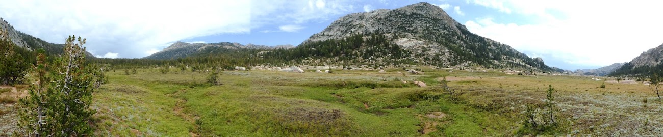
The trail crosses into Yosemite at Peeler Lake’s northwest corner, and soon opens into Kerrick Meadow. The sky was mixed clouds and some patches of blue with waves of rain and occasional thunder, and I wasn’t fully comfortable traversing this open meadow area but went ahead.


At one point I looked back up the meadow and could see what looked like smoke just beyond the meadow. Not sure, but later that day some CCC crews passed me hustling upcanyon. Here are a couple of shots of that:


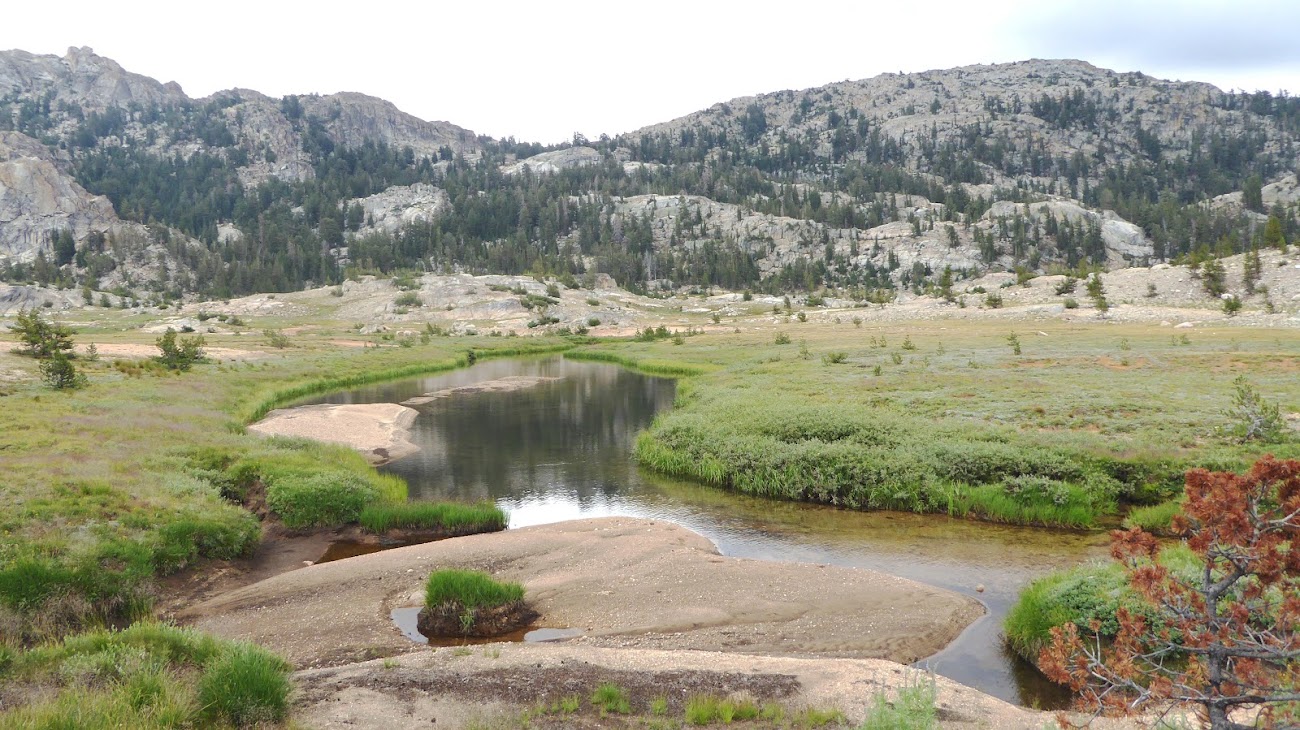
Kerrick Meadow is very nice, but I consider it more a place to churn out some miles, it’s not much of a destination to itself IMO. There’s one point where the meadow chokes down to a tight gorge which is pretty, but mostly it’s open with some interesting but low domes and ridges along the way. And I saw no one all day until beyond the PCT junction.
The trail finally crosses Rancheria Creek and veers to the southwest as Kerrick Meadow becomes Kerrick Canyon, and soon arrives at the PCT junction. The uphill to Seavey Pass immediately becomes steep, and I never knew exactly when I was crossing the real Seavey Pass as there seem to be a few false passes.
As I was going through the Seavey Pass area a helicopter flew directly overhead toting what appeared to be a full water bucket. I think it was traveling roughly east to west, but it’s twisty up there so may have been more south to north. Judging by how far behind the water bucket was trailing, it was crankin’ some serious knots.
Shortly after crossing the real Seavey Pass, the trail heading south comes to a beautiful unnamed lake, where I camped for the night. Even though it had rained a good portion of the day and much of my hike that day was wide-open exposed, my gear and I were dry.


TUE 7/20 – BENSON LAKE, RODGERS LAKE
7.1 miles
+2450’ / -2050’
After the clouds and rain of the previous two days, this day started with a crystal blue sky.
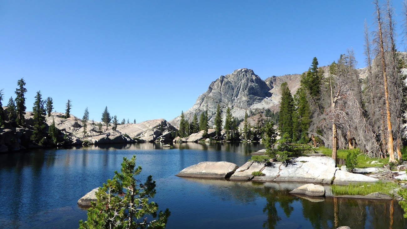
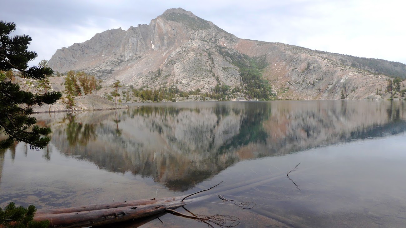
Coming south from Seavey Pass, the trail passes through this wonderful notch that is like stepping through a doorway -- suddenly the views to the nearby south ridge and peaks further east open up.

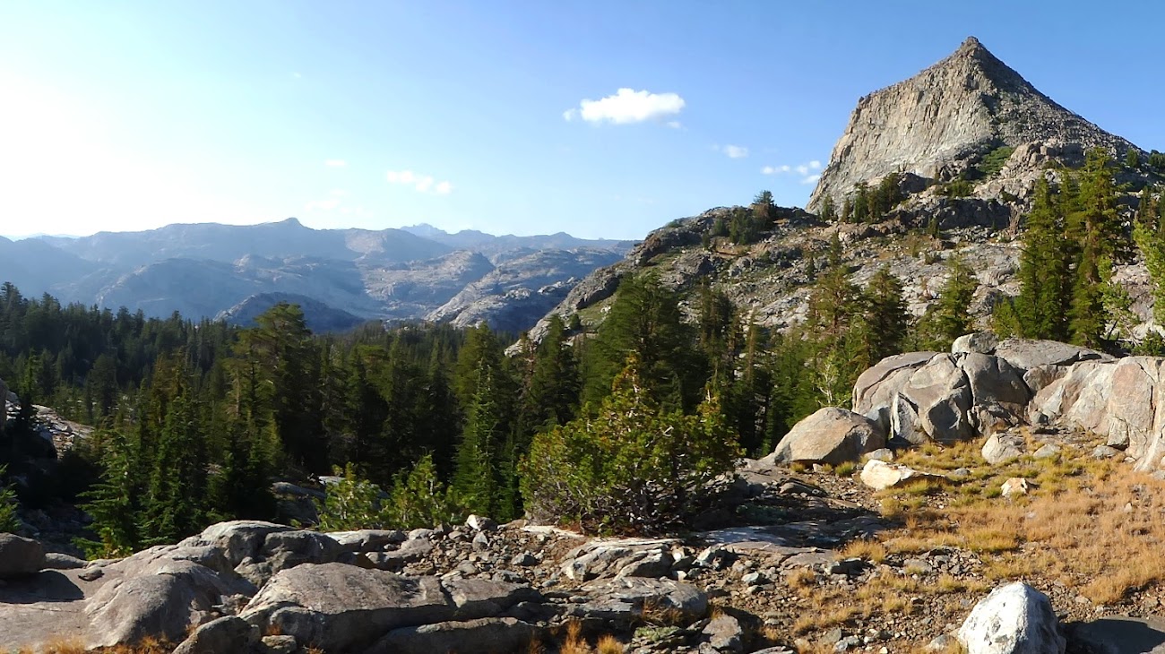
This also is where Volunteer Peak makes its first appearance and will dominate my views for the next 3 days. Looking at it from the west out of Seavey is an intimidating sight for those planning to climb it, and that’s before you remember you have another 1,000’+ to drop before you even start that climb.

The drop down to the flat at the Benson Lake spur trail junction actually went quickly for me. It seemed less than the 1,500 ft it's listed as. Somewhere along this stretch I found a wallet just lying in the middle of the trail. Unsure what would be best to do, I took it with me with the intent of returning it to the owner, but I had 5 more days until I was back to civilization, so when I passed some guys coming the other way who said they would be off the trail in 1-2 days I gave it to them to return to the owner.
And it was on this descent that I first noticed my shoe.
At some point during that morning’s descent, probably the upper rockier part, as I was walking I must have grazed my foot against a sharp rock along the outside of my right trail runner, because the outer mesh was slit open about 2-3 inches. I never really thought about the construction of my shoes before, but now as I examined my shoe I realized that the mesh is mainly what holds the sole of the shoe to my foot. Uh oh, not good. If it stayed the way it was I would be fine, but if walking on it caused the tear to widen I could end up without a shoe. And no I don’t bring camp or water crossing shoes or sandals, so I had no footwear backup plan. I decided to deal with it at Benson Lake, which was coming up soon.
The trail at the Benson Lake junction can be confusing. It didn’t turn me around but a group of 3 I’d seen on and off since that morning made a wrong turn. Coming from Seavey, you are coming down one side of the top of a T, so the trail either goes straight or to the left. Straight is to Benson Lake, but there’s no sign at all indicating what is down that direction. It’s wide and straight and looks like the continuation of the main trail. But, the PCT is the left turn, and the sign for that is set back several yards from the junction so easy to miss if you aren’t looking for it.
I got to Benson Lake around 11am and had the whole beach to myself.

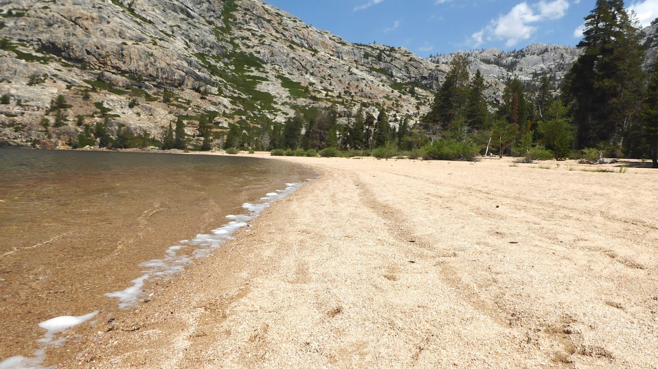


I spent an hour of solitude on the Riviera of the Sierra -- solitude but not all tranquility as I had been worried about my shoe and spent a good amount of time on my first attempt at a repair job using Tenacious tape and duct tape, neither of which stuck to the shoe’s mesh very well, and the tear was near the outside of the ball of my foot so flexed with every step I took, further challenging any tape to stay on.
.
Next comes one of the biggest, toughest climbs of the trip – about 2,000’ in just a couple of miles. It’s a steady climb but not as hard as I'd read others describing it. Relentless switchbacks but a moderate grade and a fair amount of shade along the way.

I was pleasantly surprised at how well my legs were doing – tired yes, but able to keep climbing without barking at me. At the top of this big climb I turned right onto the trail to Rodgers Lake, which climbs up and over the shoulder of Volunteer Peak down to Rodgers Lake, affording views of Volunteer more from the south.
Dropping down to Rodgers:
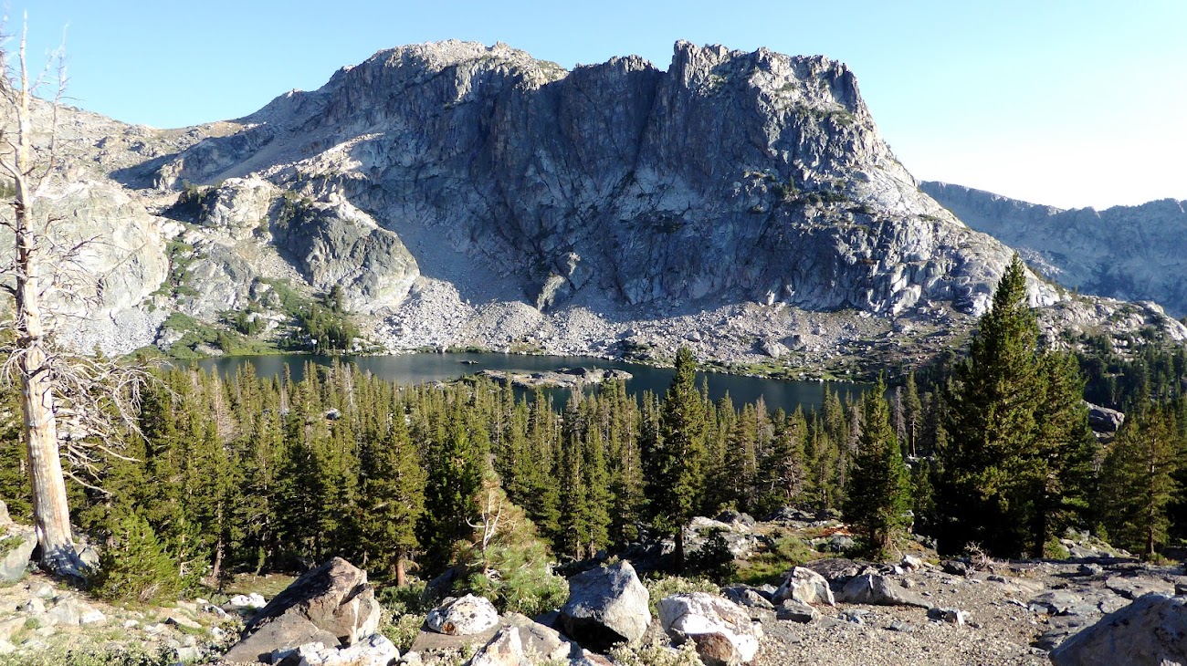
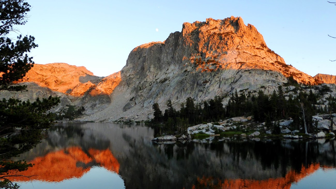
I was the only one at Rodgers Lake and set up camp on the north shore atop a rock promontory above the established campsites down in the flat. That slight extra elevation and getting away from the wet flats along the shore kept the bugs at bay. The views of the lake and Regulation Peak are spectacular.
This trip report continues here.
- Billy Joel
Edited 11 time(s). Last edit at 08/16/2021 07:22PM by JRinGeorgia.

