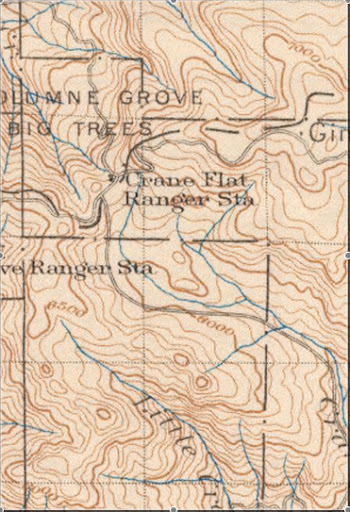
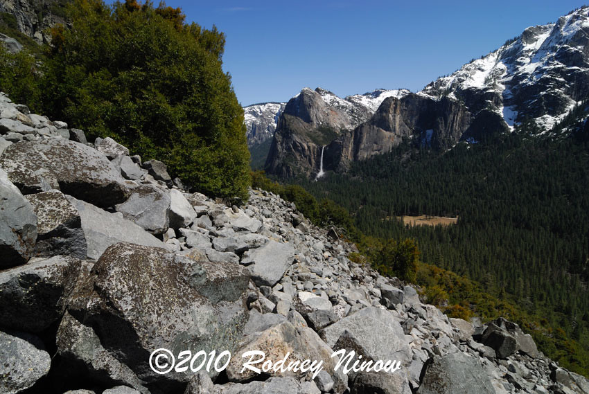
You want a hike that isn't overrun with people? This one qualifies, though it is on the sunny side of the valley and should be avoided on very hot days in the summer. The bottom mile qualifies as a great short round trip hike in its own right, as it provides the best view in the Valley of Bridalveil Falls, and is free of snow except in the depths of winter.
Feel free to add some photos taken yourself when you did this hike. mrcondon posted some from this hike on the recent Coulterville thread, though his first photo (of Tamarack Creek crossing) is on a different trail. http://yosemitenews.info/forum/read.php?3,26509,26517#msg-26517
History: The Old Big Oak Flat Road was the main road into Yosemite from the north until the new Big Oak Flat Road (Rt. 41, Valley to Crane Flat) was built. At that time it immediately fell into disrepair as a road, because the talus field at the great switchback encroached a bit more every winter. However, it was maintained as a hiking trail long after that time.
There are several books on the history of these roads. This road was built in a race with the Coulterville Road. Both were originally toll roads. The Big Oak Flat Road was longer, but had much better views descending into the Valley. One feature on the road is Rainbow View, which still has a good pipe railing today. Just east of that was the only switchback on the road, and it was a beaut. It was somewhere near here where the famous pioneer hotelier James Hutchings was killed when his team ran away and he was thrown onto the boulders. http://www.yosemite.ca.us/library/yosemite_indians_and_other_sketches/james_hutchings.html
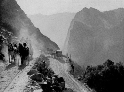
see http://www.yosemite.ca.us/library/one_hundred_years_in_yosemite/tourists.html#page_60
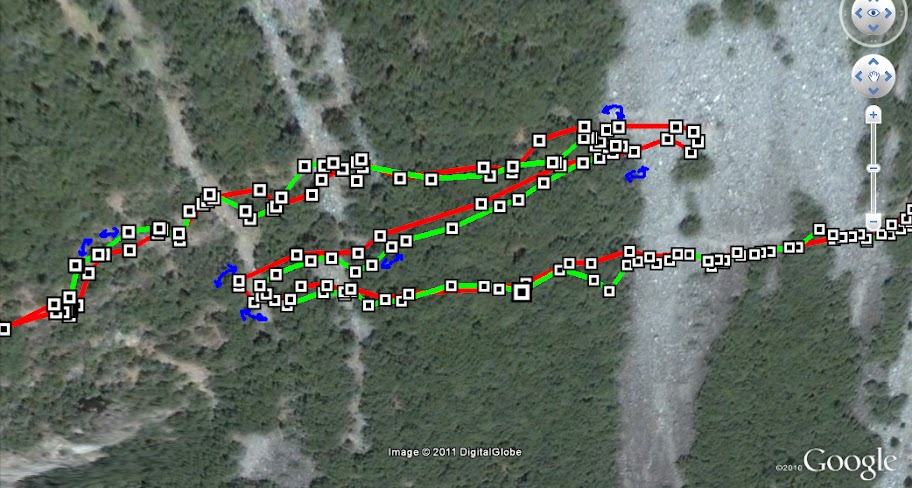
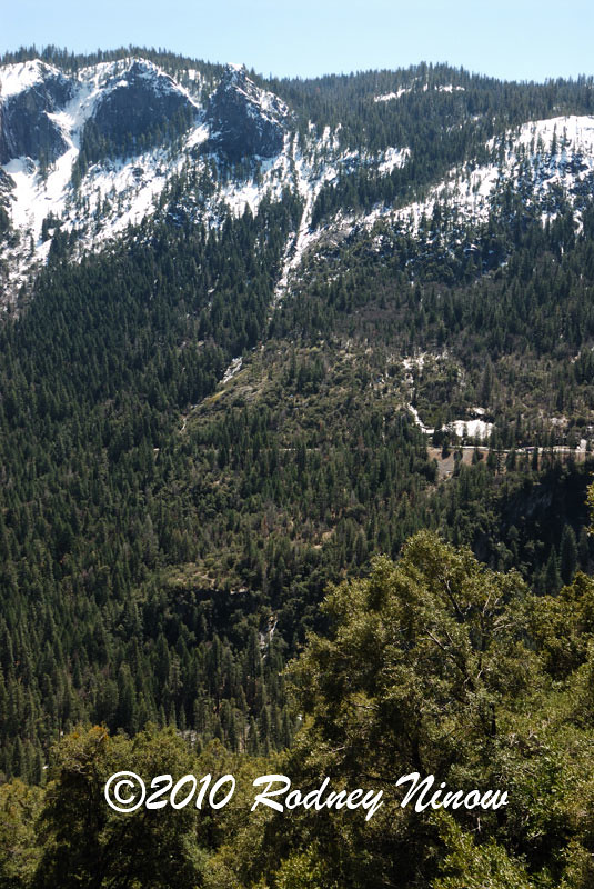
This switchback was situated in a major talus and boulder field. You can still see a bit of stonework just where the turn to the right was located, but otherwise it has disappeared completely. What you need to do here is descend among the talus about 150 vertical feet to the road where it can be seen going into the next band of trees to the east. Since this is where people get a bit lost, here are a couple more figures to give you the layout.
as a map:
http://mapper.acme.com/?ll=37.72558,-119.67175&z=14&t=T
http://docs.google.com/leaf?id=0B9ZDeFswongBYmRlODM3MGEtYTRmMy00NTdiLWJkZmQtNGY5OWVmMjEwY2Qw&hl=en
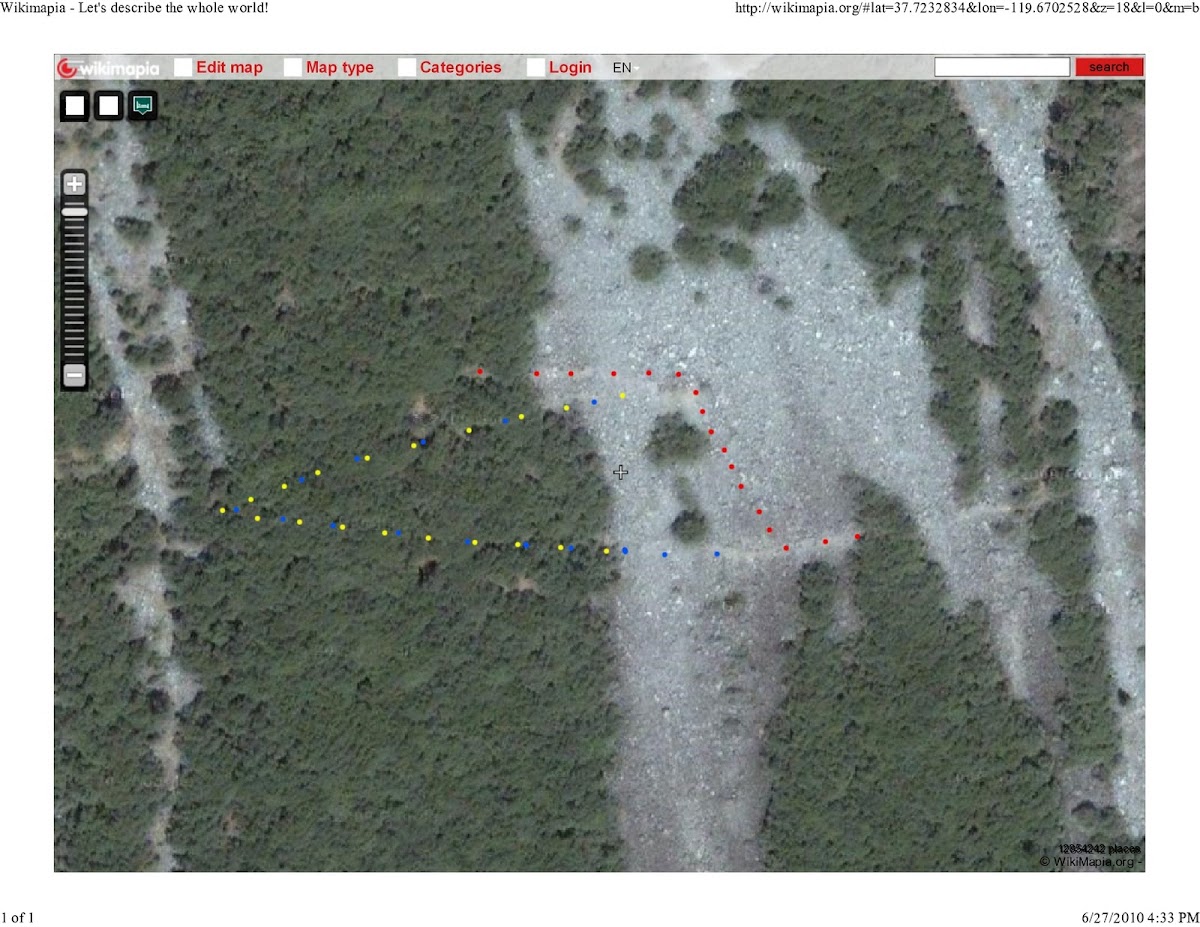
A blowup of the switchback:
http://wikimapia.org/#lat=37.7232834&lon=-119.6702528&z=18&l=0&m=b
The view below shows the foot descent in red and the old switchback in blue and yellow.
http://docs.google.com/leaf?id=0B9ZDeFswongBZWNjZmVjOTItMTcxMi00ZTM1LWEzMjktMjcxMDUyNWIyYThl&hl=en
The 1974 edition of the High Sierra Hiking Guide to Yosemite Valley features this hike as being an easy, mostly asphalt 5 mile walk, with parking at the Cascade Creek crossing. By the 1985 edition, you had to park at the Tamarack Flat Campground, which adds 2.2 miles to the hike, or you can park at the Foresta trailhead, which adds 4 miles. It was still shown as a trail on the 1985 guidebook map. I remember that at that time it was marked "not a trail" by a sign at the top entry (N 37.7345, W119.70455), but someone had still been cutting through the windfalls and trimming the bushes to maintain it as an easy walk.
In recent years, this maintenance has stopped, and the windfalls and brush can slow you down. I would appreciate a comment from some someone who has done the trail this year about how much the trail has deteriorated. In spite of that, there is no route finding problem, except possibly at the missing switchback...see above. The only other obstacle is during high water, when the Fireplace Creek crossing can be difficult because the culvert is plugged. There are a couple of dry washouts, but they are easy enough to get across under normal conditions.
bill_e_q tells me that the rangers still recognize the old road as an off-trail wilderness hike route, and call it "Rockslides". He also mentions that he has posted photos of it in the past, but I haven't spotted those threads yet...
The Valley end is at Northside Drive (Rt. 140) a bit west of Ribbon Creek. Longitude W119.645. However, the park service has been using this area as a dumping ground for trees and windfalls that have been hauled off the roads, and which are left there for park residents to cut into firewood. Just follow the dirt road up the hill until it turns to the west, and you can see the gate that blocks the entrance to the old road.





 (been looking for an excuse to use that particular smiley! I genuinely do admire you guys for keeping such detailed records on this stuff and sharing your knowledge here.) Maybe I'll start a seperate thread about the old Wawona and Coulterville roads just for some variety on this topic!


