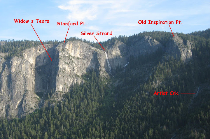
Thanks! I'm thinking specifically of the ones on the south wall of the valley, as I've done some of the ones on the north wall....The south wall is something I've driven by my whole life and never, until recently, considered/thought about ascending, as I'm sure millions of other people have also done.
I'm always looking for new photographic perspectives, and assiduously avoid the photos/places that I briefly mentioned, ala Half Dome from Glacier, etc.... It's like photographing the GG Bridge or the Eifel. Just. Not. Interested.
************
OK. You want to get off the beaten path to take photos. You have mentioned the previous abandoned trails thread, which lists a lot of places to go: thread
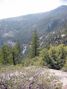
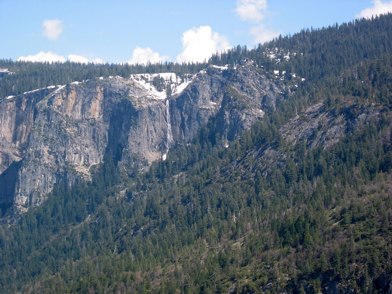
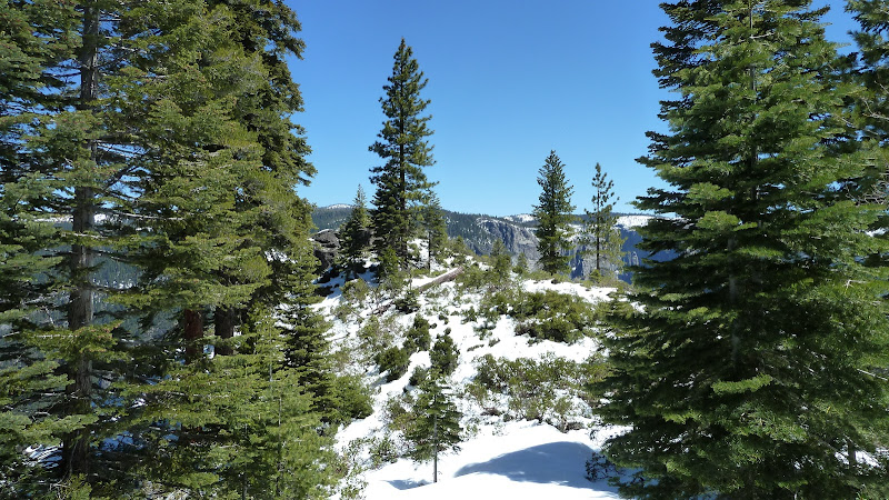
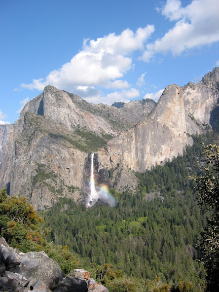
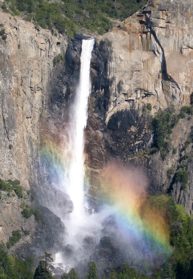
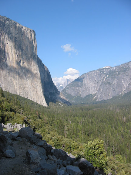
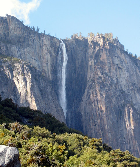
Let's start with a very easy walk that I have mentioned before: The Old Big Oak Flat Road. Doing the whole trail is strenuous, but the bottom mile is easy and perfect for your purpose. You start up the road from the Valley, and almost immediately get above the trees that carpet the valley floor. As you gradually ascend, the view of Bridalveil Falls just gets better and better. You've seen a zillion photos of Bridalveil Falls from the tunnel and from Inspiration Point. But the view from the first mile of the old road is even better. The road is not steep and you can't get lost on this section (before the missing switchback). Here are four views from one point about a mile into the road, taken May 2003. The first two look across the valley:
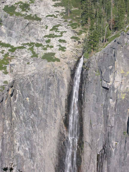
These two are from the same spot on the road. The view on the left show El Cap, the Four Mile Trail, and Half Dome. In the foreground you can see what the old road is like here. The one on the right looks up at Ribbon Falls
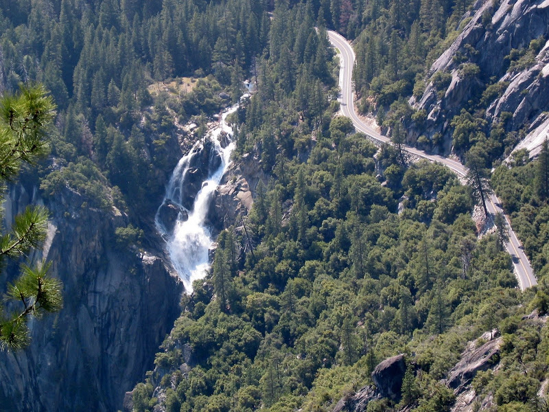
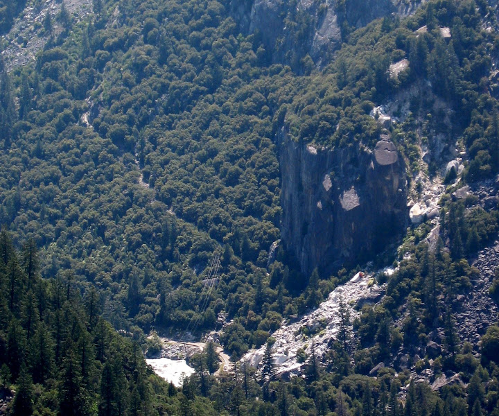
Beyond this point it's not far to the the missing switchbacks. If you continue on past there and past the pipe railing, you get to some valley views that are hard to get anywhere else. Here are two: The first shows the top of the Cascade from a different angle. The second shows the base of the Old Coulterville Road hike. You'll see the river and Highway 140 at the bottom. That big boulder next to the road is a prominent landmark just west of the Cascade bridge and parking lot; there is a fine pullout right there. Millions of people drive by here without realizing that the old road up to Foresta still exists, almost, and is an easy bushwhack hike. You see it ascending up to the left.
Now I have to apologize to tanngrisnir3. He wanted vantage points on the south side of the valley. Perhaps I'll post some tomorrow. Most of my photos are analog and unsorted. I'll see what I can find.