First let me say that if you just want great views, you can get similar ones on the Pohono Trail, from Inspiration Point to Sentinel Dome. The Four Mile Trail and Glacier Point also have some of the best views in the park. So this hike is for fun, more than photography. It will definitely avoid the crowds. Except for a few rock climbers, you won't see another person on this hike. You won't need any equipment. It's just talus-hopping and brush-walking. You can greatly reduce your effort if you look ahead and use good route finding skills. But you can also just bull your way through. Steve Hall recently mentioned that he has done Sierra Point, which is another fine abandoned trail. This hike is just like Sierra Point Trail, except that it lacks the (possibly) exposed-feeling place on that one. However, it is four times as high and will test your stamina. It makes a perfect hike to do on a short day, when you have to leave the valley to go somewhere in the late afternoon.
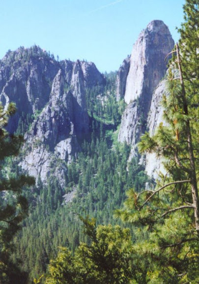
This hike is the climbers' descent route from Upper and Middle Cathedral Rock. You can get to the top of the gully via a long bushy ridge walk from the Bridalveil Creek bridge on the Pohono Trail, but as a hike this trail is usually done round trip from the valley. Here is a very old, low resolution photo of the route:

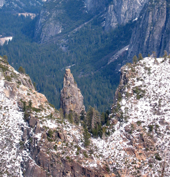
You can see Upper Cathedral Rock on the right, and the Cathedral Spires on the left of the gully. You can just see the ridge above Dewey Point peeking through the notch at the top of the gully. Here is a view of that notch taken from the Pohono Trail near Dewey Point:
That's Upper Cathedral Spire which you are seeing through the notch. Lower Cathedral Rock is on the left. Middle and Upper look fused from this vantage point, but it is actually difficult to get to the summit of the Middle rock...
Route Description
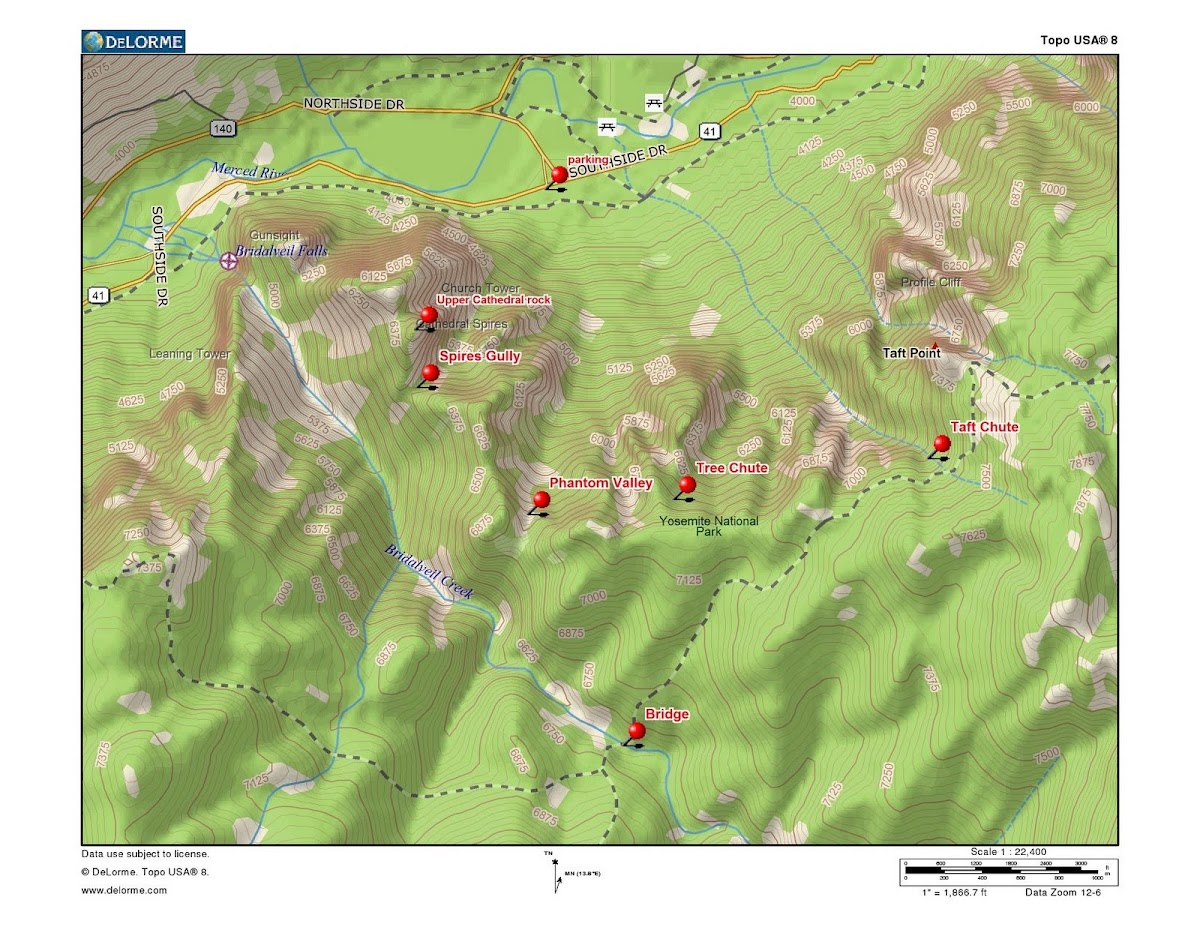
Park at the intersection of South Side Drive and the turnoff to El Cap Bridge. There is a well-beaten footpath that starts at this intersection and heads towards the rocks. It crosses the main valley foot trail and continues towards the gully. Climbers use this trail all the time, and it is easy to follow until you approach the base of Upper Cathedral Rock. From this point, numerous minor trails branch off the the starts of various climbs. You ascend anywhere in the gully, but there is a lot of tedious talus along the right hand side. The best trail stays towards the center of the gully in its top and bottom thirds and near the left side in the center section. When you pass the base of the spires, begin shifting back towards the center. There are ducks and cairns everywhere, so don't try to follow them all.
When you reach the top of the gully, don't scramble up towards the summit on the first slabs that you see . Continue through the notch and a short distance beyond, where you can turn right and ascend the ridge in steep but open terrain. If you continue downhill and to the right from the notch, you can beat your way to the creek, and (in very low water) walk all the way to the falls. Doing that and the summit would make for a very long day. Don't expect to do both.

Keep an eye on your route going up in this section, because it is easy to get too far to the left on the way back down.
You will find that the hike up is strenuous, but it's the hike back down that gets your legs. Also, be very careful of fallen leaves and loose dirt on the trail. Descend carefully. Good luck.


