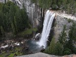
If you look out the window while riding up to Badger Pass, you will see the ridge. It is thinly wooded, not because it has burned over, but because the soil covering its granite heart is so thin. There are patches of trees, but there is also a lot of open space. Here is what you see from your car:

It was the day before Christmas, and the family was skiing at Badger Pass. I took advantage of the opportunity to steal away and check out the upper part of this bushwhack. The plan was to ski up the main road trail from Badger Pass and out along the start of the ridge ski trail to Dewey Point. Most people don't realize that this trail follows the only the right branch of a Y-shaped ridge. The left branch is what I am calling Inspiration Ridge. Here is a map of what I'm talking about. I skied out the marked trail (yellow dots), but turned left at the fork and broke trail for about an hour along the planned route before I had to head back.

You can find the full resolution version of this map at map
Why is this going to be a great summer bushwhack? Well, if you have ever hiked that ski trail in the summer, following the yellow flags up in the trees, you will realize that it's not great. Too many fallen logs and brush, very few views, and too much up and down. Until you reach Dewey Point, of course, where the views of the Valley are terrific. The left fork of the ridge, on the other hand, is much more open. The views are to the southwest, west, and northwest...not the ones that you usually get from Dewey Point. But the ridge is a fairyland of boulders, scattered around on gravel and slickrock meadows. Giant boulders, little boulder, weird boulders. Chick-on would love it.
Here are some photos. The snow was crusty, but there was plenty of it. A larger selection of photos can be found at this album:album
Looking West:

Looking back at Badger Pass Ski Area:

Lunch time:

Typical open forest:

As an aside, another promising bushwack will be the meadows of Meadow Brook. This the creek that feeds Silver Strand Falls. Satellite photos show that It flows through a series of nice open meadows before crossing the Pohono Trail and plunging off the cliff next to Old Inspiration Point. This brook starts at the point on the map marked "1st Saddle". One can just follow the Pohono Trail down to the Valley instead of leaping over the falls....


