Yosemite 2012 trip. Day 2: Cascade Creek to Yosemite Falls
2012 Yosemite Trip, Part 3 (days 3-5): YOsemite FAlls to Olmstead Point and May Lake
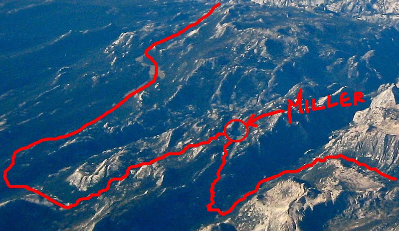
2012 Yosemite Trip, Part 4 (days 6-8); Tuolumne Meadows, Glen Aulin, Cold Canyon, Miller Lake, Matterhorn Canyon, Burro Pass
2012 Yosemite Trip, Part 5 (days 9 and 10): Slide Canyon; Mule Pass; Crown, Robinson, Peeler Lakes; Kerrick Canyon, Peeler Lake, Rodgers Lake
2012 Yosemite Trip, Part 6 (days 11-13): Rodgers Lake, Rodgers Meadow, Pate Valley Grand Canyon of the Tuolumne, Waterwheel Falls, Le Conte Falls, Tuolumne Meadows
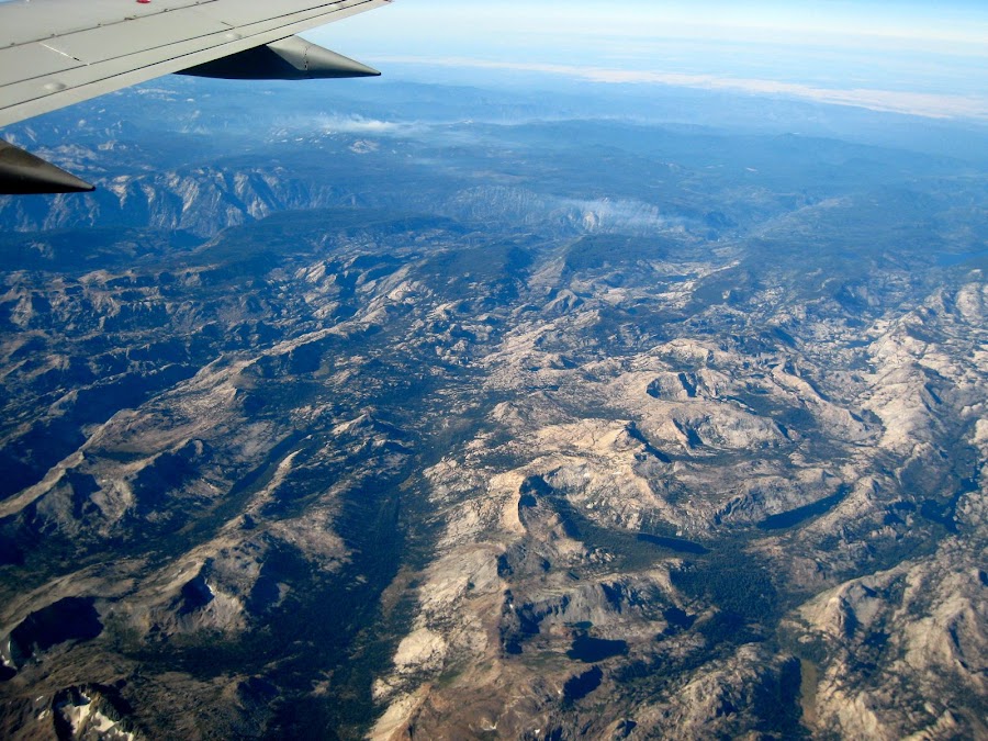
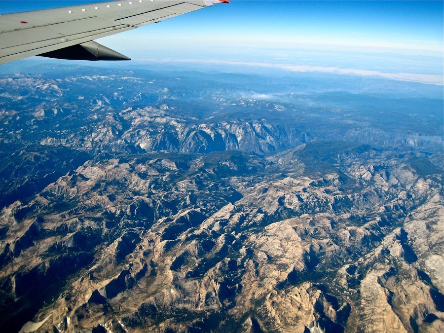
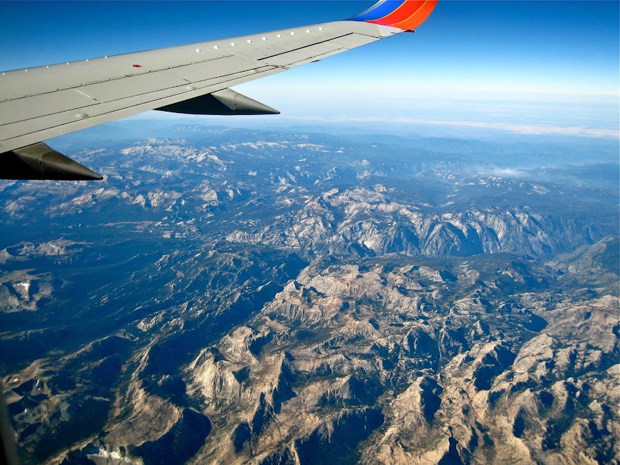
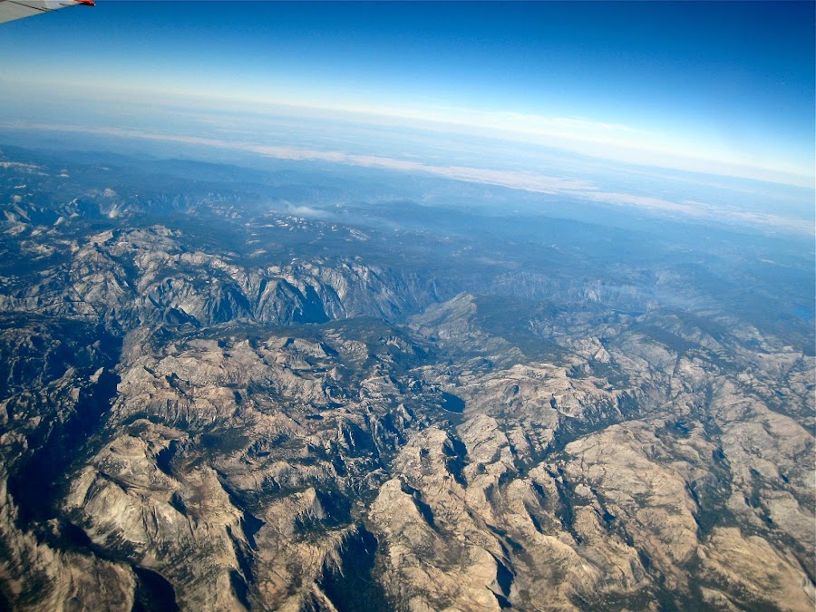
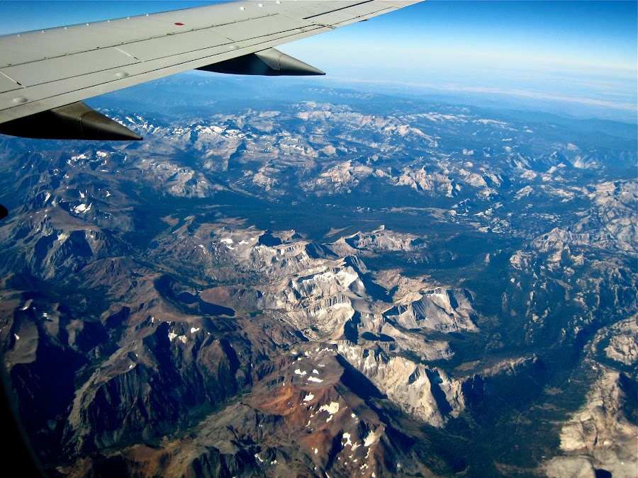
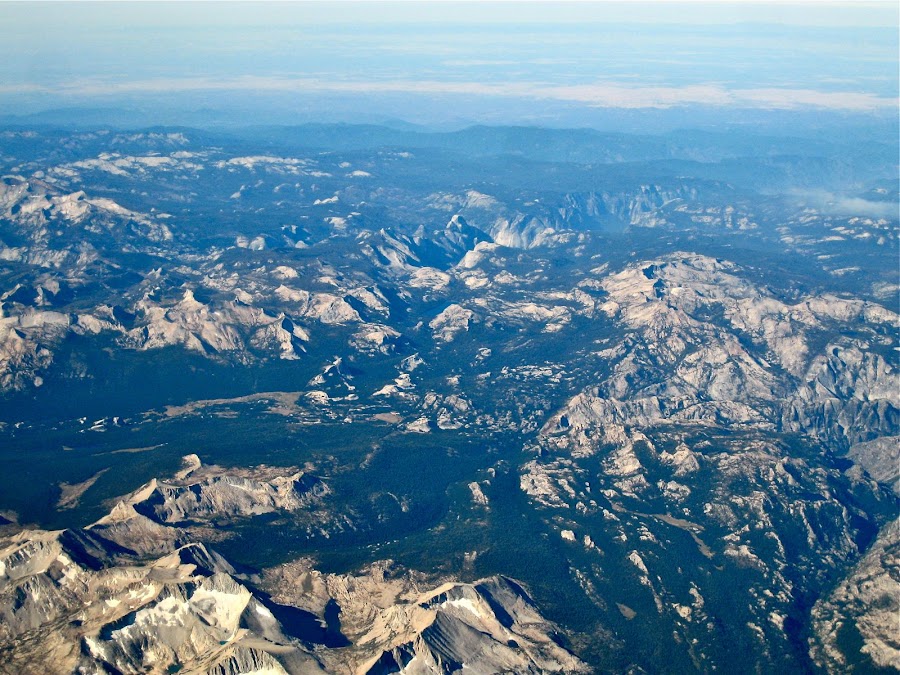
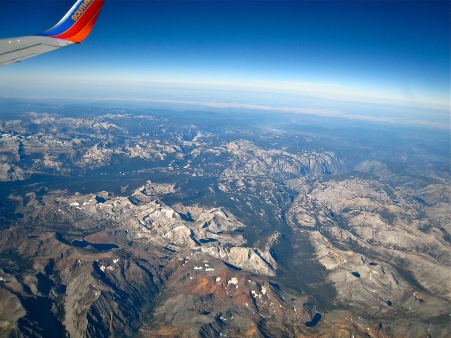
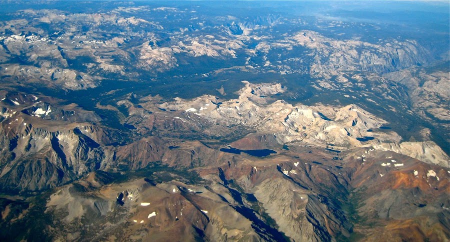
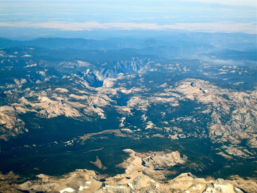
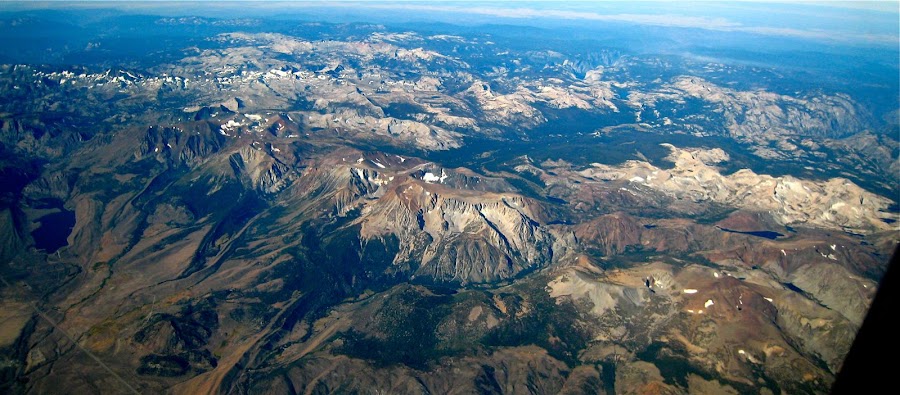
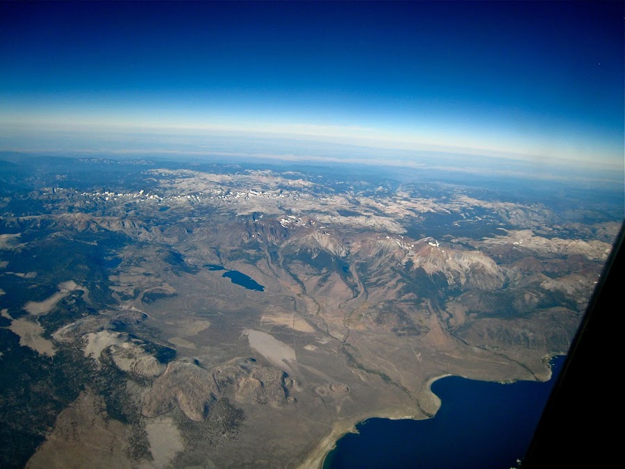
Aerial pics from plane of Northern Yosemite
When I flew into Sacramento on the way to Yosemite from Las Vegas in 2010, I was sitting on the east facing side of the plane and the west-most thing I could see was Lake Tahoe. Heading back, the flight was going to Chicago, and I think I forgot to look or did not have a window seat. This time, heading again from Vegas to Sacramento, I forgot and again sat on the east-facing side of the plane. Again-- Tahoe. But, unlike in 2010, on the way back I connected through Vegas and decided I'd try the west-facing side and see if I could see anything. I almost forgot to look out the window in time. When I did, I was totally disoriented, but I thought the area had potential. I had to start superimposing the maps in my head onto the visual feast laid out in front of me, and at one point I had that "Aha" moment and knew I where I was. It was very cool, because the area of Yosemite that was closest was the northern region -- exactly where we had been tromping around for 8 days, and in the distance the places we had been in the 5 days prior. While I can identify some things in the pics (including the airplane wing), many I cannot yet. I need to get a map out and look at them together. In any case, these are some of the images. They can be found here in full resolution along with a couple others:
Picasa gallery of these and a couple more at higher resolution
Edited 3 time(s). Last edit at 02/18/2023 05:21PM by Frank.


 It too dashed across the trail so fast I could not identify it, about half way down the Piute Creek switchbacks before Pate Valley. It definitely was not a rattler.