
We first followed the Old Big Oak Flat Road ("Rockslides"
 to the Cascade Creek bridge, with a photo break at Rainbow View and a benchmark hunt (successful!) at the former site of the Gentry's Ranger Station. (Hint: once you know where the old station was, the on-line NGS benchmark location info is spot-on...)
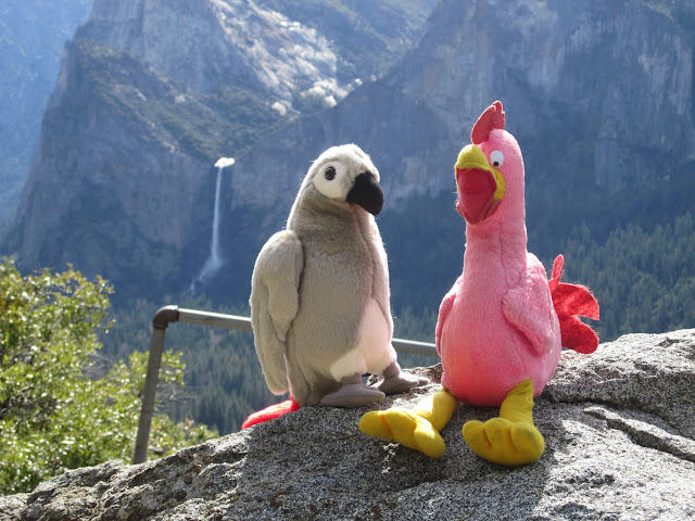
Rainbow View Photosynth
(Apologies: the white balance for many of the photos in this set is off due to an incorrect camera setting--and not because I was going for the faux retro Instagram-sepia look....)
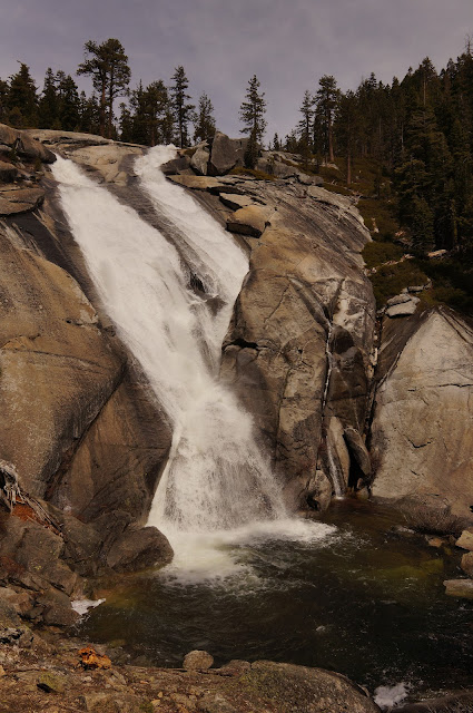
From the Cascade Creek bridge, we checked out an old road spur just west of the bridge--which ended abruptly--before heading up-creek towards some nice falls (labeled "Falls" on the topo map, just over a mile upstream from the bridge). The route was rough in places, but overall not bad.

The falls were definitely worth the scramble:
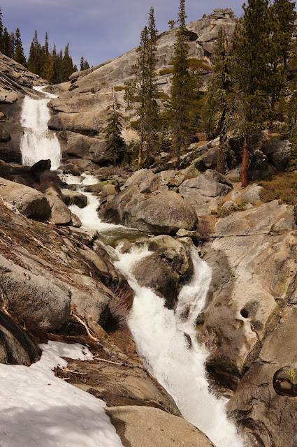
Up to this point snow was not an issue, but above the highest cascade, coverage was almost 100% along the creek. We didn't have snowshoes, but the snow was mostly firm, except when it wasn't... Instead of getting our feet wet crossing the creek, we got them wet trudging through the snow until we found a log that we butt-scootched across (no style points awarded).

From here, we traversed eastward, then descended to a dome that the pink one had camped on previously (it's the dome maybe 1/2 mile SSE of the falls). This dome had nice views back at the falls:

...and, well, everywhere:
Pano From Dome
We had decided to push to camp on the top of El Cap, so we pushed on from this dome, following the ridge north of the El Cap trail past Point 8105, descending to meet the El Cap trail just before the Ribbon Creek crossing. The route had many areas of wonderful open granite:

...some not-so-tell-tale signs of a former trail (has someone been trying to modernize the Mono Trail...?)

...and a burnt-out area near Ribbon Creek (from the Cascade fire from a few years ago?)

The snow was soft and rough near Ribbon Creek, especially after we loaded up with water to haul to El Cap. Fortunately, a log that I had used about a year or so ago provided a dry crossing.
We saw the only people we'd seen since the Rockslides trailhead (apparently local climbing celebrities) just as they were leaving El Cap, maybe 20 minutes before sunset. They were heading for the trailhead...

Although it had been breezy in the afternoon, the wind died down once dark hit, and the night was very calm and restful. I was exhausted after following the pink one around and fell asleep right after my head hit my (inflatable ultralight) pillow.
The next morning, after packing up "Camp Cuben", we followed the trail towards Eagle Peak and Eagle Tower.

Eagle Peak offered excellent views all around, although its claimed benchmark remained elusive:


Eagle Peak Panorama
From there, after a little cross-country travel, we emerged on Eagle Tower with its wonderful views of Yosemite Falls.


Eagle Tower Panorama
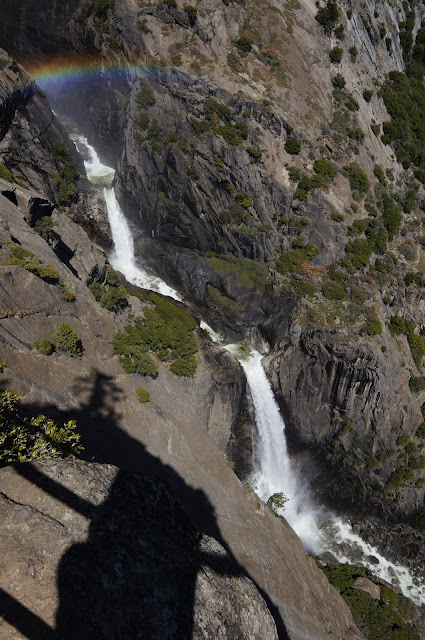
From Eagle Tower, we could clearly see the rigging that someone had strung across the top of the falls, but it was far too windy for anyone to be using it.
After a bit more cross-country and a bit more snow, we hit the Yosemite Creek trail maybe 1/2 mile upstream of the junction at the top of the switchback. This is where we encountered the first people we'd seen since the climbers on El Cap. After checking out the brink of the falls (too windy), we headed down the switchbacks, stopping at Oh My Gosh! Point for some pictures and a final panorama:

Oh My Gosh! View
Although we had encountered a fair amount of snow up high, it was definitely summer in the valley, and many people were taking advantage of the weather to get out an enjoy Yosemite.
Okay, I lied... not so short-ish, but it was a wonderful trip, and I'm grateful to the pink bird for showing me some "off the beaten path" places. Can't wait for the next trip!
More Pictures
Technical Note: Since someone asked about creating Photosynths on a different thread: for the ones above, I used a Sony NEX 5N with either a Sigma 19mm or 30mm prime lens.


