Welcome! Log In Create A New Profile Recent Posts
Tuolumne Meadows and Lembert Dome during a summer storm, Yosemite National Park

The Moon is Waxing Gibbous (77% of Full)

JanSport - Accept no Imitations. The Original Backpack since 1967.


Advanced

Re: 1910? Yosemite Rail Road Map and Brochure

All posts are those of the individual authors and the owner of this site does not endorse them. Content should be considered opinion and not fact until verified independently.

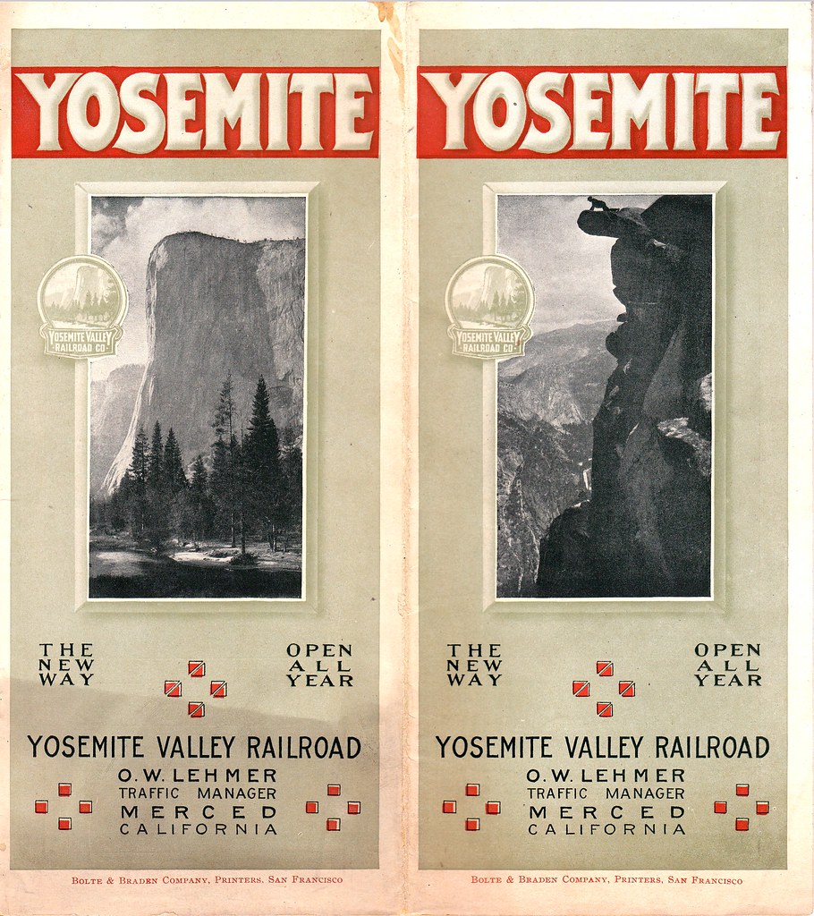
avatar 1910? Yosemite Rail Road Map and Brochure
January 30, 2014 11:03AM


Edited 2 time(s). Last edit at 01/30/2014 11:14AM by thechief.
avatar Re: 1910? Yosemite Rail Road Map and Brochure
January 30, 2014 11:16AM
avatar Re: 1910? Yosemite Rail Road Map and Brochure
January 30, 2014 11:17AM
avatar Re: 1910? Yosemite Rail Road Map and Brochure
January 30, 2014 11:18AM
avatar Re: 1910? Yosemite Rail Road Map and Brochure
January 30, 2014 11:18AM
avatar Re: 1910? Yosemite Rail Road Map and Brochure
January 30, 2014 11:19AM
avatar Re: 1910? Yosemite Rail Road Map and Brochure
January 30, 2014 11:20AM
avatar Re: 1910? Yosemite Rail Road Map and Brochure
January 30, 2014 11:21AM
avatar Re: 1910? Yosemite Rail Road Map and Brochure
January 30, 2014 11:22AM
avatar Re: 1910? Yosemite Rail Road Map and Brochure
January 30, 2014 11:23AM
avatar Re: 1910? Yosemite Rail Road Map and Brochure
January 30, 2014 11:24AM
avatar Re: 1910? Yosemite Rail Road Map and Brochure
January 30, 2014 11:25AM


Edited 1 time(s). Last edit at 01/30/2014 11:26AM by thechief.
Re: 1910? Yosemite Rail Road Map and Brochure
January 30, 2014 02:48PM
Thanks for posting this piece of Yosemite history. I've already downloaded it and placed it in my iPhoto album.
Re: 1910? Yosemite Rail Road Map and Brochure
January 30, 2014 06:08PM
I love that, in the photo just inside the cover, one of the guys sitting in the carriage is holding what appears to be this same pamphlet!


Edited 1 time(s). Last edit at 01/30/2014 06:23PM by DavidK42.
avatar Re: 1910? Yosemite Rail Road Map and Brochure
January 30, 2014 11:29AM
Full size scans can be saved from my Flickr page at http://www.flickr.com/photos/chiefranger/sets/72157640317331676/ I just obtained this great piece of Yosemite history and want to make sure that it does not disappear. So I am making it available to the public. The more it is shared. The better the chances that it will be around for future Yosemite fans to enjoy.
Re: 1910? Yosemite Rail Road Map and Brochure
January 30, 2014 12:50PM
Thank you for posting these.
avatar Re: 1910? Yosemite Rail Road Map and Brochure
January 31, 2014 06:48PM
Thank you, thechief!
Re: 1910? Yosemite Rail Road Map and Brochure
January 30, 2014 02:23PM
Awesome! Bowing to his greatness
avatar Re: 1910? Yosemite Rail Road Map and Brochure
January 30, 2014 08:41PM
The last page has "Hotel and Camp Rates".

This mentions:
)Sentinel Hotel
)Camp Lost Arrow
)Glacier Point Camp
)Camp Ahwahnee

Could I get more info about these, such as their location?

ADVthaAnksNCE
Re: 1910? Yosemite Rail Road Map and Brochure
January 30, 2014 09:03PM
If I remember correctly Sentinel Hotel was near the current Sentinel Bridge in the area that is referred to as the "Old Village". If you look carefully you can still see a section of an old sidewalk between the sugar maple tree and Sentinel Bridge.
avatar Re: 1910? Yosemite Rail Road Map and Brochure
January 31, 2014 11:32AM
There's a sign there also which has a map of the old village. I can post it here if desired later.

EDIT:

Take a look here... some nice maps:
http://www.yosemite.ca.us/library/guide_to_yosemite/yosemite_village.html#map_of_yosemite_village

and

http://www.yosemite.ca.us/library/auto_tour/yosemite_valley_map.html


Chick-on is looking at you!


Edited 1 time(s). Last edit at 01/31/2014 03:36PM by chick-on.
Re: 1910? Yosemite Rail Road Map and Brochure
February 05, 2014 03:29PM
Thanks for the maps. I just saw them today because your post was lost in all the other posts.
Re: 1910? Yosemite Rail Road Map and Brochure
January 31, 2014 11:19AM
If you look at page 15 of the brochure, it gives at least approximate locations of the 3 camps are (Ahwanee at base of Sentinel Rock, Lost Arrow at base of Yose Falls and GP was "near" the GP Hotel (which was at the top of the little hill you climb when coming up from the parking area)). I don't have time to check now but there's at least a chance that you might find the locations marked more specifically on some period maps.
Re: 1910? Yosemite Rail Road Map and Brochure
February 03, 2014 11:44AM
Very cool!!

Appears they were about 50% off on the height of Bridalveil though
Sorry, only registered users may post in this forum.

Click here to login